

ORH_wxman
-
Posts
90,902 -
Joined
-
Last visited
Content Type
Profiles
Blogs
Forums
American Weather
Media Demo
Store
Gallery
Everything posted by ORH_wxman
-
This would be quite the Scooter high pattern in winter.
-
Yeah what a pain in the ass to count the contours. After counting them manually, it looks like our west is -2.5 SD on the deepest color and it is +2.0 on the eastern ridge. So they are close but the western anomaly is a little deeper. I wonder what the eastern anomaly would be if we didn't have the NAO suppressing it somewhat.
-
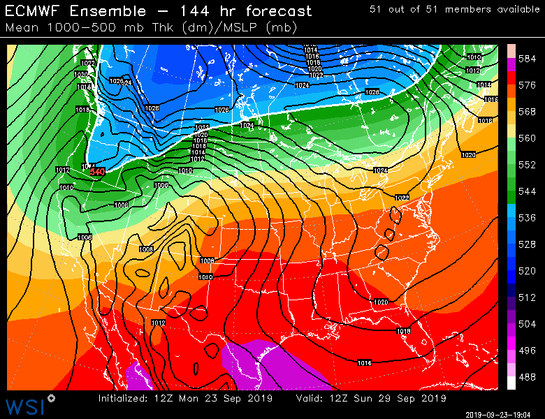
Look at the thicknesses out west. Lol...now down to 528. Powder blizzard for Montana on Sunday. Nevermind just wet snow. What a pattern. Mid summer here and mid winter out west.
-
Are you a really good skier? MRG is pretty gnarly so if you like that stuff, prob worth the pass at the sub-30 price. It's a hike and a half from RI though. Prob 4 hours. Youll prob be going to Mt Snow a lot on the drifter pass. Not nearly as far.
-
The snow levels get down to stupidly low levels for this time of year out west this coming weekend if guidance is correct. Like 534 thicknesses.
-
We had some people canceling winter in autumn of 2007 when we were torching. Same deal in 2017. Both saw pretty wintry Decembers. (Esp 2007) Nevermind the back half of winter.
-
I mean, I understand the angst of not being able to relish a 47F day in early October....but no need to start worrying about winter. Ironically, those same posters would freak out if a 10/10/79 showed up. Lol.
-
Lol. I missed this while making my post above. Yes. That's a nice arctic pattern for winter....almost certainly would be good here with the longer wavelengths and much further south Polar jet. -PNA/-NAO with an overall -AO is one of our best patterns for snowfall in winter.
-
That ridge bridge would be sweet in winter with the longer wavelengths. Hopefully it stays around.
-
I'm not going to go down the political rabbit hole of discussing capitalism vs socialism in this forum but the nuclear energy part is spot on. It is hard to take any person or any group seriously that say they believe climate change is a dire emergency and also will not consider nuclear power.
-
Most politicians aren't really that serious about climate change anyway. Even the ones who claim they are. There are some exceptions of course. But we see something like the Paris accord being touted by politicians as this crucial thing when in reality it is non-binding and even if it wasn't, the commitments through the end of the accord in 2030 would do very little to change the longer term outcome of climate change...especially if one believes that we are closer to the "worst case" scenarios of higher climate sensitivity. The difference is something like a couple tenths of a degree Celsius or even less. If you are generous and make a bunch of assumptions like everyone continues to ramp up their cuts beyond 2030 like I've seen done in some analysis, then you can maybe add several more tenths. But that's a big assumption. It comes across as something for politicians to pat eachother on that back about to make them feel as if they are tackling the problem when they really aren't. This probably isn't the thread for such discussion, but a far more efficient way to attack the issue would be to invest most of the money into R&D for green energy.
-
Getting an intense foliage season (that also comes a bit early) is really related to 3 factors: - early/mid summer precip - late summer/early fall sunshine - late summer early fall temps (esp nightttime temps) If precip is high in early to mid summer that is a good stage-setter as it will allow the leaves to stay healthier into the early autumn and continue to produce sugars...then later in summer and into early fall you want to start really ramping up the sunshine to get that destruction of chlorophyll cranking...then at the same time you want to start cooling the nights to increase the red pigments from the sugars that get trapped in the leaves once chlorophyll production has ceased. You just don't want hard frosts or freezes too early because that destroys the creation of the pigments. Getting the cool nights started earlier can help the change start early which is what might have happened in the 2nd half of August. Drought can also cause leaves to change early (via stress) though usually the colors are muted and dull when drought is the cause...we haven't been in drought this summer so that isn't the cause this time and these limited early colors have been pretty bright in my opinion. Weve had pretty ideal weather for the production of good color the past month or so. Lots of sunshine and plenty of crisp cool nights. Unfortunately we may be seeing that run come to an end so we'll see how much that affects the foliage going into October. We got a good start so we still might have a decent foliage season even if the weather turns warmer.
-
I should update this in that the NSIDC minimum extent dropped a bit further to 4.09 million sq km....still outside my range but a bit closer than the 4.23 initial value I posted above. Doesn't change the analysis above in any material way. The area minimum hasn't been matched again and will remain at 2.87....we're now over 300k sq km above the 9/4 area min so that won't be caught again. We'll see if 4.09 million sq km is the final minimum extent....still a chance it could fall back below that from the current 4.17 million sq km value, but it's getting very late now to significant drops.
-
Maybe I'm just less afraid of the warm patterns because I feel like they rarely actually produce 80s after late September. They end up verifying as a lot of 70s which is fine. Ok maybe the BDL tarmac gets 80s. Even the epic October 2017 hit 80F exactly one time at BOS. Zero times at ORH. Just a ton of 72/52 type days. This weekend breeches 80F but then I'm not convinced we see it again until spring.
-
Seems like every sugar maple around here is showing at least some color already. The stressed ones are already near peak. It's definitely early. The rainy June/July and all that sun with cooler temps in August (esp last week of August) and early September prob was ideal for getting some early color started. You typically want a wet early and mid summer and then start ramping up the sunlight late summer and autumn with some colder nights mixed in to enhance the sugar production. Cool nights but no freezes are ideal. Kind of like what we have had pretty frequently the past couple weeks.
-
I'm fine with +10 days. I'll do without historic 2007-esque 90F highs but 77-83 doesn't bother me a lick this time of the year. I'm actually rooting for slightly warmer. I have zero use for this crap that we saw the past 24 hours with a high of 60-61 and lows of 38. It felt like October but I don't actually prefer it over 70s or even low 80s as long as it's relatively dry. The novelty of the first freeze will interest me but that is about it. Getting rid of the bugs with a hard freeze is a bonus too but then given me 70F days and 47F nights through Halloween. We can flip the switch in November.
-
That would be hilarious if the D8-10 verified after all the torch talk.
-
Sneaky chill-down Tuesday/Wed next week on the Euro. Dendrite and Tip are right...these little troughs find a way to keep sneaking in as we get closer.
-
Lol. Scooter it totally triggered by a few days of 80s in September. By the time we're 71 in October on a warm spell I am dancing around outside.
-
Perfect conditions. You can probably walk right up to a nest and beat it with a stick and they'd all just fall out and be totally useless wiggling on the ground. They can't function at all in these temps. Definitely a good time to go on the attack.
-
When you look at some of the temp records around here, the 1960s through early-mid 1980s are pretty unrepresentative of the century as a whole. They had some of the lowest variance year to year and were very cold.
-
This is about average for them on first freeze.
-
That's the kicker about that winter. Man, if December and the first 3 weeks of January had been just been run-of-the-mill crappy instead of absolutely putrid, we could probably tack on another 1-2 feet to the totals...and then don't forget March was kind of a dud ending too even though it was cold. The cape and southern MA/RI got a big event but BOS and even Scooter didn't. Obvioisly you can't complain when you go absolutely nuclear for a one month period but it's only natural to wonder what could have been if some of the other months were not as hostile. It goes back to what Tip often says about some mythical epic 6" QPF blizzard parked south of LI at 940mb having probably happened before in the past before records began....at some point in the past 500 or 1000 years (or 2000...whatever the number is) you know there was probably a winter where we had a 2015 stretch that coincided months that were pretty normal or even above normal for snowfall to produce the "Dream winter"...or as we know it, "The DamageInTolland winter"....buried by mid November followed by nonstop carnage with multiple blizzard through New Years...maybe a relaxation of just "normal" snowfall for a month or so before a another several Nor easters in Feb/Mar.
-
If we keep up our good run a bit longer, I may have to start bumping everyone up on that map, lol.
-
So he probably beat Stowe. Lol. Scooter prob had over 120" that winter with depths over 40". We were joking during winter that Boston became Stowe that year. Because even outside of the huge storms there were a ton of trace snows and smaller measurable events that you often see up there. Between January 24th and February 28th that winter, BOS had 22 days with measurable snowfall. An additional 4 or 5 had traces. I think people forget amidst the absolute snowgasm is how we narrowly missed like 2 or 3 other major events. They ended up scraping us and/or late bloomers that got Eastport and Machias Maine...but we were still getting a couple inches on those near misses. Throw in a few clippers too.

