

ORH_wxman
-
Posts
90,902 -
Joined
-
Last visited
Content Type
Profiles
Blogs
Forums
American Weather
Media Demo
Store
Gallery
Everything posted by ORH_wxman
-
Ray the 06z euro prob ticked south 25 miles or so (06z on top) You can see how the Scooter high is more robust too
-
No. It doesn't. NYC is too far south in this setup. They might get a little at the start and at the end.... A place like Armonk would definitely be better off...probably a few inches.
-
No. It's cold in the low levels on a track like that. It would be in the mid to upper 20s.
-
Yeah 06z tickled colder again through 90.
-
Solid euro run for SNE and CNE save maybe the south coast. EPS looks pretty good too. Those are continued good trends on the high going into the event.
-
Yes the 00z suite has trended that way so far....of course we all wait for the really important model.
-
Hard to tell with the awful free graphics, but the Ukie looks like it is between the GGEM and GFS. Closer to GFS though.
-
File that run away in the "how many inches of GGEM snow do I have this year" folder
-
Yeah gfs did trend colder but still not as good looking as the 18z EPS. 00z GGEM is coming in significantly colder.
-
Yeah that probably helps for sure. There's still a bunch of stuff downstream in the arctic and subarctic that I thought it might treat differently, but i guess not enough to cause a drastically different solution.
-
Surprisingly looks very much like the 18z EPS. I was expecting the NAM to show something ridiculous at 84h
-
Ha yes. You get multiple Colucci hits when looking up literature on anticyclones. (Colucci '87 et al, Colucci '80 et al, etc...lol) My other favorite is "I'm fond of saying that it doesn't snow in Ithaca on a southeast wind"
-
If it trends better between now and 00z tomorrow night then yeah, I think it's about time to party. That would be like 72 hours out from start time...but if we hold steady, it might be a bit premature...that's pucker time in the next few runs after that. This run looks good for interior but it's still cutting it close.
-
Nosing into northern Maine that run. Zero percent chance the interior would sniff freezing on that setup. A little more and the coast can start partying too...they get into it somewhat there but would need a little more to stay all frozen.
-
The Scooter high holds tougher this run with the primary ceding to secondary development sooner and further SE. That's what we're going to want to see on future runs.
-
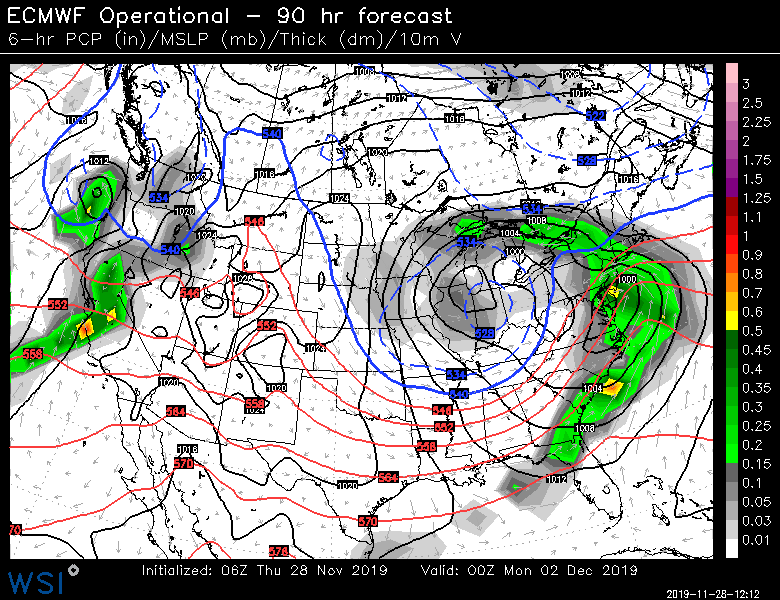
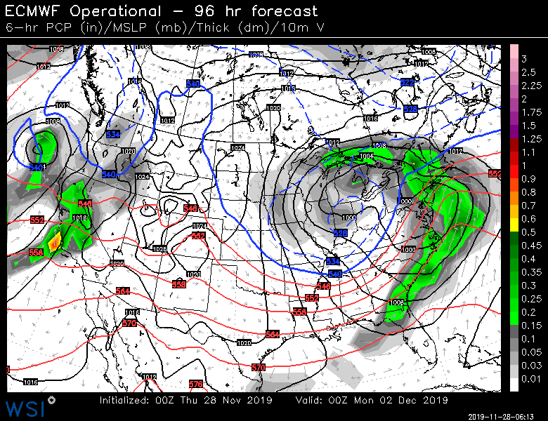
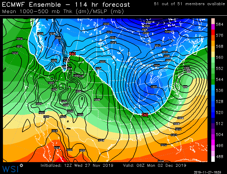
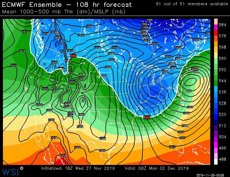
Here's 114h on 12z vs 108h on 18z...you can def see 18z coming in colder
-
18z EPS looks colder than the 12z OTOH through 96.
-
18z OP only goes out to 90h and the ensembles are only out to 72 so far. 18z looked pretty darned close to 12z through 90 though. Maybe just the slightest touch warmer.
-
That happened in December 1992. They were late picking up the leaves in ORH that year and then 32 inches of snow (that started as rain) fell and the roads were an epic disaster for the rest of the winter with frozen leaves in the snowbanks taking up extra room.
-
Yeah that look is fine for 495 belt.
-
It actually ends up hitting a lot of New England pretty good as it wraps back up when the ULL swings northeast to near ACK....in the 132-144 timeframe.
-
I dont' expect guidance to handle this system well as a whole because of how ridiculously big this bowling ball is and trying to deal with the NAO ridge at the same time. Timing of ULL ejection from the Rockies will play a role as well as any of those scooter streaks rotating around the backside of the T-day system that gets blocked a bit by the NAO ridge.
-
It pushed the ULL further SE in the 108-126 timeframe...sort of elongates it more E-W than the 06z run did.
-
It did correct more eastward late in the run, so it ends up not too different. But there were some noticeable changes earlier in the run.
-
It's not that shocking actually...yeah, the GFS sucks, but this system is still like 4-5 days out.


