ORH_wxman
-
Posts
90,902 -
Joined
-
Last visited
Content Type
Profiles
Blogs
Forums
American Weather
Media Demo
Store
Gallery
Everything posted by ORH_wxman
-
Oh I was pretty sure that was gonna happen....should make it up into your 'hood too...but I am skeptical it will last a long time there...and we'll see about ORH up to Hubbdave. It could fill in fairly quickly if the mid-levels can resaturate a bit faster than guidance has been wanting to. I've seen it happen before on these ripping east flows off the water before. Could be some terrain enhancement too on east slopes.
-
Yeah or we can replace with:

-
I still have this saved in my folders from 2007-2008:

-
The sleet line rotted around the MA/CT/RI border for hours....where have we seen that before?
-
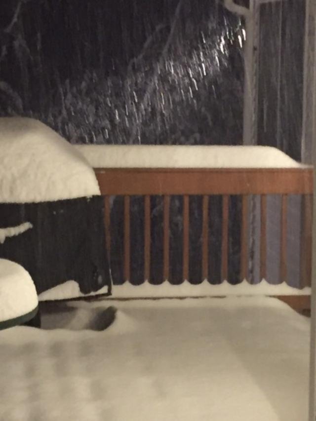
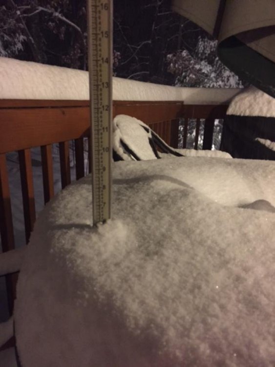
Just over 9" in Holliston...getting dryslotted now.
-
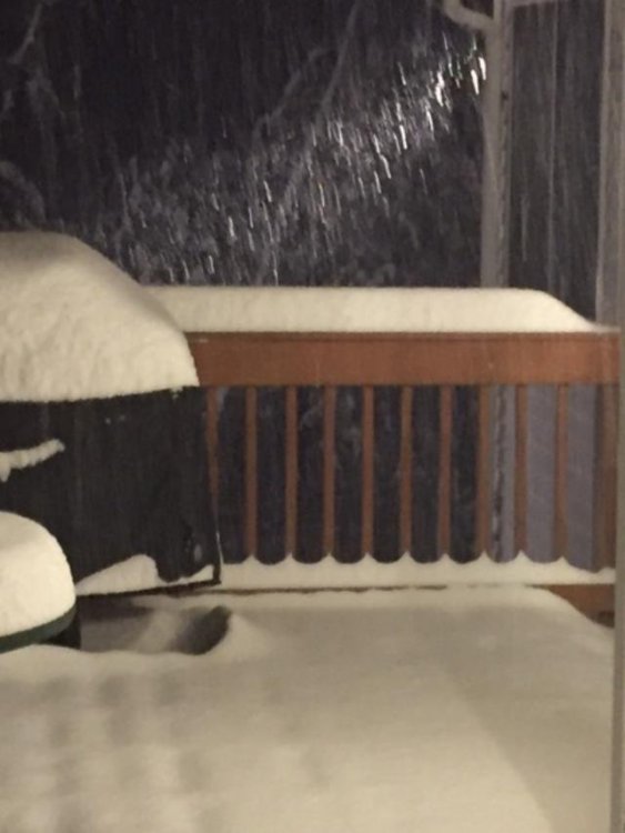
Absolutely pounding right now....had 4" at 8:50pm, and just went out at 9:20pm and snapped these:
-
Sleet line is having a lot of trouble moving northeast in RI. Keeps stalling SW of Fozz and accordion man.
-
Absolutely ripping now. Temp has crept up steadily. Now 29.5F. Prob will get above freezing even here for a time late overnight hours and early tomorrow before CF sinks back SE.
-
Yeah that was still a very nice look for E MA despite the shift east. Esp right on the coast. Midlevel features look sweet. It'll be interesting to watch this unfold tomorrow. I still have no idea what might fall. Bust potential all over the place.
-
Sleet line has receded back near or just south of Kevin with that heavy stuff.
-
37 looks too warm at Logan. But they are def at least 34-35
-
Yeah pretty much. Good signal for Monday night a bit east of CHH.
-
Didn't the 3km NAM have like 1 inch of WAA snow for Ray yesterday?
-
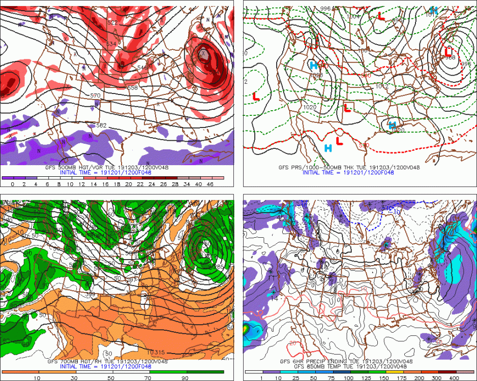
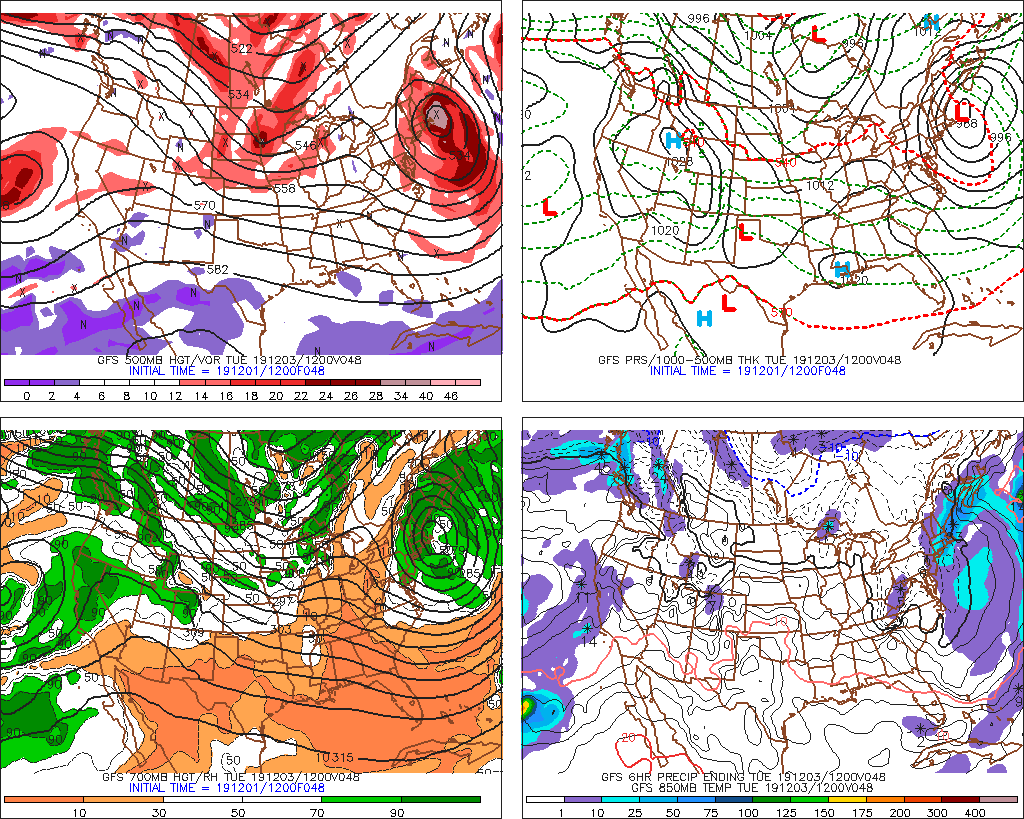
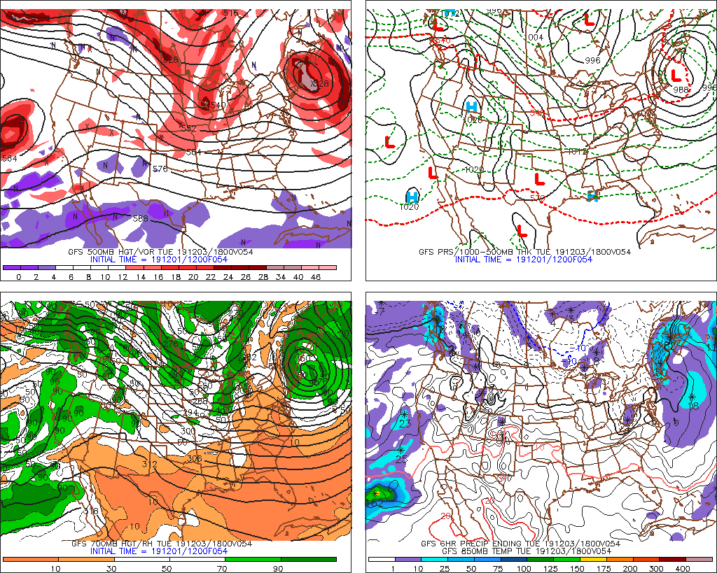
I feel like it trying to consolidate though it definitely may lighten for a time Monday. But this reeks of east flow in the midlevels with terrain enhancement too that keeps things on the steadier side in between the two periods of deeper synoptic lift.
-
Big hit for Maine too.
-
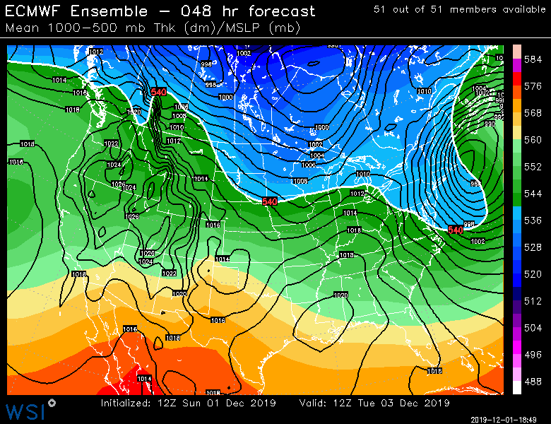
Wow that really wraps up. E MA takes it on the chin well into Tuesday morning.
-
Good hit for eastern areas round 2 but everyone gets some goodies
-
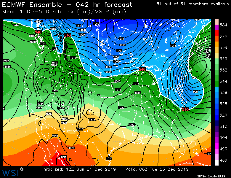
Euro gone wild for round 1
-
There's gonna be some east slope lollis for sure I think.
-
For the interior hills, I agree....I def wouldn't actually forecast that right now, but there is some potential this could bust pretty big positively....I wouldn't be shocked if weenie ridge in Princeton or even ORH didn't stop snowing for 40+ hours in this. But there's still uncertainty in both parts of the storm....and in between, lol. But the trends are pretty auspicious the past 12 hours for something higher end. BOS is gonna rain for a while, so a bit different for them...but it could be kind of weird in that they pound out 6"+ tonight, and then could go 10"+ monday night/Tuesday morning if things work out.
-
Lol...not a worry in the sense that I don't want it...but a worry in that nobody is really talking about it. There is a perception right now that Monday might be pretty fine for travel, when I'm not sure it is going to be at all.
-
I'm kind of getting worried about a firehose type deal during Monday afternoon/evening for the interior even before that coastal tries to go crazy for E MA.....the flow at H5 is like ESE with ENE mid-level flow and it's like that for a good 8-12 hours as the ULL takes its time passing to the south. More and more runs are not really showing much of a break in the precip during that time....or the break is getting smaller or over a smaller area. It is something to watch.
-
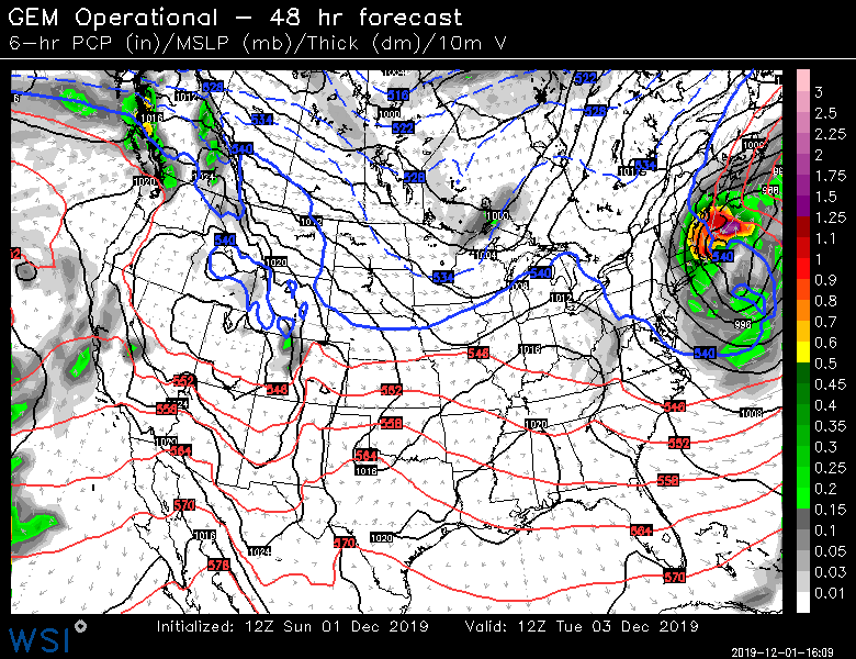
GGEM gone wild...
-
CF is rapidly collapsing SE tomorrow morning over E MA, so it could be a problem with flash freeze....depending on exact timing,.
-
Yes it would....GFS does it too except it's a little further east of CHH.