

ORH_wxman
-
Posts
90,902 -
Joined
-
Last visited
Content Type
Profiles
Blogs
Forums
American Weather
Media Demo
Store
Gallery
Everything posted by ORH_wxman
-
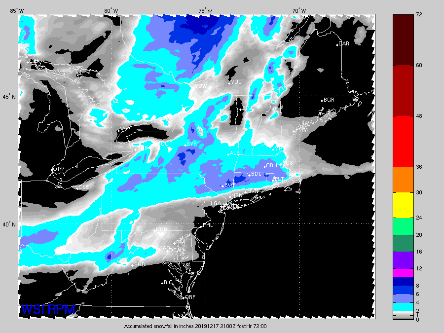
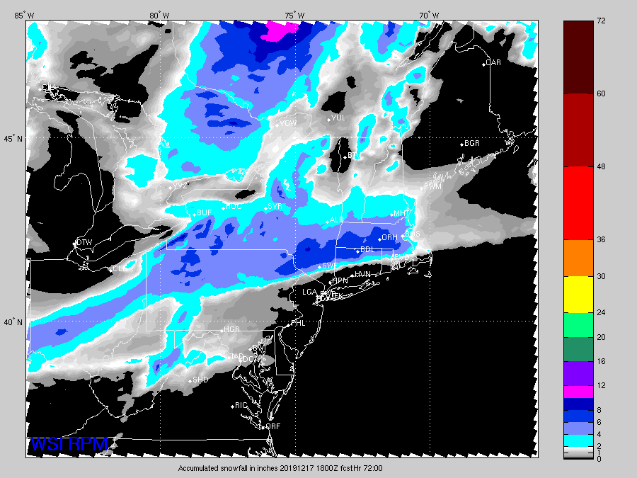
21z rpm even more suppressed. Metfan jackpot on the 00z run?
-
I was mostly joking with PF and then the 18z euro comes in and basically gives NNE a goose egg. I think the models troll sometimes.
-
I was mostly trolling there. Lol. This has a good midlevel look for NNE. Though there's prob a decent chance that a lot of people get 3"+ on this forum if the cold ticks continue.
-
You're cooked on this one too. Gonna end up congrats Ray to Hippie....Dr Dews trolls his way to 6".
-
Yeah pretty sure something happened with the siting since NWS checked the ASOS. It's beyond obvious on the MADIS graph in mid-2018. MADIS is pretty lenient and they've been failing Logan on the temp graph recently from time to time. That's how you know it's really bad.
-
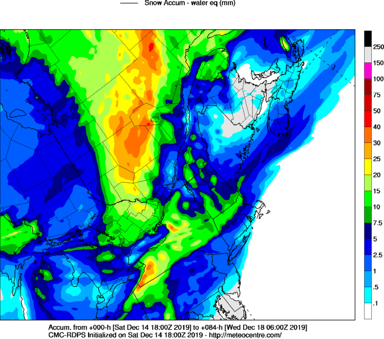
Actually the 18z RGEM is trying to get on board with that unbeatable triplet
-
RPM/ICON/JMA combo....absolutely deadly.
-
Yeah you can toss BOS into trash heap. What's PVD running? -3?
-
I'm throwing all my eggs in the RPM basket (still not quite over at this point)
-
Oh boy, that is an interesting look at d7. Don't think they quite phase this run but that's a powderkeg setup worth keeping an eye on if those two shortwaves keep showing up like that.
-
The front end thump on this thing is pretty weak sauce. That's what you get with a sheared shortwave out in Detroit-STL corridor when the best WAA precip hits. I agree the best thing to root for at this point is just another tick or two colder so we stay mostly snow in the weak commahead this thing has. The overall orientation of the vortmax doesn't seem to be changing that much so I think we're probably gonna keep the really sheared look.
-
That's close to all snow north of the pike in MA.
-
Just remember that you have to shave off some for the amount that will actually accrete. Accretion rates are generally less than 1 to 1 ratio unless conditions are optimal. The median tends to be closer to .75 to 1.
-
He gets the early bird buffet at country kitchenat that exit 71 truck stop.
-
Shortwave is still looking rather sheared on guidance. Take the most conservative amounts until it shows up a bit better (if it does at all). No doubt the sfc looks really cold though so this likely won't be liquid at all NW of BOS-PVD-HVN
-
18z Euro looked a little better on the front end thump. Quite cold at the surface even after the flip.
-
NAO starting to be felt in that GFS solution.
-
33/30 here....prob will get some brief glaze and then we're 32.1 rain....there's no real good dewpoint drain coming down the coast....33F DP at PSM and 31F at PWM isn't the recipe for more than a couple hours of marginal ice.
-
Yeah they aren't actual temp contours in purple and yellow....they represent "growth" of the ice crystal....can't remember the units, but optimal is to have the omega centered inside the yellow contours.
-
Yeah it still might...need the vort to stay less strung out further east in order to really ramp it up.
-
Our term for an overrunning event where the flow in the midlevels (basically H5 to H8) is out of the southwest....there's some different flavors to them, but they generally have an advancing sleet line that may or may not make it to us in SNE and typically the steadier precip is a 5-7 hour "Thump" since it is all associated with the warm conveyor belt.
-
Not with a vort strung out between Montreal and DFW.
-
Like 1-3" and then hours of light ZR away from immediate coast.
-
Glad we don't live there. Already over 20 inches here on the season.
-
Ha, that was supposed to say this weekend....


