

ORH_wxman
-
Posts
90,902 -
Joined
-
Last visited
Content Type
Profiles
Blogs
Forums
American Weather
Media Demo
Store
Gallery
Everything posted by ORH_wxman
-
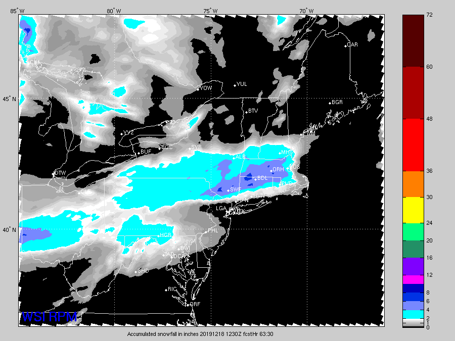
Guidance is showing the WAA sort of hit a brick wall in SNE earl tomorrow morning which is a good sign for some enhanced WCB precip....it almost starts getting shunted east a bit once it hits the wall.
-
You know you are trying a little too hard once you have to start referencing winter climo south of NYC to shorten the season.
-
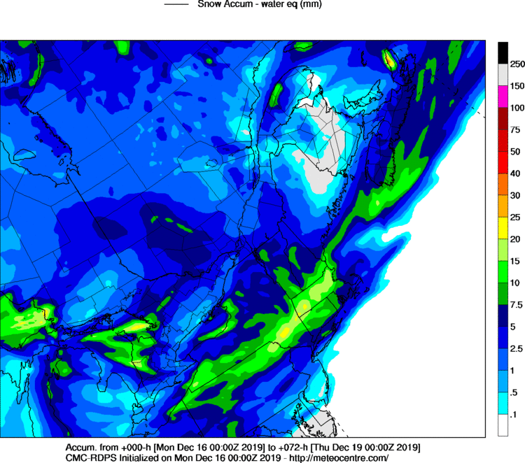
Yeah this run showed maybe like 4-6" in about 6 hours. It's not a huge system, but it comes down pretty heavy for several hours at the peak.
-
Thats a pretty damned big thump for the pike region through about 15z tomorrow.
-
Really nice looking 06z euro run for here. Front end stuff looking pretty nice.
-
00z RGEM was way better for south of pike peeps
-
Surprised how suppressed it still is....that run may have been more suppressed than 18z...though kind of hard to tell because it was faster. I initially thought it was north but then i looked andsaw it was already collapsing the back end into eastern NY at 42 hours while 48 hours at 18z was still raging in W NY.
-
Lets turn this into a 4-6 front ender then pellets/dryslot. More exciting than getting 5" over 15 hours.
-
Yeah I agree with scooter....3k isn't always better. Remember how poorly it handled the front end thump in the Dec 1-3 storm? It was pinging the chickens like 30 hours before the event started and I never even flipped here. 12k NAM wasn't as bad. Sometimes it does better synoptically, but I'd tend to focus on how it handles stuff like CAD vs what it's spitting out on the synoptic front.
-
Actually you didn't sync up the timing on the plots....one is for 12z ad the other for 18z Tues.
-
That's not even close IMHO....that GFS sfc low is way NW....it is still back in W MD on that plot.
-
Dynamics def looked better that run....would like to see it show up more on the Euro before getting excited, but thats a good sign to start 00z.
-
You'd think at some point they would correct an error that has been known in the model for decades now.
-
A lot of that is the GFS is utterly clueless when it comes to LL CAD. You can toss the GFS BL temps.
-
Euro def ticked north a bit but it was also better on precip...the two are likely connected in this case. We should also say that it is nowhere near the 18z gfs solution as to not confuse people who aren't reading each model output. Euro was still pretty cold even though it was a bit warmer than 12z.
-
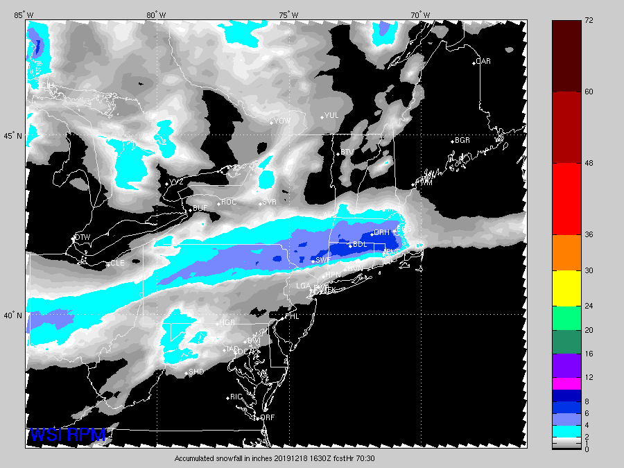
Rpm not as robust at 21z
-
GFS is definitely the further north but the other models differ from each other. There's southern outliers too.
-
ORH has 20 Decembers over 20 inches. But very few of them had that much by mid-month.
-
Looks more like Ashburnham/Ashby if we're picking nits.
-
18z gfs is def the northern leader in the clubhouse at the moment. We had the 00z GGEM last night and the GFS took over at 12z and increased its lead at 18z.
-
That's even pretty good for powderfreak too. No consistency at all in guidance today.
-
Man, 18z Reggie looks way south too so far through 48.
-
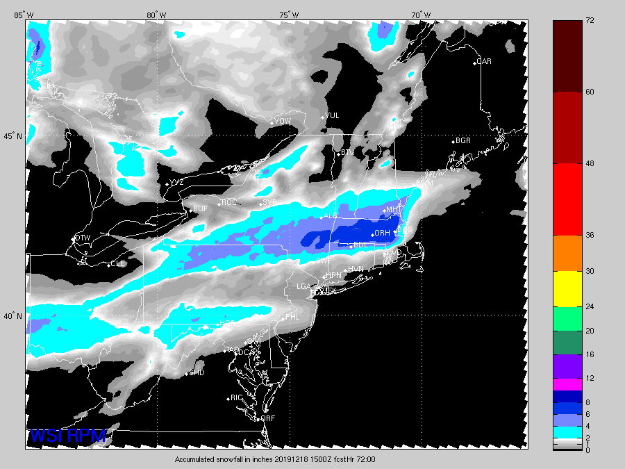
Rpm went south again...kevin is def trying to steal Dendrite's snow
-
RPM tickled south. Awaiting JMA now.
-
Seems like the Xmas forecast is pretty sensitive to the potential phase next weekend. If that phases into a big storm, we're more likely to end up cold for Xmas.


