ORH_wxman
-
Posts
90,902 -
Joined
-
Last visited
Content Type
Profiles
Blogs
Forums
American Weather
Media Demo
Store
Gallery
Everything posted by ORH_wxman
-
Yep. I was convinced it would be a long time before i surpassed the 39" snow depth from January 2011 (technically February 2011 after the 2/1-2/2 storm. Then 2015 happened and I got to 44-45".
-
LOL....Def starting to look a bit '94-esque on that EPO. Hopefully we can squeeze in an event before New Years in a marginal pattern. That seems to happen a lot in the good winters. You hit more frequently those "1 in 3" or "1 in 4" type patterns...whereas in the crap winters, we always miss. It's like in baseball, when a .300 hitter is going good, he gets a single on a nasty pitch outside on the black....when he's going bad, he whiffs. He never misses on the fastballs or hanging curves down the middle when he's going good....but when he's going bad, he pops them up.
-
EPS wants to get the EPO in better shape with a cold start to January. We'll see if it sticks, but that has been trending better steadily the past 3-4 runs or so. edit: scooter beat me to it
-
Euro shows how the split flow and Hudson Bay/Quebec blocking can work to our advantage.
-
Sun angle gets pretty brutal down in DC/BWI area by mid/late February. It's the equivalent of an early March sun angle here...and probably 2nd week of March where you are. So it starts eating that snow pretty quick.
-
Agreed....a bit early to punt the rest of the month. Nothing is screaming out at the moment, but this is the type of pattern where stuff could pop inside of 5-6 days.
-
Ya'll should take the home heating discussion to off topic/banter thread.
-
Yeah I remember the cutter...but it didn't hit until 12/26...might have started in the M.A. on the night of 12/25.
-
He was talking about the NESIS map.
-
You melted 26 inches in 5 days? That's brutal.
-
It's been a nice holiday season. We've literally only had 3-4 days without snowpack all month. Been a while since we've had so much of the pre-Xmas period with snow cover. Dec 2017 was pretty good but not quite matching. We established cover on 12/9 and never lost it. But this year it happened on 12/1...and while we've lost it twice it was very brief. The next system happened very quickly.
-
They had Shelby Scott reporting in one of those south shore towns. I think it was south Weymouth. I remember her sticking a yard stick in the walkway where she was shooting from that had been shoveled prior to the storm and it was like 22". I was so angry
-
Too bad they didn't have like South Weymouth over to Norwell and Hanover on that PNS. They jacked I remember with over 20". But clearly you can see nearby with Milton getting 18+.
-
6-12" for that Wednesday....lol. We did get some from the upper vortmax actually...I remember it snowing most of the day with a pretty nice period midday. But I think the total was like 3" that day instead of 6-12". That storm was frustrating. We had the rare "blizzard watch". 1-2 feet was being thrown around. We ended up with around 9 inches total on top of an already decent snowpack....so can't complain too much....but man, what could have been. I remember south weymouth had like 22 inches from all that ocean enhancement.
-
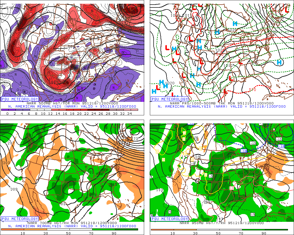
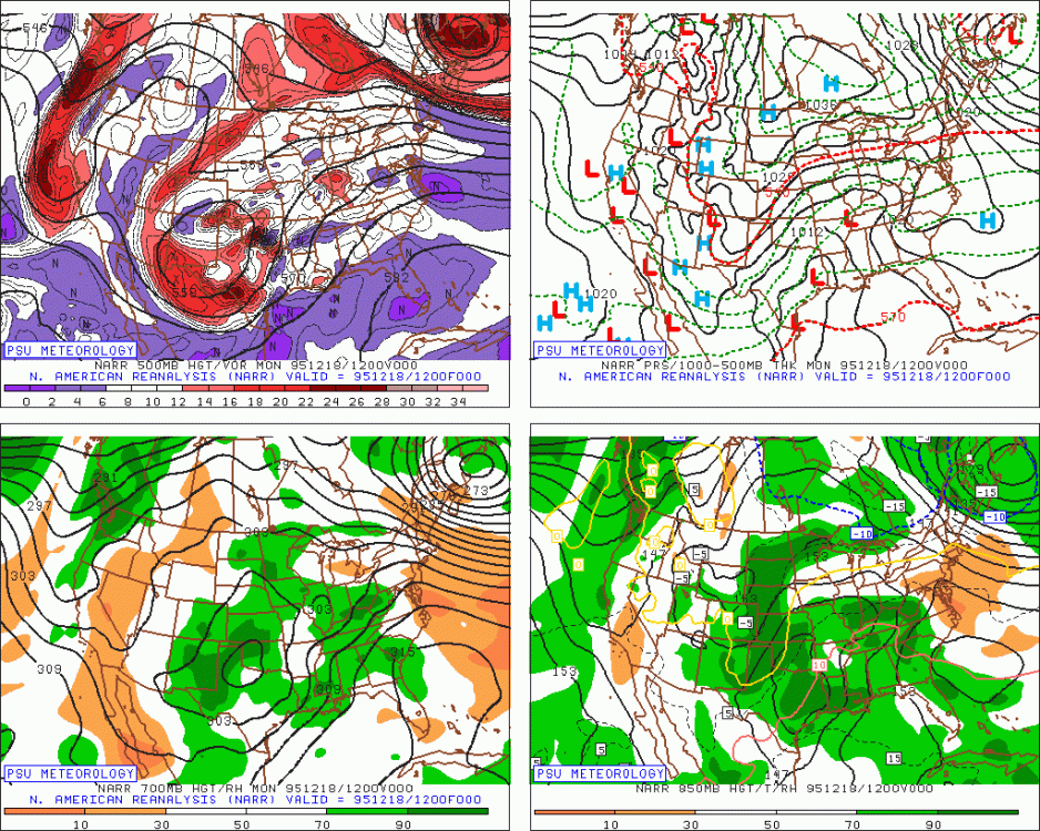
If you want to see an example of how an ugly PAC with hudson bay and davis straight blocking can work out....the lead-in to the Dec 19-20, 1995 storm is a good example: http://mp1.met.psu.edu/~fxg1/NARR/1995/us1218.php
-
The PAC isn't really bad in the 11-15 actually...trending better toward the end of that. It has PNA ridging with still signs of split flow....EPO is still pretty blah, but with the decent Atlantic, temps are plenty cold enough for threats.
-
What a screwed up pattern with all that canada blocking....don't expect model guidance to handle any of these shortwaves with consistency at all over the next few days.
-
No not necessarily, it's more that those blocks are further south in the direct path of the PJ rather than the arctic blocks we see....so you end up with a lot of weird interactions with shortwaves that will change the orientation of the blocking....and since the blocking is a lot closer to us distance-wise, that orientation seems to affect our sensible wx more directly.
-
Guidance is really going to struggle with the hudson bay/Quebec blocking....they almost always do.
-
I actually don't mind the split flow Hudson bay block....it's def no KU parttern, but it beats the alternative with that PAC look....we can get some overrunning events this way.
-
Ukie has it too but it's a bit further north. Something to watch anyway. The non-GFS guidance is actually trying to make Xmas eve somewhat chilly with a front diving in from the NNW.
-
GGEM has the 12/26 threat.
-
Oh, I thought you were up the hill a bit from Amherst in Belchertown/Pelham area. So that would have been a higher threshold....30" in Amherst in the valley could def be a record.
-
Yeah that's def getting up there. I think 1969 might beat that though, and perhaps 1945.
-
How much do you have so far? Not to be a nitpicker....but I'd bet that Dec 1945, 1947, 1969, 1970 all give this year a run for its money and likely a couple of them exceed this year. A couple of those were prob over 30" out there.