ORH_wxman
-
Posts
90,902 -
Joined
-
Last visited
Content Type
Profiles
Blogs
Forums
American Weather
Media Demo
Store
Gallery
Everything posted by ORH_wxman
-
Ginxy is good people...he just once in a while steps in dog doo....but we still love him whether he has it on his shoes or not. Back to the next storm....yeah Scooter...GGEM shows how to get some snow at the end. GFS was close (and so was Euro actually).
-
The next system could end as a bit of snow...NNE may even get accumulations at the end. Down here, prob not more than flakes, but if that upper level energy trends stronger at the base of the trough, then even down here could see a bit....just something to keep half an eye on as we wait to see how the 1/8 time period unfolds.
-
Doubt there would be much in the way of ice with that...maybe at the onset.
-
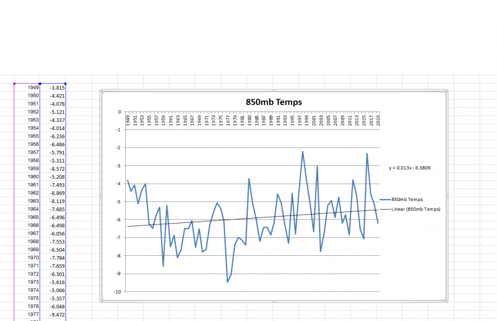
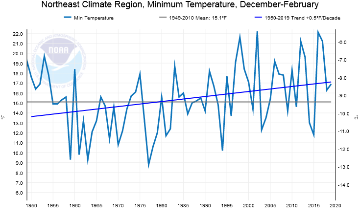
You can grab it here: https://www.esrl.noaa.gov/psd/data/timeseries/ You gotta make your own time series and plug in the coordinate bounds otherwise you'll get the entire globe, lol. And to get the trend, I just copied the data to excel as you can see above and plotted it on a graph and stuck a linear regression trend line in there.
-
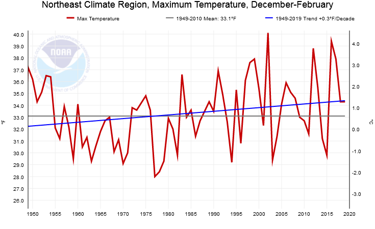
Yeah agreed.... the skiing stuff is crap....mom and pop ski areas used to function sometimes for like 20-30 days out of the winter...whenever they had natural snowfall, and they'd be closed when a cutter wiped it out. Most of them closed because of a combo of interstate highways making the larger mountains more accessible and the rise of lawsuits which small areas mostly couldn't afford to deal with. CC had very little to do with it....most of them actually closed during a very cold period in the 1970s. I learned to ski on absolute garbage in the 1990-1992 timeframe. We had bare ground on half of the killington ski trails and the ones that had snow were like icy death ribbons. I could only have been so lucky to learn to ski in the 2010s when ski trails have been mostly packed to brim with snow. This myth that we had some sort of skiing utopia where Joe's ski hill in Southington CT could be open 90 days a winter with full cover is totally a figment of climate weenie's imagination. Being critical of that 20th century utopia narrative does NOT make one a climate denier either...I hear that garbage all the time too from climate weenies...usually in an attempt to shut down the debate...it's easier to paint one with a pejorative than actually read some literature or look at data. Hyping up a narrative is just as bad as discounting climate change exists....both are anti-science. CC makes a torch more likely...events like March 2012 are more likely due to CC as well as torch winters like 2015-2016, and those record warm months that come with such winters. But on the flip side, this seems to be offset somewhat by more snowfall in recent years. Could be a result of more moisture and also an increase in frequency of the "warm arctic, cold continents" pattern. The temperature increase is also not uniform. The minimum temperatures are increasing about 40% faster than maximum temperatures mostly due to radiational cooling on clear nights....and because of this, it will have less impact on a snowstorm or snow retention versus if the temperature increase was uniformly increasing. Whether we radiate to 12F versus 14F or 15F isn't going to impact a snowstorm as much as maximum temperatures in cloudy/precipitation situations. Our winter time maximum temperatures are warming at roughly 0.35F per decade while the minimum temps are like 0.4 to 0.5F per decade. The mid-level temps for New England in the D,J,F period have warmed even slower than the surface and this is important since mid-level temps are more important to our snowfall than sfc temps...as far back as we can go (1949), the trend has only been about 0.13C per decade, which comes out to about 0.23F per decade converted into Fahrenheit....even slower than our maximum sfc temp rise and about half the rate of the minimum sfc temp rise. In the literature, extratropical storm tracks overall have shifted slightly poleward in our area since the middle 20th century, but not enough to explain a cutter over Buffalo versus a redeveloper over Cape Cod...that difference is way beyond the net effects of CC. I think the easiest way to think of CC is that it is an underlying trend that gets dwarfed on a seasonal and sub-seasonal basis by natural variability. We can't get our coldest month of all time (Feb 2015) in a world where CC warming overwhelms natural variability on that type of timescale. The months like February 2015 become less likely in a warming world, but they still obviously happen. It happened in 1934....and we somehow repeated those temps (and then some) 81 years later. Likewise, 1949 is still the warmest summer on record in Massachusetts....CC warming will eventually ensure that we break that record, but we haven't broken it yet because natural variability still reigns supreme for the time being.
-
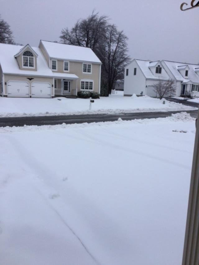
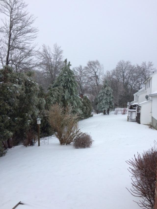
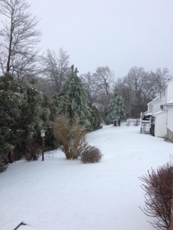
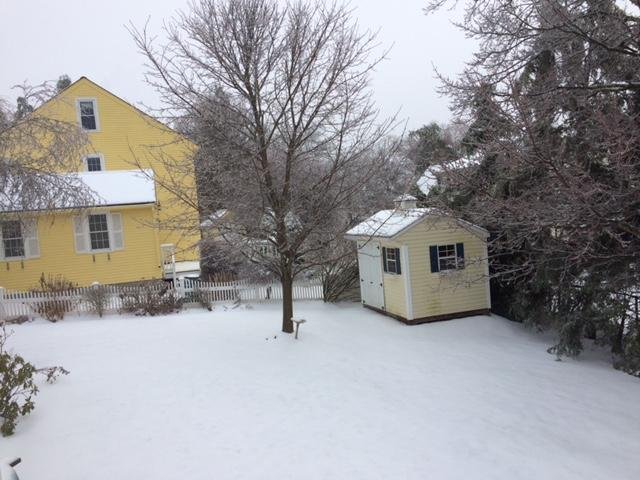
Some winter pics from winter hill this morning....pretty solid icing overnight. There was more ice overnight than anything that happened the previous night.

-
This weekend is a big cutter. No real ice threat...maybe very briefly at the onset. There could be a bit of snow at the end though as models are trying to hang back some energy.
-
Even Jan 2012 had several snow events. We'll get something unless we're super unlucky.
-
Yeah the sfc cold drain finally happened in more earnest late yesterday into the evening when model guidance said temps should have been rising.
-
Yeah it's kind of stalled to your northwest...having trouble making that push across 93. We'll see if it can do that in the next hour or two with the last push of higher pressures. They start to fall again after 9-10pm...though even when they fall, sometimes they'll really tug that flow more ageostrophic for a time.
-
Good drain going on from just outside 495 in the ASH to Tip in Ayer to just north of ORH corridor. Looks like it just hit Holden on the mesonet sites....Jefferson site went from 32 to 29 in like 20 minutes just now. Should be hitting north side of ORH soon. Models did pretty good with the temps earlier today but they eventually missed starting this evening...delayed but not denied on the "unmodeled" cold drain.
-
Too often there's sleet mixed with snow so you can't separate them out.
-
I've been fairly well behaved thus far this season Yeah you actually have been...you may have passed the torch to dryslot. Let him do the dirty work.
-
He learned well from lavarock and Tblizz...just throw a tantrum and say you are skunked for the next couple weeks and then a big snow event shows up a couple days later.
-
Yes it did. Clown maps were atrocious but the euro itself was good. That warm nose was pretty obvious but for some reason the clown map algorithms ignore do it.
-
Yeah I'm happy about selling those weenie maps that showed solid advisory snows to the pike.
-
Cell looks like it's weakening to the southwest....but still pretty heavy echoes.
-
Just had some thunder sleet.
-
Nobody should be caring what an OP run shows at 200 hours.
-
Yeah I'd think it would at least try....but this has been a weird system....like the secondary is squashed so far south, that we're having trouble turning winds to the NE though recently we're starting to see more of a NNE wind in the ASH-DAW corridor and that might finally get our little drain pipeline going....we'll see. At the very least, when you see pressure rises from the northeast like that, sell any meaningful warmup. I just checked some stations in far N ORH county and it seems they are dropping steadily too now in the past hour...like a good 2F in the past 60-90 minutes after being level for several hours this morning.
-
Looks like temps have finally been dropping steadily the past hour or so between ASH and MHT....we'll see if that tries to press further SW....I noticed we actually get pressure rises between around 21z and 03z.
-
I'm a bit surprised we haven't seen a stronger tug at the sfc up near Ray and into the ASH-FIT corridor....you almost ALWAYS see this undermodeled with a stubborn/building high to the north....but it seems this is one of the few times that we haven't had that happen. It's almost like the secondary got squashed too far south to help turn the winds more NE.
-
I'm told there's legit flakes in ORH now...airport is at 3/4 -SN....holy cross webcam on the far south side of town looks like flakeage.
-
Currently 750-800mb temps are like +5 and we're getting pellets. Shows how strong that low level push of drier/colder air is. I know we were wondering yesterday if it was going to be pellets or not with a warm layer of +5 or greater.
-
Flipped to sleet here about 20-25 min ago on my drive home from dropping boys off at daycare....nice pelting.