ORH_wxman
-
Posts
90,902 -
Joined
-
Last visited
Content Type
Profiles
Blogs
Forums
American Weather
Media Demo
Store
Gallery
Everything posted by ORH_wxman
-
GFS and RGEM have nice ML magic look for eastern areas.
-
Anyone who has been around the block with these systems would never totally discount it at this lead with that look. Kevin is doing his reverse psychology shtick...nobody is buying it. We all know he's going to be looking at each run just waiting to jump back on. He hasn't checked out of this threat yet.
-
Yeah it's possible we torch on that look but I've seen so many times where that confluence look in Quebec keeps us out of the warms sector. At the very least it looks short lived on that H5.
-
Hrrr and 3k show some too east of ORH or so. Not much but a coating to an inch wouldn't be that surprising.
-
That's not even that warm of a look. Lot of confluence there in Quebec.
-
Yeah. Dec '92 broke the drought for me and then we had some amazing winters there for a time before the little lull in late '90s.
-
18z NAM trying to ramp up a little on that.
-
Nobody is "all in"....we're just not dismissing threats 4 days out. Same reason we don't lock stuff in 4 days out like you often do.
-
I usually am referring to the '80s plus first 3 seasons of the '90s. When you include those putrid years that period becomes pretty ugly.
-
Lol...it's almost as if nobody has seen a vortmax tracking south of LI start to produce model ticks back NW before. Bunch of snowflakes. I'm not sure how some of these posters survived the '07-'09 years. Though I do remember when a ton of posters melted in Jan 2013 and 2015...that was pretty funny. But this is kind of embarrassing on 1/5...I'd sort of understand a little more if it was 1/20 or 1/25.
-
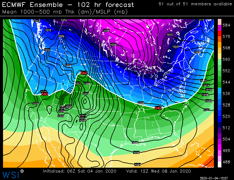
It was 1010mb 12 hours earlier. That's a pretty damned fast deepening. Doubt it verifies but something deepening that quick would support warning snowfall.
-
Lol. There's no way he changes his mind by looking at a chart. He changed his mind a couple runs ago when some of us were mentioning fast flow will keep this system progressive...so he changed from expecting it to cut or congrats NNE to a whiff. When it starts to bump back north a bit he will be fully back on the bus.
-
Yeah the whiners are out in full force today....this is pretty bad today. Lol. Tblizz will bitch his way to a good event I'm sure...Kevin will be fully back on the bus within 24h.
-
You'll be fully back on board by tonight or tomorrow AM. You even got sucked into the garbage setup for today;s storm for a time.
-
It's actually not a terrible spot...the trend in this fast flow pattern has been to flatten everything in the D3-5 range but then try and bump it back north a little in the final 48.
-
For the Cape maybe....NW of canal looks fine
-
SE MA special...pretty much a total whiff NW of I-95.
-
Or '08-'09 and '10-'11
-
What a nuke on the GGEM.
-
No snow at all until January 20th.
-
Yeah that's a little nuke cooking there...nice look.
-
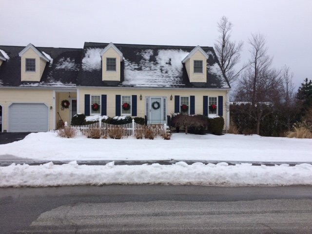
Yeah there's been a gradient for sure. We drove through Milford center a few days ago when we still had full pack and it was mostly patches there. Winter hill in ORH is still full cover. This was yesterday when I took this.
-
We lost our cover here a couple days ago. But it's been mostly covered since early December. Maybe 7 days bare.
-
Yeah looks like a classic Tip NJ model fast mover that drops a quick 3-6"...maybe we get a weenie stripe of low end warning if lucky. Esp if it tries to bomb out just as its reaching the islands or so.
-
102 for NNE peeps