ORH_wxman
-
Posts
90,902 -
Joined
-
Last visited
Content Type
Profiles
Blogs
Forums
American Weather
Media Demo
Store
Gallery
Everything posted by ORH_wxman
-
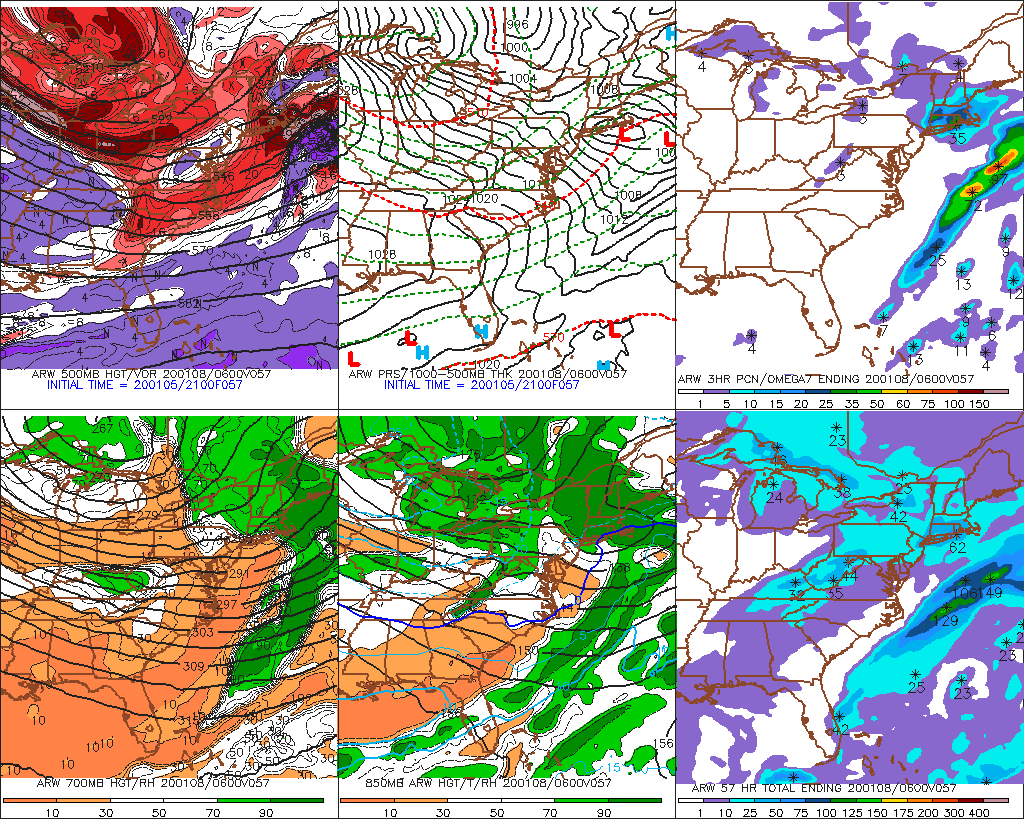
GFS is a bit NW through 18 hours
-
No help from Reggie....actually looked better early on through about 36, but then it kicked east pretty hard and actually ended up worse than 06z.
-
A scraper this run for you and the Cape...but better than the near total whiff at 06z on the 3km. I think you guys have a shot on this one.
-
It definitely looks better through 36.
-
Agreed Scott...I looked at H5 and expected a little better. But even with that H5 change, it was small....I feel like we need some bigger moves here.
-
Maybe you'll get a legit snowstorm out of that....if that system follows the dominant trend of the past 2 weeks, it will press big time in the next 2-3 days or so before maybe trying to tickle back N a bit. But I suppose at some point that seasonal trend will break.
-
06z Euro came NW a little bit. These are pretty small moves...though it does give an inch or two from ginxy over to Around PYM. Again, need another jump for a meaningful event.
-
Euro didn't improve enough. It didn't get worse but we need a pretty good jump now on the 12z suite. The earlier 00z models made better moves.
-
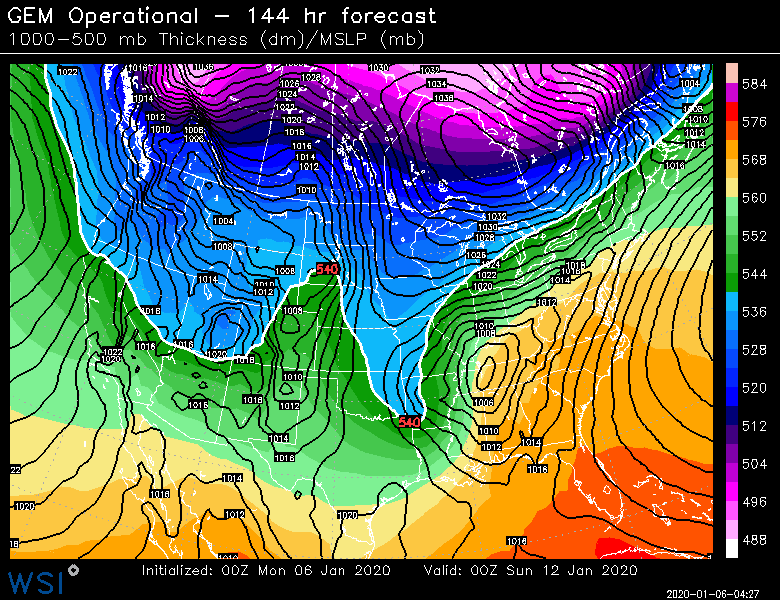
Oof....for those 60F to powderfreak calls. GGEM was even starting to look precarious for SNE too but both medium range models first out of the gate tonight trended that way
-
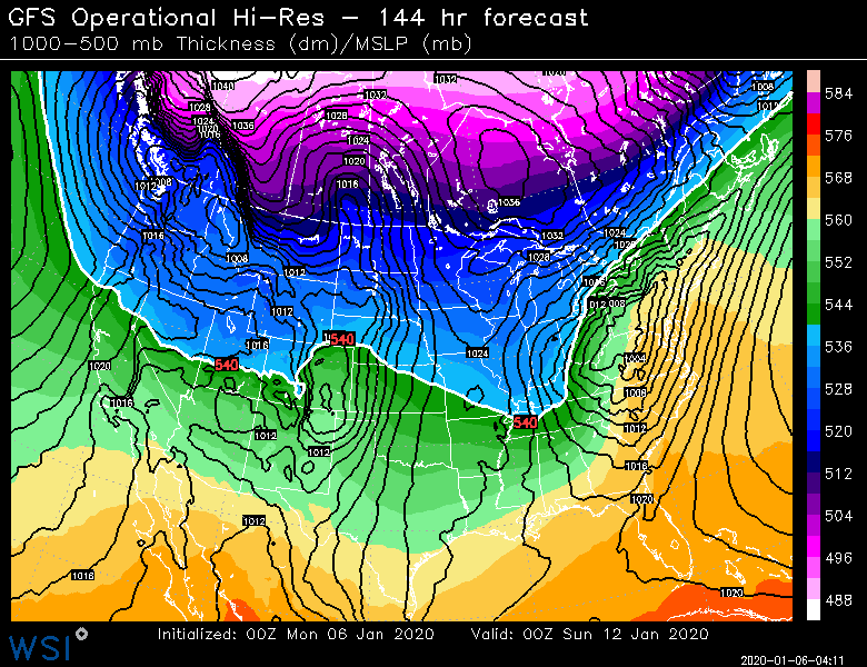
GFS will be a little better too looking at it through 36. Not staying up for euro tonight, but SNE folks still need another bump after this too and CNE would need a larger one. There's still some time though.
-
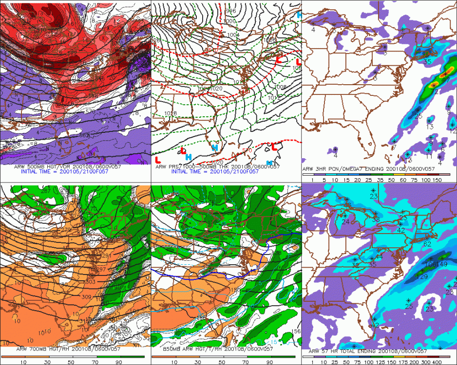
Rgem a little better than 18z too...all of these jumps so far at 00z aren't big but if they happened again then it would probably bring some pretty good snows into at least the southeastern half of SNE.
-
That one stung. We had a big set of runs in a big NW trend about 36-48 hours before it hit (closer than we are now) and then it got pulled out from under us. I still think we got 2-3" or so in eastern areas (less back west) but it could have been like 6-10 or more. We did get a good system two days later on 3/4 though.
-
And pretty crappy for snow too. At least quick glance at BOS. Maybe it was better in the interior. That was a putrid stretch for BOS snowfall. 8 straight winters with below normal snowfall. Thy oxen got tired with so few days of sleighing.
-
Rpm was close to a lot more. That 2-4 band was from a developing CCB/deformation but the whole thing almost jumped east and redeveloped and just shut off the snow abruptly.
-
Yeah the shitstreak is still killing us but we managed to bully it a little more this run with a better injection of energy into the main shortwave. We'd probably get some exponential improvement if we could lift that thing out of the way even just an couple hours earlier.
-
It looks a little better to me though 36....not sure it's going to help a lot but at least it is not a trend worse.
-
We can all channel our inner 2015-powderfreak.....the ARW smokes us
-
Lol nice. That storm looks amazing on satellite.
-
1913 weenies jumping off their horse and buggys
-
Brian's response was more thorough that mine...I only mentioned the moosefart shortwave but like he said, we can get this to amplify other ways too such as a much stronger main shortwave and allowing the extra Canadian energy to come down and deepen it further. More amplified ridge out west would help because a more amped ridge would slow the flow down...but we come to the chicken/egg with that...does the fast flow prevent those scenarios from happening? The northern front runner wave lifting out quicker seemed a little easier to attain given the pattern but it also goes against today's trends.
-
See if that shortwave tomorrow/tomorrow night that gives the snow showers (esp to moutnains) lifts out quicker than model guidance is showing. It trended slower today which is all that was needed to shoot the storm east because it didn't give our main shortwave enough room to amplify.
-
Sounds about right. It was def inside of 48. We started seeing a move maybe 36-42h from the main guidance? RPM showed it a bit outside of 48 and then never let it go...I just remember it had like 6 runs solo as a big hit until the first "real" model showed a hit. (Keeping in mind the rpm runs every 3 hours)
-
Jan 2015 was def a late move...though I didn't include that one in my examples because it was due to complex phasing and not a simple move NW based on W ATL ridging or maybe a confluence zone moving north. Something like that which this current threat is more analogous to.
-
I agree with Bob this is not the thread for this talk. This is supposed to be a storm threat thread...but to quickly answer your question before I move this response to banter....my beef with the posts was the psycho-analysis that implied that somehow anyone who says it hasn't adversely affected SNE snowfall is in some sort of defensive denial. It's really weird considering that statement isn't a denial but rather based on empirical evidence as Nick implied. If anything, maybe CC has actually helped SNE. We don't know for sure.
-
We probably want to see a bump NW on the 00z suite to keep this one alive...or at the very minimum hold serve and then a bump NW at 06z or 12z. On our threats that came back within 60 hours, usually we started seeing a move by 48...I'm thinking of systems like 2/5/16 or even 12/29/12 (aka "the rpm storm")...we started seeing a creep back NW around 48h out even if it wasn't a hit yet.