

ORH_wxman
-
Posts
90,902 -
Joined
-
Last visited
Content Type
Profiles
Blogs
Forums
American Weather
Media Demo
Store
Gallery
Everything posted by ORH_wxman
-
Euro not biting on the big cold with the wedge this weekend....probably correct too. I feel like the wedge will be dirtier with 30s/40s and not temps of 18F within 25 miles of 60s like some of those clown GFS solutions.
-
GFS more amped this run.
-
Winter 2020 New England Banter and General Obs
ORH_wxman replied to CapturedNature's topic in New England
I like the branches drooping a bit in the later pic -
Yeah, if you measuring solely retention, your way is better than overall snow cover days....someone on the west side of the green mountain spine could have snow cover most of the winter but that is largely due to the extreme frequency of snowfalls there but not their retention ability. They'll melt down quite a bit of what falls during cutters but it's always being replenished so bare ground is very rare....unlike to the east of the spine (or nestled down in it) and especially your area which could get much less frequent snowfalls but rarely torches any snow fully down to bare ground once you get a few inches established.
-
We're gonna wedge on Sunday I bet....might not be frozen, and could be a miserable 37F rain, but I bet at least pike-north drains. The topography will want to force it...you'll get the little mesolow protrusion into the Gulf of Maine off Cape Ann or something that will drive everything SW.
-
There's no doubt though it looks way better after about 1/16 or 1/17. Still possible we sneak in a snow threat next week.
-
I'll be out on the deck Saturday if it's dry. Grill something good.
-
Dropped the cold trend it had at 18z. Looks more like the warmer globals this run.
-
Winter 2020 New England Banter and General Obs
ORH_wxman replied to CapturedNature's topic in New England
That's a high end windex event for NH there. Where it's widespread 1"+ with lots of 2-4 lollis mixed in. -
Definitely two opposing forces. Very strong arctic high but also a beast of a SE ridge with a deep trough to the west. It will be interesting to see which one ends up winning from this point....whether we trend warmer or colder from here on out.
-
Big southward trend on the high pressure press for this weekend on clone range 18z NAM. Is this just the clown range NAM being the clown range NAM or start of a real trend?
-
Already a pretty big change by d9-10 The clown range is getting really weenie-ish though...almost looks like 2015 with the EPO/PNA phased ridge there with low heights basically from Baffin Island to Quebec right down into the northeast. Before that happens though, we get some ridging in Greenland around D9-12 which may help out with any storms threats in the flatter PAC look.
-
There's been a slow but steady trend for the Atlantic to become better the past few runs of EPS.
-
What's your definition of retention? The line you drew seems to bound roughly the "75 days per year" of snow cover which is defined as 1" or more on the ground. It's not a bad definition...2.5+ months is a lot. But some might argue 2 months is a lot too. The max depth might be another way to define it. Those same areas typically seem to approach an 18 inch (or more) depth most winters. Partly because these same areas highlighted are traditionally the last places to turn to liquid rain in a lot of our storms with CAD/freezing rain. So they don't melt as much in those types of storms which are somewhat frequent.
-
Someone check Jan 1932 and 1950 too...I bet there's some disasters in there. Don't have the climate data at my fingertips though to see specifics.
-
I remember the 1995 disaster because we had one of our few snow events right before it happened. Stuff vaporized in minutes, lol.
-
Wonder if Middleborough to his east picked up up a 4 spot...they were rotting under a narrow intense bandfor a while while Bob was on the edge of it
-
KEWB down to 3/4 mile....maybe they can pop a 1/2 moderate ob.
-
Yeah...he's on the edge of that band and prob the best spot of the posters on here....SouthCoastMA may get into some goodies though pretty soon. Too bad we didn't have someone in Middleborough...they have been consistently under that band. That's where prob someone snags a 3 spot.
-
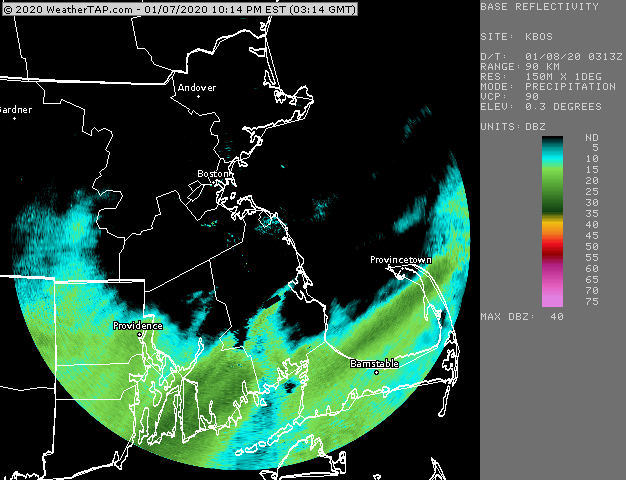
No prob, it might be the most exciting thing to track in the next 7 days, LOL....gotta hit the rack soon though.... Here's one more close up that just refreshed....it looks like the precip north of the band is filling in darker now...so hopefully a couple more hours of good steady snow for you guys.
-
That band seems to be maxing out between Bob and SouthCoastMA.....might end up with a 3 spot somewhere in there when it's done. Prob will be the jackpot considering the Cape/Islands are wasting precip on the front end with BL issues.
-
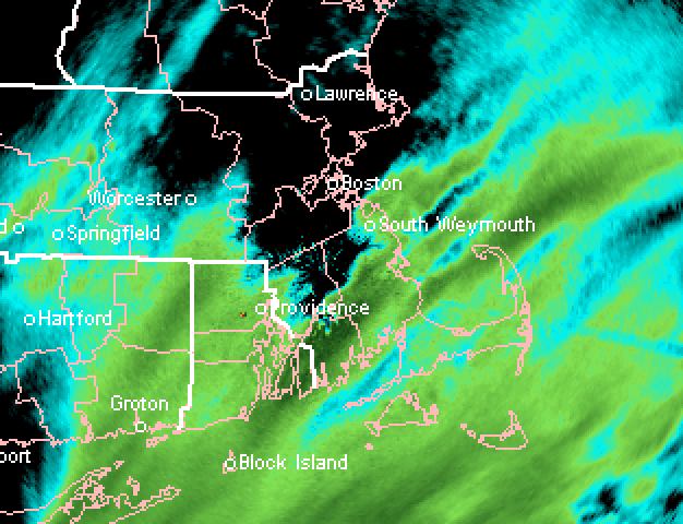
Here's the TWR radar from BOS....useful for those in the cone of silence too close to the BOX radar
-
I see 4 mile vis at FMH....nothing close to moderate. Closest I saw on the 11pm obs was KUUU (Newport RI) with 3/4 mile vis, KTAN with 1 mile vis, and KEWB with 1.5 mile vis.
-
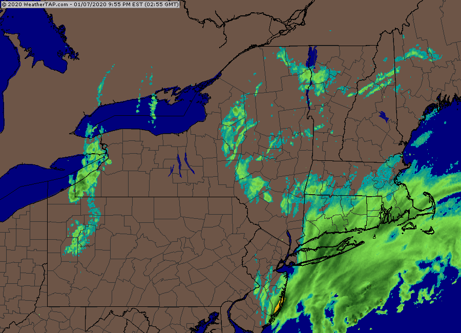
Closer view

-
I don't think we have any posters in Middleborough? Northeast side of town looks like it's getting hammered on radar. Little 35-40 dbz showing up there.

