ORH_wxman
-
Posts
90,902 -
Joined
-
Last visited
Content Type
Profiles
Blogs
Forums
American Weather
Media Demo
Store
Gallery
Everything posted by ORH_wxman
-
Lol. He’s actually pretty hilarious. It’s gotta be an act.
-
Airmass is pretty marginal tomorrow night. Leaning against any accumulating snow on that unless it really rips for a bit. Maybe mangled flakes mixing in though. Friday night has a more legit airmass so that won’t take as much to produce.
-
Not out until just after 8. DST FTL.
-
So GFS and Ukie are whiffs. GGEM/Euro/NAM are huggers. Split the difference...congrats on the historic snowstorm Scooter.
-
Kevin's summer 1816 repeat finally comes true the year he doesn't predict it?
-
Yeah thats SE of previous runs. Sfc low might technically not be, but that doesn't mater as much as the upper air stuff which is def SE of the 00z run.
-
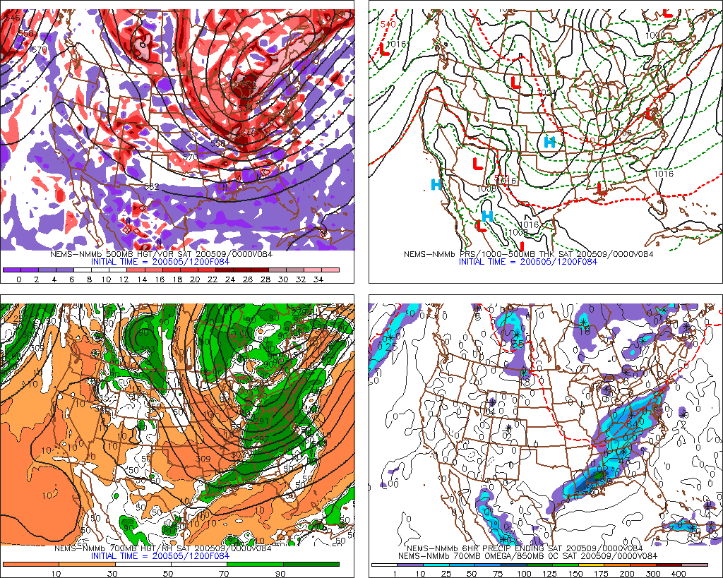
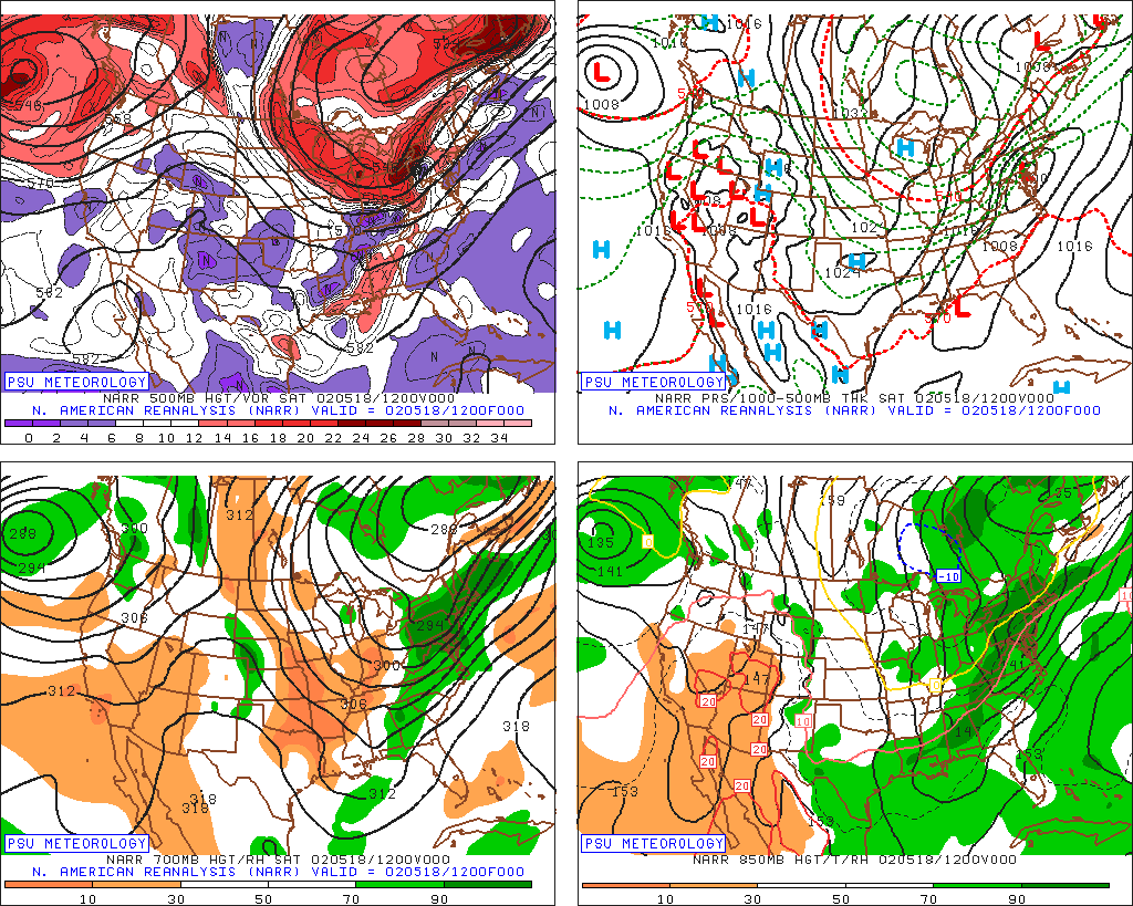
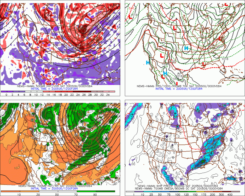
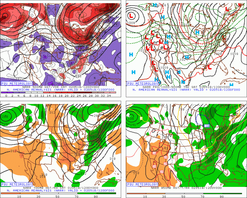
Looked like a colder version of 5/18/02 setting up (2002 panel is on the bottom)
-
Convective temps are in the 30s across some spots and at least in the 40s elsewhere. TTs around 60 or even higher(!!). Good chance of thunder where any cells pop. GFS actually shows CAPE getting to near 700 J/KG over central/western MA, lol. Hopefully it keeps up on model guidance. Still 4 days out so things could change.
-
Yeah that has slowly trended SE....could see interior hills flip over before ending. Then we get the chance at cold pool thunder snow showers and thunder graupel showers on Saturday.
-
It’s probably helped...esp lower down..but we should also remember it’s been very cold during the period where the fastest melt-off occurs. Usually all that snow is releasing really quickly in late April and early May but we’ve been really cold during that period.
-
Friday could get dicey PM. Go morning but it will be chilly.
-
Thursday should be mostly dry. Could be a passing sprinkle and some clouds around, but I wouldn't cancel a birthday golf outing over it.
-
I'm hoping for several cells to produce thunder on Saturday....that would be fun.
-
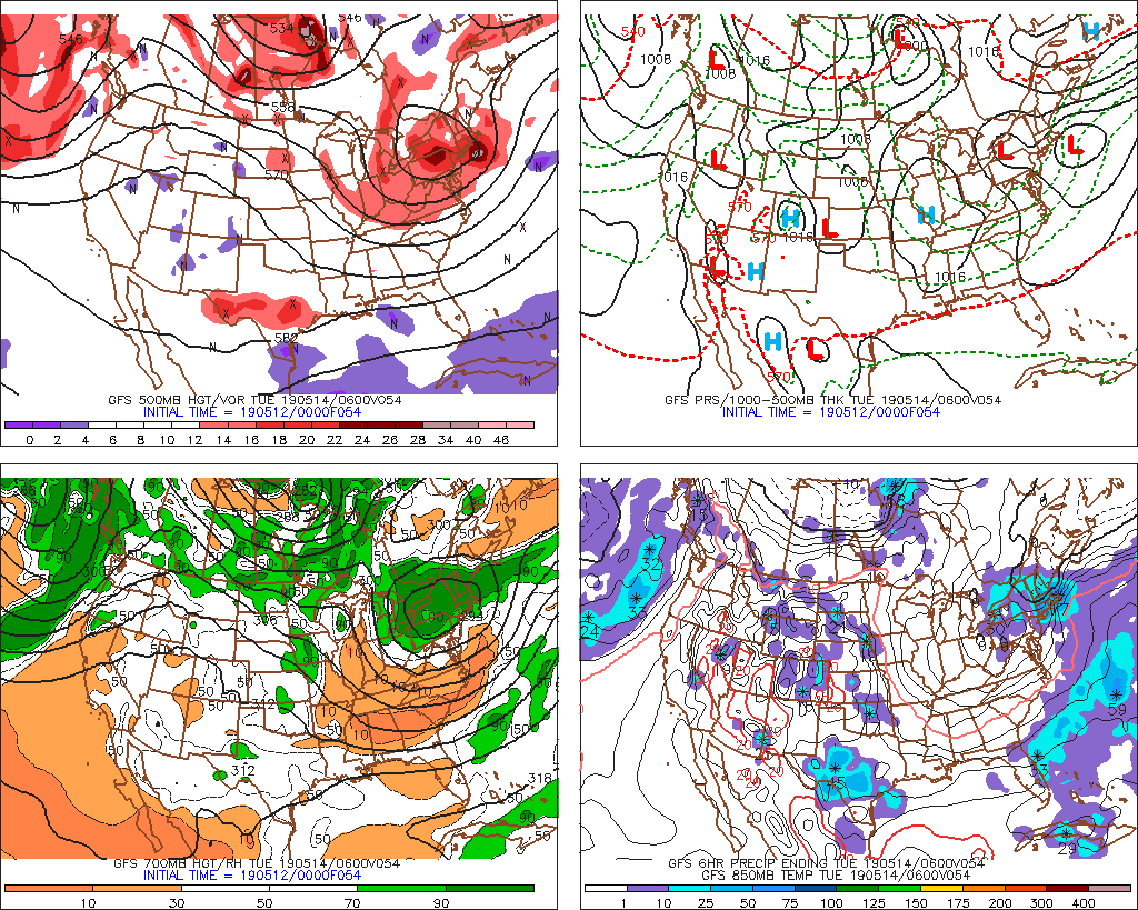
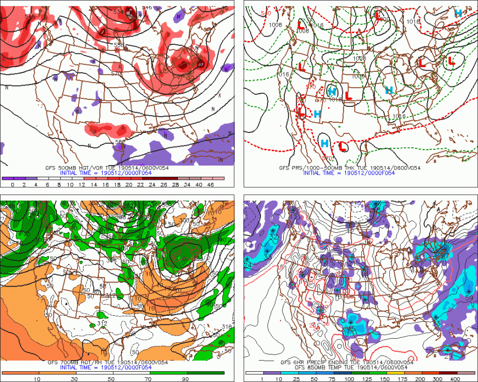
Saturday is insane...516 thicknesses. Not sure we've ever seen a cold pool aloft that intense in May. Basically anything that falls will be frozen on Saturday....definitely the type of day where even if there is sunshine, a shower passing would immediately produce graupel at temps in the low/mid 40s (ad temps would fall quickly too).
-
It’s definitely not just a 36 hour cold shot. The 2/14/16 cold shot you reference had highs in the 50s a couple days later. That would be like rebounding back into the 70s and 80s in a couple days.
-
Kevin is in classic “polish the turd” mode. We see it in winter when we have a crap pattern with +10 departures. He will say highs in the 40s isn’t that bad and try and squeeze out a marginal snow chance that has like a 10% shot at verifying. But deep down he knows it sucks. The weekend was great. It’s gonna be a while before we see that again.
-
Yeah here it is....it's not the same as the current progged pattern with the whole northeast corner of the country under sub-530 thicknesses. Cranky just doesn't want to admit how dead wrong he was on the cold reload into Canada. If we got a low in that position with precip in this coming airmass, we'd be 8-10 degrees colder than last year's storm.
-
This is like the equivalent of a good cold snap in an otherwise torch winter....only in reverse.
-
Yeah my son is outside in shorts and tshirt right now....awesome. Probably our last above-normal high temp day until at least 5/15 or so.
-
Classic post-FROPA downslope dandy where the airmass lags the wind change.
-
Congrats Jimmy and ackwaves on the NAM? lol nija'd by Scooter

-
The PV is a bust if it doesn’t get down into the teens.
-
Lol the dude is trying to spin his horrendous call after the 4/19 snow event. He specifically talked about the cold source in Canada being exhausted. The opposite had happened and we’re seeing an epic reload.
-
Lol this is classic.
-
Unbelievable. The euro run is just ridiculous looking. Glad ive been outside most of today enjoying it. Not gonna be back for a long time.