

ORH_wxman
-
Posts
90,902 -
Joined
-
Last visited
Content Type
Profiles
Blogs
Forums
American Weather
Media Demo
Store
Gallery
Everything posted by ORH_wxman
-
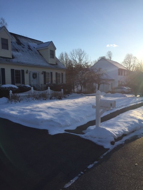
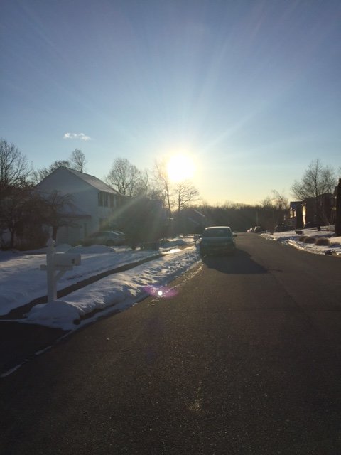
Yeah hard to get big surprises now. E MA/RI/SE CT had a good one on 1/30/18....weak 2-3" event forecasted and they got blitzed with 6-8". Thats prob the last good one i cant think of off top of my head in SNE. You could maybe fit Dec 1-3 last year into that in parts of SNE....nobody expect nearly 2 feet out just east of BAF/CEF....clocked with firehose overnight I remember.
-
Fell below 1949 yesterday by 0.1F and won't rise back above it today with a 52F low and highs in the low 70s. Whew....that was a close one.
-
Yeah in most winters where I have a snow pack intact for weeks on end, it’s usually accompanied by multiple storms refreshing the pack every so often. You get the rare winter where it snows a ton and then rots for 3 weeks (this happened in feb 2014 after we got crushed like 4 times in 10 days and then didn’t get crap for the next 3-4 weeks...and the snow pack started to get those radar shards from sublimation) but I feel 90% of the time it’s inherent that you are getting snow to refresh it. In your area, it’s true to an extreme. You’ll get upslope in addition to all the synoptic stuff.
-
Having gone to college out in central/western NY and also chased while out there, I have a love/hate relationship with LES. I think in the middle of an intense LES event can be hard to top...especially when it’s perfect snow growth and little wind...it’s almost magical seeing the 5” per hour stuff just stack straight up. But there is definitely a post-storm depression aspect of it when you look and it’s all compressed down to one third of its original depth within a day or two. Also, when that big event is elusive and you’re just seeing these 1-3” type events while it’s ripping 10” of high-QPF snow off to your east, it gets very frustrating very quickly. You start craving even a 6-7” synoptic snow with some meat to it.
-
Probably a good move re: NH plates. I definitely expect some states to freak out again this fall when cases jump back up (and they will), and that could affect access to ski resorts.
-
I was in BUF like 10 days after their 82” storm in late dec 2001, and it looked like they had gotten like 20”. LES is pretty sweet when it’s happening but the staying power is hideous, lol. Unless you’re in a place like the tug hill where it basically never stops.
-
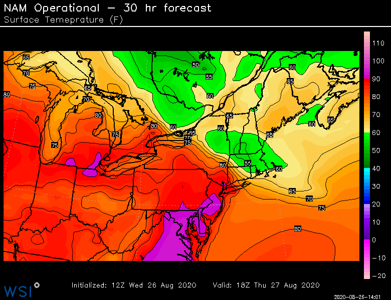
Euros had a bad warm bias in the medium range it seems like. Hard to believe in a such a hot summer but it had so many 95-100F outbreaks.
-
Euro still has +20C 850s for Thursday which would easily be 90s....though it's shorter lived on the 00z run. I've been skeptical for "big heat" on that look....I feel like maybe one day of it. Non-Euro guidance is really never getting things above +16ish at 850. However, I do think we could see a longer period of above average temps....which is fine by me in September.
-
Summer 2020 Banter and random observations
ORH_wxman replied to Baroclinic Zone's topic in New England
I’ve driven up MWN 3 times. It’s def kind of nerve wracking. Smaller car is def better. -
Repeat of T-day 2018? 16F high under full sunshine (coldest max on record in November)
-
Yeah at least you get some really good Cape blizzards there and TCs that actually produce good winds.
-
Basically the first half of 2002-2003 and the 2nd half of 2000-2001 is what we're looking at here.
-
Yeah unhinged was probably hyperbolizing it a bit. We'll have to wait until this winter when Ray's area down to my area gets smoked in a classic 128/495 storm while you are 39F and heavy rain....Bryce will learn an entire new set of swear words. You'll make crankywx look even-keeled and logical.
-
He’s gotten a bit unhinged in the retaliation against ACATT. I’m a little worried.
-
Yeah that looks about right....looks like the spread is closer in August.
-
Sept furnaces are fine....unless they are truly historic, they usually lack a big punch like we see earlier in the summer. The really big stuff usually only ends up as like one day of 90+....unless maybe you are on the tarmac at BDL. I want it above average until maybe mid november. I'll embrace a couple cold shots to remind us the season is changing, but for the most part, give me like 80/55 in Sept and 70/45 in October.
-
Btw, is Kevin still using the NAM for tomorrow or did he give up on that model?
-
That's usually going to be the case...at least for ORH. Off the top of my head, I know that the summer high temps have a higher standard deviation than the low temps so you are typically going to see the high temps drive the departure on an absolute scale. But on a standardized (sigma) scale, it may be different. I haven't actually calculated to see which has a higher sigma value this summer. My guess is that it is close....the high temps have been very warm....they just haven't been driven by extreme heat. More the "lack of cold max temps". Very consistently hot max temps....just not extremely hot where we see a lot of record max temps fall as in past hot summers.
-
Yeah if it’s one of those 240” winters there, that’s gonna be a hoot....
-
We’re due for some interior crushers. The classic 495 to 84 type storms. Haven’t seen a lot of those recently. I guess Dec 1-3 last winter was pretty close though down in your area didn’t get as much as like N CT to interior MA.
-
Keep tickling that front Southwest for Thursday. 18z guidance liking the idea.
-
Yeah. I just told kevin I’d remember this summer as hot. But not like 2010-2012 years when we were busting out 95s and 96s at ORH. Same reason people don’t remember a 23/-10 day with calm winds and radiational cooling as colder than a 14/0 day with ripping CAA. The “Science says” the 23/-10 Day was colder but nobody is going to remember it like that.
-
Yes. I won’t remember it as brutal as the 2010-2012 summers for example.
-
Yes. Coldest month on record for ORH and BDL. #2 and BOS and PVD.
-
BDL becomes complete anathema to Kevin in the winter. He won’t even mention them after October.

