

ORH_wxman
-
Posts
90,902 -
Joined
-
Last visited
Content Type
Profiles
Blogs
Forums
American Weather
Media Demo
Store
Gallery
Everything posted by ORH_wxman
-
December 5-6, 2020 Storm Observations and Nowcast
ORH_wxman replied to Baroclinic Zone's topic in New England
Metrowest is going to get a lot. Big power problems are in store.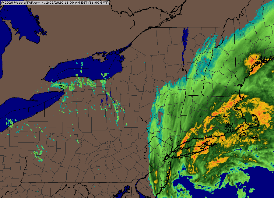
-
December 5-6, 2020 Storm Observations and Nowcast
ORH_wxman replied to Baroclinic Zone's topic in New England
-
December 5-6, 2020 Storm Observations and Nowcast
ORH_wxman replied to Baroclinic Zone's topic in New England
Fighting midlevel temps there but it should go back to snow soon. You can see the CC collapsing back SE in the last couple frames. Meanwhile, getting blitzed in ORH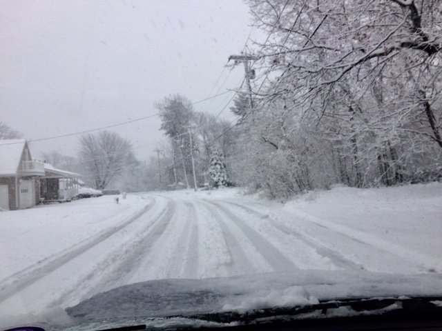
-
December 5-6, 2020 Storm Observations and Nowcast
ORH_wxman replied to Baroclinic Zone's topic in New England
Check out the stuff streaming into LI and banking up into the deformation/fronto zone in your mesonalysis. That gonna be sick over CT for the next few hours...that’s when it’s time to start adding it up...like 11am-3pm there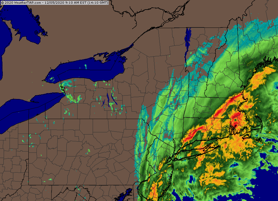
-
December 5-6, 2020 Storm Observations and Nowcast
ORH_wxman replied to Baroclinic Zone's topic in New England
WaWa webcam is pretty fun right now https://www.wachusett.com/The-Mountain/Media-Center/Web-Cams.aspx -
December 5-6, 2020 Storm Observations and Nowcast
ORH_wxman replied to Baroclinic Zone's topic in New England
Northern ORH up through like Princeton is definitely the “Westminster” of the general BOS region. -
December 5-6, 2020 Storm Observations and Nowcast
ORH_wxman replied to Baroclinic Zone's topic in New England
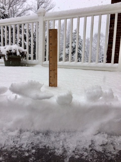
First inch down on winter hill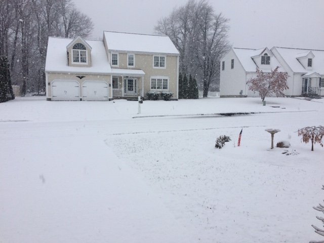
-
December 5-6, 2020 Storm Observations and Nowcast
ORH_wxman replied to Baroclinic Zone's topic in New England
Intensity dependent. You can see when Kevin flipped back to rain it was lighter echoes going over him. Same with you now. The frocimg should become extremely intense soon so I’d expect the radar to light up quite a bit in the next hour or so. You see this pretty well on the OXK radar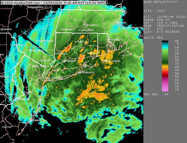
-
December 5-6, 2020 Storm Observations and Nowcast
ORH_wxman replied to Baroclinic Zone's topic in New England
All snow on NW side of town at 900+ feet. Should be all snow there shortly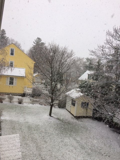
-
December 5-6, 2020 Storm Observations and Nowcast
ORH_wxman replied to Baroclinic Zone's topic in New England
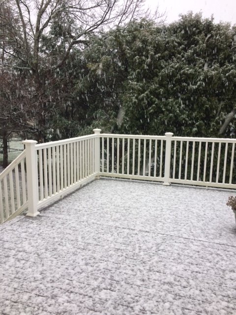
An ORH obliterator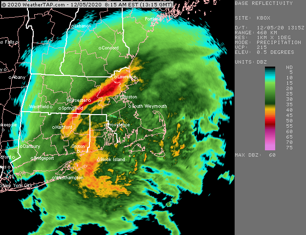
-
December 5-6, 2020 Storm Observations and Nowcast
ORH_wxman replied to Baroclinic Zone's topic in New England
-
December 5-6, 2020 Storm Observations and Nowcast
ORH_wxman replied to Baroclinic Zone's topic in New England
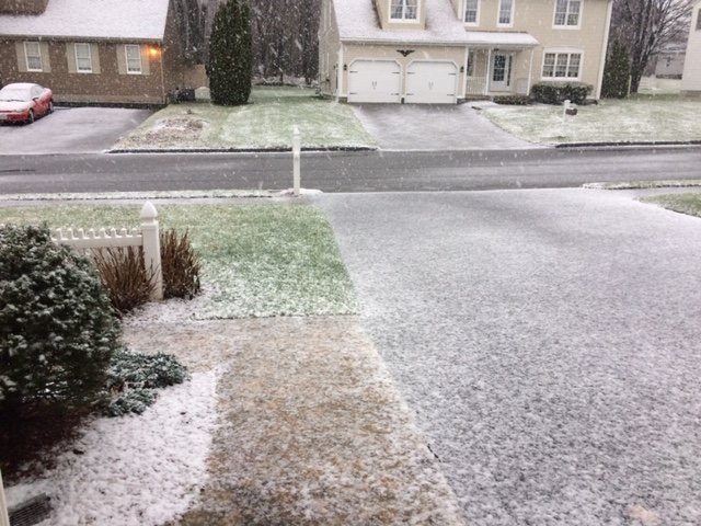
Yeah prob a lot of 20+ amounts with even about 3C colder. -
December 5-6, 2020 Storm Observations and Nowcast
ORH_wxman replied to Baroclinic Zone's topic in New England
I do like the trajectory of the warm conveyor belt south of LI. That looks like it’s just going to destroy interior CT up into MA later as it pivots into the CCB.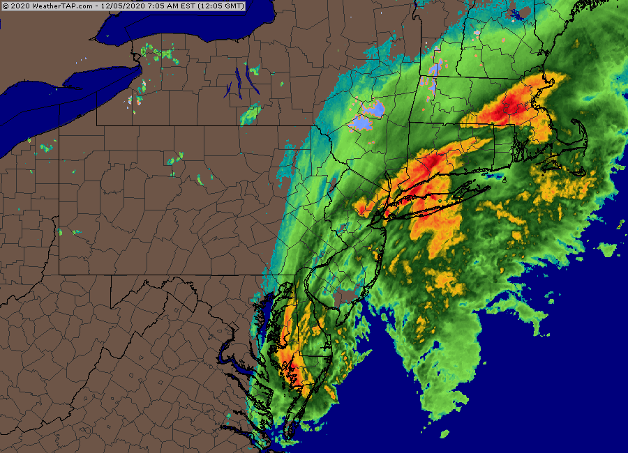
-
December 5-6, 2020 Storm Observations and Nowcast
ORH_wxman replied to Baroclinic Zone's topic in New England
Very beginning of stickage in ORH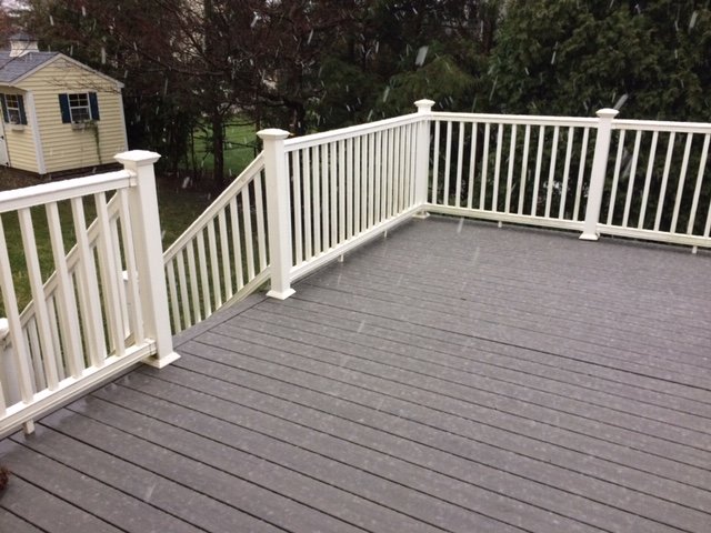
-
December 5-6, 2020 Storm Observations and Nowcast
ORH_wxman replied to Baroclinic Zone's topic in New England
Snowing on winter hill now. -
December 5-6, 2020 Storm Observations and Nowcast
ORH_wxman replied to Baroclinic Zone's topic in New England
It’s been mixing on WaWa webcam in pulses the last few min. -
Dec 5/6th major coastal/ west Atlantic cyclogenesis ...?
ORH_wxman replied to Typhoon Tip's topic in New England
Yeah the Wachusett webcams are usually live. The HD summit cam is a good one that points up the mountain. -
December 5-6, 2020 Storm Observations and Nowcast
ORH_wxman replied to Baroclinic Zone's topic in New England
WaWa webcam def looks like it’s snowing up the mountain a bit. Perhaps even some cat paws at 1050 feet on the base cam. -
December 5-6, 2020 Storm Observations and Nowcast
ORH_wxman replied to Baroclinic Zone's topic in New England
You can see the melting layer on dual pol. Im guessing about 2k feet up?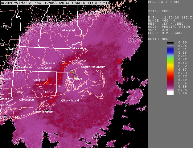
-
Dec 5/6th major coastal/ west Atlantic cyclogenesis ...?
ORH_wxman replied to Typhoon Tip's topic in New England
Thanks for the insight Walt. I agree that we’re prob looking something more like 6-10 for high terrain interior MA and not those 15” totals. I guess 12” could happen if we start seeing a changeover soon. Melting layer on BOX radar looks to be around 1500-2000 feet. ORH went from 40F to 38F last hour. I suspect mixing will start around 36F -
Dec 5/6th major coastal/ west Atlantic cyclogenesis ...?
ORH_wxman replied to Typhoon Tip's topic in New England
I’ll also take the over on ORH at 2” -
Dec 5/6th major coastal/ west Atlantic cyclogenesis ...?
ORH_wxman replied to Typhoon Tip's topic in New England
The 10 to 1 maps are def wrong for BOS. I don’t think the lowest 1500-2000 feet of the 00z sounding looks realistic though for BOS at 00z. It has extremely heavy precip over them but a steep low level lapse rate despite N/NW wind. That should prob be like 32-33F paste. My guess would be BOS gets several sloppy/pasty inches if the euro came to fruition (and adjusting for the lowest 2k feet) -
Dec 5/6th major coastal/ west Atlantic cyclogenesis ...?
ORH_wxman replied to Typhoon Tip's topic in New England
This has to be the biggest throwback thread we’ve ever seen. Mid-Atlantic posters, Ekster, DT.....LOL. -
Dec 5/6th major coastal/ west Atlantic cyclogenesis ...?
ORH_wxman replied to Typhoon Tip's topic in New England
Slower is definitely better for BOS area. Gives them a couple extra hours to get smoked by the CCB as it collapses east. Obviously the clown maps are overdone, but the rates between 18z and 00z are going to be crazy. Can’t discount some pretty good snow after 00z for far E and NE MA too. A lot of guidance is starting to show that hanging tough. -
Dec 5/6th major coastal/ west Atlantic cyclogenesis ...?
ORH_wxman replied to Typhoon Tip's topic in New England
Dude that vaporizer... Looks good on the 00z euro again. This thing slowing down a bit is going to be good for someone who gets under that CCB/deformation. That could be a lot of folks from like ORH to E NH to lake region to Sugarloaf.


