

ORH_wxman
-
Posts
90,902 -
Joined
-
Last visited
Content Type
Profiles
Blogs
Forums
American Weather
Media Demo
Store
Gallery
Everything posted by ORH_wxman
-
Active mid December with multiple event potential
ORH_wxman replied to Typhoon Tip's topic in New England
I'm hoping the convection gets wrapped into the WCB in this and we get an obscene few hours on the front end. -
Active mid December with multiple event potential
ORH_wxman replied to Typhoon Tip's topic in New England
Only a matter of time until the GFS scores the coup from yesterday! -
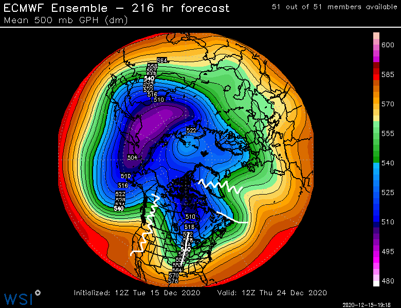
May even have to watch 12/24-12/25.....nothing great on guidance yet and we've seen some grinch storms, but if you look at the longwave pattern, this is pretty classic for a correction to more wintry.....look at the features. As Tip would say, "the correction vector" may point to colder here if that look stays.
-
Active mid December with multiple event potential
ORH_wxman replied to Typhoon Tip's topic in New England
Yeah I saw one run early yesterday that did that....I wasn't checking it regularly yet though until this morning. Interesting that it was doing that the whole time but slowly moving it up. -
Active mid December with multiple event potential
ORH_wxman replied to Typhoon Tip's topic in New England
18z RPM is tickling SE a bit too. -
Active mid December with multiple event potential
ORH_wxman replied to Typhoon Tip's topic in New England
18z NAM might be the first NAM run in a while to not be more amped than the one before it....looks a shade shallower with the shortwave and downstream ridging through 15h. The confluence might be a hair weaker though so we'll see if it makes up ground. -
Active mid December with multiple event potential
ORH_wxman replied to Typhoon Tip's topic in New England
The coup is complete.....
-
Active mid December with multiple event potential
ORH_wxman replied to Typhoon Tip's topic in New England
It's fine to speculate about where it would be...as long it is understood that it is speculation OR you are playing devil's advocate on a particular run. I think some of your posts came off as high certainty. I wouldn't say it is high certainty you end up in a subby zone. Some of your subsequent posts were more reasonable on the issue....it is certainly possible but there are also a number of ways you can avoid it. -
Active mid December with multiple event potential
ORH_wxman replied to Typhoon Tip's topic in New England
Yeah, basically just get slammed with the WCB and then the lower level forcing behind it. I don't think it's going to come that far NW though....but yeah, that would be yet another way to get rid of the precip minima -
Active mid December with multiple event potential
ORH_wxman replied to Typhoon Tip's topic in New England
What happens is it pushes the best WAA in the mid-levels in the WCB from CT almost due E over SE MA and out to sea while the ML magic banding goes from like N/central PA to Catskills into NW MA/S VT/SW NH....and MA is kind of left in the middle and E MA still gets decent low-level forcing precip while central MA to the CT valley gets kind of shafted....this is where scott (coastalwx) was saying we need to watch the convective blob....if that is escaping eastward less as we get closer, then we're going to see a much stronger WCB into MA. -
Active mid December with multiple event potential
ORH_wxman replied to Typhoon Tip's topic in New England
Yeah it gets kicked by the s/w behgind it digging more. The whole precip shield is further NW though since our man s/w is deeper. -
Active mid December with multiple event potential
ORH_wxman replied to Typhoon Tip's topic in New England
Still NW at 48...but not a big shift compared to other guidance. Kind of a typical Euro move. -
Active mid December with multiple event potential
ORH_wxman replied to Typhoon Tip's topic in New England
It's definitely making up gorund now...more amped at 36h. -
Active mid December with multiple event potential
ORH_wxman replied to Typhoon Tip's topic in New England
We didn't get hosed as bad in boxing day as further east and northeast in the Tip to ASH belt....we had about a foot while some of those areas had like 6-7" of sand. -
Active mid December with multiple event potential
ORH_wxman replied to Typhoon Tip's topic in New England
The confluence is just a smidge weaker, so that might be enough to make up for the s/w dragging some on this run. -
Active mid December with multiple event potential
ORH_wxman replied to Typhoon Tip's topic in New England
Euro is actually less amped through 18h than 06z....wouldn't that be the ultimate Euro move, to do the opposite of the other guidance. -
Active mid December with multiple event potential
ORH_wxman replied to Typhoon Tip's topic in New England

-
Active mid December with multiple event potential
ORH_wxman replied to Typhoon Tip's topic in New England
Euro running now...definitely expect it to come NW this run, but the question is how much. -
Active mid December with multiple event potential
ORH_wxman replied to Typhoon Tip's topic in New England
I was commenting on Taunton....the Cape would get a lot of rain on that setup. You'd still get some snow....but rain at the height for sure. -
Active mid December with multiple event potential
ORH_wxman replied to Typhoon Tip's topic in New England
Doesn't look like 925 gets warmer than about -3C....pretty hard to rain in that setup unless you are out on the water. -
Active mid December with multiple event potential
ORH_wxman replied to Typhoon Tip's topic in New England
It's not ideal for huge wind due to the frigid cold low levels....when you have a damming setup, it's harder for winds to mix. It should get pretty darn windy on the Cape though where they are much warmer in the low levels....abd maybe even E MA coast for a time. The interior would probably due better for wind if the high was more west in Ontario which would be less cross-isobaric flow. -
Active mid December with multiple event potential
ORH_wxman replied to Typhoon Tip's topic in New England
I think that will be an issue just north of the mid-level death band...you'll prob have a lot of lower level dry air that makes it arctic sand wherever that happens. I don't think you'll get a massive virga storm though...you prob need to be at the very northern periphery to stay virga all storm. -
Active mid December with multiple event potential
ORH_wxman replied to Typhoon Tip's topic in New England
You taught them well...... They were even whining about NAO blocks for a few runs even though this would be in Ottawa without it. -
Active mid December with multiple event potential
ORH_wxman replied to Typhoon Tip's topic in New England
I fully expect a meesenger shuffle SE at the end...the question si where does this peak on the models for the NW trend. It could go further at 00z before coming back some. -
Active mid December with multiple event potential
ORH_wxman replied to Typhoon Tip's topic in New England
He just pissed off the karma gods...now he'll be choking on exhaust while MHT gets ripped.


