

ORH_wxman
-
Posts
90,902 -
Joined
-
Last visited
Content Type
Profiles
Blogs
Forums
American Weather
Media Demo
Store
Gallery
Everything posted by ORH_wxman
-
Significant upper middle Atlantic S/CNE mix/snow potential Jan 3+
ORH_wxman replied to Typhoon Tip's topic in New England
About 2” total. Wintry appeal at least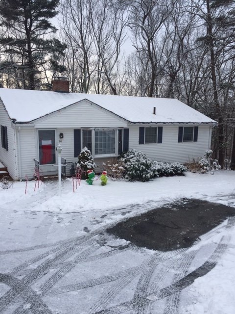
-
Significant upper middle Atlantic S/CNE mix/snow potential Jan 3+
ORH_wxman replied to Typhoon Tip's topic in New England
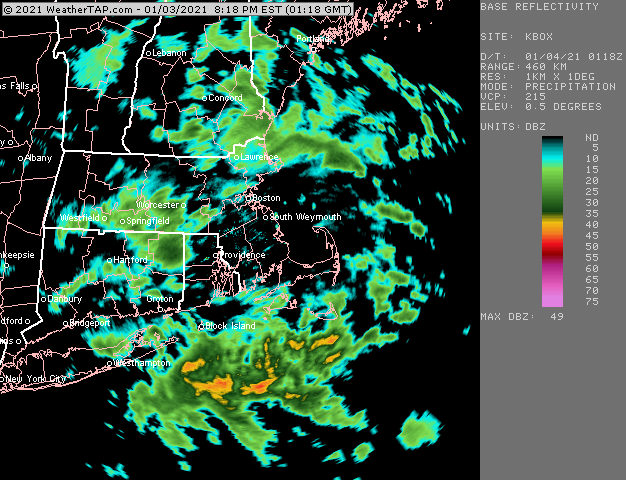
Really ripping in this batch. Hoping to clear 2”. Nearly there. Busted event but still a nice snowy evening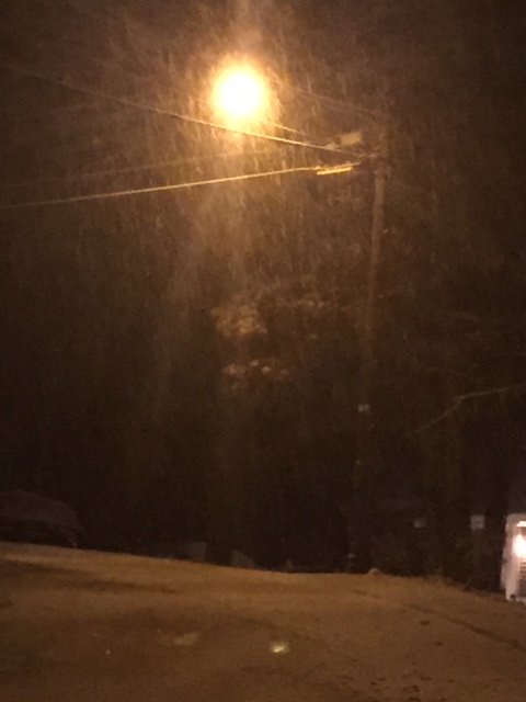
-
Significant upper middle Atlantic S/CNE mix/snow potential Jan 3+
ORH_wxman replied to Typhoon Tip's topic in New England
-
Significant upper middle Atlantic S/CNE mix/snow potential Jan 3+
ORH_wxman replied to Typhoon Tip's topic in New England
Nice little blob incoming. Hopefully we can score another half inch or inch out of it. That would actually prob cover any remaining grass blades trying to poke up. We look for the small victories in crappy events.... -
Significant upper middle Atlantic S/CNE mix/snow potential Jan 3+
ORH_wxman replied to Typhoon Tip's topic in New England
ANother round moving through. This has been very good snow growth. -
Significant upper middle Atlantic S/CNE mix/snow potential Jan 3+
ORH_wxman replied to Typhoon Tip's topic in New England
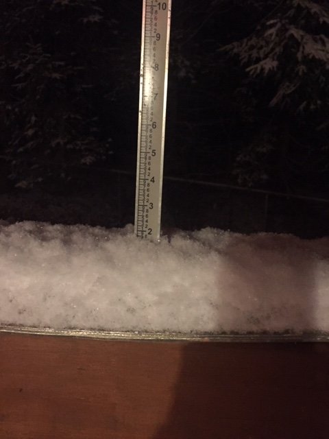
Almost an inch here eyeballing. Hopefully some more intense batches roll through. Most of that fell in under an hour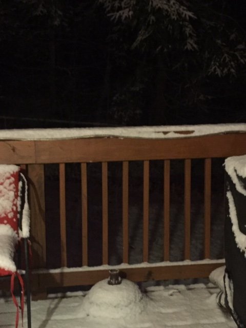
-
Significant upper middle Atlantic S/CNE mix/snow potential Jan 3+
ORH_wxman replied to Typhoon Tip's topic in New England
Flood light actually catches it a bit better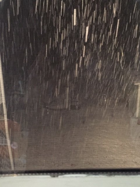
-
Significant upper middle Atlantic S/CNE mix/snow potential Jan 3+
ORH_wxman replied to Typhoon Tip's topic in New England
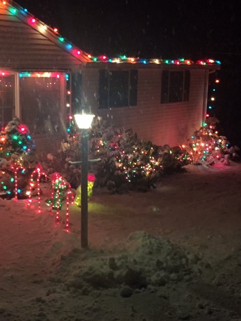
Ok this is legit in this little dark echo. Legit fatties and moderate it maybe even heavy snow. Too bad it doesn’t last. Pic doesn’t capture it well but still nice to see
-
Significant upper middle Atlantic S/CNE mix/snow potential Jan 3+
ORH_wxman replied to Typhoon Tip's topic in New England
Nice little batch moving in here. Good fatties. -
Significant upper middle Atlantic S/CNE mix/snow potential Jan 3+
ORH_wxman replied to Typhoon Tip's topic in New England
Off and on light snow here. Have a coating so far. Plenty cold to stick with temp of 30F. -
Significant upper middle Atlantic S/CNE mix/snow potential Jan 3+
ORH_wxman replied to Typhoon Tip's topic in New England
Bitching and whining has really become in style on here the past 3-5 years. -
Significant upper middle Atlantic S/CNE mix/snow potential Jan 3+
ORH_wxman replied to Typhoon Tip's topic in New England
I dunno, was looking at 15z run on ewall. It’s prob wrong anyway...but can’t rule out advisory snow quite yet I don’t think I’m spots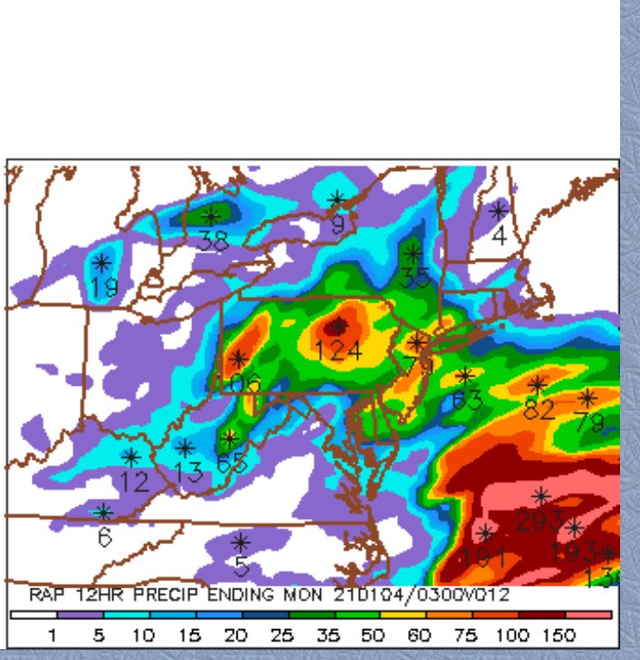
-
Significant upper middle Atlantic S/CNE mix/snow potential Jan 3+
ORH_wxman replied to Typhoon Tip's topic in New England
Rap goes wild for SW CT later. Give them borderline warning snows. Its from the stuff out in PA developing...that’s what you’ll want to watch if there’s a surprise somewhere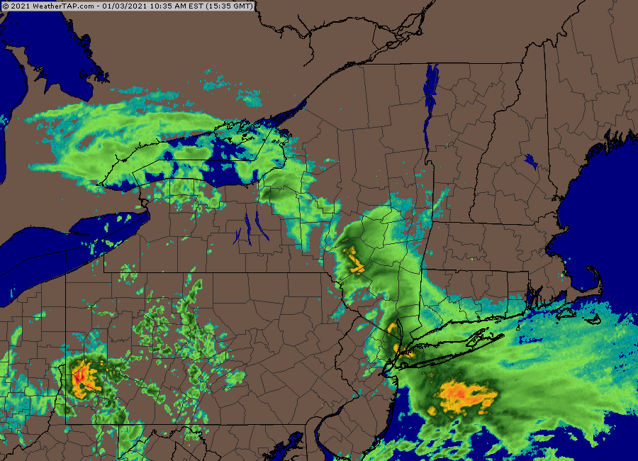
-
Significant upper middle Atlantic S/CNE mix/snow potential Jan 3+
ORH_wxman replied to Typhoon Tip's topic in New England
But either way, it screws with the downstream height field. So you get less “curling” from the main shortwave our west. -
Significant upper middle Atlantic S/CNE mix/snow potential Jan 3+
ORH_wxman replied to Typhoon Tip's topic in New England
Agreed. It was not showing up nearly as defined on those euro runs and some other guidance but the NAM was insisting on it. It’s tough though to trust that it’s real all the time because we’ve seen that garbage overplayed so many time on guidance. Even the Dec 16-17 storm had too much spurious convection out east that was causing some of those runs to pull the storm straight east off the Delmarva which ended up a lot different than reality. -
Significant upper middle Atlantic S/CNE mix/snow potential Jan 3+
ORH_wxman replied to Typhoon Tip's topic in New England
What a bizarre system. I couldn’t even tell you why guidance fizzles it so fast from N PA/NY state into SNE. We’ll still have to watch if that stuff holds together better than guidance says and some peeps pick up at least maybe low end advisory. -
Significant upper middle Atlantic S/CNE mix/snow potential Jan 3+
ORH_wxman replied to Typhoon Tip's topic in New England
Just saw it too. When the early 00z guidance came in I wasn’t feeling great. Some of those same mesos are looking a bit better now though....so still gotta think there may be a decent stripe of advisory snow? Vortmax track is pretty classic for it....it’s just we aren’t going to be able to sync up the conveyors so warning snowfall isn’t happening. -
Significant upper middle Atlantic S/CNE mix/snow potential Jan 3+
ORH_wxman replied to Typhoon Tip's topic in New England
GGEM has a nice midlevel sig that actually gets into pets of CT and then E MA later as the big CCB tries to back in. The meat is out of the cap but there is some lift showing up at 500-600mb to the northwest. -
Significant upper middle Atlantic S/CNE mix/snow potential Jan 3+
ORH_wxman replied to Typhoon Tip's topic in New England
V16 came in nicer than 18z. Prob advisory snows for a chunk of the interior. -
Significant upper middle Atlantic S/CNE mix/snow potential Jan 3+
ORH_wxman replied to Typhoon Tip's topic in New England
Ok so the rgem does not agree with the other mesos at 00z. Only ugly black and white maps are out but best i can see is it still has widespread high end advisory snows for most of CT/MA/RI (away from SE coast) I was kind of assuming it would go the direction of the others. -
Significant upper middle Atlantic S/CNE mix/snow potential Jan 3+
ORH_wxman replied to Typhoon Tip's topic in New England
I think the euro will be more correct but I’d be lying if I said I wasn’t spooked a bit. I still think the Synoptics favor something closer to the euro. I think Bob is correct noting that the mesos are chasing some lead crap....whether that’s real or not is hard to say but I usually am skeptical of it. -
Significant upper middle Atlantic S/CNE mix/snow potential Jan 3+
ORH_wxman replied to Typhoon Tip's topic in New England
Just as ugly as the NAM. Long range RAP is hideous too. All the mesos so far at 00z are doing the same thing. I’m assuming the RGEM will join the party here in a minute. The more interesting thing is what do the globals do. -
Significant upper middle Atlantic S/CNE mix/snow potential Jan 3+
ORH_wxman replied to Typhoon Tip's topic in New England
Yeah those are some UGLY runs. Really bizarre seeing this so close to the event when you have the euro much better looking. It’s weird that the midlevel stuff is actually pretty potent out to the west in NY state and then just goes poof as it enters SNE. -
Significant upper middle Atlantic S/CNE mix/snow potential Jan 3+
ORH_wxman replied to Typhoon Tip's topic in New England
Looks like 18z EPS held serve. Might have even tickled slightly west. -
Significant upper middle Atlantic S/CNE mix/snow potential Jan 3+
ORH_wxman replied to Typhoon Tip's topic in New England
I’d like to see the h5 look tighten up just a smidge more to get on board with double digits anywhere outside of downeast. Euro is basically nearly there but it’s just leaving enough slack on the east side of the shortwave to make me worried about losing the baroclinic zone east quickly after the initial midlevel thump that gives widespread advisory snows from CT to MA.


