ORH_wxman
-
Posts
90,902 -
Joined
-
Last visited
Content Type
Profiles
Blogs
Forums
American Weather
Media Demo
Store
Gallery
Everything posted by ORH_wxman
-
-
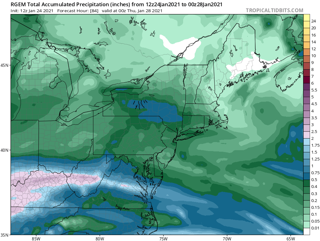
RGEM is actually a pretty decent thump during tomorrow evening for a good chunk of SNE...that initial WAA band is stronger on that model than some other guidance. One of the reasons it is spitting out near-warning snowfall.
-
NAM snows for like 40 hours....lol. I'd take it at this point even if it takes 40 hours to get 3 or 4 inches.
-
7 days out....never set expectations that early. This could still be congrats SLK or a whiff. It does look at the moment though.
-
06z euro juiced it up a little from 00z.
-
Para GFS not really biting in the big IVT/norlun aspect for 1/28 that the OP GFS is selling. More like just very light stuff lingering. It likes the pike region though for 1/26 into early 1/27.
-
Congrats Ray on the norlun for the GFS.
-
This event isn’t supposed to impress for rates. It’s a long duration event. It might snow for 30 hours and you have 3-4” to show for it. Maybe even longer. So the radar isn’t required to look amazing to reach 3 or 4 inches if you are snowing for that long of a duration. That said, still probably best to keep low expectations until we’re another 24 hours closer since this type of system isn’t super stable on model guidance. But I do see potential for some upside.
-
The snow growth looks good. But obviously that could still change.
-
RGEM looked like more than that for many. Like solid advisory for a large chunk of SNE.
-
Yeah that’s the best NAM run yet for here. Lol.
-
Anyways. That is the feb threat. Prob should post in the other thread.
-
It doesn’t even look bad. Not sure why he’s whining. That will prob hit us.
-
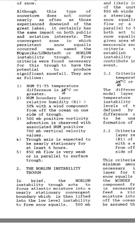
It’s essentially the same as the WINDEX checklist except a few tweaks (as you know, the instability parameters will be similar)
-
It might go into the 28th ala Tip’s post. Depends on the orientation of the ocean storm and upper air but I could see that playing out...kind of the “clear air mode radar elements moving in from the E or NE”.
-
New thread for Jan 26-27 https://www.americanwx.com/bb/topic/54423-jan-26-27-light-snows/
-
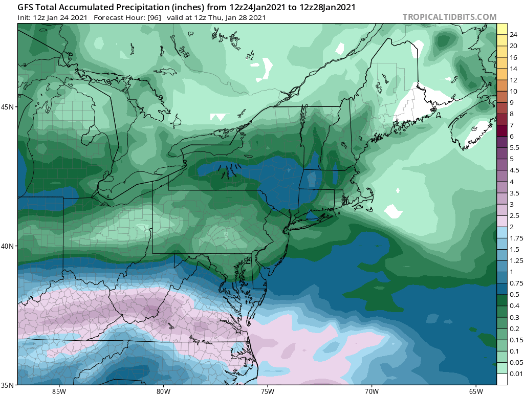
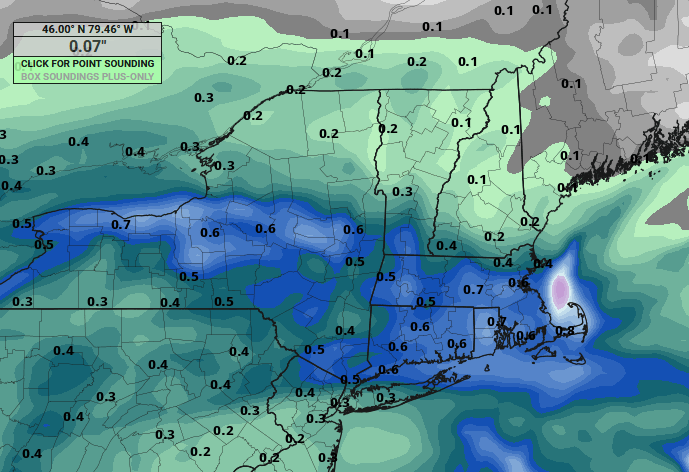
Starting this thread for the Jan 26-27 overrunning snows. Favored is southwest but some of the model guidance today is showing some better potential for further north and also prolonging the snows with an inverted trough. GFS was the most weenie-ish so I’ll post it, first but other guidance is suggesting reasonable chance for advisory snows somewhere in SNE....you’ll notice the heavier band in central NY that points toward SNE and it’s on almost all the guidance...we’ll need to watch if that can maintain longer as we get closer to the event...that is the key for getting more than an inch or two


-
GGEM is pretty decent too. Maintains that shortwave integrity longer and gets the steadier snows into SNE.
-
GFS looking pretty nice actually. Even better than 06z
-
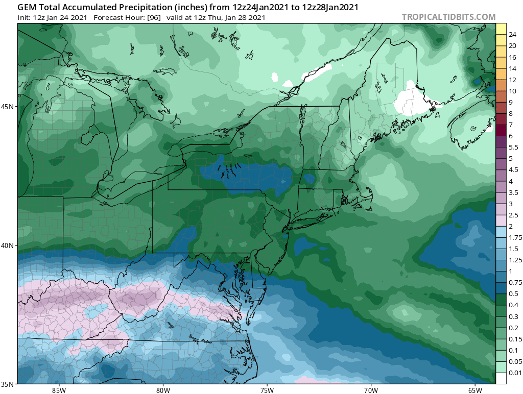
RGEM has maintained the shortwave integrity better than the NAM which is why it’s liking the precip further northeast and more robust amounts where it falls. ICON does this to an even more extreme...which we can probably toss since it’s getting a few inches well into NNE.
-
Very possible. I’m not committing northeast of HFD yet. I’d be fairly optimistic for at least an inch or two in SW CT though with a chance for advisory if things go well.
-
12z NAM was hideous. This event has been flip flopping almost every run though. SW CT is best but still can’t rule out some snows getting further northeast.
-
Quite unlikely considering that is the most favorable piece of guidance and the block isn’t going anywhere. Euro is significantly southeast of that.
-
Feel free to check out until the spring. I’m not forcing anyone to invest. But I’m not going to pretend threats don’t exist either just because past ones have failed.
-
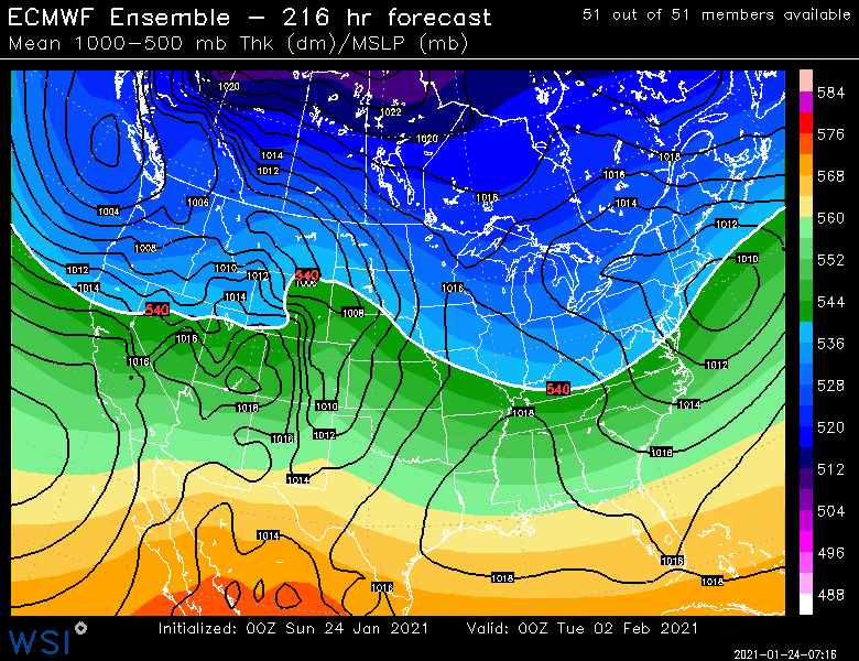
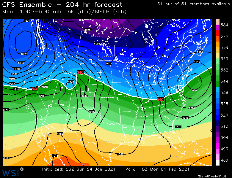
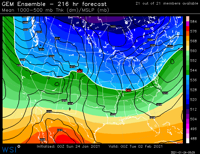
One thing you want to see on a longer range threat is strong cross-guidance ensemble support. Heres the EPS, GFS, and GEPS in that order: For those who can’t handle the emotional roller coaster of failed storms, I’d suggest not checking back in until the 2nd half of this week. But this is at least a pretty strong guidance signal for a D8-9 threat.