

ORH_wxman
-
Posts
90,902 -
Joined
-
Last visited
Content Type
Profiles
Blogs
Forums
American Weather
Media Demo
Store
Gallery
Everything posted by ORH_wxman
-
NAM is going to demolish SNE this run....that southern stream just went crazy.
-
Yep, that southern strema isreally strong this run, it might make up for the northern stream not digging as much early on. By 60h, it has made up most of the ground already it looks like.
-
Weeklies decided to finally punt on the idea of a warmup in late February. They are trying to torch March though.
-
Yeah the northern stream is fighting it this run...not digging quite as much.
-
Lol, I hot linked the 2nd image by accident....should be fixed now.
-
EPS is pretty decent looking for the 2/9 threat
-
Epic ice storm in MS/AL too leading into it.
-
Nice bump W on the EPS too.
-
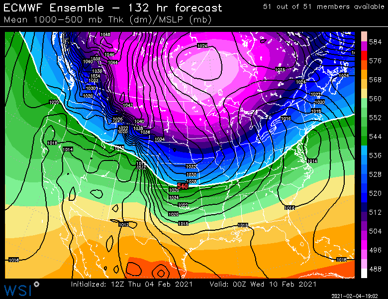
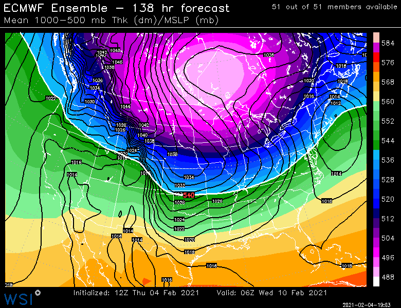
Look at that meridional pattern near the end of the run
-
Euro has kind of a typical SWFE for 2/9. Like 3-6 pike northward (and 6+ for CNE area in C NH to S ME) with 1-3 south and some ytransition to sleet/ZR (and RA on coast). At least that one has a really nice antecedent airmass so it wouldn't take too much gymnastics in the flow to keep it all snow.
-
Yeah where you see those isotherms packed, you'd prob get a weenie band displaced NW of that...esp in a very tilted system like this one. The key is getting it close enough so the realy good band gets over land. It might get the Cape on this run (even though it doesn't directly show it on QPF)
-
18 year anniversary...lets get a band that produces similarly.
-
That has a sweet fronto-banding look on the NW side....get that just a tick west.
-
Scraper this run...maybe 1-2 inches for a chunk of SNE....maybe low end advisory for far SE areas.
-
Yeah it kind of slingshots around the northern stream in the lakes....it just needs enough room to do it.
-
Euro is def west of the 06z run so far....we'll see if it is enough to get decent snows into SNE this run or if it is a scraper.
-
It's the same system. Euro originally had it for Sunday night maybe into very early Monday morning. It is basically just sped up 8-12 hours on the current reincarnation.
-
Yeah sell that...its def cold enough in SE MA, but I'm not sure I buy ACK over to George's bank getting smoked like that yet.
-
It did last storm for sure.
-
Nice bump on V16...that's prob high end avisory or low end warning snows for the SE folks in the PYM to UUU belt.
-
Better than 06z GFS but not at NAM levels....the GFS gets SE MA/RI pretty good though on this run.
-
GFS looks like it is going to be west of 06z just looking at 36 hours out west for 2/7.
-
Lol....you are technically correct. It didn't help us at 12z. Didn't hurt us either though....at least not yet.
-
So that means it trended well SE since it was a big hit at 06z. At least the other guidance was trending NW....even if incrementally.
-
It definitely is "The Ukie of shorter term models". It loves to have some weird solutions and isn't afraid to make big swings. I do like it inside of about 24-36 hours though....it actually did a half-decent job identifying that Maine/NH resurgence in the snow in the last event. It was a little bonkers otu at 48 hours, but more reasonable inside of 30h. But I'm definitely not too worried about what it is doing at 78 or 84 hours.

