

ORH_wxman
-
Posts
90,902 -
Joined
-
Last visited
Content Type
Profiles
Blogs
Forums
American Weather
Media Demo
Store
Gallery
Everything posted by ORH_wxman
-
They continued to the winter pattern into early March unlike last week.
-
18z NAM is going to be south of the 12z run.
-
Just like we all thought before the season. Cold/snowy February.
-
Trend has been south with Feb 11-12....might come back but it needs to reverse soon.
-
Yep, Euro is nada for Thu/Fri....goes big for Vday though. I should say it really goes moderate for Vday, but there's potential there for a lot higher.
-
That's a nice sig for NW CT to the pike region up into S NH for a weenie band
-
Only behind ORH by 0.3"
-
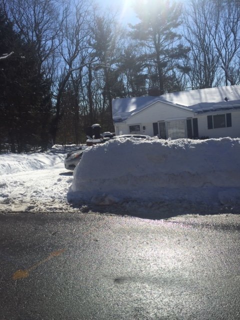
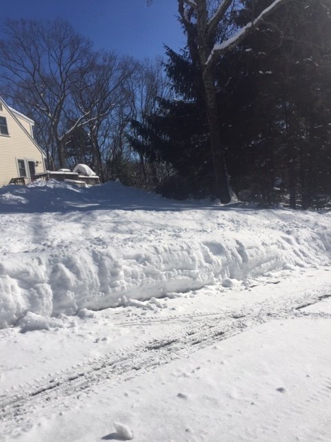
Pack becoming pretty impressive.
-
Ukie was pretty juicy. That's a nice event for almost all of SNE and into S NH/S VT.
-
No, he made one for the Feb 11-12 threat....this is for after that around 2/14. edit: I see he updated the thread to include both....
-
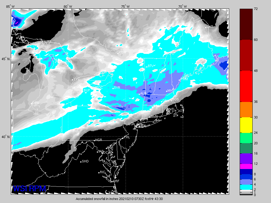
ORH had 0.47" of QPF which was about double of the 00z Euro run the night before. 12z Euro run was slightly better but still off as it only had 0.30" of QPF. OTOH, the NAM had like 0.7" so it didn't fair any better. I agree with Ryan that the snow growth made the high QPF models look more correct than they were. They were way too juicy in most areas.
-
I'm thinking 3-5ish right now for most of SNE and into S VT/S NH....a little less near the south coast and taering as you head north. But there is room for a stripe of 6-7" totals if things break right. On some of these runs, there is a banding sig....so that has to be watched. It would prob be pretty high ratios again too. Like someone gets 7" on 0.40" of QPF in a band.
-
Big coastal snowstorm on GFS today for 2/14. This threat has been there but bouncing around on every run on each model. The way guidance handle the PV will change these solutions and that feature is very difficult on the models.
-
Yes, how tilted a system is matters, but also how far northwest into that tilt does the big lift penetrate. Those aren't always the easiest to diagnose. The models could be a little off on both aspects and you miss by 25 miles on a big band.
-
The nickel and dime pattern is a lot more appealing when there is already a good snow pack...lik many in here have right now.
-
GFS looks about the same as 06z....maybe a smidge south but basically negligible. It's a nice look for a lot of SNE.
-
ICON ticked south too.
-
I wouldn't have forecasted the band to be as far NW as it was based on guidance....the max H7 fronto was down near the south coast or even slightly offshore....so I would have had the max band going from like SE CT to maybe TAN or something. Not an easy forecast.
-
Well Reggie is coming in a good tick south of 06z. So much for consistent cross-guidance trends.
-
RPM is zonked too
-
Yeah that is a pretty solid jump north. Ptype issues south of the pike for a time on that.
-
You prob get a couple inches on that.
-
06z Euro looks pretty solid too. Not quite as good as the American guidance but still solid advisory look.
-
Definitely some nice looking overnight runs. Those 06z NAM and GFS runs are developing a cross-hair sig too...I had said previously that the runs I checked didn’t really have it. But these beefed up cycles definitely do so someone could get a nice stripe of low end warning snows if that happens.
-
LOL. I loved Bode Miller. A New Hampshire native...from right near your new stomping grounds. I think he grew up in Franconia and did a lot of his early skiing on Cannon.


