ORH_wxman
-
Posts
90,902 -
Joined
-
Last visited
Content Type
Profiles
Blogs
Forums
American Weather
Media Demo
Store
Gallery
Everything posted by ORH_wxman
-
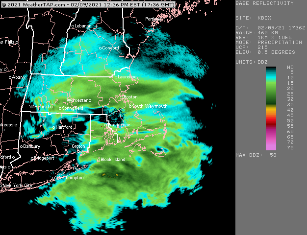
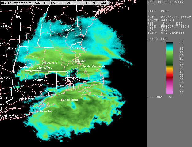
Filling in now
-
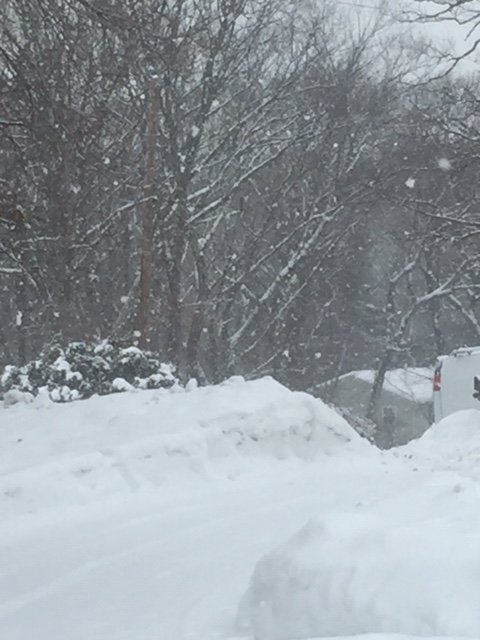
Good flakes here
-
We're def getting better and better snow growth by the second just north of the slot....was pure baking powder/dandruff even 20 minutes ago, but now it's probably more than half hooked-dendrites. Seems like 25 dbz is prob the magic number down here.
-
You can actually see it better on OKX radar....new bands trying to start up in CT
-
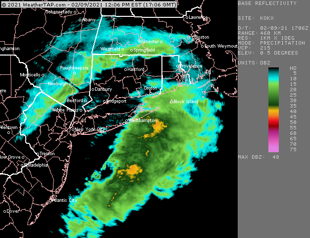
There's stuff trying to redevelop to your SW. You prob aren't completely done.
-
Getting some better flakes in this now. Still a lot of baking powder but mixed with some hooked dendrites. Vis is really low now. This is borderline moderate/heavy.
-
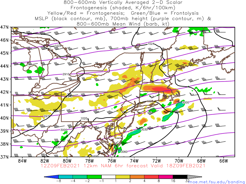
NAM developed some modest H7 fronto....if we're going to see some enhanced bands, we'd want that to start showing up in the next couple hours.

-
Snowing pretty decent in this band, but the snow growth isn't good. Its like snowing moderate dandruff.
-
You might be screwed....it'll be close. There will be redevelopment, but it might be almost top of you or it mainly is N.
-
Doesn't look like a very wide area will be seeing the steadier/heavier stuff unless this fills in more...which it might.
-
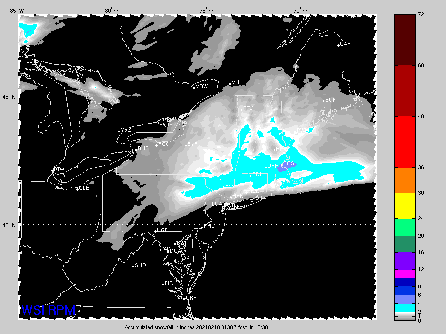
2-5"....not seeing much warning snowfall potential. Maybe a narrow stripe can get 6 or 7 if everything breaks right in the next 8 hours. If that stuff south of LI could link up with the northern bands, then it would get exciting, but it seems they don't do that until offshore. But we watch...
-
It is hot and cold. I've seen it do great and then other times it's a dumpster fire. Someone is gonna be wrong though between HRRR and NAM.
-
Radar trying to fill in now off to the west.
-
Feb 2015, Jan 2005, Jan 2011, Jan 1987, Jan 1996, Jan 2015.....prob Feb 1899 in there too. The top months all seem to be bunched near 50" for the month. Though obviously if you cross over month boundaries, you can get 3-4 week periods with more than that (ala 2015)
-
Yeah biggest difference between the NAM and the RAP/HRRR is south of the MA/CT border....NAM looks a lot better there than RAP/HRRR.
-
12z NAM looks really good for pike region...best cross-hair sig continues to be N of pike though....it does get better QPF south of MA/CT border than previous runs.
-
Congrats Scooter, Dotrat, wxniss, and Jerry on the RPM.
-
Yeah model guidance suggested a putrid-looking radar early on and that's what we are getting. It starts to organize over SNE late morning and our peak time is like noon to 4pm.
-
The system may try to blow up a little before it exits east so I could see some areas out there getting some enhancement before it ends. Not sure I’d have the confidence to go warnings though.
-
GFS has an excellent cross-hair sig for far N CT and the pike region. A little different than the NAM.
-
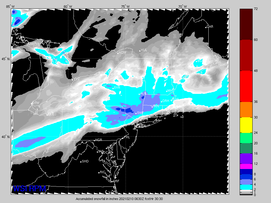
RPM for Jerry.
-
Best cross hair sig seems to be up near rt 2 and the NH border...even though they aren’t the QPF Max. Could be a secondary little stripe up there if there is a little band since they might get very good ratios. Thats assuming the soundings are accurate which is a big assumption.
-
That’s a pretty tasty NAM run for the pike region. But almost all of SNE gets advisory snows on that save for immediate south coast.
-
Technically not a clipper but it’s essentially behaving like one as it gets here for all intents and purposes.
-
Gonna have to watch as this thing exits east....some fo the guidance tries to make it go a little nuts at the last second. Could be some enhancement from that.