

ORH_wxman
-
Posts
90,902 -
Joined
-
Last visited
Content Type
Profiles
Blogs
Forums
American Weather
Media Demo
Store
Gallery
Everything posted by ORH_wxman
-
What an arctic man high there.
-
Not too weird for them....they avg like 83.
-
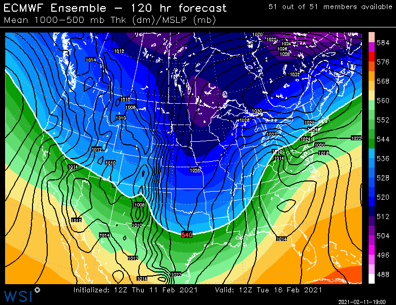
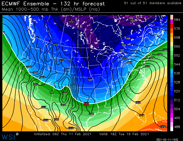
EPS
-
One more tick and it won’t be a SWFE anymore here. More of a straight coastal.
-
Maybe. Depends how strong the thump is. This isn’t quite as far west as some typical SWFEs either.
-
Yeah solid warning thump it looks like transitioning to sleet and ZR right before the dryslot where there would be FZDZ. Low level cold doesn’t have a prayer of leaving...even down to the south coast of CT.
-
Euro is going to hit a lot of the forum hard.
-
On that run I’d take the under on the clown maps. They look generous where IP is probably happening relatively quickly. Not that it makes a big difference. It isn’t a prolific system.
-
Def some sleet and ZR Sunday south of the pike. Might even tickle north of the pike at the end. One thing to watch for is freezing drizzle too even after the main band of precip moves out.
-
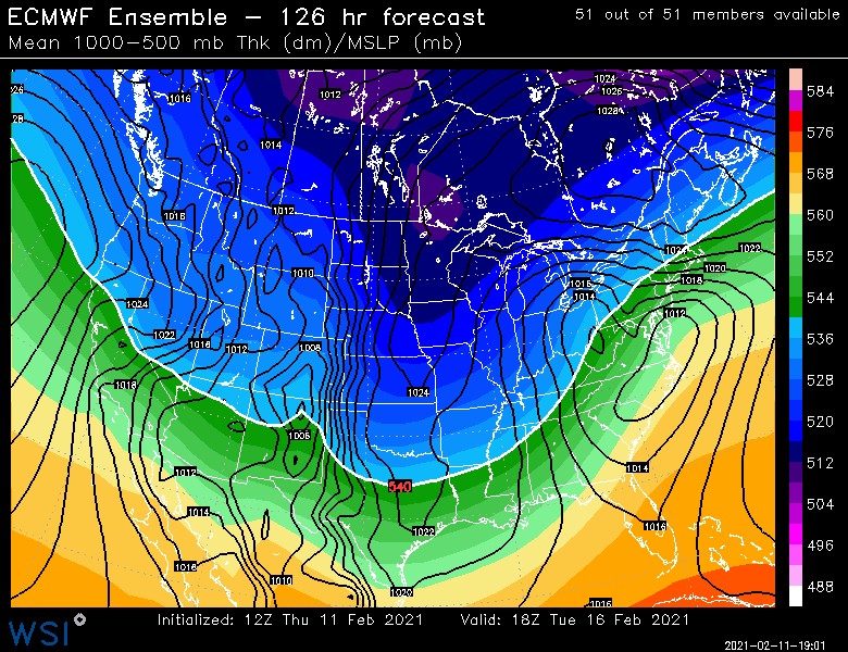
Euro has 2-3” north of the MA/CT border or so into S NH on Sunday.Then maybe an inch or so south of that and ZR/IP. And maybe an inch or two of all snow for most of NNE.
-
Ukie also looks good on the crap 24h maps for next Tuesday. My guess is a lot of New England would do well. As for the day 7-8 system, that def looks like a farther west track but still a ton of CAD showing up so it could be a good SWFE or even a decent icing situation for a time over the interior. Still a long ways off though.
-
"Storm" is a generous term here. But yeah it could end up as mostly sleet/ZR. But some of these 12z runs have very little precip at all.
-
ICON is a Mid-atlantic special...mostly whiff for here. Gets the south coast.
-
RGEM is a pelletfest right into S NH for Sunday, lol.
-
Yeah, lol....NAM being the NAM.
-
NAM is doing the pseudo-phase that the GGEM did last night....that would be bad for the 2/16 threat. Hopefully it's wrong.
-
NAM actually has very little precip at all on Sunday.
-
An inch or two and maybe some sleet/ZR to finish....seems like south of pike will warm aloft.
-
May have to watch some glazing in S CT for Sunday....sfc temps aren't going anywhere even if it warms aloft.
-
We need a 2015 pattern where the lows are swinging north a little better....Maine got crushed during that too, not just SNE. Recently storms have been getting shoved east at the last second before they can get further north. At least this next storm looks like it will gain latitude a lot better than previous ones.
-
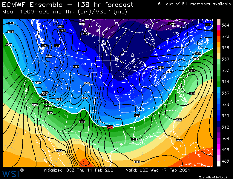
06z EPS cooled again

-
NAM is warm aloft south of the pike too.
-
Canadian sort of partially phased the arctic shortwave with the southern stream deal so it ends up as this long stung out wave. No other guidance pseudo-phases them, though the 06z NAM looks like it would come close (but still not do it)
-
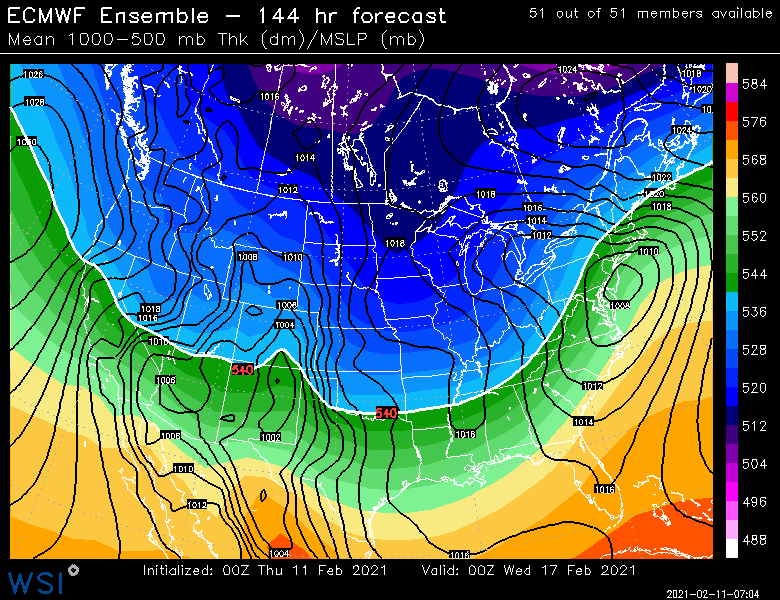
EPS quite bullish for Tuesday...almost trying to go a little more coastal than SWFE. It’s still more of the latter but the thump would be greater and change over take longer when coming in like that

-
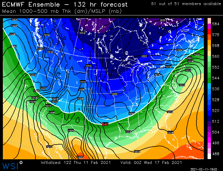
18z Euro looks ugly again for Sunday after 12z looked better.

