

ORH_wxman
-
Posts
90,902 -
Joined
-
Last visited
Content Type
Profiles
Blogs
Forums
American Weather
Media Demo
Store
Gallery
Everything posted by ORH_wxman
-
Yeah that’s where the upside is IMHO...unless you are near the south coast...esp in CT where you may do better from the thump.
-
Not sure why you insist on double digit snowfall. I don’t totally hate the upside of this storm but a lot would need to go right to pull 10-12. It hasn’t trended that way so far.
-
You are definitely correct LE is by far the more important factor. That’s why fluff melts out so much faster regardless of how cold it may have been the day before. I still consider a variable that may be 5-10% part of the equation as mattering though.
-
Spoiled rotten....once you grab a couple double digit storms in a season, advisory or even low end warning is meh, esp if it all doesn’t fall in 4-5 hours. I get it, big rates are fun, but they just don’t always happen with the frequency we desire. The alternative is partly cloudy, 37F and breezy with warm bum-bums in the car if you park it in the sun while the pack sublimates. No thanks. I’ll happily take an advisory refresher. Funny part is if this event was on the docket last February, it would be a totally different vibe...we couldn’t buy a 3” storm last winter after December until spring time.
-
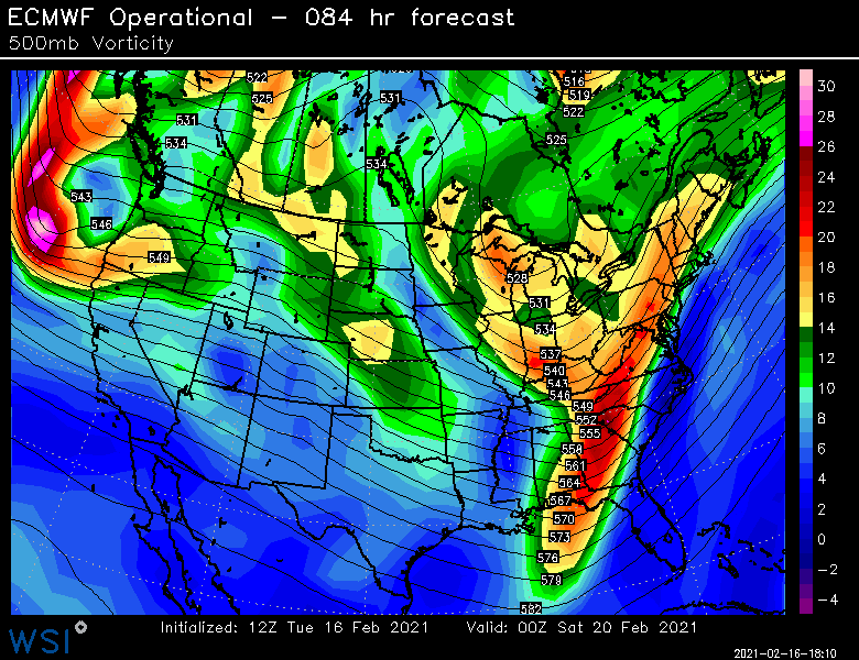
500mb height/vorticity map is a good crude one....but if we want to get a little more weenie-ish I’ll look at 700/850 levels for signs of warm fronts. But typically the H5 level is good for looking where the best upper level support is. There’s a disconnect in this system...the WAA burst is running way ahead of the upper level stuff, and that can be risky for driving the baroclinic zone too far seaward, but it seems like it hangs back enough on a lot of these runs to allow the upper air to reinvigorate the system before it slides east. This is the part I’m most enthusiastic about trending better. Down where you are, maybe the thump can be good, but it’s sort of shearing out as it goes into SNE. Maybe that changes on future runs....ideally we’d get both.
-
As soon as there was siggy CAD showing up, we knew it wasn’t going to take a hard hit. The key to pack retention as you are well aware of is basically: 1. Get some liquid equivalent in the pack (check.....already had the high water content 17” storm on Feb 1-2 surrounded by the multiple powder events) 2. Limit the exposure to high dewpoints > 37F (check....had maybe a few hours barely exceeding that number today) 3. Cool the pack back down quickly. If the core temp of the pack is very cold, a day or two of sunny 40-50F weather will do far less damage than if the pack is already pretty mild/soft/ripe. Energy is wasted warming up the pack rather than phase transitioning the ice crystals into water. (Check....very cold air advecting in behind storm)
-
Yeah best run yet imho for the midlevels...I actually don’t like the thump look on this system....but I like the midlevel potential in round 2. Don’t get me wrong, I hope the thump comes back a bit stronger, but the best upper air forcing is clearly well to the west so it’s not surprising the thump dies quickly as it tries to outrun the shortwave.
-
Maybe. But not necessarily. It could be that SNE sees a stronger thump but NNE is getting some 500-600mb goodies...I remember this happening in the 12/19/08 storm. Either way it would remain frozen/freezing given the surface high.
-
There’s a solid chance imho that NNE gets in on good snows in this even if they aren’t the jackpot. This has the look of models not pushing the forcing far enough north.
-
2009. Ginxy posted above. Ask tamarack about that one. For N ORH county it was a sloppy 4-6” iirc. Doesn’t mean we’re getting the same result but that run today reminded me of that storm and it’s evolution.
-
And juice up on the moisture. I don’t hate where everything sits at 48-60 hours out.
-
2/22 on the Euro looks a lot like the same date 12 years ago.
-
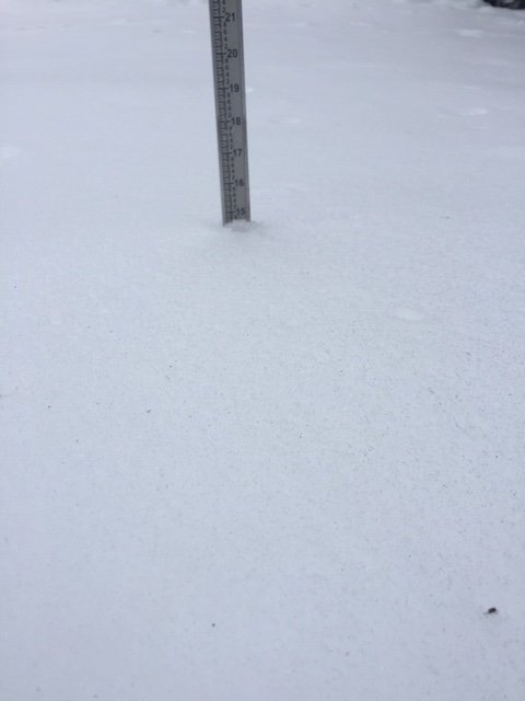
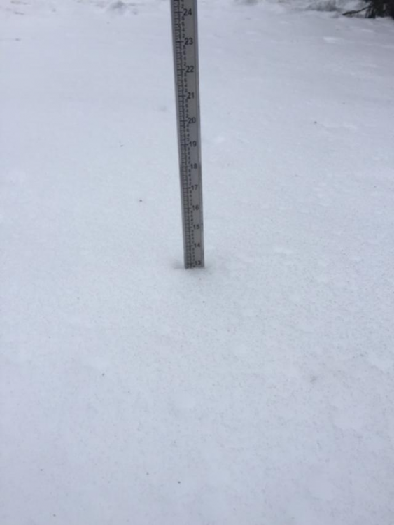
High was 39F and temp has fallen back to 37F. Didn't end up losing all that much. About 2 inches and some of that was compaction.
-
They were discussing 2/22 earlier...I moved all those posts to the February pattern thread
-
The trough axis spends a LONG time to our west....there are several ways this system could get invigorated between early Friday and early Saturday. While I wouldn't be going gung-go at all right now, I don't think this is one of those "we can forecast high end advisory to low end warning and pack it up for the rest of the week" type deals. There's still some good upside that may or may not materialize.
-
If things worked out I could see some 10-14 type amounts....but that would likely require more of a capture at the end. Those amounts are unlikely, but still possible in this setup.
-
I was a little surprised how dry it was...it didn't look that bad aloft. It wasn't 2/1/21 either, but there's still some upside to this one, even if somewhat limited.
-
Yeah I don't hate where it is right now. It's pretty close to a much better system.
-
I don't hate this look though....that could end up pretty good if it can invigorate the system before it escapes too far east
-
Pretty weak sauce from Euro...it's cold but not all that prolific. It tries to get going late, but not quite enough. I do like how that vorticity is a little more concentrated at 84h....that's what could help pop this thing before it pulls off to the east.
-
Your area up to Sunday River has done ok. Tamarack further to the northeast has been pretty brutal relative to average.
-
Yeah most of my long duration events like Feb 7-9, 2015 or March 4-6, 2001 or Dec 1-3, 2019 or Feb 8-11, 1994 or Jan 2-4, 1996 are paltry totals.
-
Up to 37 here...prob will spike low/mid 40s at FROPA.
-
BOS with a NW wind...must be the mesolow trying to protrude northeast offshore of E MA.
-
Actually a lot of similarities with the current model guidance. http://www.meteo.psu.edu/fxg1/NARR/1996/us0103.php


