ORH_wxman
-
Posts
90,902 -
Joined
-
Last visited
Content Type
Profiles
Blogs
Forums
American Weather
Media Demo
Store
Gallery
Everything posted by ORH_wxman
-
Yeah maybe...it depends where in the yard though....where I measure is down to like 2-3" but there are shaded spots that still have over half a foot. I think that 2-3" will go today. There are houses in the neighborhood that have 100% full pack in their shaded yard and it looks at least 6" deep, lol. Typical uneven March melt-out.
-
Looks like my snow depth is going to go to zero today finally...well maybe a "trace" since as long as you have patches in the yard, that's a trace. There has been continuous snow pack since January 26th, so a pretty good run. We had continuous from Dec 9th through January 12th in 2017-2018 so this beats that stretch. Have to go back to 2015 I think to beat this 43 day stretch. The previous 5 years have not been good pack winters. We had longer stretches than this in 2008-2009, 2010-2011, 2012-2013, 2013-2014, and 2014-2015.
-
This is the week after the 2013 firehose storm...there were a couple torchy 50F days afterward which receded the snowpack, but it's interesting because you can see that secondary jackpot area still SW of Boston
-
I was working in BOS on 3/7/13....took the train home. Accumulations were noticeable once past 128 in Wellesley, and by the time I got back to ORH, there was about 4-5". But nobody thought the 20"+ amounts were happening even that evening. I was still on the 9-14" bandwagon. The firehose just went insane after midnight it was like consistent 1-2" per hour for the next 8-10 hours.
-
Yeah if we could have snuck that 1/3 storm into the picture and had it be a solid warning snowfall, the entire tenure of the month would have changed. That pack would have stuck around for the next 3 weeks until 1/26 replenished it and then going off to the races in February.
-
This is Bretton Woods at its finest...you could maybe add in a similar day later into March or April when temps are around 40-45ish at the base and you have corn snow going on. But these bluebird days late in the season make the presidentials stand out so much. Almost blinding to look at without goggles or sunglasses.
-
ORH is still due for more regression.....they had nearly 120" in 2014-2015 against their annual average of 69.1" Since that season: 2015-2016: 47.2 2016-2017: 78.3 2017-2018: 96.1 2018-2019: 51.4 2019-2020: 44.9 2020-2021 (so far): 70.7 Mean: 64.8" So they are running a little below average (mean could still come up with additional snowfall this year), but not nearly enough to offset the good times.
-
March 2020 was pretty boring until the 3/23 event.
-
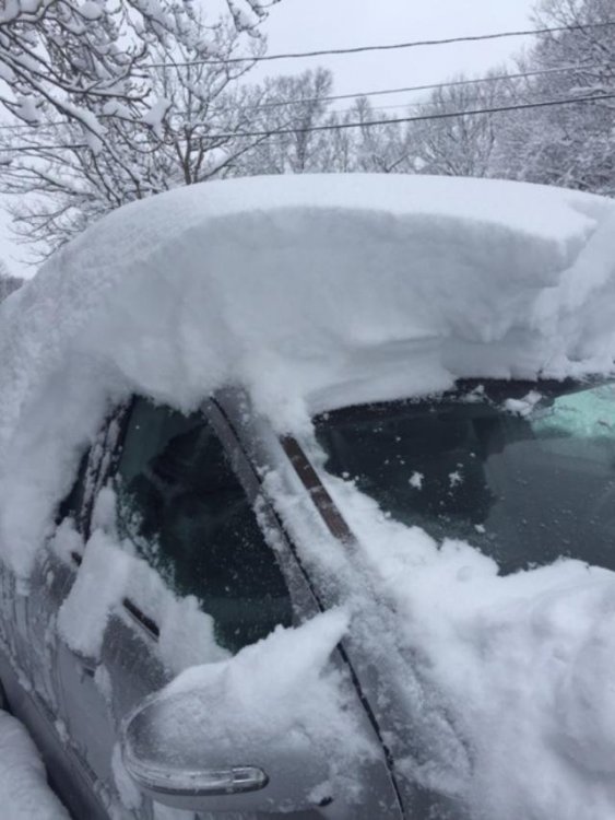
Yeah Ginxy, we lost power for 3 days in that one. We had about 12” of grease...even at the bottom of the hill was more like 9-10”. Noticeable elevation gradient
-
FWIW, EPS still looking interesting post-ides. This is prob the first “chance”. OP wasn’t loving it but EPS shows how it could success...sort of like how the GFS does it. You have a southern stream wave on the heels of that northern stream cold shot. Time it perfectly right into that cold airmass The other chances would likely come a few days later when it tries to go more classic western ridge/eastern trough look
-
Yep we got smoked by that derecho here on 10/7/20. Lost power and some trees came down in the neighborhood. But obviously that was kind of an odd setup being so late in the season. Not your classical “severe season” set up. Definitely aided by stronger kinematics in October.
-
Severe season is easy in SNE. Almost always expect under performers...a few EF0 warm front spinners, maybe a rogue EF1 and then a lot of marginal hail and rotting branches down from 40 knot gusts. About twice or three times a decade we get a real sweet setup. We’re like the mid-Atlantic coast for snow events when it comes to severe wx. Hopefully you get to chase out in the plains.
-
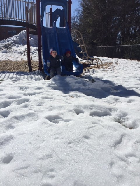
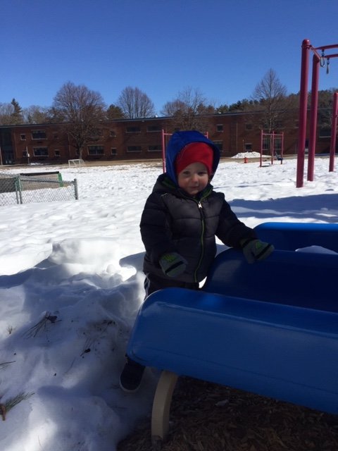
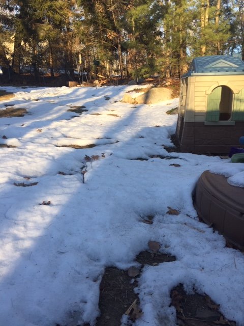
This decaying snow pack is useless now. At least the torch areas are opening up. Took the boys out to the local elementary school playground. Snow was actually pretty blinding in the March sun The backyard is getting there. Should be gone in the next few days
-
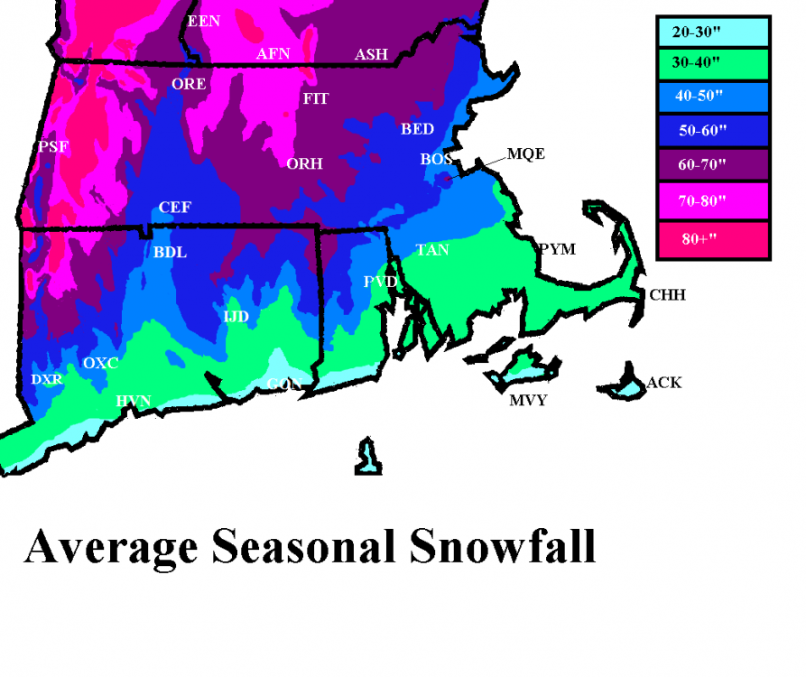
My map has BOX right about 40” for average. Granted, I made the map like over a decade ago. You could probably add a couple inches to the long term average there given how ridiculous the 2010s were there. I’d probably drag that 40” contour a solid 10-15 miles southeast if I included the 2010s
-
Feb 1-2 is pretty obvious on that map. Look just west of BOS where the positive departures are. Also, the fact that they are still below climo snow despite those other storms like 2/7 and 2/19 means their “climo” is actually the opposite of hostile...it’s because it’s a 12 year mean on that map....2009-2020. Those were very kind years to SE MA. They prob averaged over 20” for February during that stretch. If that map was based on like 1981-2010, they prob wouldn’t have negative departures. Yep, the 128 belt back to ORH had 30”+ for the month of February.
-
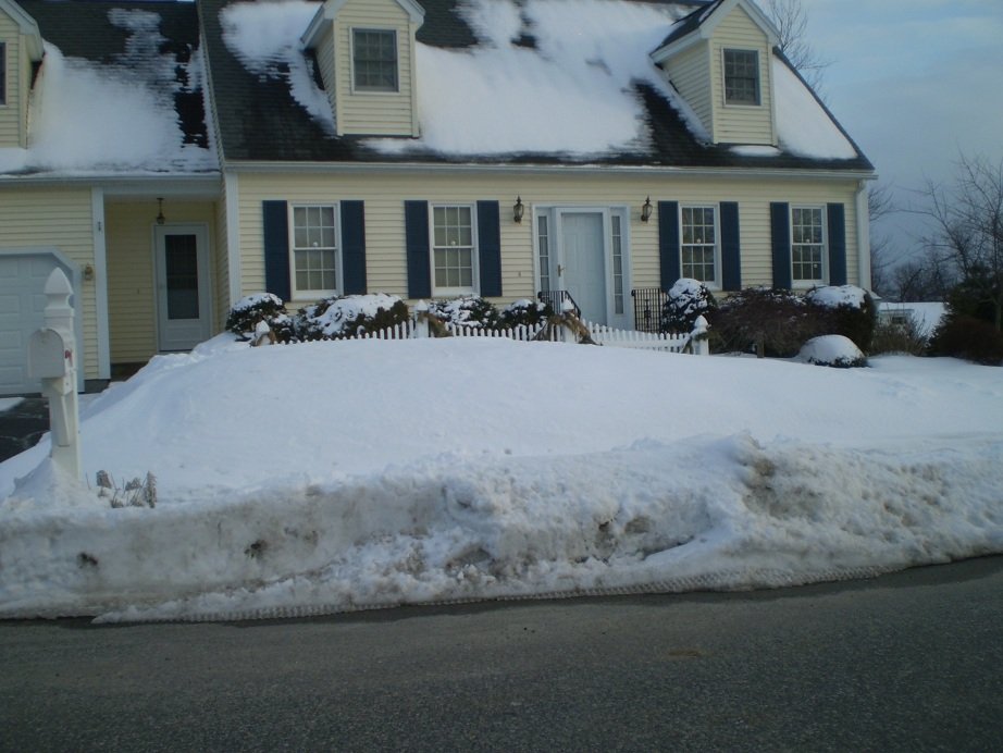
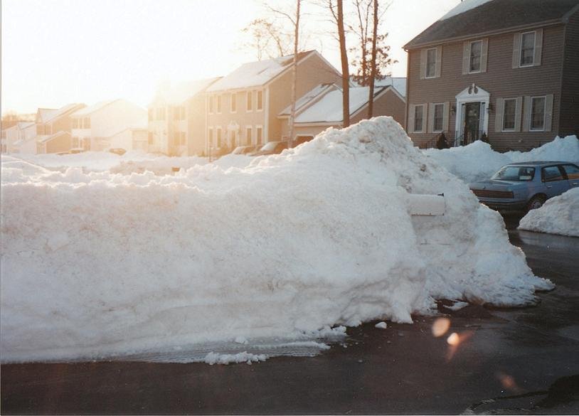
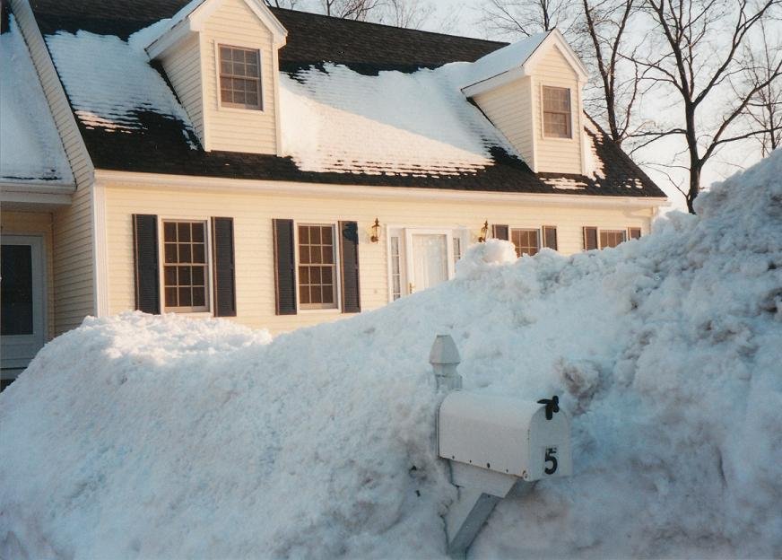
1996 mostly melted out in mid March....there was a pretty good warm spell the week after the big snows in the 3/2-3/8 period before it got chillier again. Even 2007 was mostly gone IIRC going into April but it was still present in the typical shaded spots. 2005 def had pack going into April but it was on its last legs and didn't last long. But I remember it still pretty impressive like on March 29-30ish and then it started going pretty quick. 2018 had some leftover pack too but it was pretty mangled because that final few days of March torched pretty good. 2017 was also trying to hold on too and even got an event on 3/31-4/1 to reinforce it. 2013 was trying to hold on but it went really fast in the first 3-4 days of April. I do have a pic of what it looked like on Mar 22nd that year: Nothing rivals 2001 though because it was like legit pack everywhere (not just shaded spots) going into April. Though I will say that ORH was literally the line for that....you went to southern and lower parts of the town and it didn't look nearly as uniformly covered. But my area up into Holden and those areas was like 18+ even in open fields and because the first week of April was pretty cold, the pack was taking a while to melt out so you had like full pack everywhere still on like 4/9 or 4/10. Part of the reason for that too was the 3/30/01 storm. That storm literally sliced the city in half....even the airport had some trouble because they are kind of south. Up by the north side on the Holden line we had like 8-10" of paste but the airport was like 4" with a ton of sleet and marginal ZR contamination. It was a sick gradient. I think they basically got almost shut out down around Auburn/Millbury. The only year that probably rivals 2001 for continuous pack into April around here was 1956. The difference is that 1956 was probably much more impressive than 2001 southeast of ORH...like my current area back toward Auburn/your old stomping grounds in Shrewsbury and then south into N RI....they got destroyed/jackpotted in multiple late March storms worse than ORH did surprisingly whereas 2001 was mostly N ORH county for the obscene pack durability into April. 1984 went into April with a stout pack, but it wasn't super durable since the winter pack had already mostly melted out before the big 3/29-30/84 storm. Ditto 1997 of course...ton's of pack on 4.1 but it was all from one storm, so the liquid equivalent was no more than 2-3" maybe. Still impressive, but you usually want like 5-6+ inches of water in that sucker late in the year from the winter pack that has absorbed all those ZR/sleet/cold rain events....it makes it harder to melt out fast. We really squandered 1993 badly....had a massive pack after the superstorm and then even added to it (or at least slowed the melting/compaction) with a couple of events over the next 10 days. That pack had a lot of water in too from all the events (including a juicy snow to sleet SWFE) in Feb '93 and pre-superstorm Mar '93 and virtually zero rain at all during that time....but then we absolutely furnaced the final week or so of the month. We had multiple days near 70F IIRC and then a massive rainstorm and that was all she wrote. The piles lasted until May, but dreams of full pack into April were dashed with that final week of March which was a bloodbath. If you had shown someone a pic of the snow on like St. Patty's day or the equinox that year, you would have never guessed it would mostly melt out by 4/1.
-
Not sure I follow...you saying you don't believe the cold dump because of the background La Nina? I suppose it could fail...it's not an overwhelming signal yet though it has been trending more pronounced each run. I don't know how "wintry" it would be anyway unless we get a precip event out of it. As you know, this time of the year you can be 44F under clear skies despite 522 thicknesses. The sun is just too strong....but if you have precip falling in the same column, it's 21F blowing snow off your roof.
-
The EPS are def going with that transient EPO dump of cold air....way more than even a few cycles ago....so there's a window there first when that happens....and then likely another window of opportunity several days later as it morphs more into a western ridge
-
Then of course, winter hill after Mar 4-6, 2001....the snow got even deeper too after that, LOL
-
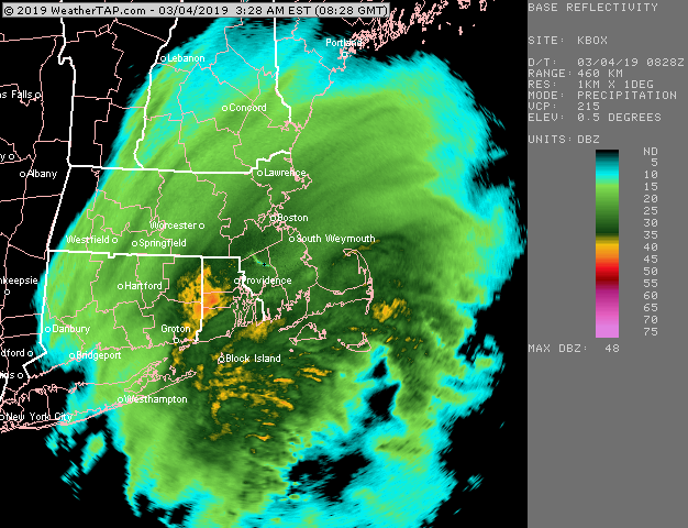
3/4/19 was a great one here...right near the jackpot with just under 17"

-
Usually Bethel is a great spot but the last month-plus has sucked up there. So many of my March trips will have a big snow pack increase between about Windham and North Waterford/Stoneham and then it usually levels off with maybe a small increase toward Bethel and SR.
-
Yeah there might be a solid 8-10 day window there. EPS still has a decent look at the end of the run that looked like it would go for a few more days. Lets get a 70F Tip Tulip day and then a 18F powder job for St Patty’s day.
-
Yes. He’s the crazy good skier sometimes people reference (name is pete) on here when discussing past ski GTGs. He sometimes goes up to alaska and jumps out of helicopters to ski.
-
Yeah the historical snow climo shows this too...there tends to be a pretty sharp dropoff in snow climo though once into the final week of March but that 3/14-3/22 period or so is not too difficult. Then there is another pretty sharp dropoff in snow climo after about 4/12-4/13 in the historical record.
-
I remember a couple events close together in Mar 2002...around 2-3" on 3/18 or so and then we had 7" on 3/20