

ORH_wxman
-
Posts
90,902 -
Joined
-
Last visited
Content Type
Profiles
Blogs
Forums
American Weather
Media Demo
Store
Gallery
Everything posted by ORH_wxman
-
Little nuke on the NAM...if we keep the trend of tightening up the circulation, then it would get pretty interesting again for interior SNE. There's a pretty decent 3-6 hour period on that run for like ORH back to W MA and W CT before the SGZ starts to dry out a bit.
-
Yeah it's going to need to trend back south to make it interesting in SNE outside of northern Berkshires. But this could just keep trending north. It's been a pretty hard trend since 12z yesterday.
-
06z Euro actually went north again....might put places like Bridgton ME over to Phineas in a good spot. Good firehose look up there on that run.
-
Certainly northern Berks....but close call there though for being out of the meat of it for further south looking at the midlevel stuff. We'll see though...could easily tickle back south.
-
Focus for snow on the overnight runs would be monadnocks to central/southern greens and maybe Berkshires. There could be some lighter snows at the end over a lot of SNE on that setup. The ULL has definitely trended north compared to yesterday which would shift the snow threat further north.
-
Nah, 2015-2016 was the big stinker up there. This year was a lot better than that year. This year just had an absurdly weak end to the year but at least most of the mid-winter months were pretty decent for skiers.
-
18z op Euro bumped solidly north. That would likely take most of SNE out of the snowfall threat outside of nuisance stuff and mainly high terrain...hard to say for sure since it only goes to 90h but that look would be better for CNE
-
I remember that one. We had about 4-5” of paste. Here’s last years thread.
-
Yeah it was already pounding over the far interior near ORH and westward. Another panel and it’s probably choking aggregates in metrowest BOS.
-
Yeah this would have to shift northward quite a bit to hit your 'hood hard. That block forces the ULL underneath as it approaches from the lakes. Though I wouldn't rule out snow up there beyond this threat, as the pattern continues to look pretty ripe for late season snow threats up north. A lot of troughiness over the east and cold intrusions.
-
Yeah it has the rapid deepening of the upper low as it slides by our longitude and that track is optimal down between 40 and 41N. We'll definitely need that if we want the good rates/dynamics to overcome the marginal temps. If we're nitpicking, maybe we could use a bit more of a defined high up in the CAR region, but even the current depiction has that higher pressure isobars nosing down to provide the drier air for evap cooling.
-
Yeah, even 2-3 weeks earlier would matter a lot I think.
-
I think most of interior SNE would get accumulating snow if it played out like that. Prob significant snows for at least the Catskills/Berkshires, NW CT and prob N ORH county/Monads.....the details would determine if bigger impact snows hit the rest of the interior. Those details won't become clearer for a couple more days. The ULL could trend north or south....or weaker or stronger.
-
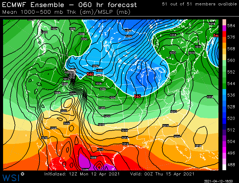
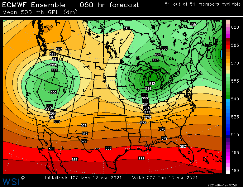
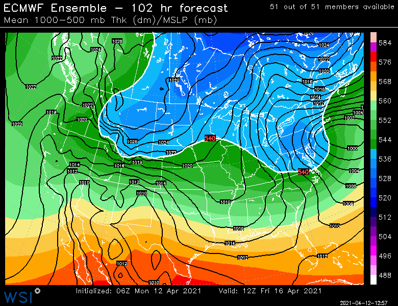
12z EPS has a pretty impressive evolution.
-
Yeah prob late afternoon/early Thu evening that run it flips there.
-
This is a pretty impressive look. This ULL takes its time too.
-
Euro still quite interesting. It did trend a tick north with the ULL so that will be something to watch. That's quite the firehose though for a solid 18+ hours.
-
Most model guidance is cooling the column pretty quickly over the interior, but whether or not it becomes a prolifc snow maker will be so dependent on exactly how that ULL tracks underneath SNE. The orientation matters....if the ULL is more elongated E-W, that is probably good for snow getting into more regions. But having it more circular or elongated N-S then it would be less favorable for snow in SNE...you'd prob see more snow out in NY State and maybe VT on that type of setup.
-
I'd def be keeping an eye on it over the interior. That is a pretty classic look for some late season fun. Odds are still that it ends up a miserable rain event with some marginal wet snow in the elevated interior, but you cannot rule out a much more significant impact. EPS looks pretty ominous actually....that's a pretty classic firehose sig.
-
925 temps are between -1 and -2 on the Euro over interior SNE on those panels so they are probably parachuting if precip is coming down at a good clip.
-
Sneaky shit year up there. March was extremely pathetic for NNE. For SNE too but it really sticks out how bad it was up north. That’s usually a pretty big snow month.
-
Percent positive numbers would show the fraud in keeping “case numbers” high if the spread has really diminished. I agree that deaths/hospitalizations are really all that matters.
-
I’m also assuming that the case numbers are going to be super low at that point...the public pressure would become high when you have had widespread vax availability for a few months AND you have cases down to minuscule numbers.
-
The mandate will be dropped IMHO once we reach the point of “everyone who wants a vaccine has been able to get one for 2-3 months now”. That’s really the threshold. The tolerance will become pretty low once we reach that point. Maybe it lingers another couple months beyond that but public pressure will become strong I think.
-
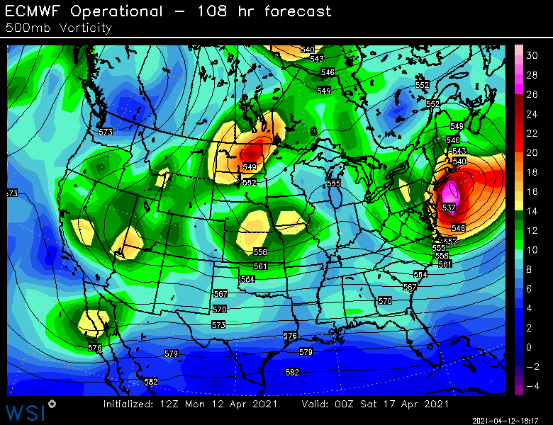
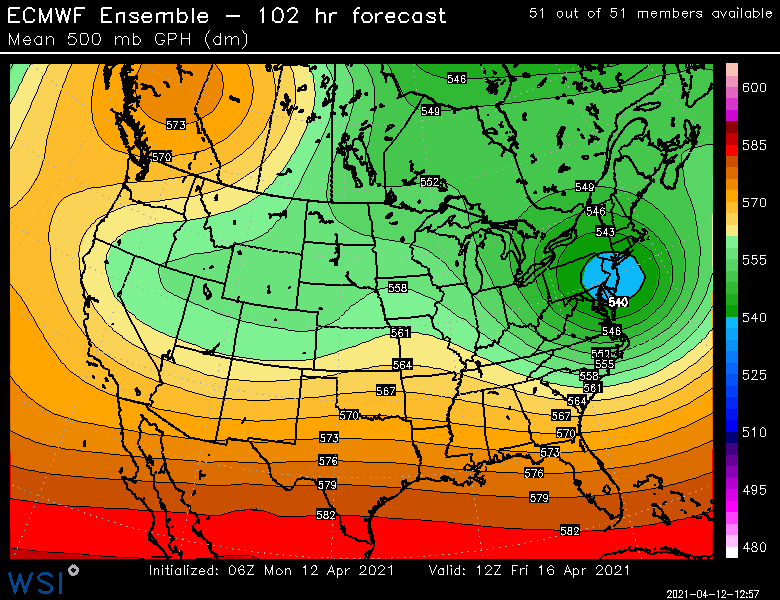
Pretty strong cross-model guidance for end of week ULL. That could get interesting over interior.


