ORH_wxman
-
Posts
90,892 -
Joined
-
Last visited
Content Type
Profiles
Blogs
Forums
American Weather
Media Demo
Store
Gallery
Everything posted by ORH_wxman
-
Flip flop on guidance. Wanna see some more consensus today.
-
Lol, reminds me of ecmwf.int sending emails in 2009. One of my few meltdowns on here.
-
I remember waiting for it to update on weather.unisys.com. Usually around 8pm. Then it was more like 6-7pm in the 2003ish years. I think that site went defunct like 6-8 years ago. Lol.
-
Yeah that more positively tilted than 12z so prob less impactful but we wouldn’t know for sure unless we saw more panels. But good to still see plenty of southern stream involvement.
-
Block up north will give a limit to this. But yeah, even with the block it could still theoretically try and cut up through NYC or some crap…but I’d put the probability fairly low right now. You need a lot of downstream ridging into Quebec to make that happen and the block will try and prevent that downstream ridging up north from getting extreme.
-
Post H5
-
Yeah I wouldn’t even care about the dryslot on that if we actually got the front end. Reminds me of the Mar ‘17 front ender. I think I had 15” in about 8 hours on that.
-
Nah that one tracked due north over eastern MA even just west of BOS.
-
No Dec ‘92…that storm was stalled for like 30+ hours, lol.
-
Go back a few frames. It gets pretty tucked under LI.
-
The entire forum should be. Slightly less leery down in SW CT but the majority of us always hold our breath on them. But beggars can’t be choosers at this point. We’ll take any plowable snowstorm right now.
-
That’s tucked but thankfully that block up north helps keep those 925s solid. Still tough for immediate coast at the height of it but just inland would slay.
-
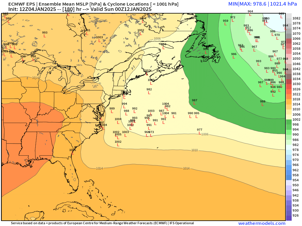
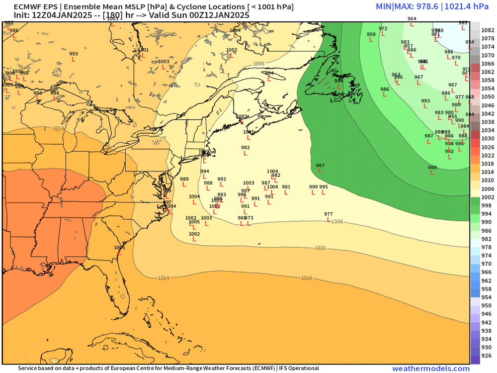
Much rather have those two models showing garbage than the GFS/Euro showing that. We’ll see if we get some more agreement at 00z.
-
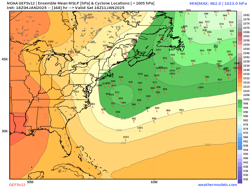
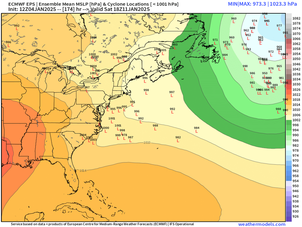
EPS ensembles. Still some work to do but a big improvement.
-
I’ll only post that if the 1/10-1/15 period fails.
-
Yeah I was mentioning the other day that this type of NAO is usually more favorable for our region. It still allows room to pin low heights in the 50/50 region but it’s not so overwhelming that it suppresses everything. That type of NAO is also less likely to link up with a SE ridge too because it’s coming from the wrong direction for that.
-
Should provide a lot of chances going into the second half of January if that verifies. Ridge will be offshore so there’s going to be more cutter risk, however, the NAO will help with that and there’s a lot of cold available. Prob some SWFEs in that look too.
-
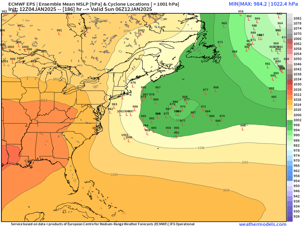
Splitting the difference would prob be good. Euro doesn’t go nuclear until Maine on the OP run. GFS maxes out down near NYC.
-
Still dragging its heels a bit but a lot better than previous runs
-
Problem was we had no phasing with southern stream. Even partial ejection and phasing would’ve produced something but we always kept everything too sheared.
-
I didn’t expect euro to play ball with southern steam. That’s a nice surprise.
-
I think the 1/14-1/20 period will likely have a couple chances too. You’re relaxing the block a bit but it’s still there.
-
I agree that I think it’s somewhat likely a larger storm occurs if you eject and phase that southern stream considering how meridional the northern steam is. Almost every single solution that phases it has been pretty huge going back a week when it was out at D14-15.