ORH_wxman
-
Posts
90,902 -
Joined
-
Last visited
Content Type
Profiles
Blogs
Forums
American Weather
Media Demo
Store
Gallery
Everything posted by ORH_wxman
-
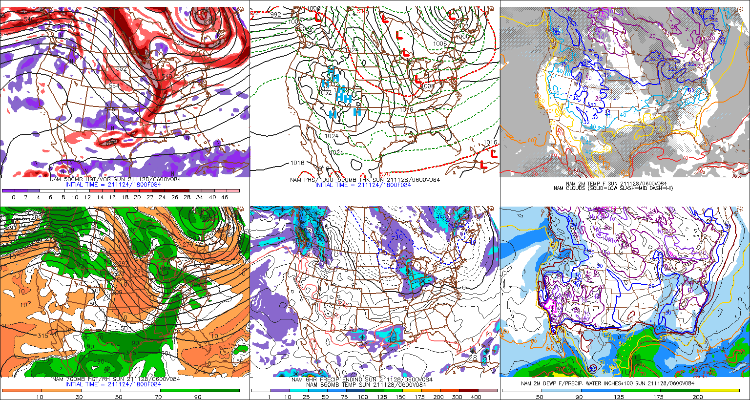
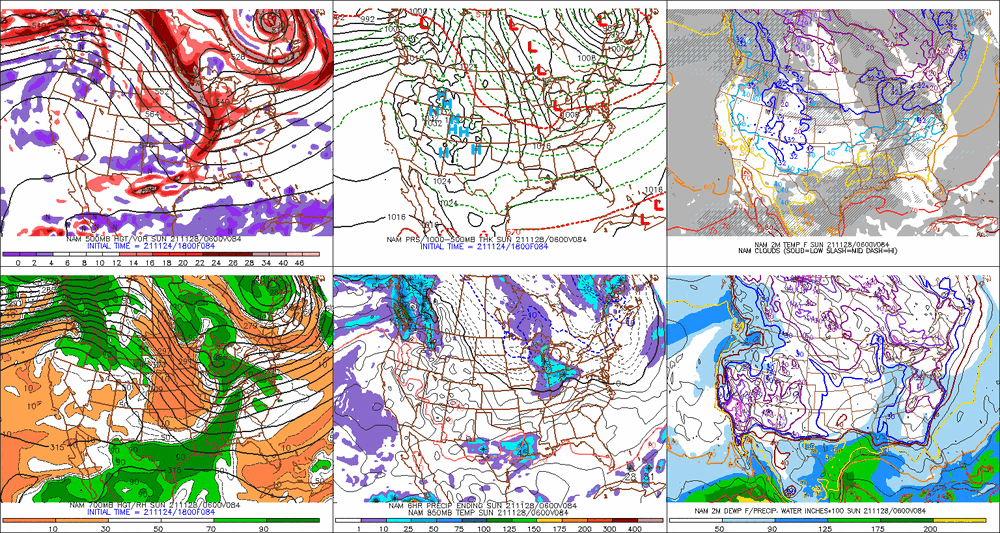
06z GFS is an advisory type event for a lot of SNE. The overnight runs haven’t been going quite as hard with the northern stream. That’s why we’re seeing some weaker solutions. But that doesn’t mean those are locked in...it’s still really close to being a powderkeg there as we bring the shortwave near us. You really need to track that vort under LI to get the higher end solutions.
-
Feb 5th was also a huge storm for E MA. Like 8-12” of paste.
-
The legend of powderfreak really started to materialize in 2014-2015 winter when Boston got about 100” in 3 weeks. He started off posting a random ARW or GGEM run as a joke but by the time we got to the 3rd or 4th monster event he would post them more frequently and with text that sounded more forced/desperate. He would play it off as a joke but we all secretly started worrying. Then the next season happens and we’re all wondering if the next event is the one that does him in.
-
925 is pretty marginal for a while between 105-111...details don’t matter at this point but that overall look was definitely one that would have some red flags for me south of the pike and even around the pike. Luckily it’s just one run and is pretty meaningless on the specifics at 4.5 days out.
-
18z Euro looks pretty tasty at 90h. Prob would be a nice hit for a lot of the region trying to extrapolate if it went out further. Northern stream really digging nicely.
-
There’s an eternity still for this storm. Kevin, you can’t lock in jack sh*t yet. If this amps up a little more than the 18z GFS, then you’d prob get mostly skunked and even up in pike region prob would. Hell, you already had some Ptype issues on the 18z GFS track. This is a good airmass for late November but it’s not the same as late December or mid-winter. Less wiggle room than those scenarios.
-
Agreed....though in a lot of these solutions where the northern stream goes nuts, we get this very tight/tucked circulation near the vortmax where it's closing off aloft....so it wouldn't surprise me if we see a really enhanced area of precip in a narrow stripe if that happened. We saw it in 12/9/05 even though that hit a pretty large area...but a narrow stripe from SE NH to NE and E-central MA got obliterated for a few hours on the rates. But we have a long ways to go to worry about something that specific yet. This could still just be a few snow showers.....but we're trending toward shovelable at least right now.
-
BOS would prob have ptype issues verbatim that run...it's a little tucked, but it annihilates 128 belt and just NW. It's really compact.
-
Clown range on 18z NAM but that is the type of look you want with the northern stream really digging so that it catches up with the OH valley shortwave.
-
What the hell is going on with the Euro? Looks like it's going to phase all 3 shortwaves this run...or at least try. No other run tries to phase in the lagging southern stream s/w in the southwest US.
-
There's two pieces of energy diving in from the plains...the northern piece digging more is associated with the bigger solutions. It's really obvious on the Ukie, the older GFS runs and actually the 84h NAM at 12z looks like those bigger runs. The weaker runs have the energy more separated...particularly the northern piece is not digging as much in those weaker solutions.
-
GGEM is weaker but still an advisory event for SNE.
-
I dunno, it's gonna pop quick when that trailing s/w catches up.
-
It's definitely weird that BOS actually got colder in November averages compared to 30 years ago. But looking at the decadal numbers, it makes sense...one of those flukes. The cold Novembers in the 2010s did it.
-
BOS January 1961-1990: 28.6 BOS January 1991-2020: 29.9 ORH January 1961-1990: 22.8 ORH January 1991-2020: 24.7 November was by far the lowest change...which is interesting. Anecdotelly I would've thought November would be the worst, though it's probably being blunted by some epically cold Novembers we've had recently (like 2018 and 2019)...and the 1980s did not have cold Novembers...the only one that was more than like -1 was 1989. January is kind of in between December and November for the amount of rise.
-
Trading 1989 for 2015 alone adds almost a full degree to the 30 year average for December in ORH.
-
BOS November 1961-1990: 45.3 BOS November 1991-2020: 44.7 (!!!) ORH November 1961-1990: 39.4 ORH November 1991-2020: 40.2 BOS December 1961-1990: 33.6 BOS December 1991-2020: 35.7 ORH December 1961-1990: 27.4 ORH December 1991-2020: 30.5 ORH really got nuked in December..BOS did too but not as much....losing 1989 and gaining 2015 is a big one though.
-
It'll definitely be less at non-radiator spots. Radiational cooling has been the biggest casualty of CC.
-
Yes Hudson Bay is lagging badly....the arctic ocean though and adjacent seas are way ahead of recent years. Hudson Bay had no ice at this point in 2016, 2012, 2010, 2006, and 2003 too, so while rare, it isn't unheard of.
-
Those of us along the pike are always conflicted...
-
EPS was a bit paltry on the Sunday/Monday system last night. Would like to see it come back on board a bit more. But there’s still plenty of time.
-
Haven't fired up the heated sidewalks yet? My monitor is saved from a high-impact event for another day.
-
Chukchi sea froze over faster than any year since after the 2012 monster melt. The difference is 2021 also has refrozen on the Atlantic side very fast unlike that 2012 autumn. That's why we're more like the early 2000s right now for extent
-
You realize that it's like 5-6 days out still, right? This isn't a 3 day lead time right now. It's fine to point out the possibility (hell, I linked to my post 4 days ago pointing out the favorability of the pattern for Nov 28-30), but "locking" it in is ridiculous.
-
He cant help himself....man, even 2014 Kevin wasn't this bipolar.