ORH_wxman
-
Posts
90,902 -
Joined
-
Last visited
Content Type
Profiles
Blogs
Forums
American Weather
Media Demo
Store
Gallery
Everything posted by ORH_wxman
-
Well it was the first run in several cycles that deepened the northern stream shortwave further south. So at least for now the trend of it being flatter has stopped which is what we need to get this back to being a bigger deal.
-
18z euro coming back now a bit. That’s a pretty decent look for SNE. Prob a nice advisory stripe of snow. Maybe even low end warning lollis for interior E Ma?
-
18z NAM looks like kaka now too. Gonna need some reversal of the trend at 00z tonight. We’re not burying that northern stream as much on today’s runs.
-
18z NAM gone wild for tomorrow night. That’s prob like 3-5” for Ray, lol. 1-3” for much of the rest of E/C MA
-
December 2021 Obs/Disco...Dreaming of a White-Weenie Xmas
ORH_wxman replied to 40/70 Benchmark's topic in New England
Still looks like Ka-ka in the d12-15 range but it’s actually trying to balloon the Aleutian ridge again at the very end, so maybe this will be fleeting or get seriously muted like the early December signal did...that’s the hope anyway. -
December 2021 Obs/Disco...Dreaming of a White-Weenie Xmas
ORH_wxman replied to 40/70 Benchmark's topic in New England
OP euro was folding over the WPO ridge into a little EPO block north of AK in clown range...we’ll have to see if that is something that gains traction because it would change the outlook for the second week of December. -
The key is that northern stream shortwave. On these lighter solutions it’s coming in flatter and not digging. The bigger solutions were closing that sucker off well south into NJ and S of LI. Now it’s kind of crossing overhead...it still produces a period of light snow because of some good divergence aloft just ahead of the PVA, but you’re not getting an organized conveyor system going.
-
That include tomorrow night.
-
Euro is fairly paltry....prob like C-2” type event for SNE.
-
Euro trying to throw a bone too. Maybe a coating to an inch.
-
I think for ORH the only ones I can think of are 1898 and 1971 off the top of my head. Maybe I missed one. There’s plenty of 6-10” type storms in there but 12+ is truly rare that early.
-
You and powderfreak should have a GGEM party sometime. Reminisce about how much snow you would average if the GGEM was actually accurate.
-
Ukie is a whiff again. Playing to its extreme bias....I think it had like 12-18” here two runs in a row and then the next two runs were both whiffs...lol.
-
Yeah I thought it was solid advisory look for the metrowest region and up into Rays hood.
-
Pretty good chance of that up there. You’re going to get warning snows from this event and the Sunday/Monday event may be a little too far south and weak to give those amounts there.
-
Trend has been for that ccb to try and wrap in some steady snow for a few hours even into central and eastern MA. We’ll have to see how it plays out...def hedge lower because of west wind in the boundary layer but can’t rule out a C-1” Friday evening.
-
That’s still within the realm of possibilities. But I get the feeling that many were latching into some of those solutions that showed a foot-plus. That is just well outside typical November climo...even ORH only has a handful of Nov snow events that high.
-
GFS is a widespread 1-4” for SNE. What are people expecting in November? Lol
-
Thunder
-
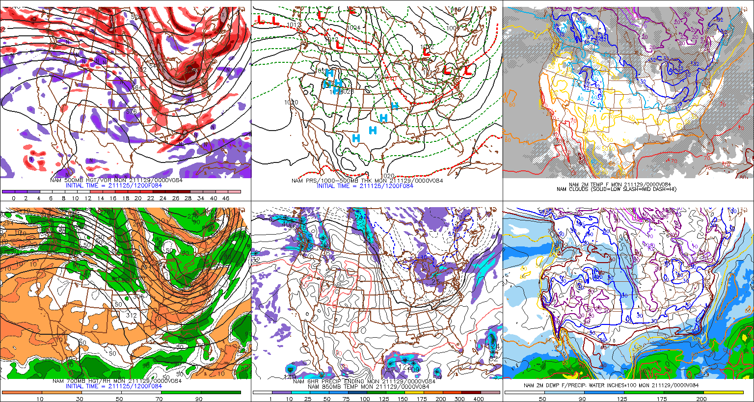
That’s a very good look. That would go to town in another panel or two.
-
Too bad we don’t have another panel on the NAM. Pretty weenie-ish at 84h.
-
So does 06z nam. Late tomorrow PM and tomorrow evening id be surprised if there weren’t at least a lot of snow showers around but a steadier band up in NE MA wouldn’t surprise me. That’s a really strong and rapidly deepening ULL.
-
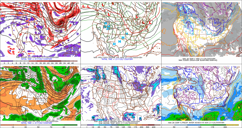
06z euro would likely blossom more precip in SNE if we could see another couple panels. The main ULL/shortwave is still out over BUF at that point.
-
That euro ptype map is wrong.
-
December 2021 Obs/Disco...Dreaming of a White-Weenie Xmas
ORH_wxman replied to 40/70 Benchmark's topic in New England
That’s like 3 runs in a row. Not liking that trend. That would set up a pretty big torch for mid-December and perhaps into Xmas.