ORH_wxman
-
Posts
90,902 -
Joined
-
Last visited
Content Type
Profiles
Blogs
Forums
American Weather
Media Demo
Store
Gallery
Everything posted by ORH_wxman
-
Yes flurries count as a trace. Measurable would be 0.1” or more.
-
12z NAM trying to throw back a bit more moisture.
-
11/26-11/27 Rain Ending as Snow Obs/Disco
ORH_wxman replied to 40/70 Benchmark's topic in New England
A bit over 1.5” on winter hill last night. Pretty good elevation gradient. Back in Holliston I’d call it about a half inch at most. But still nice to see most surfaces except pavement all whitened up. -
Almost time to punt on anything over an inch...but there is some legit IVT chance with this one that could produce a localized heavier area.
-
11/26-11/27 Rain Ending as Snow Obs/Disco
ORH_wxman replied to 40/70 Benchmark's topic in New England
Getting stickage. Took this about 10 min ago. Even more accumulation now.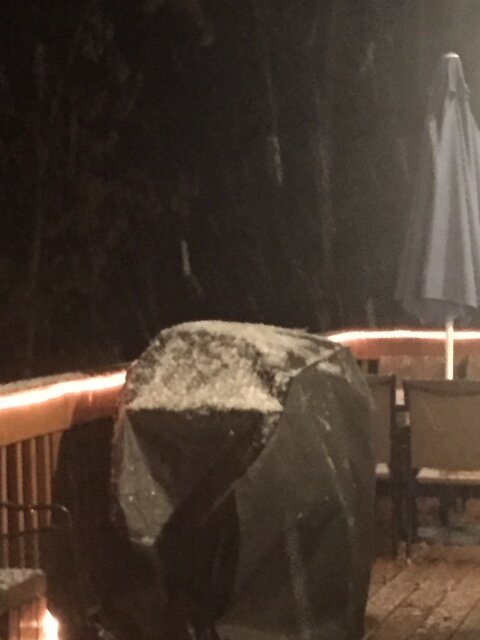
-
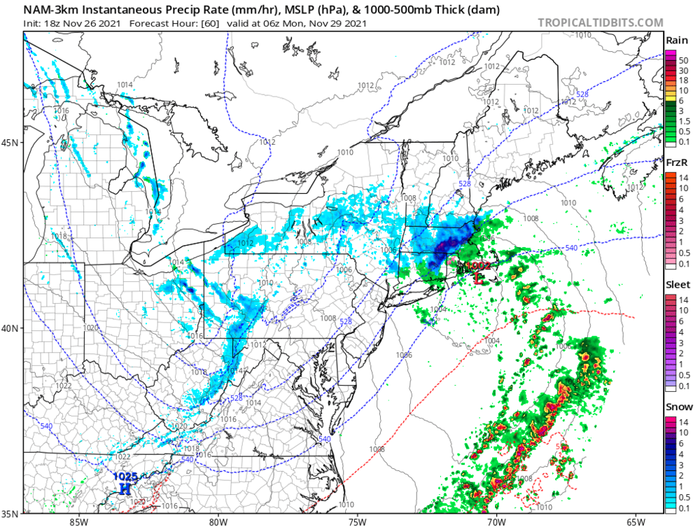
Need another panel on the 3k but even 60 hours is wild
-
Happy hour NAM doesn’t disappoint.
-
11/26-11/27 Rain Ending as Snow Obs/Disco
ORH_wxman replied to 40/70 Benchmark's topic in New England
Best chance is this evening. Might see some precip blossom almost overhead. If it doesn’t happen by 8 or 9pm then it’s toast. -
December 2021 Obs/Disco...Dreaming of a White-Weenie Xmas
ORH_wxman replied to 40/70 Benchmark's topic in New England
EPS is definitely showing the folded over WPO ridge now into the EPO domain...look N of AK here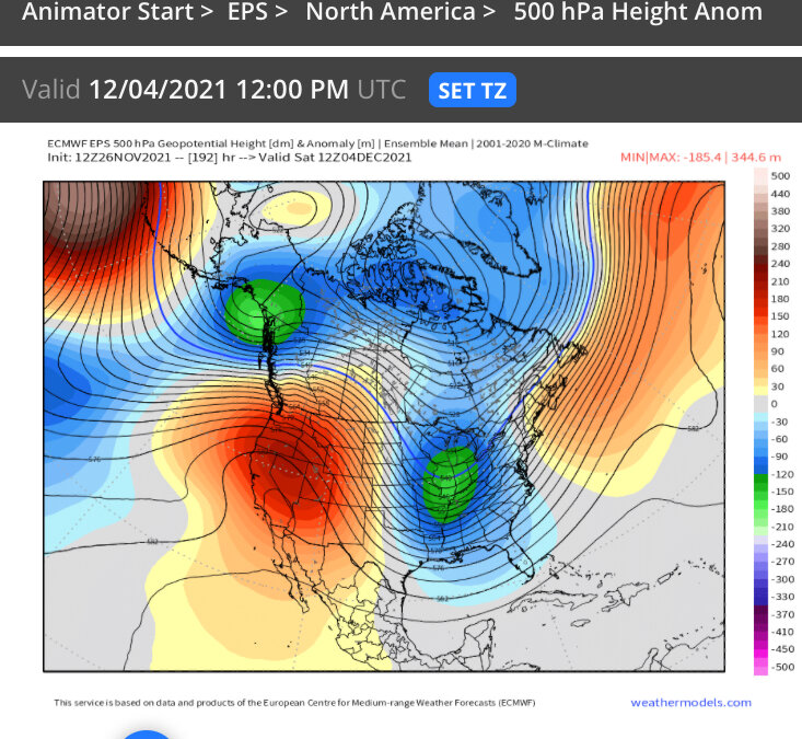
-
11/26-11/27 Rain Ending as Snow Obs/Disco
ORH_wxman replied to 40/70 Benchmark's topic in New England
Yeah the comma head precip tries to rejuvenate late this PM and evening. So that’s when the best chance for any accumulation would be. If this ULL was like 100 miles south I’d be a lot more bullish but as is, it’s kind of too little too late but maybe enough for a quick burst of steadier snow. -
December 2021 Obs/Disco...Dreaming of a White-Weenie Xmas
ORH_wxman replied to 40/70 Benchmark's topic in New England
Here’s a good look at what I’m talking about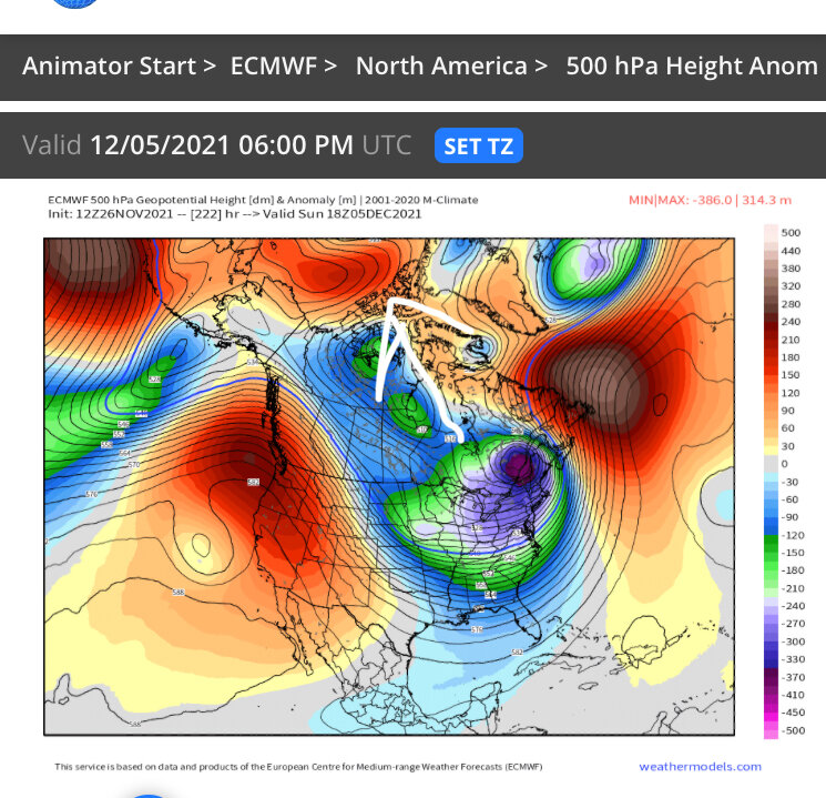
-
December 2021 Obs/Disco...Dreaming of a White-Weenie Xmas
ORH_wxman replied to 40/70 Benchmark's topic in New England
It’s a really active pattern for early December. One of these might cut but I think there will prob be a winter threat in here too. OP run is still folding over the WPO ridge into an EPO block north of AK out in the extended. That is a really good look to keep the frigid air in Canada and into the northern tier of CONUS. Lets hope the EPS shows that happening more. Even last night sort of hinted at it. But with the OP run being pretty insistent maybe it will actually lead the way. -
Yeah I’ll consider anything > 1” a win this early. There’s going to be more chances too...the pattern looks pretty active over the next 10-12 days. They all won’t be snow chances but probably at least one of them will be.
-
About an inch or two for eastern areas of SNE with another enhanced area up in NW MA and S VT with 2-3” on the euro.
-
11/26-11/27 Rain Ending as Snow Obs/Disco
ORH_wxman replied to 40/70 Benchmark's topic in New England
I’ll be happy with C-1”. These don’t usually produce well on W wind. Your area may do a bit better...and esp hubbdave’s region on the other side of the ORH hills spine. They could grab a couple inches and it wouldnt shock me. -
GGEM digs this pretty far though. That’s still worth watching. Kind of surprised it didn’t spit out more
-
GFS hasn’t been playing ball with this system for a couple days now. It’s been the furthest north with that shortwave and this run is no different.
-
RGEM was digging pretty good but just couldn’t quite get conveyor system going in time. I agree with tip that some of these runs also ha e spacing interference. RGEM seemed that way...but it was still enough to drop a couple inches in eastern areas and then it croaked downeast/midcoast Maine.
-
These are both tonight’s event. Not Nov 28-29
-
If it comes back he will have gone from no snow through Xmas, to 4-8”, to just flurries and then back to a hit again in a span of 3 days.... If we’re ever running a forecasting clinic, we could put that 3 day set of posts together as a perfect example of what NOT to do. It will be like those cheesy videos we used to have to watch in school in health class or something where they show some dumb kids deciding to drink or do drugs but the acting is horrible. Instead we’ll just use Kevin’s posts in place of the horrible actor.
-
Enjoy it because it’s all down hill from here.
-
Yeah that’s the key. Getting that northern stream to send the vort to our south while going neutral tilt before it reaches us.
-
NAM gone wild.
-
NAM improved from 18z too. Still escaping a bit but that was pretty nice looking with the northern stream shortwave track.
-
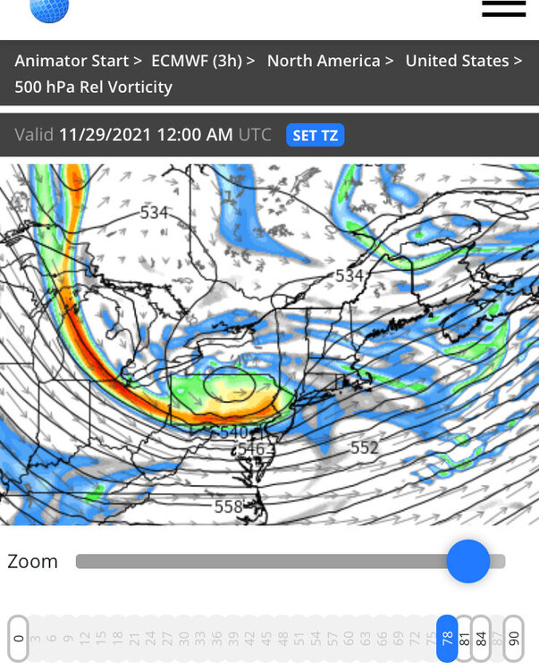
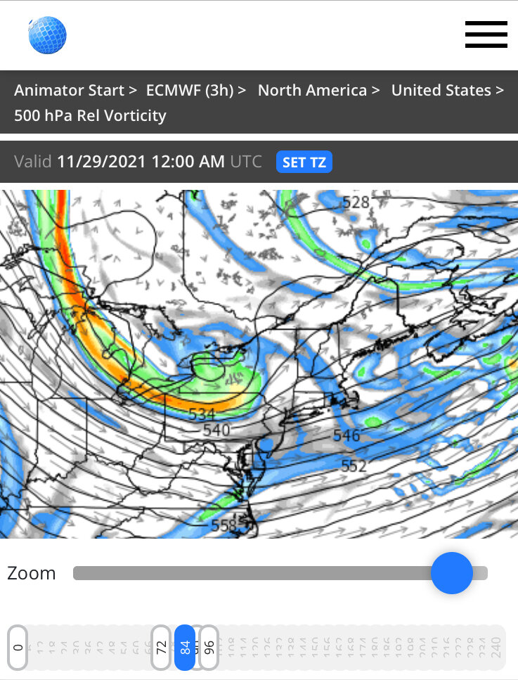
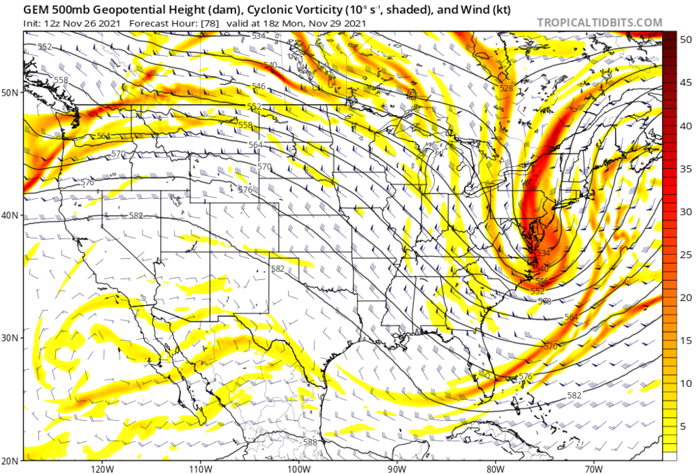
It’s significantly south imho. It’s enough to matter anyway. Here’s 18z on top and 12z at the bottom at the same time: