ORH_wxman
-
Posts
90,902 -
Joined
-
Last visited
Content Type
Profiles
Blogs
Forums
American Weather
Media Demo
Store
Gallery
Everything posted by ORH_wxman
-
December 2021 Obs/Disco...Dreaming of a White-Weenie Xmas
ORH_wxman replied to 40/70 Benchmark's topic in New England
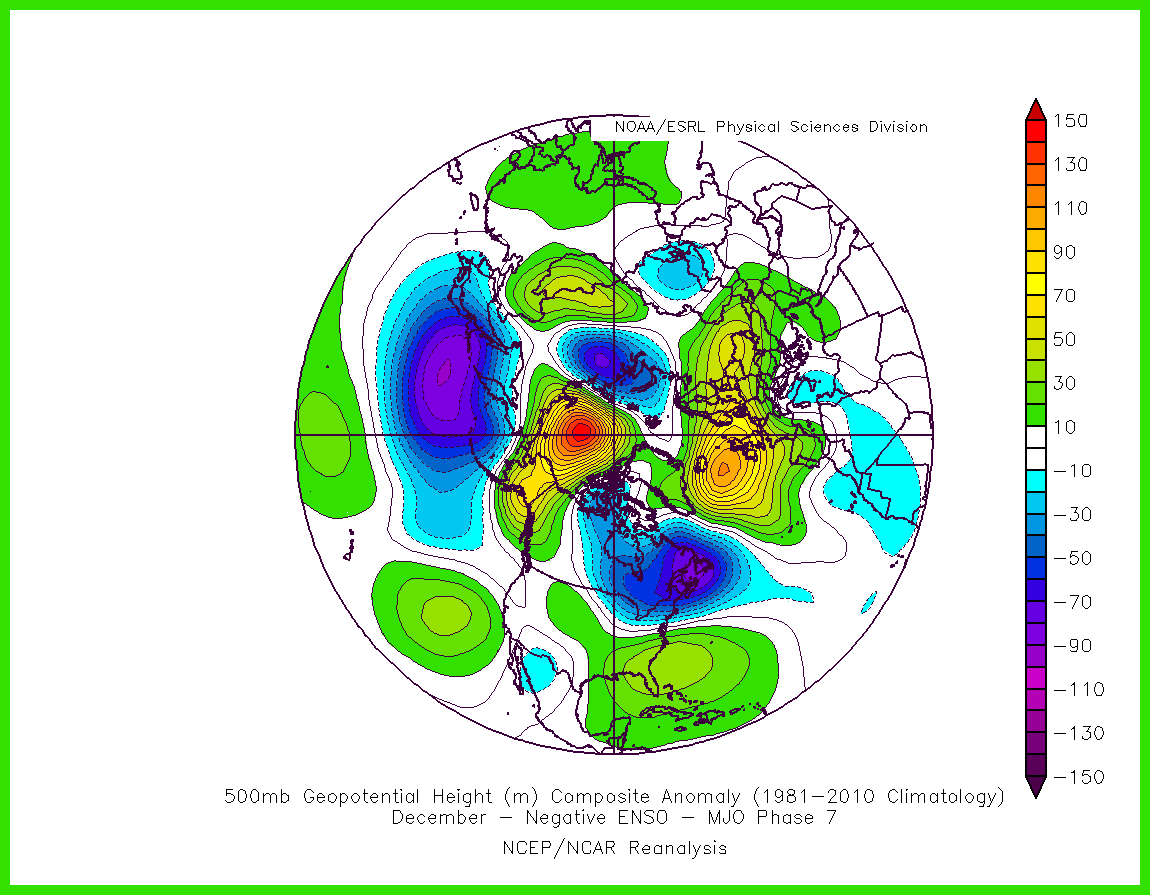
Dec MJO 7 composite looks a lot tamer than progs....not saying the prog is wrong, but digging the trough really deep into CA doesn't seem to be on here
-
December 2021 Obs/Disco...Dreaming of a White-Weenie Xmas
ORH_wxman replied to 40/70 Benchmark's topic in New England
Or just less digging of the western trough....or a bit more of a stout -NAO....there's a few ways to get it to work. -
December 2021 Obs/Disco...Dreaming of a White-Weenie Xmas
ORH_wxman replied to 40/70 Benchmark's topic in New England
ORH had like 10" in that event....you are prob thinking of 12/29/76 a few years earlier which gave 128-495 belt like 12-18" and ORH got 4". -
December 2021 Obs/Disco...Dreaming of a White-Weenie Xmas
ORH_wxman replied to 40/70 Benchmark's topic in New England
Thursday looks like the best bet. I don't think any of Monday-Wednesday will be that warm....above average, but prob not 50s/60s...maybe 50s are possible in the usual spots Monday. It will depend how well we mix on Monday. Friday could be a downslope dandy too....something to watch for temp enthusiasts. -
December 2021 Obs/Disco...Dreaming of a White-Weenie Xmas
ORH_wxman replied to 40/70 Benchmark's topic in New England
It's there Tuesday/Wednesday....this run does warm sector us Thursday though which would get us well into the 60s if we can achieve warm sector early in the day. -
December 2021 Obs/Disco...Dreaming of a White-Weenie Xmas
ORH_wxman replied to 40/70 Benchmark's topic in New England
That sneaky high is prob going to "Ruin" the torch for most of it I think....we might be able to get Thursday or Friday pre-FROPA to get a really good day in there, but I'm starting to envision this backdoor high keeping it colder. It will still be mild compared to averages, but I was previously thinking we could make a run at all time December records and now I'm skeptical we even sniff those types of highs. -
December 2021 Obs/Disco...Dreaming of a White-Weenie Xmas
ORH_wxman replied to 40/70 Benchmark's topic in New England
Well, the NAO did help prevent cutters....we only had one single cutter for like a 6 week period starting around New Years. Our biggest problem was we couldn't buy a storm to phase during the January pattern. The airmass was kind of stale but it was still marginally cold enough to support snow. I think ORH had a grand total of 3 days with a high temp over 40F last January despite the month being +3...that's hard to pull off. We were joking how we really needed Tip's hadley cell gradient during January....but it was nowhere to be found, lol. -
December 2021 Obs/Disco...Dreaming of a White-Weenie Xmas
ORH_wxman replied to 40/70 Benchmark's topic in New England
It's an impressive -NAO showing up on that run....but storms can still cut in a -NAO. The NAO just gives more wiggle room, but if you have a couple shortwaves phase, you can still cut. -
December 2021 Obs/Disco...Dreaming of a White-Weenie Xmas
ORH_wxman replied to 40/70 Benchmark's topic in New England
Yeah this is what I view it as....S NJ to all of VA...and the zone in between. -
December 2021 Obs/Disco...Dreaming of a White-Weenie Xmas
ORH_wxman replied to 40/70 Benchmark's topic in New England
Southern NJ is def mid-atlantic....but pron not NNJ. Hilarious how all of NY State is labeled Mid-atlantic on that map....lol -
Wednesday 12/8 Possible Snow/Ice/Rain? Discussion
ORH_wxman replied to Torch Tiger's topic in New England
My son was up at 6am and made me come outside in the snow with him.....what a weenie.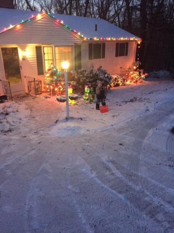
-
Wednesday 12/8 Possible Snow/Ice/Rain? Discussion
ORH_wxman replied to Torch Tiger's topic in New England
About an inch of nice fluffy snow. Looks nice out there. -
Wednesday 12/8 Possible Snow/Ice/Rain? Discussion
ORH_wxman replied to Torch Tiger's topic in New England
Snowing pretty good here. Everything covered. About a quarter inch so far.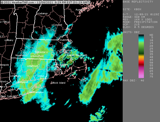
-
Wednesday 12/8 Possible Snow/Ice/Rain? Discussion
ORH_wxman replied to Torch Tiger's topic in New England
IVT becomes a bit more pronounced in the 9-10pm timeframe. That’s where we might see some enhancement of that lighter precip shield. You can see it pretty clearly on the modeled streamline analysis. -
December 2021 Obs/Disco...Dreaming of a White-Weenie Xmas
ORH_wxman replied to 40/70 Benchmark's topic in New England
Yeah seeing a +20 or -20 day in the summer is much harder than in the winter. In the winter, we can have a high of 0 or 5F or a high of 65-70F. In the summer your extremes are probably 55F to 100F for most of the area for highs. -
Wednesday 12/8 Possible Snow/Ice/Rain? Discussion
ORH_wxman replied to Torch Tiger's topic in New England
That is an amazing fire hose that hits the Sierras starting Saturday night. It lasts for like 3 days too and these aren’t high snow levels. -
Wednesday 12/8 Possible Snow/Ice/Rain? Discussion
ORH_wxman replied to Torch Tiger's topic in New England
Some steady light snow here in the past 15-20 min. Emphasis on light. Let’s see if we can ramp up the echoes as that stuff from W MA comes in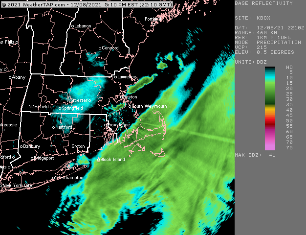
-
Wednesday 12/8 Possible Snow/Ice/Rain? Discussion
ORH_wxman replied to Torch Tiger's topic in New England
Column gets colder as we go further into the evening, so rain should change to snow in most places where it is still raining....outer Cape and Islands might be slower though. -
Wednesday 12/8 Possible Snow/Ice/Rain? Discussion
ORH_wxman replied to Torch Tiger's topic in New England
Lobster boats coming back with a foot of paste on the deck. -
Wednesday 12/8 Possible Snow/Ice/Rain? Discussion
ORH_wxman replied to Torch Tiger's topic in New England
ALB radar being down really sucks....hard to see upstream convergence zones, -
Wednesday 12/8 Possible Snow/Ice/Rain? Discussion
ORH_wxman replied to Torch Tiger's topic in New England
No that isn't what I'd forecast....I'd prob forecast 1-2" but emphasize the uncertainty associated with IVT setups. It's always possible you miss out on accumulations in these setups. -
Wednesday 12/8 Possible Snow/Ice/Rain? Discussion
ORH_wxman replied to Torch Tiger's topic in New England
ORH will be just far enough inland to avoid the regression. -
Wednesday 12/8 Possible Snow/Ice/Rain? Discussion
ORH_wxman replied to Torch Tiger's topic in New England
Taunton was overdue for some screwgies -
Wednesday 12/8 Possible Snow/Ice/Rain? Discussion
ORH_wxman replied to Torch Tiger's topic in New England
I don't think that is your meaningful snow if you get any....later this evening is what you'll want to look for. This current stuff is mostly for the shore...might be some flakes inland with it, but prob little if any measurable snow. If this starts to expand and blossom well NW though as we get into the 4-5pm hour, then that would definitely be a good sign. -
December 2021 Obs/Disco...Dreaming of a White-Weenie Xmas
ORH_wxman replied to 40/70 Benchmark's topic in New England
Look on the bright side, you might conserve a half inch pack.