ORH_wxman
-
Posts
90,902 -
Joined
-
Last visited
Content Type
Profiles
Blogs
Forums
American Weather
Media Demo
Store
Gallery
Everything posted by ORH_wxman
-
Yeah and I’ve seen it before in a lot of smaller dinky events but in the 2008 event it happened when there was 3” of QPF so it made it that much more noticeable. Like Leominster at 300 feet had catastrophic ice but then if you went to Orange MA on that other side of the spine on route 2 it was almost nothing despite Orange actually being a couple hundred feet higher.
-
My best educated guess was that the terrain blocked some of the dewpoint advection and it also likely had a mild warming effect of downsloping (and the east side had the opposite effect of mild upslope cooling). In a marginal temp profile, stuff like that will matter more than usual.
-
There was also a little bit of terrain effects in that storm too. The west Side of ORH hills had drastically less ice at the same elevation as the eastern side that was catastrophic accretion.
-
Ha we both mentioned 2008 at the same time…nice. Obviously the storm was huge but it was a greaT case study on the different variables working.
-
The 2008 storm was cool because it had offsetting factors working which kind of made the forecast a really tough call. On one hand, you had marginal temps barely below freezing and very heavy QPF (I should really say rates instead of QPF)….those would limit ice accretion. But on the other hand, you had like a 15-20 knot wind out of the NE…advecting in upper 20s dewpoints the whole time into N MA and down to about ORH.
-
A limiting factor in efficient ice accretion in this event is that 950mb temps are really warm. Tip mentioned this a couple pages back but that is important because you are going to have warm raindrops pretty close to the surface so they have less time to become supercooled. In many of our nasty icing events, you’ll see 950 temps below 0C and the freezing line is closer to 900-925.
-
It varies based on several factors but a rough general rule is that 70% will freeze on flat surfaces and then roughly 40% of THAT will accrete radially…which comes out to about 30% of the QPF. So in an example where half inch of QPF falls as ice, you may get about 3/8ths inch on flat surface and 1/6th radial accretion.
-
December 2021 Obs/Disco...Dreaming of a White-Weenie Xmas
ORH_wxman replied to 40/70 Benchmark's topic in New England
Great post….awesome animations in the pattern there. That pattern at the end would certainly be more conductive to coastal storms as well even though the overrunners and redevelopers are still likely favored. At least the meat grinder relaxes a bit. The really strong block in the Chukchi Sea has my attention too. In the past, we’ve seen some really extreme cold outbreaks into the northern tier when a block develops there. -
December 2021 Obs/Disco...Dreaming of a White-Weenie Xmas
ORH_wxman replied to 40/70 Benchmark's topic in New England
He might need this instead:
-
I’d watch the Jan 2-4 period for now.
-
December 2021 Obs/Disco...Dreaming of a White-Weenie Xmas
ORH_wxman replied to 40/70 Benchmark's topic in New England
Even the coldest guidance i think had a high around 28ish at ORH. That ended up being the high near BOS and the ORH Asos has been running warm too
-
December 2021 Obs/Disco...Dreaming of a White-Weenie Xmas
ORH_wxman replied to 40/70 Benchmark's topic in New England
Yeah that could be nasty for quite a while. Esp interior hills in ORH county into S NH. Flow is pretty light so prob many areas will latently warm to like 32.5F by mid afternoon but if even a weak barrier jet gets going then that could end up as 30F right into evening. The mesolow threat is kind of high so something to watch. -
December 2021 Obs/Disco...Dreaming of a White-Weenie Xmas
ORH_wxman replied to 40/70 Benchmark's topic in New England
Finished with just under an inch at winter hill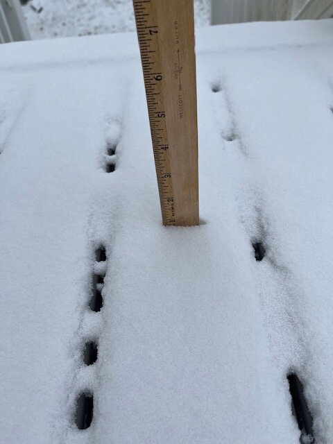
-
December 2021 Obs/Disco...Dreaming of a White-Weenie Xmas
ORH_wxman replied to 40/70 Benchmark's topic in New England
Cold day. ORH at 22F at lunchtime. -
December 2021 Obs/Disco...Dreaming of a White-Weenie Xmas
ORH_wxman replied to 40/70 Benchmark's topic in New England
Brutal my friend. Even a half inch to an inch looks quite festive. Hopefully some redemption by New Years. -
December 2021 Obs/Disco...Dreaming of a White-Weenie Xmas
ORH_wxman replied to 40/70 Benchmark's topic in New England
TF Green prob getting smacked there just south of Providence. -
December 2021 Obs/Disco...Dreaming of a White-Weenie Xmas
ORH_wxman replied to 40/70 Benchmark's topic in New England
Solid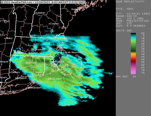
-
December 2021 Obs/Disco...Dreaming of a White-Weenie Xmas
ORH_wxman replied to 40/70 Benchmark's topic in New England
He’s not losing that tomorrow. Even when the ZR changes to showers later on it’s like mid 30s. -
December 2021 Obs/Disco...Dreaming of a White-Weenie Xmas
ORH_wxman replied to 40/70 Benchmark's topic in New England
Yeah it’s not going anywhere there. Prob icy tomorrow AM too. -
December 2021 Obs/Disco...Dreaming of a White-Weenie Xmas
ORH_wxman replied to 40/70 Benchmark's topic in New England
No I’m in Holliston. Visiting family today though and then heading to NJ where it will be brown and mild. -
December 2021 Obs/Disco...Dreaming of a White-Weenie Xmas
ORH_wxman replied to 40/70 Benchmark's topic in New England
A little over a half inch so far on winter hill. Not sure if a little more can come through but looks festive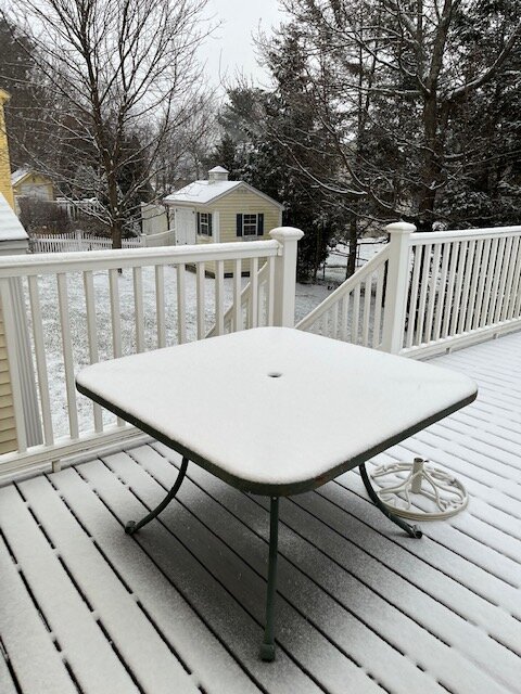
-
December 2021 Obs/Disco...Dreaming of a White-Weenie Xmas
ORH_wxman replied to 40/70 Benchmark's topic in New England
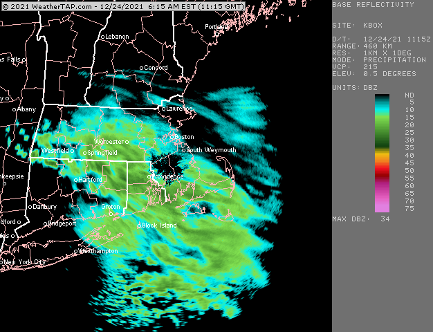
Nice burst now. “Heaviest” of the event. -
December 2021 Obs/Disco...Dreaming of a White-Weenie Xmas
ORH_wxman replied to 40/70 Benchmark's topic in New England
Of course my boys had to go outside at 630am despite just a coating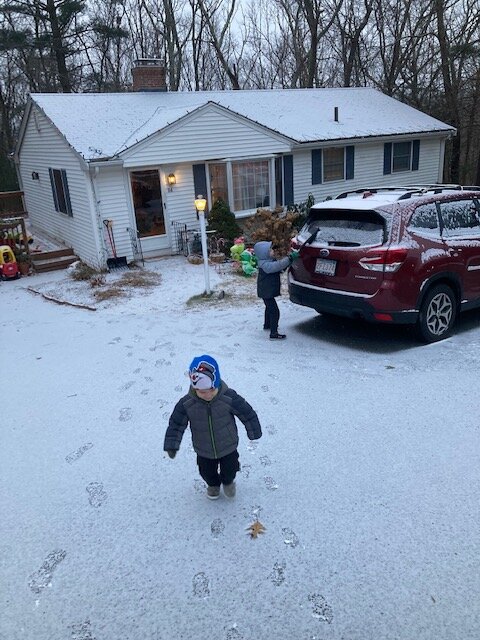
-
December 2021 Obs/Disco...Dreaming of a White-Weenie Xmas
ORH_wxman replied to 40/70 Benchmark's topic in New England
Kevin will break 2” with that band. -
December 2021 Obs/Disco...Dreaming of a White-Weenie Xmas
ORH_wxman replied to 40/70 Benchmark's topic in New England
Flakes picking up a bit…hopefully this bursT to the west gives a bit more. We have a coating right now. Congrats on the white Xmas for the CT folks.