

ORH_wxman
-
Posts
90,902 -
Joined
-
Last visited
Content Type
Profiles
Blogs
Forums
American Weather
Media Demo
Store
Gallery
Everything posted by ORH_wxman
-
It good that it didn't shift much at all from 06z....we had been previously seeing a distinct shift eastward, but this time it more or less held serve except maybe on the margins (and those on the margins will notice)
-
Nice -32C 850s over Chicago at the end, lol. Trying to make a run at 1994.
-
Yeah it could be a little light snow up in NH/VT and Maine....it isn't much QPF though.
-
Improved quite a bit actually...but it was also perhaps one of the worst runs at 00z, so no surprise it is coming back in line with other guidance.
-
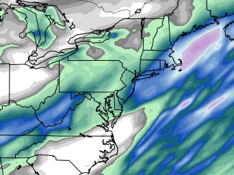
Good run for the QPF queens...
-
I usually take the 600-800 avg...often the best banding will end up on the NW edge of that. Not all the time, but frequently. modeling best fronto isn't the easiest thing for guidance...it's pretty easy to be off like 25 miles on a short term forecast...but obviously that can make a huge difference in amounts if someone was supposed to be under that but it ended up 25 miles east.
-
Yeah thats been trending colder....and the sfc cold may be underdone too if there is a fresh snow pack for it to rest on.
-
MPM could complain his way to a jackpot too there in Westborough.
-
I actually like my spot for a potential jack...far enough east for good QPF but far enough west and a little elevation for decent ratios. We'll see though....interior SE MA near the usual suspects like Foxborough are primed too for some heavy bands and their few hundred feet will help ratios some.
-
High stakes in eastern areas....there is definitely some upside bust potential if some of that veyr heavy precip can get onshore....I think really all it will take is a slight increase in the ML inflow which would happen if the convection is less dominant.
-
Yeah longitude is actually more important in SNE than latitude in this system.
-
That is still widespread warning snows on the NAM east ORH-Ginxy line despite some of the wonky convection-chasing
-
NAM looks a bit more amped so far.
-
You might have enough longitude eastward to do just fine.
-
Yeah places like BOS might be slow in the first 2-3 hours and then they'll go to poundtown tomorrow morning.
-
HRRR definitely a bit more subdued than 06z though it is still really good for E MA and RI and E CT.
-
Nice bump back west on 06z euro. Man, that off hour/on hour tango is so weird.
-
There’s going to be some pretty intense snow in that band for a while I think. Question is how long the good banding lasts…that’ll be the difference between advisory snow and solid warning snows.
-
06z reggie went east again too.
-
Went to bed before euro but that was not what I was hoping to see. 06z NAM suite was a nudge east too. We’re still west of the 12z suite so that part is good but it seems we’ve at least temporarily halted the NW trend.
-
GGEM def a bit east of 12z.
-
You needed to just refresh yourself with some training
-
I don’t think it’s done yet either. Model guidance is trying to rip this closer to the vortmax. It still tries to escape east a bit on some of these runs even though they are a lot better.
-
GFS coming in hot
-
I thought rgem looked slightly west of 18z. Phin, it got more precip up to you than 18z. Down here it wasn’t that different. Maybe a little bump in spots. It def looked healthier on the non-QPF maps.


