ORH_wxman
-
Posts
90,902 -
Joined
-
Last visited
Content Type
Profiles
Blogs
Forums
American Weather
Media Demo
Store
Gallery
Everything posted by ORH_wxman
-
Sure it can....you just have to track the storm up into your fanny and it will rain there. Happens even in frigid patterns...how'd you do on January 17, 1994?
-
GFS is gonna be a hugger....might flip us to rain.
-
Rather than go fatality on you, I'd prob just do the upper cut on the spike pit arena.
-
That's actually a pretty good hit for the Cape and Canal region. 1-2" maybe for the rest of eastern MA
-
NAM is def trying.
-
Monday starting to look really good on EPS....even though 06z EPS only goes to 144, you can see that a lot of those would likely turn the corner based on H5.
-
EPS definitely looked interesting. More so for the 1/17 threat but can’t quite rule out 1/14 yet.
-
What is the GFS doing…
-
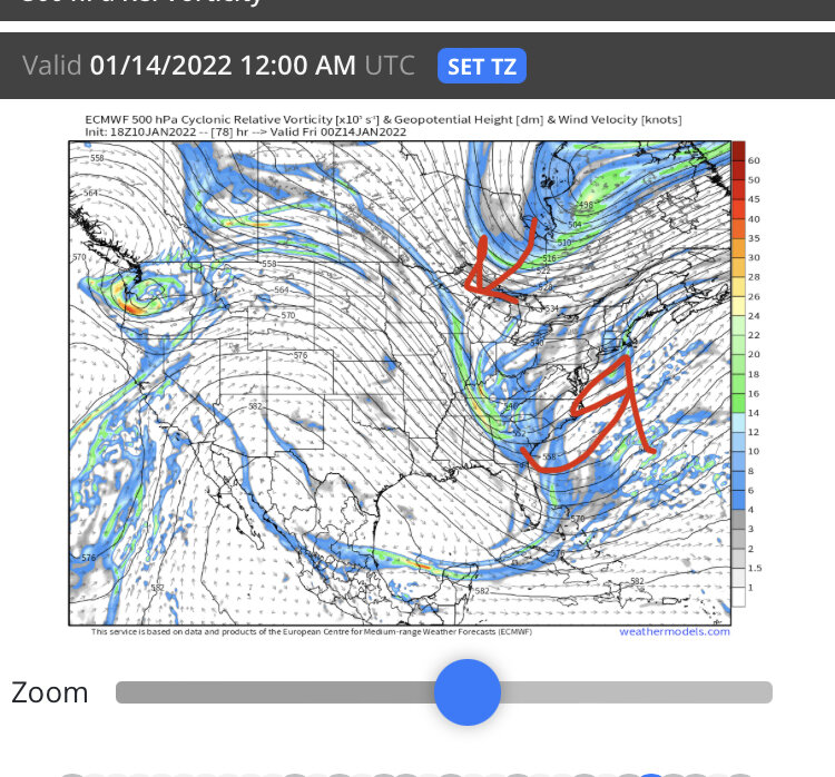
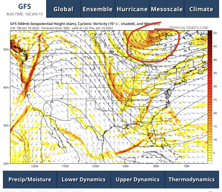
Man, we just need that PV lobe to dig a little further west and you’d prob get a partial phase enough to send this right up 70W. Wouldn't take much…I exaggerated the arrows but you get the point
-
Sorry to hear. Glad it was a nice ceremony. Let’s hope we get an awesome stretch of winter wx…it always helps me through a tough time when I can be distracted by my passions.
-
We need that PV lobe dropping down to trend a little west to give this room to amplify up the coast. I circled it in the image below
-
That’s not even a bad look for New England. But prob isn’t going to satisfy your blizzard fetish.
-
Then the pattern goes to hell around mid-Feb but obviously that is clown range on the weeklies.
-
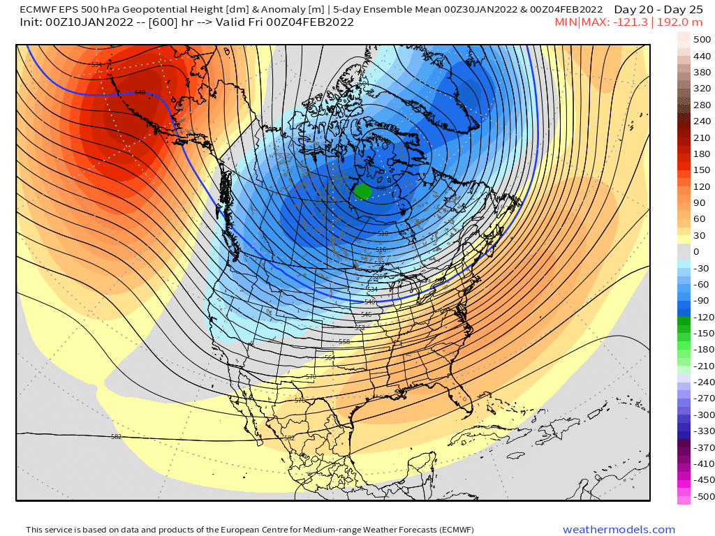
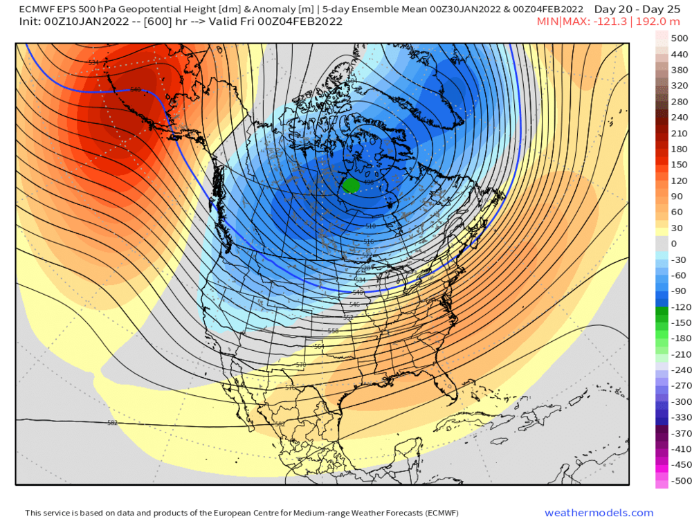
Yes. Still showing the -PNA returning for first week of February
-
And yes, I bothered to actually look at the ICON. I was bored.
-
Icon was a close miss at 18z. Need another 75 miles for the E MA/RI crowd.
-
1/22/05
-
That's prob the one...you prob had like 6-10 in that storm while further north and east got smoked.
-
Oh jeez...that hting just hangs out over the arctic ocean...it never gets better sampled until after the Friday event is past.
-
Yeah there was a bunch of OES enhancement going on along the south shore in that one. I think Blue Hill ended up with like 27 or 28 inches in that storm. BOS had 22 or 23?
-
The shortwave directly responsible for Friday comes onshore tomorrow night....I'm not sure if there is another piece you are asking about that is affecting the ridge?
-
There's some similarities 2005 and 2015 share....2015 was a little more amplified and also lasted longer. 2015 was basically that standing western ridge for 3-4 weeks....it did briefly break down and reload in the Feb 6-10 range but we got lucky while the rest of the CONUS torched and we had that weird overrunning event that lasted 3 days and culminated in a coastal redevelopment on the morning of Feb 9th. That's how you break records though....get lucky when everyone else is waiting for the reload.
-
Maybe we can do the 17 year anniversary repeat.
-
At some point, we gotta get smoked in this look, right?
-
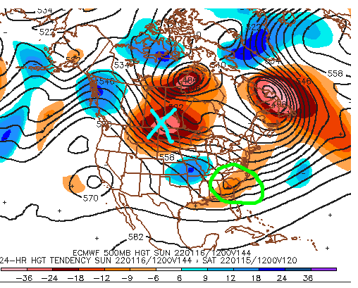
Here's a quick look at the 144 hour Euro....I marked the failed 1/15-16 threat with the green circle and the 1/17-18 threat is marked with the light blue "X".....they are different shortwaves....the reason I like the 1/17 threat better is kind of obvious on the eye test....it has more room to operate. The 1/15-16 shortwave is getting crunched by what's left of that ocean storm in the maritimes.