

ORH_wxman
-
Posts
90,902 -
Joined
-
Last visited
Content Type
Profiles
Blogs
Forums
American Weather
Media Demo
Store
Gallery
Everything posted by ORH_wxman
-
Monitoring a potential important TV to East Coastal storm: Jan 17
ORH_wxman replied to Typhoon Tip's topic in New England
Friday's system is def hanging back on this euro run....we'll see how much that affects the Monday storm. -
Doubt it comes much more west...there isn't much room in the flow to shift that west.
-
Euro might even get an inch or two back here.
-
Monitoring a potential important TV to East Coastal storm: Jan 17
ORH_wxman replied to Typhoon Tip's topic in New England
The 12z GEFS i have show a lot of interior lows.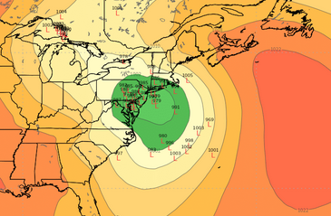
-
I think the '87 storm was a huge bust too...winter storm warnings out for most of BOS area and the thing decides to just squeeze east but destroy the Cape in an epic manner. The graidnet must have been epic....CHH 28", HYA 16", East Wareham 10"....then Kingston coop had like 3"....lol
-
Maybe we can get a repeat of 2/9-10/87? CHH gets 28 inches while you get 3" and I get an inch?
-
Monitoring a potential important TV to East Coastal storm: Jan 17
ORH_wxman replied to Typhoon Tip's topic in New England
We might all get warm sectored....that's why we gotta hope this goes more over BOS or SE MA/Cape. -
Monitoring a potential important TV to East Coastal storm: Jan 17
ORH_wxman replied to Typhoon Tip's topic in New England
Still a pretty big frotn ender for the interior on Ukie. That would be my hope right now...that this ends up more like a BOS track and we get some real goods on the front end. -
Monitoring a potential important TV to East Coastal storm: Jan 17
ORH_wxman replied to Typhoon Tip's topic in New England
I'll want to see EPS shift east a some today...there was a good cluster of members as far west as the GFS on the 06z EPS run. -
Monitoring a potential important TV to East Coastal storm: Jan 17
ORH_wxman replied to Typhoon Tip's topic in New England
Yeah it was pretty clear early on that the Friday system was hanging back and slower to exit. -
Monitoring a potential important TV to East Coastal storm: Jan 17
ORH_wxman replied to Typhoon Tip's topic in New England
Yeah those changes early on were enough to hold in the cold a bit better. Stil want to see this not track west of us...but well see if other guidance follow ssuit. -
Monitoring a potential important TV to East Coastal storm: Jan 17
ORH_wxman replied to Typhoon Tip's topic in New England
Yeah this is prob gonna be like 00z....still pretty amped but not quite as much as 06z. -
Monitoring a potential important TV to East Coastal storm: Jan 17
ORH_wxman replied to Typhoon Tip's topic in New England
GFS is prob gonna be east of 06z....ULL is slower to exit over Nova Scotia. Not that this thing could go much further west than the 06z GFS had it. -
Cape has ptype issues for a chunk of it....but if that creeps west, then it would be snow over other areas.
-
Man, it gets the heavy stuff on the Cape now....if that can come another 30-40 miles west then that would be a big hit for E MA and maybe RI.
-
Monitoring a potential important TV to East Coastal storm: Jan 17
ORH_wxman replied to Typhoon Tip's topic in New England
I;m going 1990s technology and using the Garcia method to forecast snowfall for the next storm. -
Was hoping to see the RGEM to get a handle on the NAM's Friday trends....see if they had any support. But Looks like a no go today.
-
Where are you getting the 12z CMC already?
-
Monitoring a potential important TV to East Coastal storm: Jan 17
ORH_wxman replied to Typhoon Tip's topic in New England
Yeah if we're getting a storm into NYC with decent antecedent airmass, then i could see a pretty good thump for ORH and other interior locations...esp N of pike. -
Looks like the canadians aren't bothering to run the RGEM today.
-
Monitoring a potential important TV to East Coastal storm: Jan 17
ORH_wxman replied to Typhoon Tip's topic in New England
I think GFS uses FV3 core. -
NAM has like -23C at 925 get down to the pike....lol. That's below 0F at the sfc if that happens.
-
Monitoring a potential important TV to East Coastal storm: Jan 17
ORH_wxman replied to Typhoon Tip's topic in New England
Yeah NAM is world's different from the GFS at the end of the run....doesnt mean much yet, but it's better than having it shows something as amped or more amped. -
Scooter down to PYM might get advisory snows on the 3km.
-
Very efficient delivery too for us...almost due north to south vector.


