ORH_wxman
-
Posts
90,902 -
Joined
-
Last visited
Content Type
Profiles
Blogs
Forums
American Weather
Media Demo
Store
Gallery
Everything posted by ORH_wxman
-
I think the important point you missed was we used the NAVGEM as the tiebreaker.
-
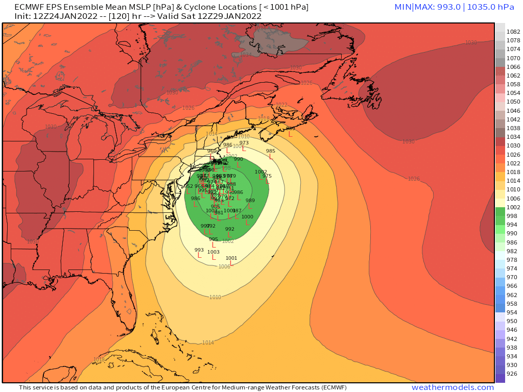
Yeah 18z euro looks like it would be a bit more amped than 12z. Def didn’t follow the 18z GFS
-
Meteocentre has the 18z gem but it only goes out to 84h on the 18z run.
-
JJ Foleys FTW. My favorite is when they politely told all of us “gentlemen, we think you may be more comfortable in our back room”…they were so diplomatic kicking us out of the main bar.
-
If this storm is in the process of hooking back toward the Cape during that time, it could be an epic tide.....major coastal flooding.
-
Winter storms are too frequent here to name them...and if you aren't following TWC all the time, you'd have no idea anyway, but most people do remember the date (or close to the date) that something happened. They aren't required to watch TWC to remember it either.
-
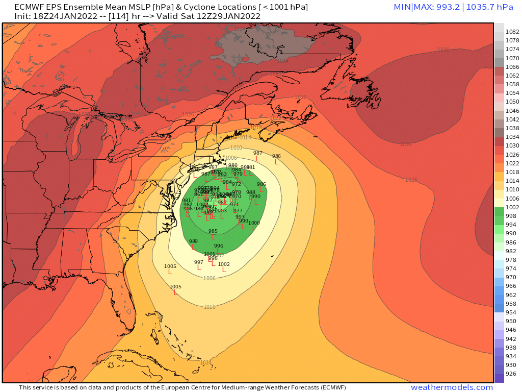
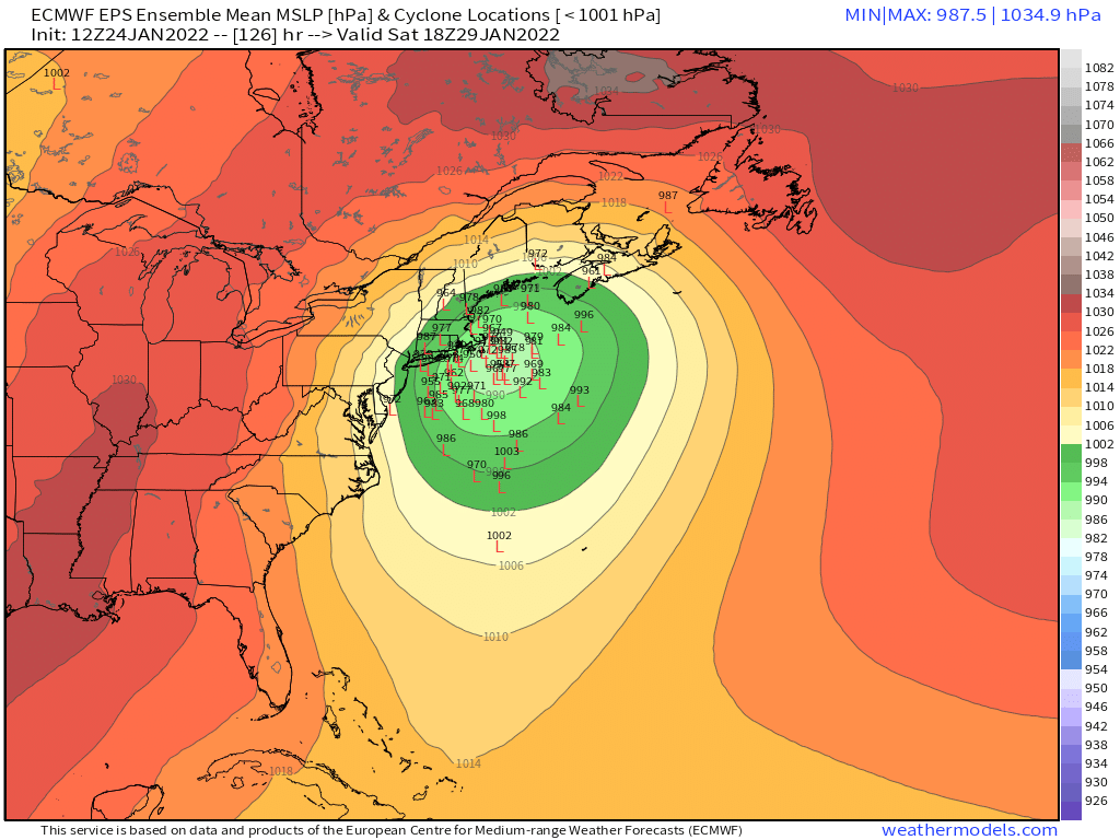
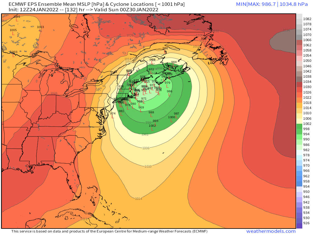
Today has really started narrowing the clusters on the ensembles and OP runs for 5 day lead time....confidence is definitely higher than normal at D5 for this one. Still have to be cautious obviously, but given the model guidance and also the larger scale pattern that is driving this evolution, we can afford to be a little more confident. It's not like some shortwave coming in slightly stronger or weaker is going to drastically change the solution....because its the larger scale features that are driving this the most.
-
Hell, if only it was Wednesday....once we get inside 72h, the shifts will not be very big.
-
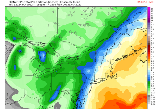
EPS mean QPF pretty good for a lot of folks
-
That was the best run so far IMHO....the densest cluster is clearly close to the mean center (BM and just E of the cape) and very few actually go inland.
-
PSU ewall actually stil has the loop archived if anyone wants to click....lol http://www.meteo.psu.edu/fxg1/ARC/2013/20130206/WRFEAST_12z/wrfeastloop.html
-
Feb '13 or Jan 15? This one to me looks more like Jan 2015 as modeled right now. There's actually a lot of larger scale similarities.
-
Yeah I disrtinctly remember Feb '13 had a couple runs where it looked like we might get 40"+ over a large area because it stalled well into Saturday afternoon. But it ended up slipping a little northeast before it did that....2015 I feel like stalled "on time" but the system was a little bit east of some of the consensus...most glaring the Euro was too far west.
-
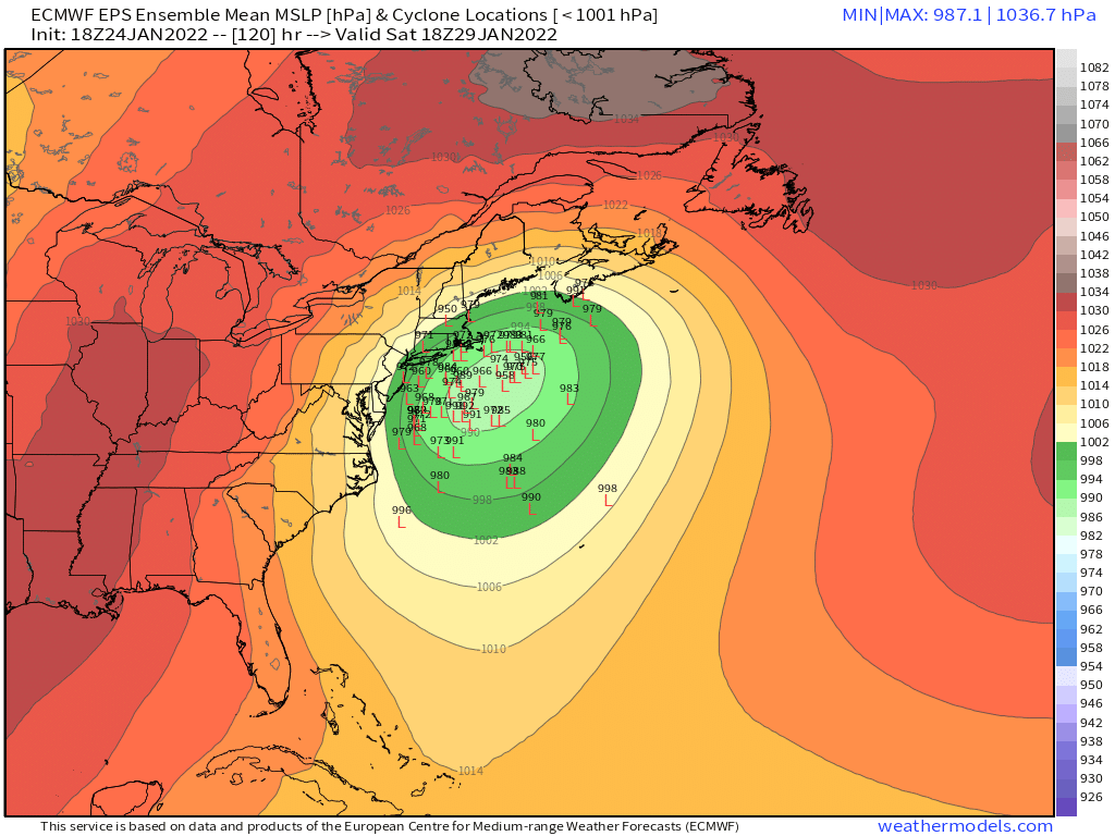
Yeah it is going to be hard to just lose this storm....this is extremely good agreement for a D5 system right now. You have cross-guidance support on literally every piece of guidance and big ensemble support....this has been on the radar for days already too and it's a larger scale type system that is benefiting from a giant large scale ridge and associated large scale downstream trough. The only question is we're still figuring out where in a 200 mile wide zone this may track....but I'm not worried about losing this to Bermuda at all.
-
This cycle was run from George's basement. It doesn't get much better than that for his area.
-
That gets captured east of the Cape so that would probably annihilate E and SE MA with 2-3 foot totals.
-
Yeah competing forces here....southern stream is dragging but northern stream coming in a steeper angle will help try and offset that.
-
The Friday PM stuff is almost like a PRE in the tropical system....it's not really directly associated with the coastal storm.
-
Interior NE MA is probably in a good as spot as any right now. Far enough east to get the Ukie-Esque solutions but far enough west to still do pretty well in the hugger solutions.
-
I want to be near the CF in this one because it’s going to be so defined. Someone will get obliterated just west of it.
-
Probably not, but the hook is always a worry on these southern streamers. But Tip is also right that there is a limit to this...the trough axis is pretty far east already when this starts rapidly gaining latitude.
-
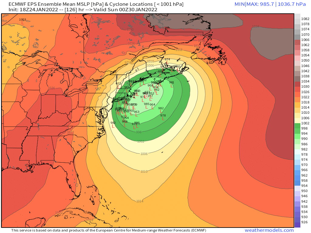
The reason it is stingy west of ORH is that the storm takes a really wide turn....it's pretty far east of Cape Hattaras but then it starts coming almost due north just barely E of the BM into the Gulf of Maine.
-
It's kind of compact with precip....really an eastern zone special. Basically E MA/RI up to your area does well but not good for western areas.