ORH_wxman
-
Posts
90,902 -
Joined
-
Last visited
Content Type
Profiles
Blogs
Forums
American Weather
Media Demo
Store
Gallery
Everything posted by ORH_wxman
-
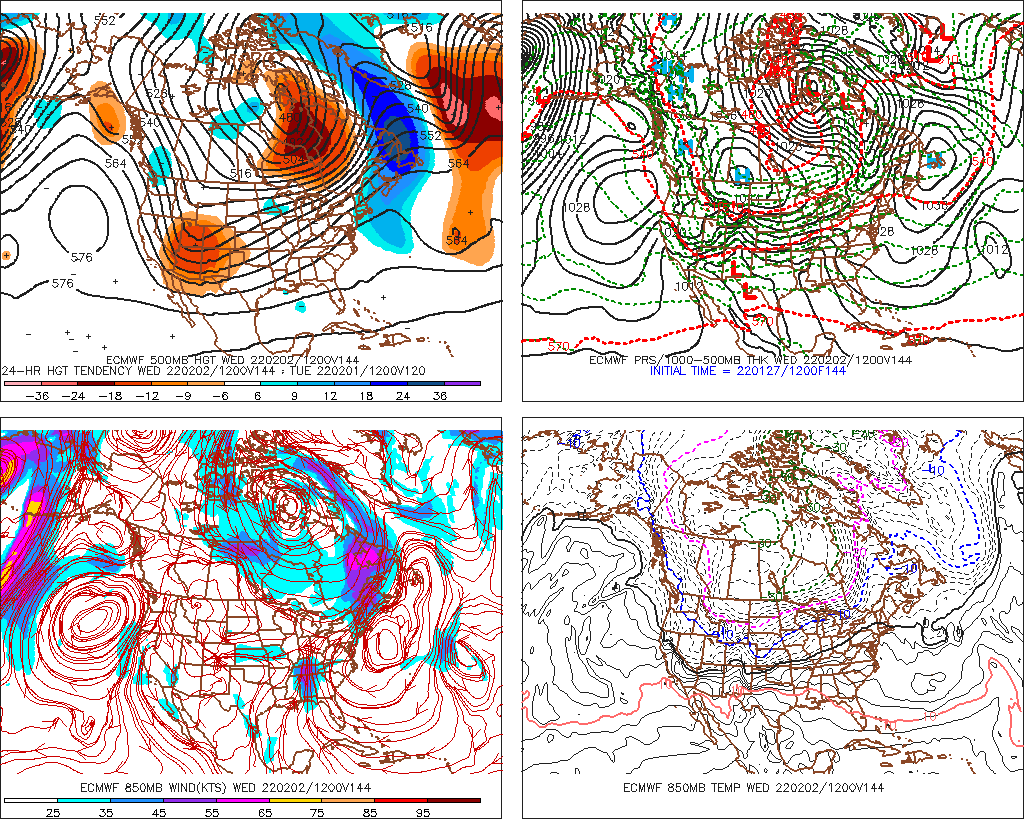
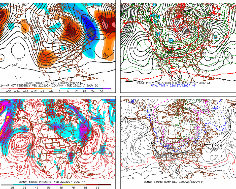
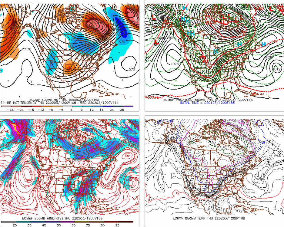
The main trough is actually a little deeper than 12z so far, but the lack of downstream ridging compared to 12z is obvious.
-
It prevents downstream ridging....and you want more downstream ridging to pull the storm west.
-
I'll be surprised if the NAM isn't east of 12z. Still looking less amped with more Quebec confluence at 24 hours.
-
Or like others said, the south shore would be good too...anywhere between Plymouth and Scituate.
-
BVY will be pretty good for winds. Even better place would be Cape Ann just to the east because they are exposed to the north by water....Gloucester or Rockport. Those two towns are just E of BVY and they will have much better winds.
-
Def more confluence up in Quebec on 18z NAM through 18h....
-
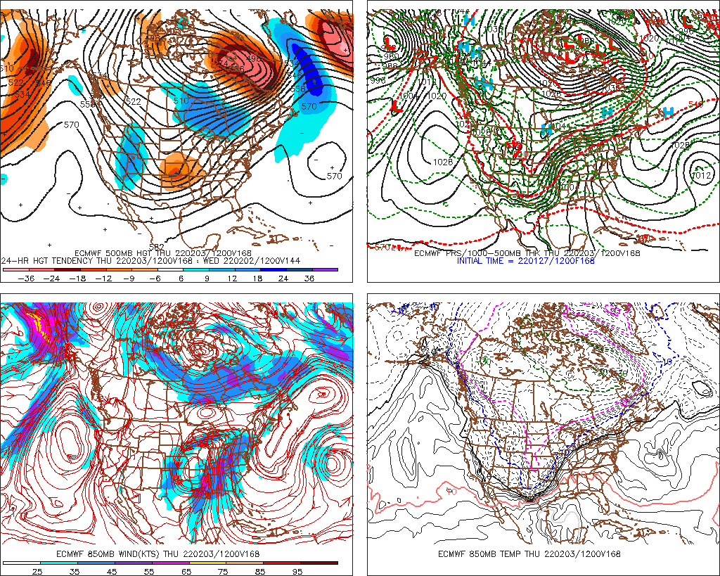
Yeah that is def showing the dual low structure...the bad members probably just run with the lead low eventually or consolidate it much later while the snowier members do what the NAM and the OP Euro did....capture the whole thing and tug it back near the Islands and stall/slow it.
-
Euro tries to stretch it out before it eventually cuts, but that is a trend that if it continues, it will turn the cutter into a winter wx event at least for NNE...still possible for SNE too but lesser probability.
-
Nov 1950 has to be one of them.
-
Not until 5pm or so....and it will eventually cave. It always does in the big dogs even if it has to be dragged kicking and screaming 24 hours before the event starts.
-
There was also a lot of "freezing sea spray" mixed in down there because of the winds.
-
Going from wet to powdery would be bad for the trees there given the winds. Only saving grace is the Cape trees are pretty gnarly and tough from the abuse they take each year anyway.
-
No problem...ratios are tough because you have to deal with multiple variables....also in larger storms, the weight of the snow on itself is going to limit ratios. IT's a lot easier to get a 20 to 1 fluff ratio in a 7-8" storm than it is in a 18" storm.
-
I don't have a magic formula on how to deal with wind, but experience over the years has taught me that in higher wind storms (and temps comfortable below freezing), the ratios will tend to converge onto typical "Cold climo ratios" that you see, say, in interior NY state...which is in the 13 to 1 or 14 to 1 range.....now further inland where winds might be a little lighter, if they get under a death band, then I could see the overall ratios being more like 16 to 1 or something.
-
Yeah maybe slightly less...I'd prob go like 13 to 1 or so because of the wind.
-
The NARCAN maps are going to have 30-burgers.
-
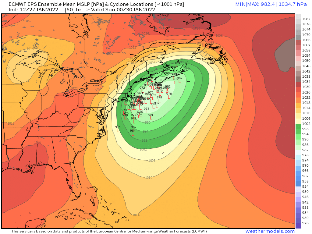
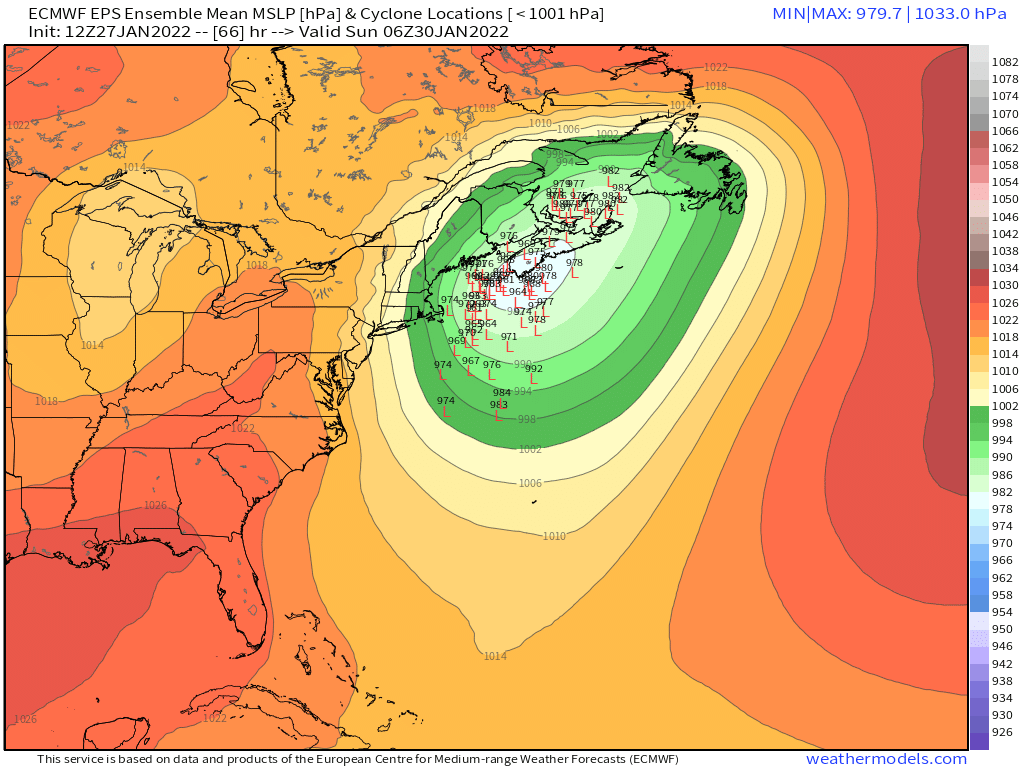
Gotta love 65 knots at H7 slamming into the E coast of MA. There would probably be yellow bands on radar embedded in a dark green solid precip shield.
-
It gets captured just E of CHH.
-
TPV lurking though...noticed the heights are a little lower to the northeast in Quebec/Labarador....but yeah, the trough west looks more amped. Hopefully that sticks.
-
It is the manner in which it achieves the BM position that is causing the eastward look to the precip compared to a more conventional storm.....typically storms move northeast or ENE to the BM....but this one is kind of taking a wider turn to the right and then hooking north....when it does that, the heavier WCB precip is not going to get western areas as much...it comes up through the Cape and eastern areas first and then you have to wait until the CCB backs in from the E or SE. The compactness of this storm will definitely be somethign to watch....if it's a bit wider circulation, then you will do fine with a BM track...but if it implodes a bit toward the center, then we could see an annoying dropoff in totals west of roughly ORH-IJD.
-
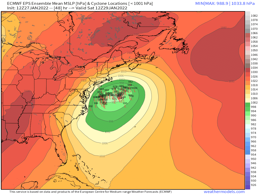
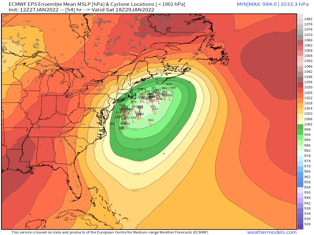
You are just NW of me (I'm near the Hopkinton/Holliston line)....your fate will be very similar to mine...so you can just wait until I get worried if you need a proxy for how good it looks there. And right now, we look very good. We are potential jackpot candidates.
-
GFS is a massive torch cutter....hopefully that mutes some. 12z GGEM looks more overrunning (can only see out to 144h though right now)