

ORH_wxman
-
Posts
90,902 -
Joined
-
Last visited
Content Type
Profiles
Blogs
Forums
American Weather
Media Demo
Store
Gallery
Everything posted by ORH_wxman
-
Yeah it will be there in the next couple hours or so. It’s gonna get pretty icy.
-
Yeah looks like the real edge of the cold is around PSM now. Seeing some meso stations ripping 15 knots sustained around Kittery. We may get to 31-32 in the next hour or two here but we probably aren’t getting the real flash freeze type stuff until we get that secondary push that’s near PSM now. Figure it will try and accelerate, but even 20+ knots will take 2.5-3 hours or so.
-
It will likely be precipitating most of the day today but the heavy stuff is probably confined to the morning and maybe lunchtime hours. Obviously even light icing though can be a problem.
-
2/8 seems like a long shot and not a great airmass anyway but who knows, maybe it threads a needle. A larger scale signal is showing up around 2/12-2/14ish…a lot of guidance juices the western ridge and we know what happens a lot with that.
-
34F and raining in Holliston. Temp made it up to 43-44F here last evening but the 50s stayed away….interesting because ORH touched 50F very briefly overnight before it dropped back to near 40F (now they are 33) Looks like we still have about 3 hours though until the real cold comes in. It’s accelerating down the seacoast now but it will take some time.
-
Yeah. Every season leaves some on the table. Even 1995-1996 (Dec 19-20 was a big underperformer, Feb 16, whiff on 3/26 etc )….
-
8am will prob be getting bad and 5pm may be bad if precip is still ongoing.
-
That’s what happened here. We compress down to about 6-8” of very dense snow and since then it’s been much slower.
-
They get a decent amount of precip after the flip. Maybe 3 quarters of an inch of QPF. Might be more if the GFS and some other colder meso are correct.
-
I think there’s more liability risk too when there’s ZR involved. Do you really want a bunch of school kids walking on skating rink sidewalks and stairs? Nevermind potential for traffic accidents.
-
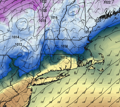
BOS will be nasty tomorrow IMHO....they go right below freezing at some point during the morning. So whether it is the morning commute or the PM school commute, it could be really nasty.
-
2017-2018 was pretty nice. It did have that one ridiculous February torch but the rest of the winter was very snow and we had record cold in late December 2017/early Jan 2018…ORH had nearly 100” that winter. The extremely high end winters are obviously rarer….winters like 2002-2003, 2010-2011, 2014-2015….you could throw in 2000-2001 and 2004-2005 on a more local level (00-01 interior N and W of 495 and 04-05 S and E of 495…esp near Cape).
-
That’s a lot to try and vanquish in 12-14 hours. But we’ll see. Depends if I make it into the 50s for 4-5 hours I think. Some guidance actually me back into the mid/upper 30s several hours before the real push of cold air comes in. If that happens, that will drastically slow the melt.
-
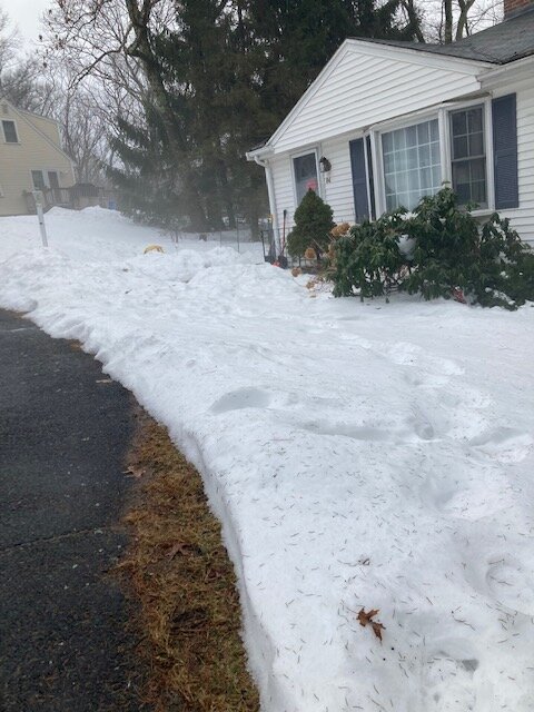
Fog is eating my pack now. Still fairly robust but still a good 12+ hours to go
-
Yeah the heart of the cold will be the plains....we might actually have a few 'bouts of seasonably mild wx too (Tip warm car seat 42F days) since we're on the eastern side of the trough....but it's got an active look. We're gonna have chances I think....and with a ridge that amplified, I don't think we can rule out another big dog chance.
-
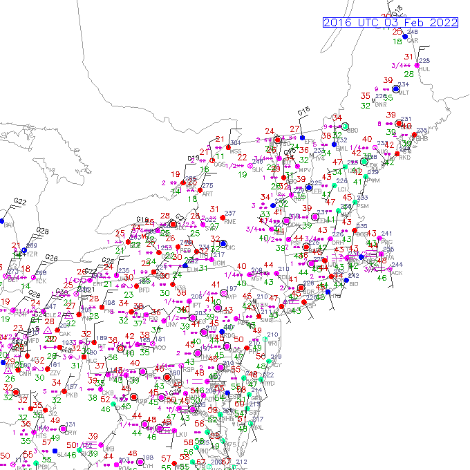
You can see the cold draining right down the valley on the sfc plot
-
Might give us a bit of snow at the end as a consolation. The sharper that shortwave trends, the more moisture it will try and hang back. GFS kind of showed this better, NAM wasn't as enthusiastic, but that is a sharp s/w....maybe have to watch for tomorrow night.
-
Ryan will have to point out on his broadcast tomorrow morning if ORH is like 27F while BDL is just getting to freezing and Tolland is still near 50F.....a lot of meso guidance shows this. The ORH hills are blocking the cold from getting over and into NE CT while it drains down the CT Valley to the west
-
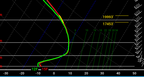
Yeah those sharp cutoff snow maps are not shoing the relatively wide area of sleet accumulation....and some of that will be mixing with snow too...esp when you have such a narrow warm layer plus 900-925mb temps in the -10 to -12C range.....soundings like this:
-
Hard to say....3" of sleet sounds high, though not impossible. I think we'd need to have the BL cool by about 10-11Z to have that much.....it would take at least 1 inch of QPF to get 3" of sleet, and 3 to 1 is kind of aggressive for sleet ratios, though by the time we get -10C in the cold layer, the sleet ratio would become higher because of pixie dust probably mixing in....but before that, it's going to be IP/ZR mix and that will have ratios well below 2 to 1.
-
Yeah the BOS-ORH corridor I mentioned to Chris earlier is a tough forecast....it could be REALLY nasty between 12z and 18z there with a lot of QPF falling.
-
EPS does not look warm....we may get a bit susceptible to some cutters after mid-month, but if that poleward ridge doesn't break down, then there's going to be a ton of cold in the CONUS.
-
HRRR takes forever to sink the sfc front from the pike region to N CT....it takes like 4-5 hours.
-
Yeah I think it will be....it was too warm a few days ago, but it's going to be closer than the GFS. Not by a ton, but I think Euro is prob gonna win this like 60/40 compromise....I'll have to go back and see what each run had at D4.5-5.
-
Yeah we're not gonna lose cover here I don't think (exposed south-facing torch spots on busy streets aside). But it's prob gonna be down to a 3" bulletproof glacier by tomorrow AM when it refreezes.


