

ORH_wxman
-
Posts
90,902 -
Joined
-
Last visited
Content Type
Profiles
Blogs
Forums
American Weather
Media Demo
Store
Gallery
Everything posted by ORH_wxman
-
That was a great storm here (3/13/18)…measured 24”. That was on top of the 3/7-8/18 paste job…we had a monster pack after the 3/13 storm. Also today is the 29th anniversary of the 1993 superstorm. Hard to believe it’s been almost 30 years. I remember that storm well. I was in 6th grade and the official forecast was for 8-16”….we ended up with 20” despite not being in the CCB/deformation. It was the most ridiculous WCB I’ve been in. It was basically 12 hours of front-end heavy snow. The front end stuff started when the low was still down in the gulf states. It was so expansive.
-
March 12 Rain to…more rain? Maybe some snow
ORH_wxman replied to HoarfrostHubb's topic in New England
Man, just went out to get firewood out back and it’s still pretty nasty out. Wind isn’t as strong as last night but plenty breezy and temps in the low 20s with snow still swirling around and off the roof. Prob the last taste of “true winter” type conditions this season barring one of those rare late season cold storms. (Ala 4/6/16) -
March 12 Rain to…more rain? Maybe some snow
ORH_wxman replied to HoarfrostHubb's topic in New England
The funny part is this will all be a dream in a couple days. Doesn’t feel like it right now though. -
March 12 Rain to…more rain? Maybe some snow
ORH_wxman replied to HoarfrostHubb's topic in New England
Lol. It comes and goes. I’m sure I’ll regress because it’s inevitable. But yeah…like Scott said, we’re not getting that much snow. Maybe 1-2” (spot 3 maybe)…but it’s the nasty wind/snow combo that’s making it such a great feel tonight. Ground blizzard with big gusts and the occasional heavier snow squall. It just feels like deep winter out there tonight. Not a passing spring storm. -
March 12 Rain to…more rain? Maybe some snow
ORH_wxman replied to HoarfrostHubb's topic in New England
This is honestly some of the “worst” winter conditions I’ve seen all year. These gusts are easily passing 40 every few minutes and the blizzard outside. Even when it’s light snow the wind is making an awesome ground blizzard. -
March 12 Rain to…more rain? Maybe some snow
ORH_wxman replied to HoarfrostHubb's topic in New England
The wind is insane in this streamer too. It was already windy but it’s like it got enhanced. Almost like a WINDEX squall. -
March 12 Rain to…more rain? Maybe some snow
ORH_wxman replied to HoarfrostHubb's topic in New England
Yeah once that streamer came overhead all hell broke loose. Still going right now. This is prob like 2” per hour stuff. Perfect LES type dendrites. Wind is packing it though so we won’t be getting 25 to 1 ratios. -
March 12 Rain to…more rain? Maybe some snow
ORH_wxman replied to HoarfrostHubb's topic in New England
Trying to capture it but I keep getting Ginxy cell phone quality pics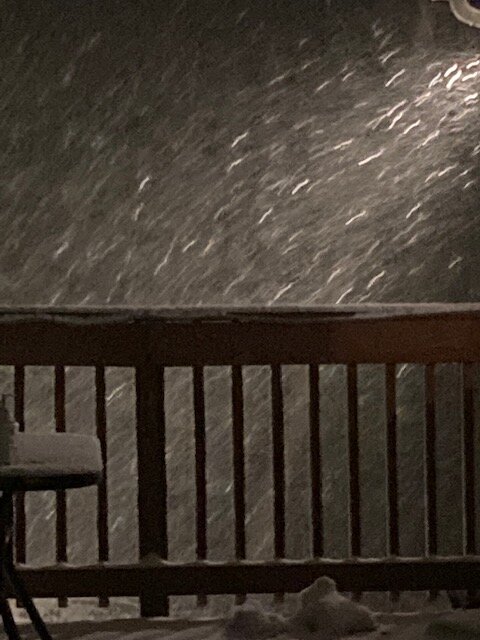
-
March 12 Rain to…more rain? Maybe some snow
ORH_wxman replied to HoarfrostHubb's topic in New England
These are like lake effect dendrites in this. -
March 12 Rain to…more rain? Maybe some snow
ORH_wxman replied to HoarfrostHubb's topic in New England
Ok we have one of those streamers over us in addition to the band, and it’s absolutely pounding. Here’s the still frame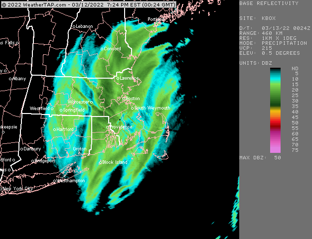
-
March 12 Rain to…more rain? Maybe some snow
ORH_wxman replied to HoarfrostHubb's topic in New England
We’re in the meat of that band now. We’re on the eastern side according to radar but ground truth is a little east. -
March 12 Rain to…more rain? Maybe some snow
ORH_wxman replied to HoarfrostHubb's topic in New England
What are you up to? Looks like you’ll get double digits with the upslope added in over the next 12-24 hours. -
March 12 Rain to…more rain? Maybe some snow
ORH_wxman replied to HoarfrostHubb's topic in New England
It’s actually ripping in this band. Less than half mile vis.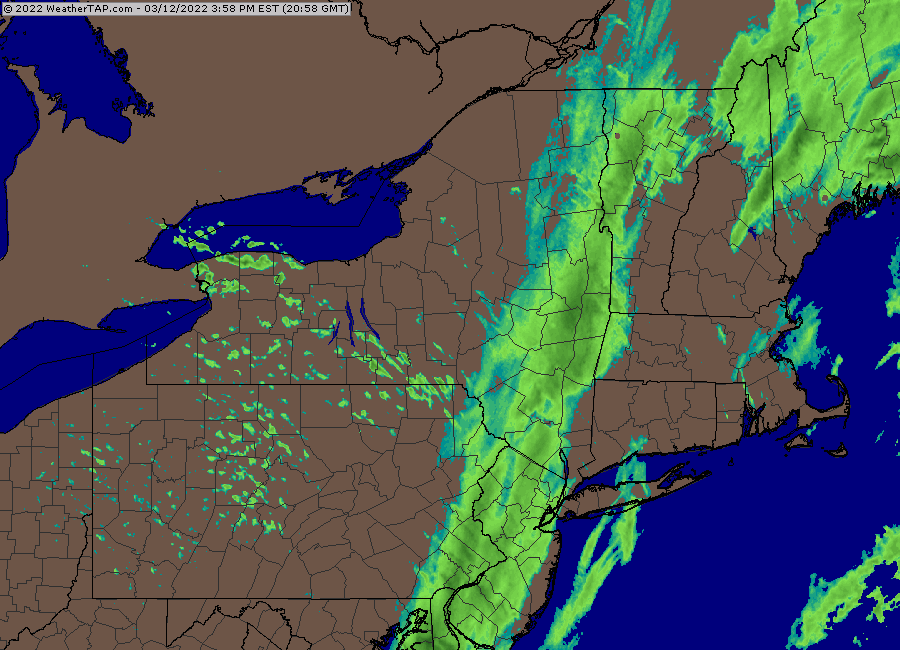
-
March 2022 Obs/Disc: In Like a Lamb, Out Like a Butterfly
ORH_wxman replied to 40/70 Benchmark's topic in New England
Pattern gets kind of slow and blocky…not really huge arctic blocking per say, but bowling ball season with pseudo blocks in Canada…Tip alluded to this the other day. But this is showing up pretty strong on all ensemble guidance is we head into the equinox and beyond during the final week of March. So while we prance in the tulips a couple times next week, there’s a reasonable chance we haven’t seen our last accumulating snow…esp for interior. -
March 12 Rain to…more rain? Maybe some snow
ORH_wxman replied to HoarfrostHubb's topic in New England
There will be another band of light snow later but the heavy stuff is done. -
March 12 Rain to…more rain? Maybe some snow
ORH_wxman replied to HoarfrostHubb's topic in New England
Yeah I mentioned that earlier too. Prob not very heavy but could be a steady light to occasionally moderate snow late afternoon into early evening. -
March 12 Rain to…more rain? Maybe some snow
ORH_wxman replied to HoarfrostHubb's topic in New England
Yeah not impressed with radar down south. The changeover seems a bit faster than modeled but that is coming at the price of precip starting to shred quicker. -
March 12 Rain to…more rain? Maybe some snow
ORH_wxman replied to HoarfrostHubb's topic in New England
Mix line just about to ORH.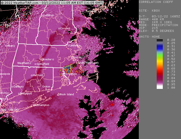
-
March 12 Rain to…more rain? Maybe some snow
ORH_wxman replied to HoarfrostHubb's topic in New England
That’s a good sign. You might be able to pull a 6+ spot. -
March 12 Rain to…more rain? Maybe some snow
ORH_wxman replied to HoarfrostHubb's topic in New England
12z NAM looks super torchy and northwest. Hard to buy it though because it looks pretty bad down to the southwest. It has almost no snow it spots that are already flipping. -
March 12 Rain to…more rain? Maybe some snow
ORH_wxman replied to HoarfrostHubb's topic in New England
No there will be accumulations. Just not sure if it will be more than an inch or two. I guess we’ll just see how quickly it can flip. -
March 12 Rain to…more rain? Maybe some snow
ORH_wxman replied to HoarfrostHubb's topic in New England
NW CT and Berkshires are def gonna get hit really good. You can see it setting up really well for them. I wonder if near Danbury and Waterbury could be a sneaky good place. Esp areas above 500 feet. I wouldn’t be shocked to see solid advisory amounts there. Further southeast is a question mark. -
March 12 Rain to…more rain? Maybe some snow
ORH_wxman replied to HoarfrostHubb's topic in New England
Yeah we fight the dry air below 850. There could be a little burst close to 00z as the upper trough gets closer but otherwise I’m pretty meh on this for advisory snow or greater. I think there’s going to be a lot of 1-3” type amounts. -
March 12 Rain to…more rain? Maybe some snow
ORH_wxman replied to HoarfrostHubb's topic in New England
12z HRRR not impressed with SNE outside of Berkshires and NW CT. -
March 12 Rain to…more rain? Maybe some snow
ORH_wxman replied to HoarfrostHubb's topic in New England
Close call there. But I think hedging lower is the way to go on this one. Usually the west slopes of the Berkshires and NW CT are gonna clean up in a setup like this while out east the northwesterly flow starts drying out the atmosphere. So it becomes a race.


