ORH_wxman
-
Posts
90,902 -
Joined
-
Last visited
Content Type
Profiles
Blogs
Forums
American Weather
Media Demo
Store
Gallery
Everything posted by ORH_wxman
-
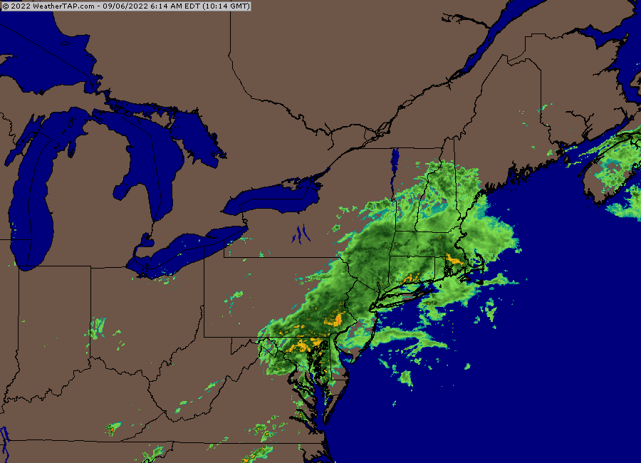
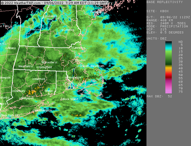
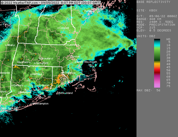
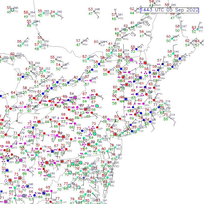
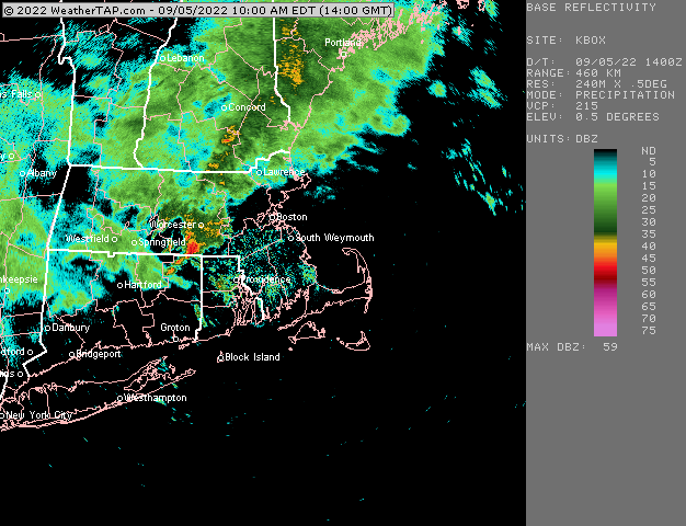
Radar looks like status quo for the next 4-6 hours.
-
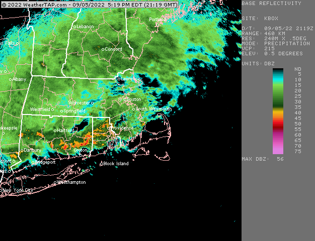
About 2.5” here now. Just steady moderate to heavy rain since midday yesterday with one lull mid afternoon.
-
Wow nice. Looks like plenty more where that came from too.
-
Yeah this area of LL convergence was over the pike region earlier this morning when we saw that initial area of convective training…it’s been sinking south all day. No surprise it’s now training down there where it has settled.
-
New thread link
-
The best convective rains right now are lining up with the low level front
-
We don’t do droughts very well in New England. It’s like trying to get a deep cold/snowy winter in Virginia or North Carolina outside of the mountains.
-
Apparently the airplane was stolen too.
-
It certainly acted like a weak Niña with a deeply negative PDO and -PNA
-
The borderline cases are all arbitrary anyway. There is no real fundamental difference between some year like 2008-2009 and 1967-1968 even though ‘08-09 is technically a weak Niña and ‘67-68 is negative neutral. Ironically about 10 years ago, ‘08-09 was considered negative neutral and ‘67-68 was a weak Niña before they adjusted everything.
-
Prob Feb 7-9, 2015 is the one you are referring to. Basically a 3-day overrunning event with that low level NE flow right off the ocean into a frigid airmass. There we’re some 25-28” burgers on the south shore where they got a little extra ocean enhancement.
-
Update: NSIDC area remains at 3.50 million sq km....same as 2 days ago (technically 5k higher as 2 days ago it was 3.496 and today is 3.501). I highly doubt the minimum has been reached as 8/29 would be the earliest minimum on record (1992 had a min on 8/31). But we'll see if it can drop low enough to get below 2018's 3.23 million sq km minimum. I would bet against that at the moment, but there is a chance we could see one last burst of increased melting with the East Siberian Sea arm of ice still vulnerable. Here's where other post-2007 years stand now: 2021: -320k 2020: -740k 2019: -530k 2018: -130k 2017: -430k 2016: -840k 2015: -170k 2014: +260k 2013: +290k 2012: -1.05 million (-1050k) 2011: -480k 2010: -230k 2009: +170k 2008: -250k 2007: -390k
-
We got dryslotted pretty bad in the superstorm in ORH but still got 20”….lol. Most ridiculous front ender of all time.
-
I still remember that vividly because I was outside playing with friends. I think it was a bit before dinner time we got that squall that turned to graupel and then actual flakes for a time on 9/30.
-
I'd be interested in comparing the low temps at first order sites like CON/BDL with more rural coops that also radiate....radiational cooling is really sensitive to land use so sometimes a warming trend can be locally exacerbated because of that (this happened at Dulles-IAD pretty clearly between the 1980s/early 1990s and 2000s)....my guess is CON hasn't been super affected by land use but BDL might be more likely because I know they have all sorts of crap built up around them then even compared to the 1990s or early 2000s.
-
Most of the N Hemisphere has been really warm in summer in the past decade or so outside of the North Atlantic and Greenland where they have had cold summers. It's not like winter where the cold has been very present in Canada and plains of US even while we torch in the east.
-
Best time to go to the Cape is during warm September weekends for the same reasons....the crowds are completely gone and the water is warmer than it is in late June and even sometimes early July.
-
Yeah I was briefly thinking we might have a really nice summer but then we got put through hell for about 5-6 weeks starting in early/mid July.
-
PDO will still be solidly negative but not as much as July....that's still really warm water south of the Aleutians while "less warm" water is closer to land in the GOA. To get the PDO into positive territory, we need the water to become warmer in the eastern GOA than it is south of the Aleutians.
-
Let’s go 1995 this year.
-
A 1955 repeat would still be a disaster for sure....just not as bad as the original. At least in ORH. I'm not sure how the flood mechanisms have changed in the CT river valley since then. Ditto about another 1978 in the Boston suburbs.....we just aren't likely to have another top-end KU catch people by surprise at work at 10-11am in the morning like back then. Closest we get nowadays is something like the 12/13/07 traffic nightmare....that was a much more modest storm than '78 obviously, but the early stages of it were very similar (wall of heavy snow arrives late morning when people are already at work/school). People didn't take '07 as seriously since it wasn't a big storm. Normally 6-10 inches of snow is pretty manageable, but not when it comes in like a wall with temps well below freezing.
-
On 8/29, NSIDC SIA was 3.50 million sq km....this actually drops it below the 2009, 2013, and 2014 minimums which I had speculated was likely earlier in this thread based on what the outstanding remaining ice looked like. The next question is whether it can drop below 2018's minimum of 3.23 million sq km (I think this is still unlikely due to the low concentration near the pole which will start to refreeze in the next 5-7 days). Here's how other post-2007 years compared on the same date: 2021: -240k 2020: -790k 2019: -520k 2018: -70k 2017: -340k 2016: -780k 2015: -150k 2014: +260k 2013: +340k 2012: -1.05 million (-1050k) 2011: -380k 2010: -230k 2009: +240k 2008: -170k 2007: -340k
-
Some of the disconnect about the younger versions of ourselves reading about disasters of yore and now is that we’re also way better equipped to handle them in many places. Like for example, ORH is never going to see another 1955 flood again due to the drainage and flood control systems put into place after that one. Tornado warnings are way better now and NWP guidance is much better now which reduces the risk of 1978-style traffic disasters. That acts as a mitigating effect on the weather disaster itself even if extreme heavy rainfall events or extreme droughts are more frequent than they were 50-100 years ago. Of course, on the flip side, we keep building really expensive homes and infrastructure in areas that are vulnerable to storm surges in hurricanes, nor Easters, etc. But that’s more of a human decision-making problem.