ORH_wxman
-
Posts
90,902 -
Joined
-
Last visited
Content Type
Profiles
Blogs
Forums
American Weather
Media Demo
Store
Gallery
Everything posted by ORH_wxman
-
Next Monday looks like best chance. Mid-week the Cape might get a C-2” type scraping. But I’d be shocked if it came NW of that.
-
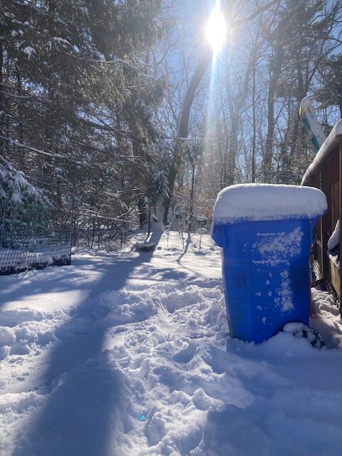
After years of 2-4” events, 6” starts to look like a foot. I remember those fond years of my childhood.
-
That 2 hours between about 930-1130 probably dropped about 3.5-4”…it was excellent snow growth in those heavier bands. Thought it was going to finish closer to 5” but that overnight band dropped another inch of pure blower fluff.
-
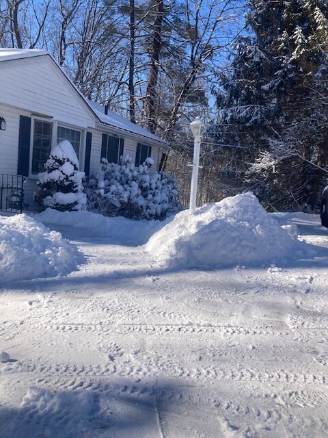
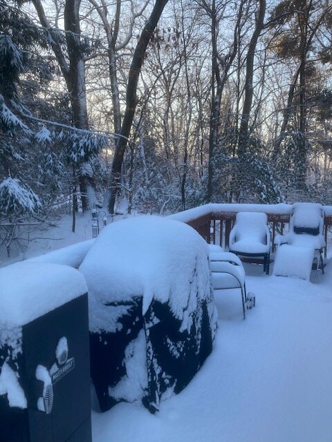
About 6” in Holliston. Very picturesque snow
-
Big fatties falling in this band
-
It’s trying. Maybe we can grab some fluff if it holds
-
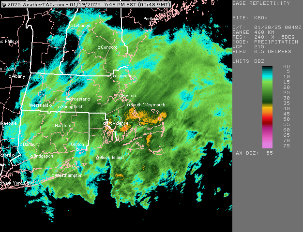
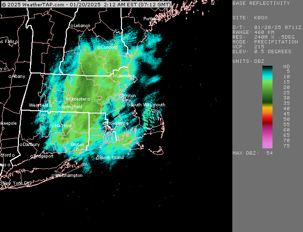
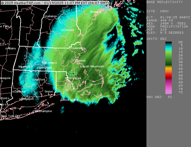
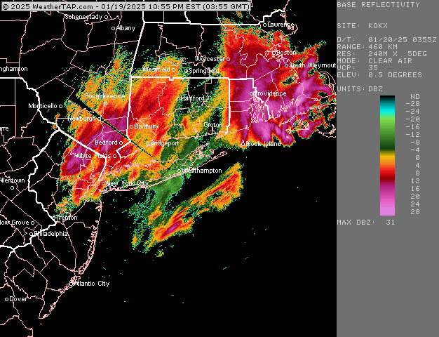
Here’s the OKX loop. Maybe CT peeps can pick up some fluff from this
-
That’s looking really good for your area
-
That band looks like it’s nuking Scooter out east
-
Pushing 4” here. Maybe just a hair under with the final batch of serious goods about to hit. Can’t complain.
-
Prob only have about an hour left in the good stuff, but this is a really nice finale.
-
Really perfect snow growth right now here. Prob similar near you as you are in similar banding. Perfect night to have the spotlights on.
-
Ok this is legit 2”/hr at minimum right now. Absolute dumpage of optimal dendrites at 27F
-
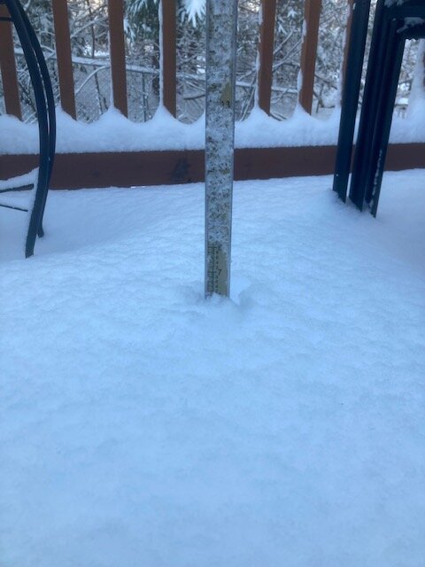
Heaviest of the storm now. Not gonna last super long but these are the moments we wait for in winter. Eyeballing about 3” so far.
-
Pounding right now. Next 2 hours is the show
-
The rare legit heavy snow here right now in this band
-
Radar has definitely improved some but I also expected it to. It looked pretty ragged earlier. The question is how long we can rip 1-2” per hour stuff. If it’s only a couple hours worth then it’s gonna be hard to break 4-5”…but I’m getting a little more optimistic to try and beat that.
-
Really ramping up here right now…legit moderate now…prob around an inch new
-
Ineedsnow intensity equation is just move the decimal place over one: light snow = greater than 5 mile vis moderate = between 2.5 and 5 mile heavy snow = 2.5 miles or less.
-
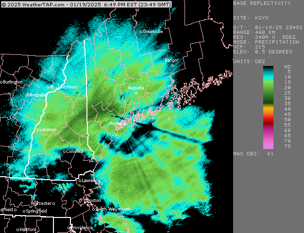
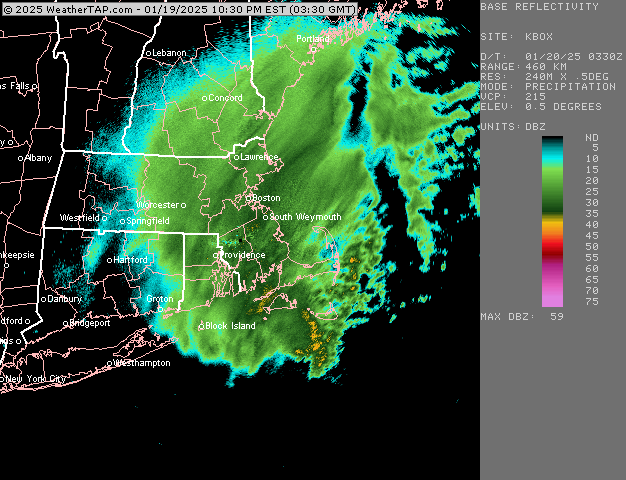
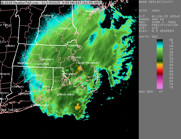
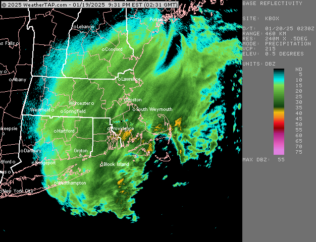
RAP has been looking healthier recently but HRRR has been staying a bit flaccid. I want to see a bit more WCB stuff trying to push north in the waters south of LI/SE MA/RI.
-
Thinking 3-6 here. Maybe 4-8 if we do good ratios.
-
At the end of the day it looks close to a typical 70/30 euro win (talking inside of 72h….it lost the medium range battle). Unless this can tuck in a bit more than guidance currently says. It’s still a decent event but widespread 8-12 with higher lollis doesn’t look very likely which is basically what GFS/Canadian guidance had at one point (with much less near coast)
-
HRRR and RAP are pretty weak sauce at the moment. I’d like to see them ramp up a bit today.