

ORH_wxman
-
Posts
90,902 -
Joined
-
Last visited
Content Type
Profiles
Blogs
Forums
American Weather
Media Demo
Store
Gallery
Everything posted by ORH_wxman
-
I am not....just looked it up and found it on Amazon though and it does seem like a good template. Basically an account of a whole bunch of weather events with a lot of accounts from people who experienced them. Yeah I wouldn't do it to make money. If it makes money, that's a bonus. But I'd do it because I love writing about weather events and I'd want to document a lot of these events before they get forgotten. A lot of past weather events really don't have good historical accounts unless they were absolute top-end events like Feb '78 or Hurricane of '38, Worcester tornado '53, etc. But so many of these semi-large events sort of get relegated to "no memory or historical account" status so it would be nice to have one place to read about them.
-
No I am not aware....though maybe one exists. I have many books on individual weather events such as the Worcester tornado and huge storms (like Feb '78). Maybe I'll write a Worcester weather book when I am older and retired one day.
-
The irony of TLH having their earliest sub-32F on record and earliest 32F of any kind since 1977 when 10/18/77 hit 32F there, is that 1977 is the year with the latest freeze on record at ORH (November 12, 1977).
-
You want a longitudinal gradient for NNJ to be snowier than SNE....or something really weird with obscene blocking like 2009-2010. Those typically won't happen in a La Nina....though it's not impossible. Happened in 2000-2001....parts of interior NNJ had more snow than Boston that winter....but '00-'01 did act a lot more like an El Nino than a La Nina....esp in the North Pacific pattern. But over the interior, there was a massive latitude gradient.....ORH had over 100 inches while interior CT maybe had 50-60"....and then interior S NH had some spots with well over 130 inches.
-
Earliest sub-32F on record there (they did hit exactly 32F on 10/18/77 though, so not technically the earliest freeze)
-
The irony being our last El Nino (2018-19) acted like a La Nina. Then the warm neutral 2019-2020 was about as scintillating as 1988-89 after the early December storm.
-
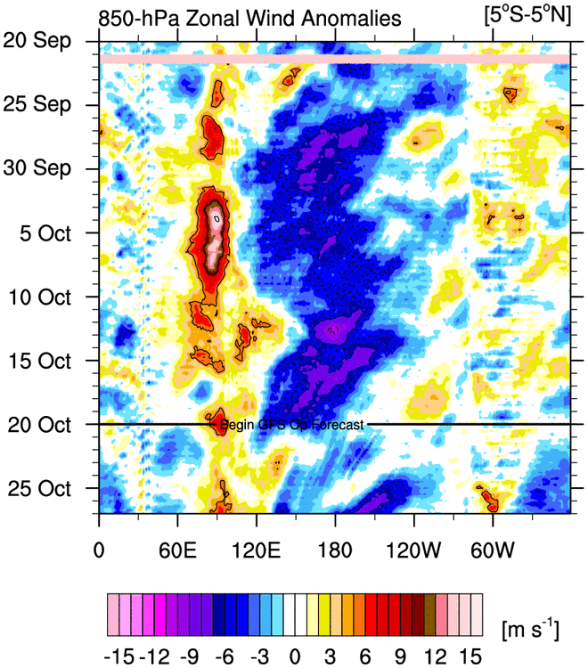
Yeah here you go Here's the link to Mike Ventrice's site where you can get it http://mikeventrice.weebly.com/hovmollers.html
-
I think maybe they are just a proxy for subconsciously being afraid of La Nina? I can understand that from our Mid-Atlantic brethren as Nina gets more hostile the further south you go, but it's really nothing to be scared of in New England.
-
What is with the obsession of the GOA SSTs? I mean yeah, I guess you want them warmer all things equal, but they are about 20th on a list of the top 25 most important variables. We literally spent almost the entire stretch of prolific years between 2007-2013 with frigid ice water in the GOA.
-
Sleeping through 4 inches per hour on 1/27/11 as a snow weenie is a good enough credential for me.
-
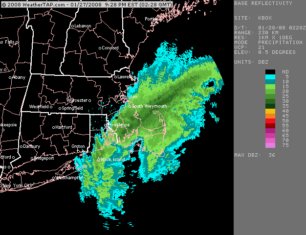
Here's the one close up loop I have....I wish I had it about an hour or two earlier but you can see where the band was before it started sinking back SE...
-
Most of the sleep experts say that standard time should be the permanent one instead of DST. Who knows what will happen though. Permanent DST passed the senate but the house never took it up.
-
I have it on my computer so I can post it later. Your area had a solid 10-12” from that one iirc…with the highest jack being right near PYM where they had over a foot…like 14” or so.
-
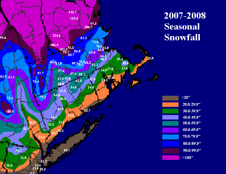
You'd be hard pressed to find another winter that had as strong a snowfall gradient as 2007-2008 Just south of the pike was probably the dividing line between below normal and above normal (maybe a line from the CT/MA border to near Scooter)...there was a little island of higher snows near PYM because they got stuck in a really good band in the 1/26-27/08 storm that missed most of the area but got the Cape.
-
Fast forward that about 6 weeks and we're ripping S+ out of that.
-
We had a legit threat like every 3-6 days that winter....save maybe a brief break in the January week-long torch.
-
Yeah I’m actually cautiously optimistic that means a more active pattern going forward into winter. We typically don’t have long stretches of dryness here. I remember we had some really long dry stretches in late summer and early fall 2007 before it seemed to snap and we had that crazy active pattern go right into winter. Fingers crossed for something similar.
-
Most of the literature points to more extremes on the whole....but it's not evenly distributed. We will see less extreme cold going forward but more extreme heatwaves, more extreme flooding events (and by precip proxy maybe some more extreme snow events). The spacial distribution isn't very well-known either. Non-temperature attribution studies are generally some of the least confident in the science.
-
Yeah top of the list was 2/1/21....I think I had 17 inches in that one here while you had like 2-3 inches of slush mixed with rain. Even Norwood not very far west of you had 10 inches of mashed potatoes.
-
Hopefully rubber band snaps on the boring wx sometime next month and into winter.
-
Hubbdave was pretty epic in the 2014-2015 winter...."meh'd" his way to 115(?) inches of snow. I don't think he liked seeing all of those Scooter jackpots. But I will at least sympathize with him for the Jan 2015 blizzard where we got annihilated in ORH and he was choking on arctic sand exhaust just northwest of the death band. Hubbdave is a little more subtle though....you and Lavarock are co-captains of the Poo-Poo Pom-Pom cheerleading team.
-
No frost on the hill here but pretty solid frost once down at the bottom driving my boys to school/daycare.
-
That was the first weather event that started making me aware that CT River valley didn’t do nearly as well for snow. At my young age, I assumed the snow always just got better the further west you went. Then when I was skiing at wachusett later that same winter after the March ‘93 superstorm, I was sharing a chair lift with this woman from Springfield and she kept commenting that she couldn’t believe how much snow Worcester had all winter including that storm compared to Springfield. Once we had that convo, I was fully aware of the river shadow.
-
Nat gas was cheap globally when there were no supply issues/bottlenecks. But now that there are, we’re going to pay for it because we’re dumb enough to not have any infrastructure to deliver the domestic nat gas to us. It’s honestly embarrassing.


