ORH_wxman
-
Posts
90,892 -
Joined
-
Last visited
Content Type
Profiles
Blogs
Forums
American Weather
Media Demo
Store
Gallery
Everything posted by ORH_wxman
-
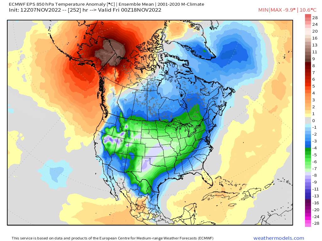
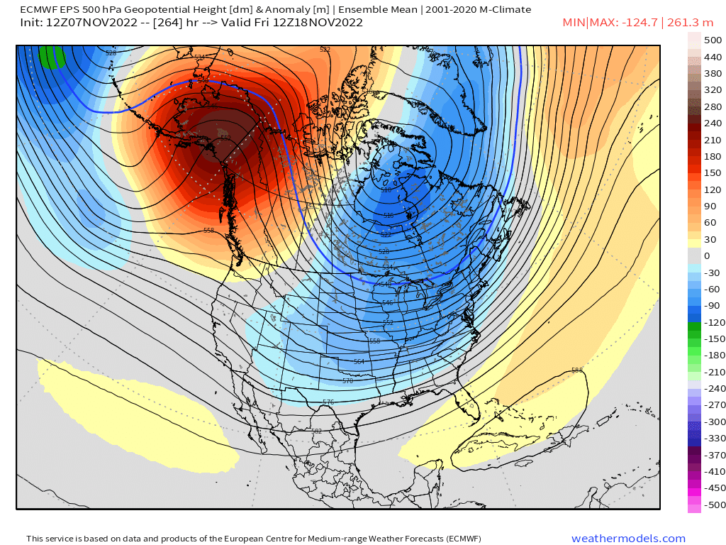
Some threats showing up in the medium/long range which isn’t a huge surprise given the pattern developing. We’ll see if we can actually cash in. I’d be surprised if NNE at least doesn’t but decent chance SNE could see something too.
-
Little ridge bridge trying to show up on the 10-15 day you can see from Brooklynwx99’s post. That helps push those negative anomalies further south into New England. You can bet there would likely be a winter threat or two in that type of pattern even in late November.
-
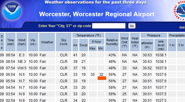
ORH tickled 32F in between obs so technically a freeze.
-
SOI 30 days prior is the always the first thing I look at when trying to predict a winter storm.
-
You can look up streaks on the threaded sites. https://xmacis.rcc-acis.org
-
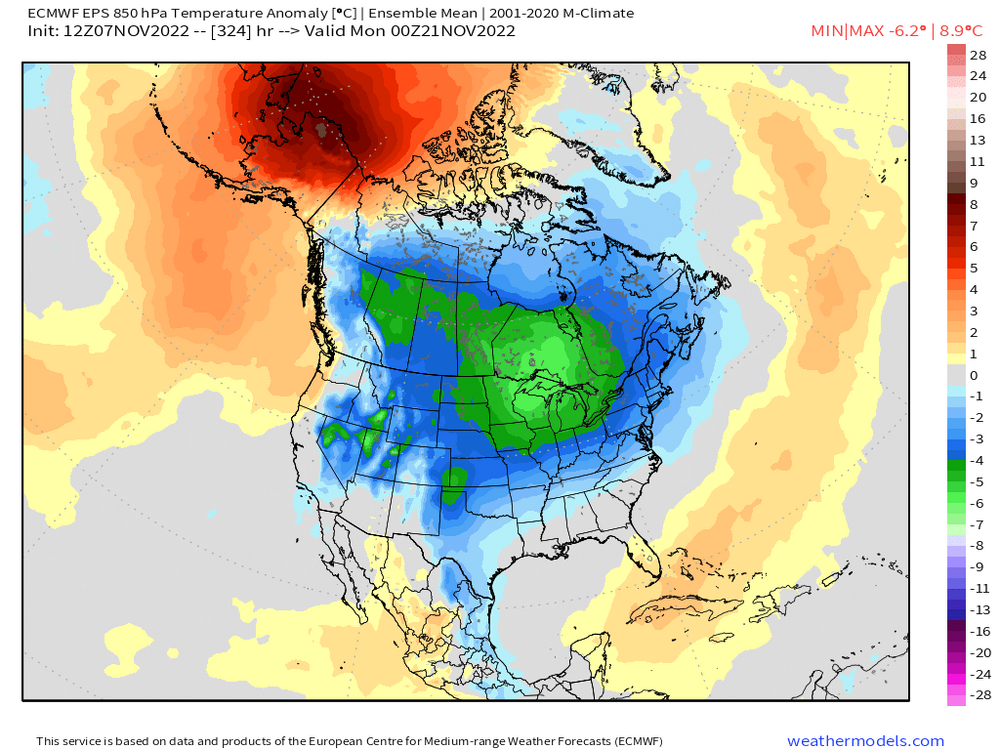
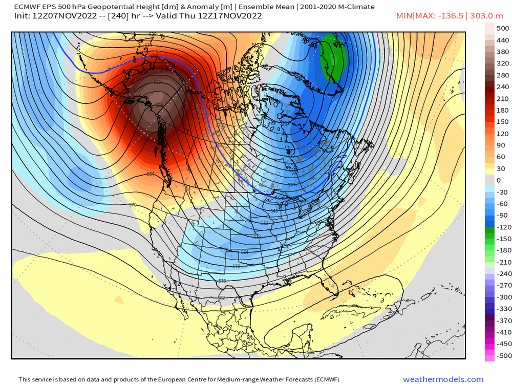
I’d say it’s pretty damned cold on the EPS given the ensemble lead time. We’ll see how much this changes as we get closer but D10-15 ensemble mean anomalies of that magnitude are not super common.


-
Yeah hard to see how at least NNE doesn’t get something out of that pattern. That’s a really cold look

-
Bit of split flow developing around D10 too. That sometimes gets interesting since it de-emphasizes geopotential height compression which you are well aware of.
-
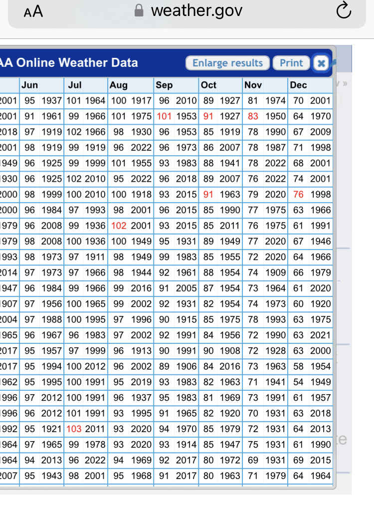
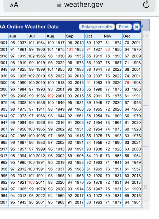
Looks like 83. Had an 81 in 1974 as well.
-
Not sure about a full fledged sea breeze but LI sound may have helped just enough. They hit 77F in 1950.
-
Their all time Nov record is 83F in 1950 isn’t it?
-
Most of the first order stations have their all time November record high temp in 1950. Hopefully we don’t get a repeat of that winter.
-
BDR is 78F for all time November record. So today breaks that.
-
It depends on the orientation. Not all -EPO/-PNA/+NAO patterns are alike. Some are Dec 2007 but others can be last year.
-
I won’t buy the +PNA in December La Niña until it’s staring us in the face. Not talking about a transient ridge either. Like a locked in PNA+ for 2-3 weeks.
-
Flip the switch to winter and avoid the 4-6 weeks of 45-50F garbage.
-
Yeah avg high at ORH on Dec 1 is 41F. Prob mid 40s lower elevations. If he’s expecting/hoping consistent 20s, that won’t happen unless you get something like 1989. Pretty hard to get -15 daily departures for more than 7-10 days at a time.
-
SWFE type pattern there.
-
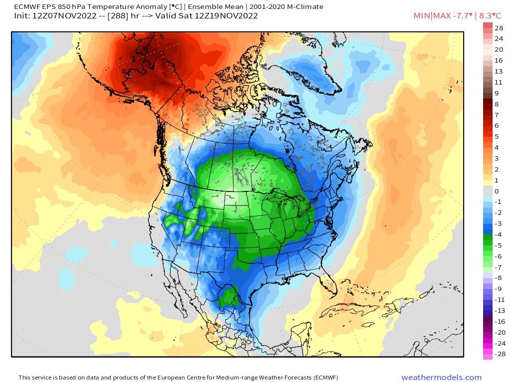
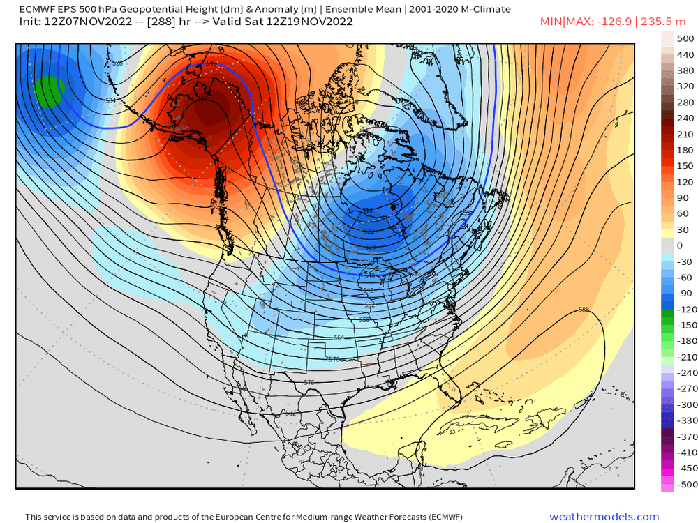
Yeah that’s a decent look. It’s been on guidance for a couple days now. Tip and I have discussed it a bit. That general pattern in the 11/16-11/20 range is favorable as far as November threats go.
-
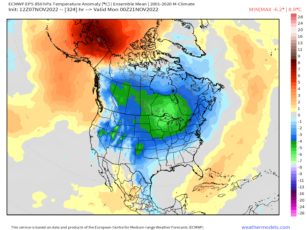
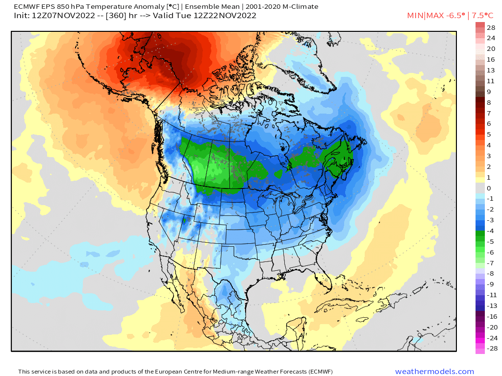
11/16-11/18 period keeps showing up for a potential winter threat. Early season caveats apply of course…NNE or interior elevations most likely to see anything that early.
-
Is that gonna get counterfeited later? Seems like it could be closer to 60 before midnight.
-
You may be correct on this depending on the timeline. I think a lot of people are probably ignorant of how warm New England was in the late ‘40s through mid-50s. In fact, there’s a lot of sites in New England that still have their warmest year ever as 1949. At least when I checked a few short years ago. Maybe that list is smaller now, I’d have to check again. But it shows just how extreme some of the warmth was around the middle 20th century here. So when we cooled in the following few decades, we had plenty of room to come back up as the underlying forcing asserted itself. And yes, nighttime mins have warmed faster than daytime highs. That’s pretty consistent with the warming climate as higher vapor make rad cooling harder and it also makes the high-end temps more difficult to achieve (as we already discussed). I do find the temporal/spacial differences fascinating in their own right.
-
Yeah it’s the frequency which changes the most. The actual high end temps haven’t really gotten hotter…high water vapor prob helps offset that some. But the frequency of warm spells has gotten higher. Hard to replicate the 1930s dust bowl conditions over the CONUS with the high water vapor environment we have now and corn fields/farm land that is better managed. So getting those 110F+ bombs in places like Ohio/PA are just not gonna happen like back then when they did it a bunch of times. I will also push back on Tip’s claim somewhat about us being “insulated”. Maybe only in the summer at the high end, but from an average temperature standpoint, New England has warmed faster than almost anywhere in North America in the past 20+ years outside of the arctic regions. There would prob be a bunch of people in the northern plains and Rockies looking at us funny if we told them about how winters ain’t what they used to be a couple decades ago….they’ve actually gotten colder out there compared to the 80s/90s.
-
What we’ve seen on some of these model runs is a longer wave trough setting up over the east and then you have a shortwave(s) diving into the longwave trough…that’s typically a favorable “look” for getting something. Esp this early when you need the cold solidly established. That’s kind of what you might mean by just looking at it….years of experience tells us that we “like” that look for winter threats. We know subconsciously that we need extra cold established for an early season threat, and the best way to do that is a deeper longwave trough putting the ambient cold overhead in place and then getting a shortwave to amplify into that. Of course all the caveats apply at this range. Could easily look different next week. But right now, it has a shot.
-
Tomorrow we make model watching great again. And extra sleep tonight.