ORH_wxman
-
Posts
90,902 -
Joined
-
Last visited
Content Type
Profiles
Blogs
Forums
American Weather
Media Demo
Store
Gallery
Everything posted by ORH_wxman
-
Oh for sure. There’s a reason me/Ray/Scooter’s generation used to think 3-6” was an amazing snow event. We grew up in dogshit winters during our formative years. Esp that crucial age 8-12 period.
-
Patriots had snow games in back to back weeks that season. The December 14, 2003 storm was a solid front ender that got them during game time. Then of course the AFC championship game against the Colts was in light snow. A week earlier was like 0F in the divisional round against the Titans. January 2004 cold snaps were epic. Then the next year another snowstorm during the divisional round game against the Colts again. I remember Corey Dillon running all over them in the snow that game.
-
1957 through 1963 was a pretty good period for early December snow in NNJ. Pretty anomalous in the historical record.
-
Pretty hard to get warning snow in November. Even at ORH at 1000 feet. November warning snows at ORH off top of my head since 1985 2018 2014 2012 2002 (2004 did have marginal warning snow southeast of ORH) 1989 1987 6 out of 37 years. Went all of the 1990s without a warning event in November. Did have some solid advisory events though in 1997, 1995, and 1991. Usually there’s a 1-2” event though. I’d be surprised if we don’t get measurable this month given the pattern shown.
-
Nice EPS run....but lets hope the weeklies are wrong in clown range. They show a furnace for December.
-
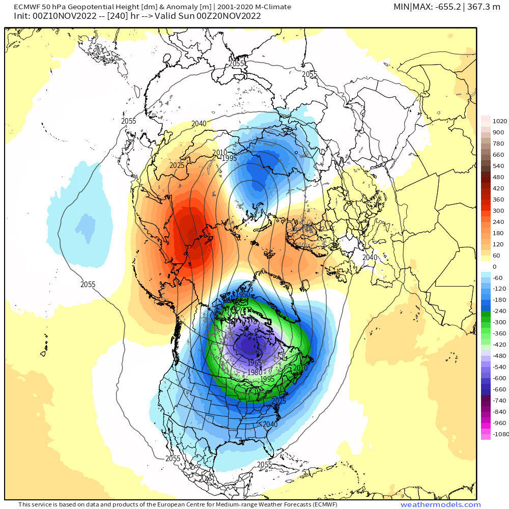
Not sure about the EPS....Scott can post when he sees this, but I do have OP run from last night and it basically splits the PV at 50mb by D10

-
Prob the worst ice storm on record for most of SNE. 2008 may have been worse in N ORH county and near NH border....though even that is up for debate. Certainly further south, 1921 was the worst.
-
November 1921 redux?
-
Yeah the one late next week looks like a needle-threader but even if that one didn’t work out I’d bet on more chances Tday week assuming the pattern being depicted doesn’t change too much.
-
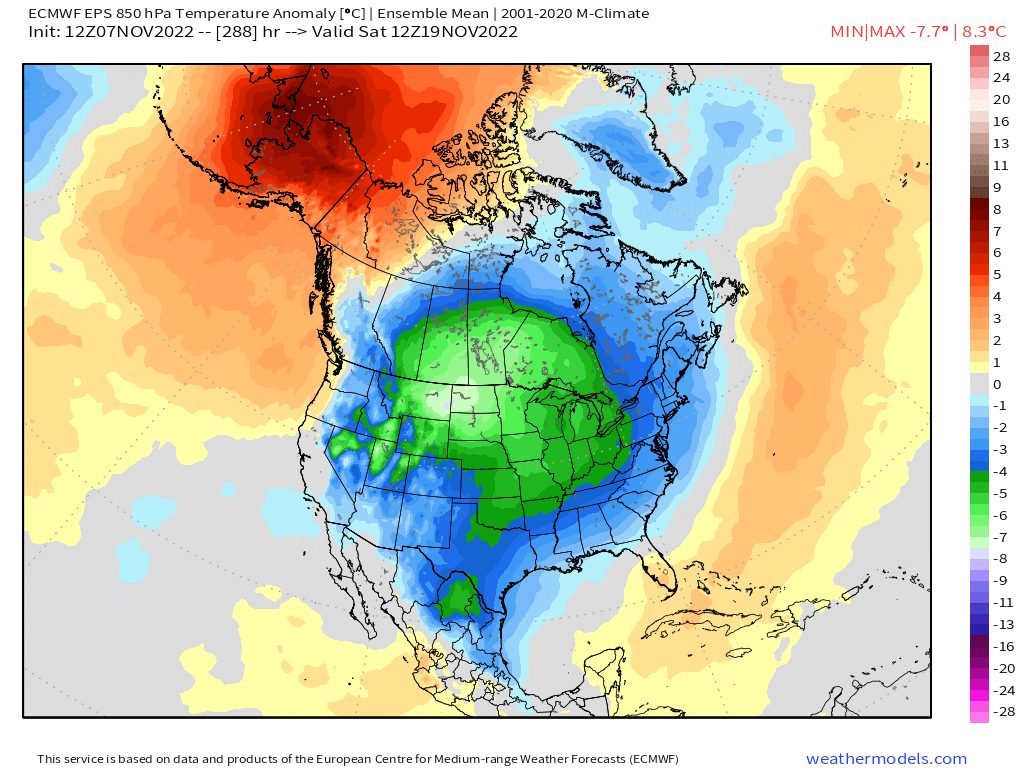
Some threats showing up in the medium/long range which isn’t a huge surprise given the pattern developing. We’ll see if we can actually cash in. I’d be surprised if NNE at least doesn’t but decent chance SNE could see something too.
-
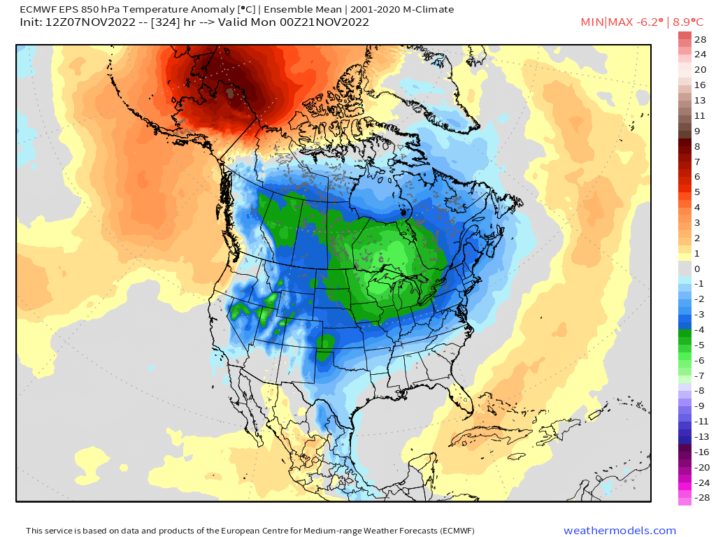
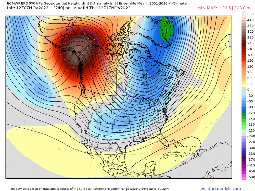
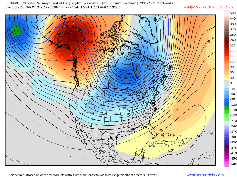
Little ridge bridge trying to show up on the 10-15 day you can see from Brooklynwx99’s post. That helps push those negative anomalies further south into New England. You can bet there would likely be a winter threat or two in that type of pattern even in late November.
-
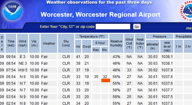
ORH tickled 32F in between obs so technically a freeze.
-
SOI 30 days prior is the always the first thing I look at when trying to predict a winter storm.
-
You can look up streaks on the threaded sites. https://xmacis.rcc-acis.org
-
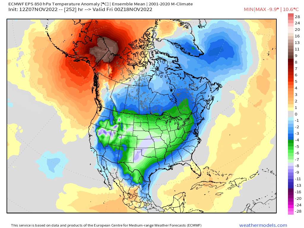
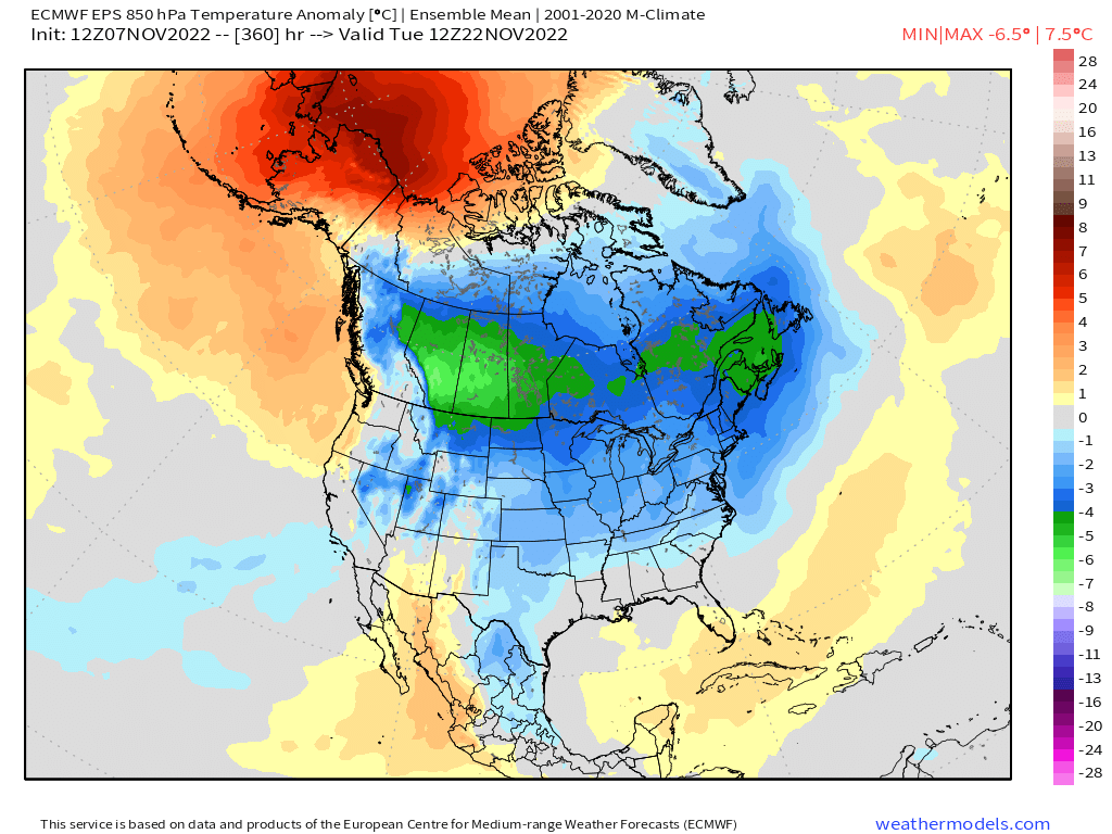
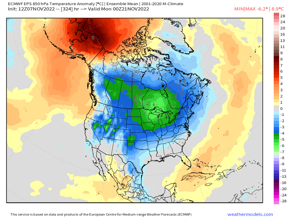
I’d say it’s pretty damned cold on the EPS given the ensemble lead time. We’ll see how much this changes as we get closer but D10-15 ensemble mean anomalies of that magnitude are not super common.


-
Yeah hard to see how at least NNE doesn’t get something out of that pattern. That’s a really cold look

-
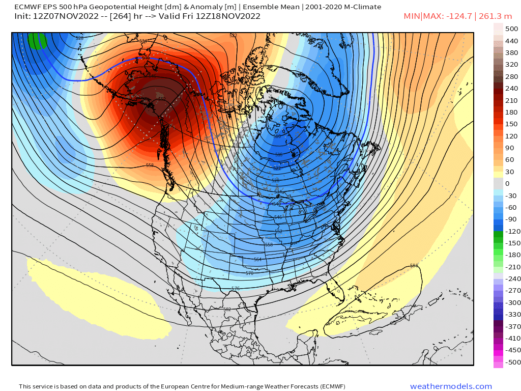
Bit of split flow developing around D10 too. That sometimes gets interesting since it de-emphasizes geopotential height compression which you are well aware of.
-
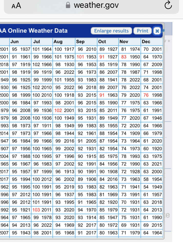
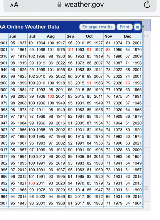
Looks like 83. Had an 81 in 1974 as well.
-
Not sure about a full fledged sea breeze but LI sound may have helped just enough. They hit 77F in 1950.
-
Their all time Nov record is 83F in 1950 isn’t it?
-
Most of the first order stations have their all time November record high temp in 1950. Hopefully we don’t get a repeat of that winter.
-
BDR is 78F for all time November record. So today breaks that.
-
It depends on the orientation. Not all -EPO/-PNA/+NAO patterns are alike. Some are Dec 2007 but others can be last year.
-
I won’t buy the +PNA in December La Niña until it’s staring us in the face. Not talking about a transient ridge either. Like a locked in PNA+ for 2-3 weeks.