

ORH_wxman
-
Posts
90,892 -
Joined
-
Last visited
Content Type
Profiles
Blogs
Forums
American Weather
Media Demo
Store
Gallery
Everything posted by ORH_wxman
-
EPS looked a bit better today. PAC still not good but less hostile than yesterday and Atlantic blocking more robust this run. So that would keep us in the game for early December.
-
Worth watching over NNE elevations if that storm can bomb to town somewhere east of New England.
-
The cold press has been inching back south little by little the last couple cycles. I don’t think it will be enough to help us out in SNE but it could def make a difference in NNE. This is for the Friday threat btw.
-
We def were spoiled with the Decembers of the 2000s. We paid back the piper in 2010s. I feel like only 2013 and 2017 were really good…2020 was decent but that grinch storm with 100 knot winds from Cuba really put a damper on it. We’re due for a really good December. But being “due” doesn’t make it more likely. I wish it did.
-
Not a lot of continuity on these ensemble runs. I’m guessing we have some more changes that will show up. At leas the AO/NAO blocking showing up has been kind of consistent. Hopefully that happens. I think your theory of weak forcing right now causing model volatility is prob correct. Nothing dominant to show a coherent signal.
-
GFS still going with FROPA next Friday. That would be ideal for the ski resorts and specifically the event at Killington next weekend.
-
I love watching the November freak outs.
-
That N PAC gets worse each run. That’s starting to get dangerously close to a pig look. Right now it’s far enough west that it’s not a disaster…esp with the ATL blocking, but hopefully that doesn’t become a mainstay on the ensembles going forward.
-
There are certain times when we can say with high certainty we’re not getting a snowstorm in the next week. The post-Tday event is on life support but not 100% dead yet. Prob in another cycle or two we can call it dead.
-
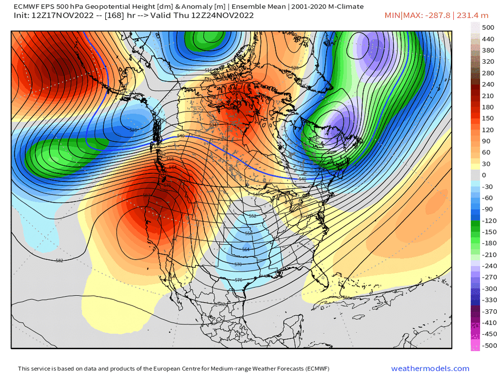
The ridge does look like it’s retrograding a bit when going from d13 to d15. But I agree that time range is often corrupted by chaos of 51 ensemble members. Esp when you aren’t seeing strong anomalies. We can actually switch it from raw Z anomalies to standard deviation…and when you do that, things look less significant.
-
It’s an annual occurrence. Every year a few posters play some violins over a D9 November threat not materializing. I’d have a little more sympathy if they were at least coming from 1500 feet in the monadnocks or something. But not the SNE coastal plain (or a disgruntled cop in Brooklyn, lol)
-
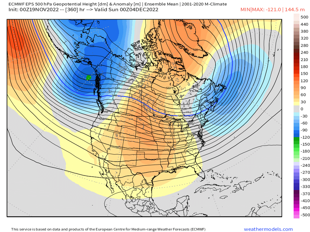
Here’s the end of the EPS run…verbatim it’s not terrible due to NAO/AO but you can see how the PAC has gone more hostile and it’s producing a lot of ridging into the central CONUS
-
Sometimes. Not always. As usual nuances are important. PAC was kind of crappy in Dec 1995 but we had an excellent NAO block up near Baffin/northern Hudson Bay that really did some magic. Heck, even Dec 2010 the PAC was not very good…lowish-amplitude -WPO with very negative PNA but we had a monster NAO block. December 2003 was another one. Pretty ugly N PAC but we lived off the good Atlantic early that month. If the PAC is a true death pig in AK, then usually we are screwed regardless. But if it’s just moderately hostile, you can still get away with it if other variables help out.
-
PAC looking more and more hostile in early December on both GEFS and EPS. Gonna need the NAO/AO to come through during that period if we want to see any legit threats.
-
In terms of anything more than nuisance snow, we rarely cash in during first week of month anyway unless the pattern is quite favorable. Interior elevations are the exception.
-
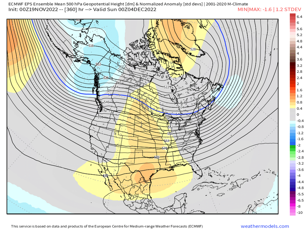
You can see the AO/NAO helping us out in first week of December here despite a semi-hostile PAC. This is the EPS, but GEFS is similar....maybe even more robust with -NAO than EPS
-
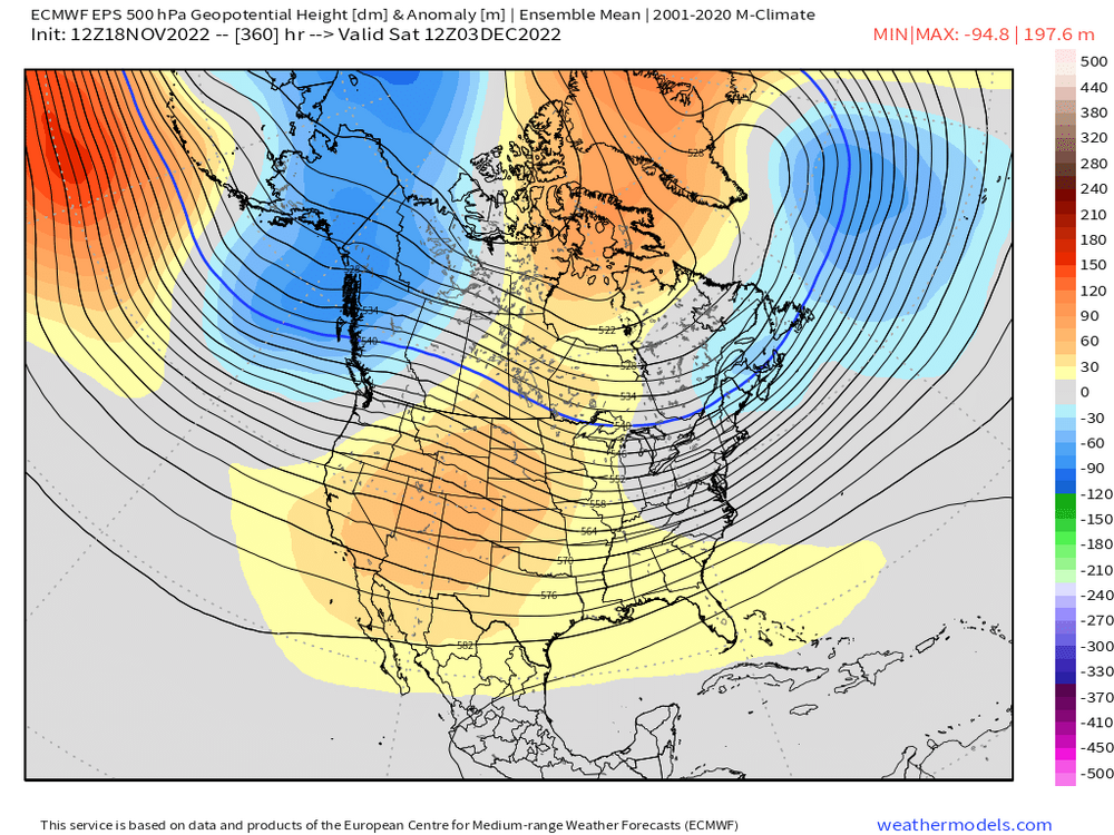
Early December will have to be salvaged by the NAO/AO I think....PAC going a bit hostile seems to be the trend right now and it was showing up that way too on some longer range stuff before we had a very brief few runs of less hostile PAC. Both EPS and GEFS do show a -AO during early December so it could keep us in the game for something.
-
Yes Here's yesterday's 12z EPS vs today at same verification time....note the PV lobe is further southwest and more robust on yesterday's run
-
12z EPS was actually slightly better than 00z for snow outcomes....but we're talking very minor difference. But in order to get back to the bigger threat look, we need to trend the cold press further south again.
-
Euro's cold turkeys here....but not by a lot. Parakeets and flamingos in the mid-atlantic. Don't think we'd hold that off for the storm a day or two later.
-
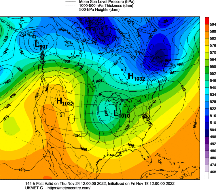
Ukie might be more interesting looking at 144h....looks like more confluence than GGEM. I think we'd still like to see that PV lobe a tick south, but that would prob produce some wintry precip over interior.
-
Yep, but it shifted N with the PV lobe too...not as pressed as 00z was. I'm guessing Euro will start backing off too....but we'll see. PRetty volatile and unstable look up north. The GFS goes nuclear with blocking after the Tday weekend system goes by.
-
GFS shifted quite lot with the PV lobe...but it was mostly an eastward shift and not south, so we're still going to have warm turkey this run.
-
They'll get out tomorrow. LES firehose should shut off tomorrow afternoon.
-
EPS previously followed the GEFS in showing the cold press for T-day....lets see if that happens again and it follows the GEFS in backing off that cold press.


