ORH_wxman
-
Posts
90,892 -
Joined
-
Last visited
Content Type
Profiles
Blogs
Forums
American Weather
Media Demo
Store
Gallery
Everything posted by ORH_wxman
-
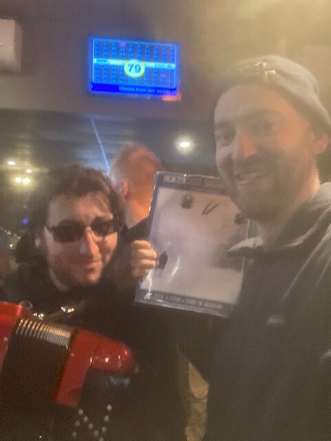
Was a great time. Glad to meet new faces…Don (wxwatcher007) and JD (WinterWolf). I talked with both for quite a bit. Great to see old faces too. The unexpected Tip appearance was fun, and anytime the accordion comes out from Corey, it’s a good time. Great to see Ginxy, Ray, Scooter, Kevin, Luke, Weatherwiz (Paul…but I still call him Weatherwiz), Bob, Pickles, Jay. I have to say, good representation from the CT crowd in this one.
-
Ripping tunes with the kocin book
-
Just got here. Sitting right side of bar with Kocin book in tow.
-
The block just makes cutters and runners less likely but they can still happen because of nuances in the flow and which piece of vorticity phase and which don’t….there’s a lot of variables. Right now we just know a storm is looking more and more likely and that’s about all we can say. It prob won’t be cutting into BUF or CLEbut huggers or inland runners are still a possibility.
-
We need to have an intervention for weenies….repeat after me: ”You can have huggers and runners with a strong NAO block” ”You can have huggers and runners with a strong NAO block” ”You can have huggers and runners with a strong NAO block”
-
Ukie not quite as tucked
-
Yeah you don’t want a low tucked into NY bight for most of SNE. But there’s miles to go on this threat. It’s good that we’re seeing a significant event continuing to show up.
-
I also think some areas in SE MA are going to do ok. Better than under an inch.
-
I like the box map for MA but I think it’s way too light in southern half of CT. Not that they focus strongly on that area as most of it is outside their CWA…is OKX going that low down there? I get temps are kind of marginal on the coast but just inland it should be plenty cold enough.
-
I prob haven’t seen you in at least 6 years. The two most recent GTGs I made were 2019 and prob 2017? I just remember you didn’t make them. The 2017 one was the pre-Xmas GTG in Boston so it was mostly locals (but Weatherwiz made it!!). Then we had a Jan 2019 GTG at funkys but you had something going on the day I recall. I was bummed about missing last year for being sick, but look forward to seeing a lot of people today.
-
Yes but notice on the next frame how many of them slide almost due east or ENE. That’s kind of what Dec ‘92 did. The sfc low initially hugged and tucked into Delaware/extreme S NJ (cape May region) and just ripped easterly flow into everywhere but then it slid ENE to south of BID which kept the interior snowing and helped flip some of the coastal areas over later in the game.
-
Yeah the GFS suite from 12z through 00z seemed dubious. It wasn’t matching any other guidance. Didn’t mean it was wrong, but it made it more likely and the shift back sort of confirms that prior.
-
You might get some enhancement there. If you can saturate the 850-700 layer then you might be able to rip for a few hours.
-
Pike band there (at least until about it 495 when it slides a little south.)
-
Are you going to order a hamburger with no cheese and cooked to the consistency of a hockey puck? I haven’t seen you in a long time…so was wondering if that is still what you ordered.
-
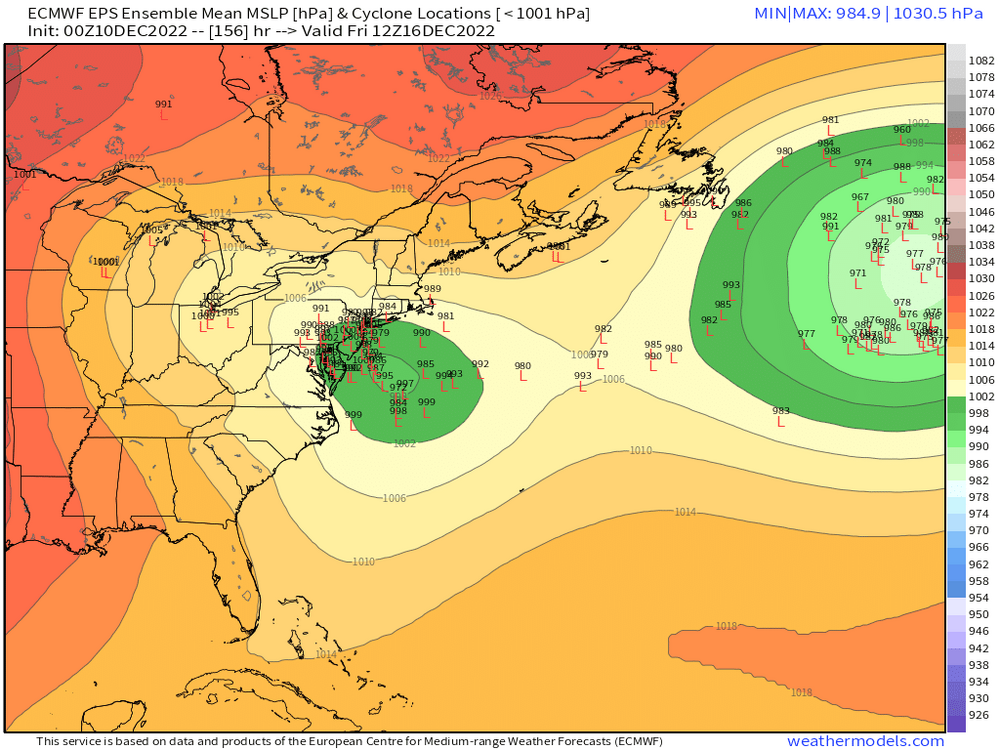
EPS…still quite a lot of spread


-
Man you really blew up my quote out of context. I didn’t say just flurries, I’m pretty sure I said ground whitened (aka, measurable) with flakes in the air. For 12/11? Yeah I’ll take that. It wasn’t supposed to imply that was all I would take in this particular pattern. I know there will be more chances.
-
Yeah flakes flying and whitening the ground is a win this time of year. Get a good holiday mood going on Sunday while people are watching football or doing whatever.
-
Might have to watch your hood for some decent OES bands and those could enhance the synoptic stuff. 3km clobbered your area…now I don’t think you’ll get warning snows like it showed but there’s some potential upside in a few lucky spots.
-
18z GFS QPF map was kind of funny…Ray and TBlizz can have their own pity party.
-
18z GFS coming back in a bit more amped. If you recall, the 12z run was the least amplified of the 12z guidance so this is bringing it back toward the model consensus.
-
Scooter will take 5.5 C/Km pulsers and like it.
-
Yeah hes in a bad spot for this one....but for much of the rest of SNE, I think this one could be a fun little first event of the met winter season. As long as the shortwave doesn't get totally crunched, there could be a few surprises. It's a pretty strong/vigorous shortwave tracking in a nice spot for many, so wouldn't be surprised a few heavier bursts of snow. Esp for the southwest half of SNE. But can't rule out a bit further east either. The 3km actually teamed up the synoptic stuff with the OES in SE MA and gave some extra enhancement there....which might be something to watch. Lot of mesoscale variables to keep on eye on in an otherwise smallish event. But the first one of the season is always a little more interesting than if this occurred in late January or something like that.
-
Yeah that 3km run has an intense norlun-esque trough starting in SE NY/N NJ and then moving south to the Jersey shore.
-
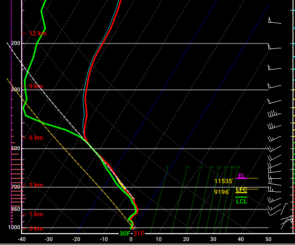
These are some crazy soundings....there's a reasonable shot at TSSN if these soundings verify....look at how steep the lapse rate is between 850-500 This is near Ginxy's hood for sunday evening