

ORH_wxman
-
Posts
90,892 -
Joined
-
Last visited
Content Type
Profiles
Blogs
Forums
American Weather
Media Demo
Store
Gallery
Everything posted by ORH_wxman
-
I told him this earlier but he ignored me.
-
Or the Bills in 1992 wildcard round against the Oilers. (35-3 in the 3rd quarter)
-
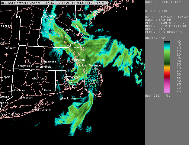
Ramping up in the last 2-3 min. Started as big fat puffy flakes but light…like almost flurries but now the ridge line 3/4th mile away is starting to get obscured. So almost moderate snow now. Like a snow globe.
-
Sell that idea. Lower levels are garbage ahead of this so I don’t like the icing idea…maybe an extremely narrow zone could get a bit of ice. There is a chance we get a flip to snow as the upper level support hangs back for quite a while.
-
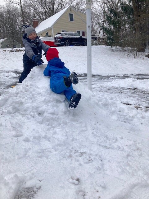
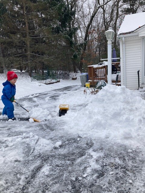
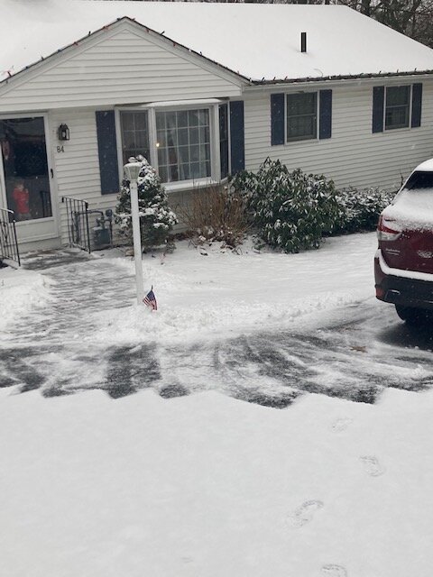
Snow was pretty dense so it made good piles. My boys are enjoying it this morning
-
At least grass is covered and looks like winter
-
Ripping here right now. Had some pingers when I was up about an hour ago but now it’s solid moderate snow.
-
It’s def snow on that panel…but yeah, I get not getting invested in a day 8 OP run.
-
That map doesn’t have ptype on it.
-
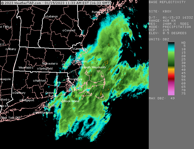
Decent band rotating toward north shore/Cape Anne.
-
Some of that may be bright banding but not all.
-
Once those big dog echoes hit, it should start sticking much faster I think.
-
I think upper cape and PYM county are starting to look pretty good on this. Nowcast for sure but those are some big echoes moving west.
-
Let’s get a GFS/Euro compromise. Steal a warning event for the pike.
-
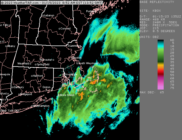
Yeah that stuff near ACK is the type of precip we want to see get onshore to get good amounts.
-

-
Not really. It does get a little back that way though.
-
06z euro really crushes PYM county. Much more than 00z.
-
RAP and HRRR both hammer the cape with like 8-12” on clown maps. Lol. Prob overdone because ratios will be a lot less. Still….gonna have to watch if there’s a more intense band with good lift as that will cool the lower levels pretty efficiently underneath one of those.
-
Hopefully some of the mesos can jump on board. I do agree with eduggs that the satellite and radar look kind of decent…hopefully not just weenie goggles which might get enhanced via desperation in an awful winter to date.
-
I think I’d be cautiously optimistic for N Conway over the next 7-10 days. Still a risk thursday totally shits the bed up there but less likely than a couple days ago.
-
Yeah that run threw a little band back there. Hopefully it has a clue. Would be fun to even get a long duration 2-3” event. Just give it a festive look and feel. Something we haven’t had much of this winter.
-
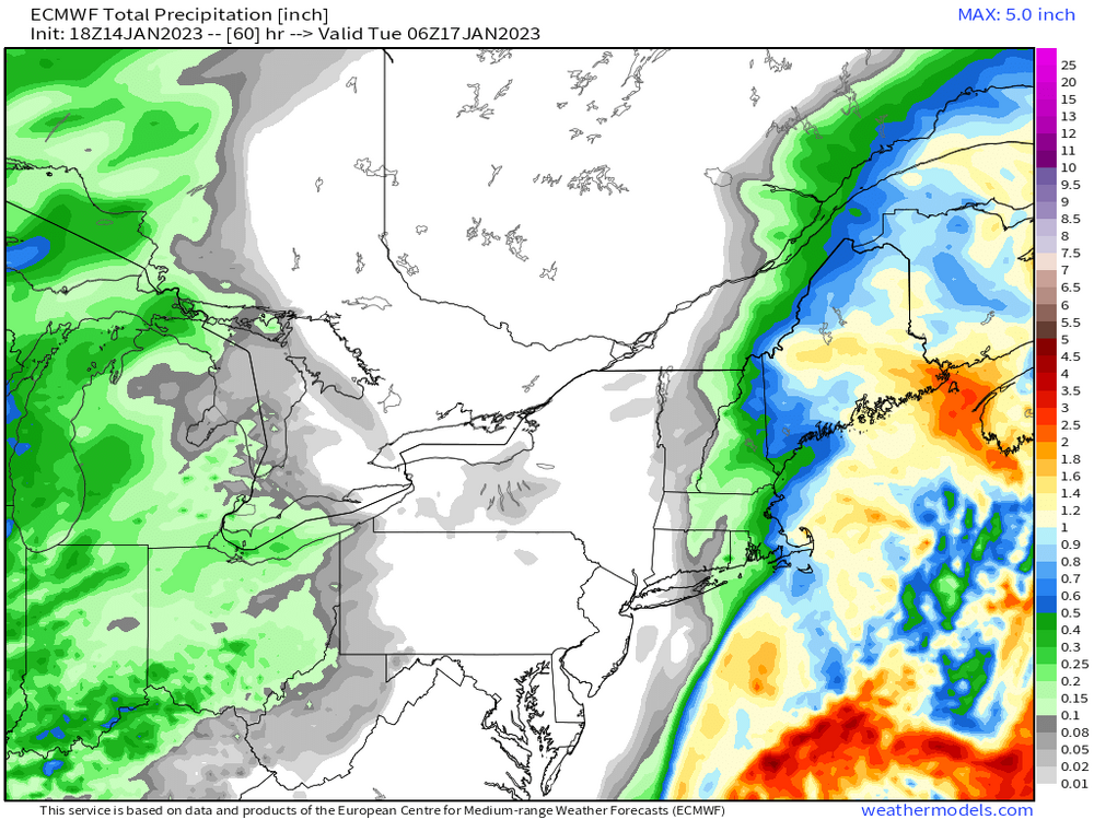
Total QPF
-
Stubborn Euro. 18z not really backing down.
-
That’s what I’d be hedging right now. Euro and GGEM show snow/sleet for pike crowd up to your area but GFS is mostly rain. I’d lean toward GFS right now. Yeah and I think that’s going to be the case over the next couple to three weeks too. Even if the more favorable pattern sets up, it’s an overrunning look like those 07-08 and 08-09 winters where were 4-5 day mid-Atlantic hits became New England SWFEs.


