

ORH_wxman
-
Posts
90,892 -
Joined
-
Last visited
Content Type
Profiles
Blogs
Forums
American Weather
Media Demo
Store
Gallery
Everything posted by ORH_wxman
-
Don’t do it
-
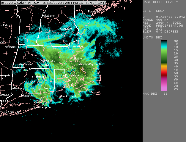
Ripping right now in this band
-
Hopefully you can rip for a bit. Looks decent just NW and going toward you
-
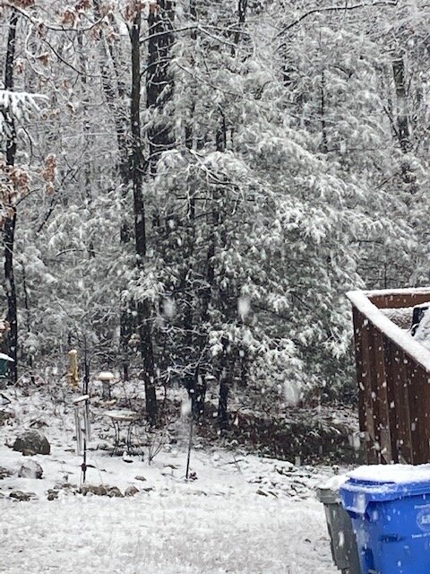
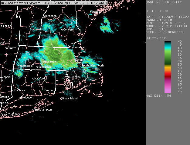
Prob about a half inch. Looks nice though. Radar continues to fill in out west so hopefully we can get some heavier bursts
-
Seems like 128 or just outside is roughly the dividing line for 32F or so.
-
Really good snow growth in this band right now.....temps continue to hover just below freezing so it's sticking easily.
-
Yeah it's weird....12z NAM/RGEM both linger this well into late evening. HRRR kind of shuts it off late afternoon.
-
Surprised at temps creeping below freezing right now. 31.6F...so even this light stuff is now having no problem sticking.
-
Things starting to coat up nicely
-
Maybe a C-1"? Most of it stays north of you but these aren't always the easiest to forecast.
-
Snow has picked up a bit as this band starts to move in....much better flakes now. Nice steady snow.
-
My current view on the next two threats: Jan 23rd: Looks like garbage for SNE but CNE/NNE should get a nice swath of warning snows from that one...slight chance SNE can maybe get something as it exits...the best energy seems to trail the sfc low a bit, so maybe a changeover. But for now, I'd expect a shutout here. Jan 25th: Looks like SNE could actually get something from thus one...most guidance agrees on the northern stream moving ahead of the southern stream which creates an area of confluence prior to the storm arriving. The airmass is still pretty meh, but it's probably cold enough for a decent hit on the front end...esp northern half of SNE. Still some time on this one...it could trend either way. Trending to shit wouldn't surprise me, but given the confluence, there is some room to trend this even a little better almost into pseudo-Miller B. That would be the ideal scenario....even if low probability.
-
Mar 7-8 was the paster though....i had 12" of mashed potatoes and lost power for 3 days in that one. Mar 13th was the fluff bomb.
-
Yeah 1/25 gets up there...1/23 might miss them though...or at least the really heavy stuff. Tough call...something more like the GFS hits N ME on 1/23 but NAM and Euro are kind of scrapers for them.
-
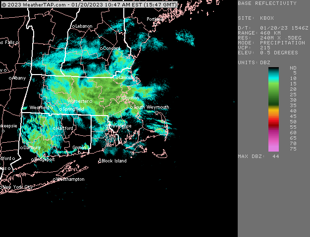
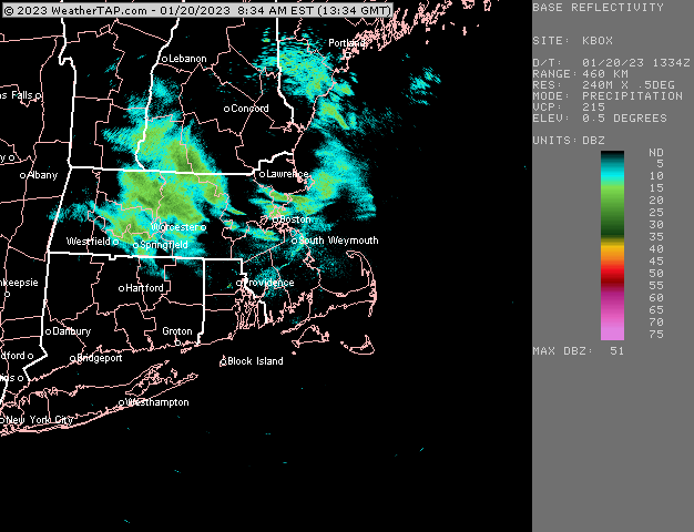
12z NAM is pretty nice for pike region up into S NH. Prob 2-3" in spots....eastern areas may actually do pretty well this evening....snow lasts until like 06z and any stuff later in the day and evening may be falling with temps nudging below freezing so the accumulations will come easier.
-
EPS looked pretty decent for 1/25 at 06z...prob the coldest run I've seen yet on that one. Kind of a classic SWFE look but there's actually just enough cold around to give a good hit....some of them sort of morph it into a miller B but as of now, I am skeptical of that evolution. But a little more confluence and we could see it redevelop soon enough for that.
-
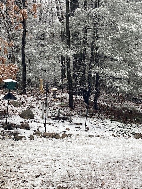
These weak echoes have started to produce steady light snow now. Hopefully we can pick up a couple today.
-
We missed the changeover by about 10 miles here. Guidance look pretty decent for 1-3” today though along pike so hopefully can grab something later.
-
Weathertap?
-
Doesn’t shut it off until predawn hours where you are around Saturday. That was an impressive run. Hopefully we keep seeing it ramp up like that on the mesos as we get closer. IVTs often disappoint but once in a while you get a doozy so they keep us on the hook.
-
18z euro looked pretty good too tomorrow. I’m always somewhat skeptical of those IVTs but they sometimes can surprise. But you usually need good/intense lift when lower level temps are kind of marginal.
-
18z euro looks pretty interesting for interior New England.
-
Rays area into SE NH is counting on that 03z to 06z period where it just goes gangbusters for a few hours. We’ll see if that verifies enough to give several inches.
-
Yea they are. They’ve been awful this year too more than normal. But just stating what it shows.
-
Man that is an absolute furnace for mid-February on weeklies. Total CONUS-wide blowtorch. Funny that it then tries for Ray’s epic ending starting in late February and into March.


