-
Posts
93,092 -
Joined
-
Last visited
Content Type
Profiles
Blogs
Forums
American Weather
Media Demo
Store
Gallery
Everything posted by ORH_wxman
-
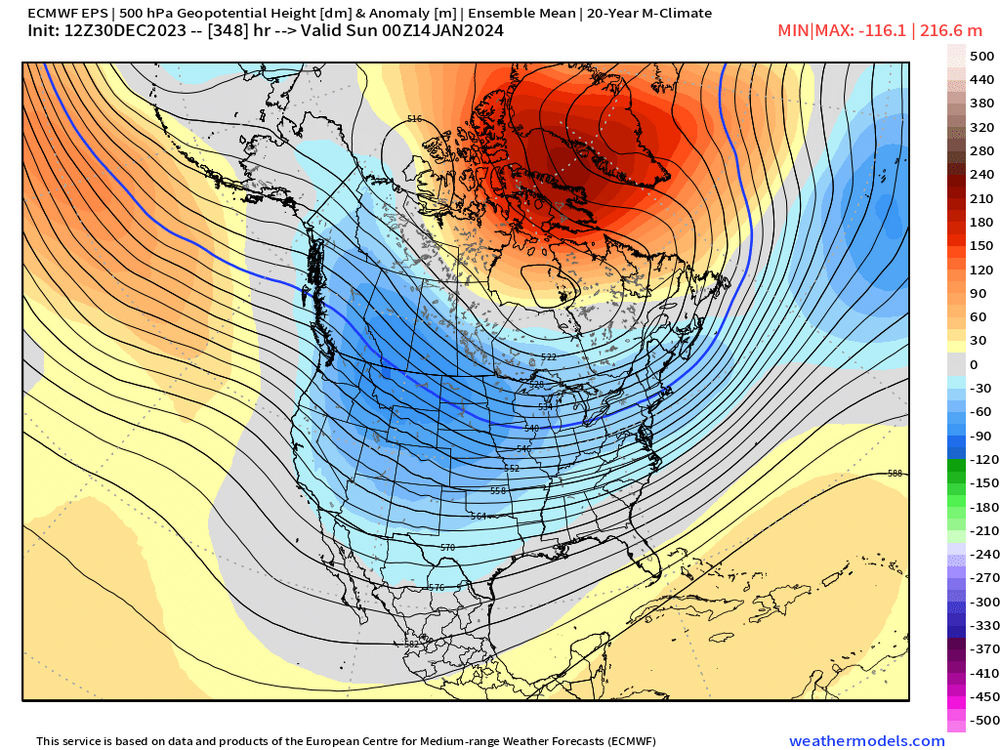
EPS is really trying to build the -NAO mid-month. Like retrograde that North Atlantic ridge back into Greenland and Baffin/Davis Strait. That would keep things interesting despite a meh N PAC
-
-
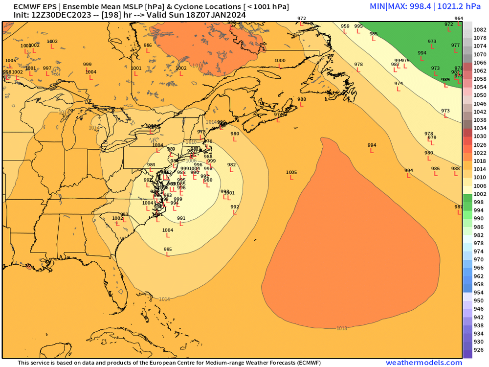
You need a bit more northern stream insert on the Euro for 1/7 or you need confluence to lift out a little faster. Plenty of time on that one, but that’s what you’ll want to look for in the coming days.
-
Especially when that blocking is starting to CAD the 1-10 system. That one might not have rain for at least NNE.
-
GFS suite is producing more northern stream light snow than before. Southern stream doesn’t really phase in well like on GGEM or ICON…but that deeper northern stream does give us a “consolation prize”.
-
It’s extremely hard to put a percentage of attribution on a thing like snowfall over a short 5 year period. Snowfall is one of the highest variance weather outcomes we have. Some of the warmth is definitely connected to CC but not all of it.
-
Yeah honestly not bad for 8+ days out. That’s a very intriguing setup with plenty of cold too.
-
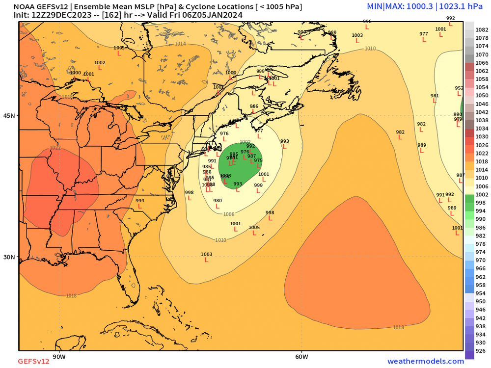
GFS not really biting on 1/5 for a big solution. Does have a general light snow over much of New England though. Maybe 1-2” for many.
-
More snow on the season for Scooter than Mitch?
-
The old saying is it’s darkest before light. Just keep giving us chances…we got 1/5 and 1/7-8…hopefully at least one of them works. Then who knows…maybe we can flip the script and turn 1/10 into an overrunning threat. Not having chances is probably a lot worse…ala 2020 or even for long stretches last year (though honestly, last year we had a decent number of chances that just failed in a variety of different ways).
-
Kind of weird that the 00z Euro suite basically got rid of the 1/5 storm while other guidance all has it. The 06z EPS did bring it back a decent amount just looking now. Not sure what was up with the 00z run. The 00z EPS did have a number of decent hits for 1/7-8 again despite OP being south and wide right. Something to watch still…esp for southern peeps.
-
Pattern change starts with the 15th cutter….complete by the 25th.
-
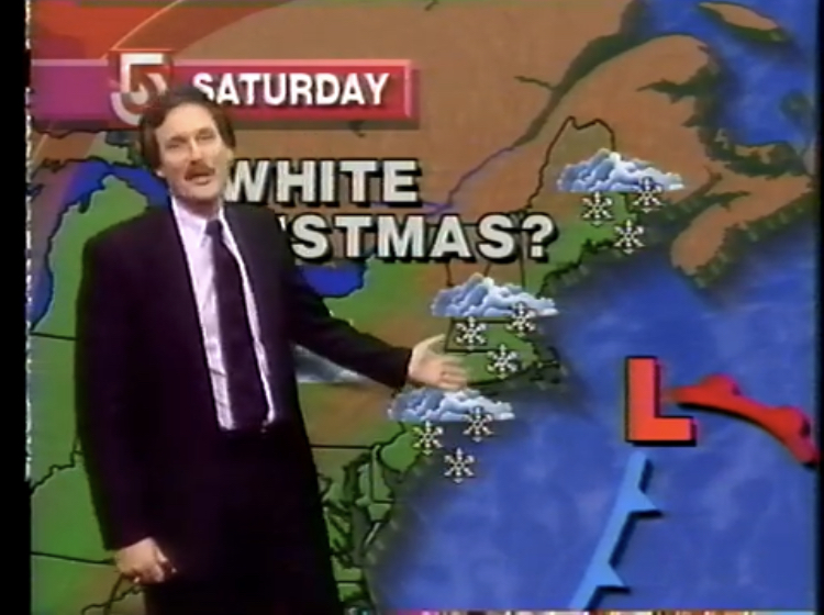
And even pre-TWC (we didn’t get cable until late ‘93 though my grandparents had it a couple years earlier) You would just wait until the local news came on and when you saw the snow symbols on the map you immediately perked up
-
Needed another all-day 40s on New Year’s Eve to have a chance but it looks like NYE is going to be sort of chilly for recent standards. Highs around 34-36 with lows a bit below freezing. Tomorrow morning’s low looks like it will get counterfeited too prior to midnight tomorrow night.
-
1/5 got weaker on guidance yesterday but it has come back much stronger today. 1/7-8 has been pretty weak on OP runs today (though 12z GFS tried to clip us) but stronger on the ensembles. Both are still a ways out. We’re talking 6+ days away for 1/5 and 9 days for the following system.
-
Mark Rosenthal used to sometimes use “tempest” and we all remember him saying “snowing to beat the band”…he loved that expression.
-
EPS was more interested in 1/7 than 1/5 today which was kind of surprising to me based on OP run. Def didn’t agree with the OP on which one was more likely. There are quite a few solid hits for 1/7 on the EPS. The LR did look better too beyond that as you mentioned. Hopefully the cutter turns more into a CAD system.
-
You’d think but we haven’t gotten many breaks in the past 4-6 winter months going back to Feb 2022…I guess for your area it’s longer since you kind of got skunked by the Jan 2022 blizzard. We’ll see on these two systems.
-
Yeah many of those “non-major teleconnector” storms have late trends. Hopefully we can squeeze on of these into an ideal track.
-
That one is def worth watching. Close call…get a little more neg tilt on that sucker and it would be a pretty big storm for eastern areas. Still watching 1/7 too but that one needs a bit more work. Would help if we had a northern stream shortwave trying to dive into it as it hits the east coast to turn it north.
-
Most of them are significantly colder. Look at January and esp February temp anomalies in El Niño…a lot of those comeback years had like -6 departures in February. Years like 2007 and 1958…of course 2015 is the extreme example when Feb 2015 became the coldest month on record for a number of places round here.
-
Yeah both are still too far out to be using OP runs more than just eye candy (or lack there of) But they seem to be coming back a little stronger as signals on the 12z suite so far. There is a nice cluster of further west members on GEFS at 12z
-
GFS trying to give more room for 1/7-8. Still has 1/5 but it’s a bit SE. GGEM is more amped for 1/5 but it’s an interior special. Wide right for 1/7.
-
You should be more honest with yourself and I think people would give you more benefit of the doubt. I specifically asked you a couple weeks ago why you thought no changes as far as the eye can see and you told me because were going to stall the MJO in phase 7…well not only did that not happen, we screamed through phases 8/1/2 in a span of like 2 weeks. So…correct for the wrong reason? Make your case for why we shouldn’t treat you as the warm/snowless version of JB…you were pulling this act back in snowy 2010s winters too which is how you earned your post limit. You used to be a decent poster your first few years and then decided it was more fun to troll.
-
Yeah if you get a good arctic it’s likely going to work out unless you have a really bad pattern out west. Hell, even a couple years ago the areas near NYC got 40”+ in a few weeks from the below pattern (strong -PNA) but that NAO block was key…and they have a less wiggle room on temps than we do


