ORH_wxman
-
Posts
93,099 -
Joined
-
Last visited
Content Type
Profiles
Blogs
Forums
American Weather
Media Demo
Store
Gallery
Everything posted by ORH_wxman
-
That’s a bold call…not sure I’d have the guts to go the over on a 15-day prog of 0F.
-
Yeah the longwave synoptics aren’t favorable for a wide right whiff…it’s all about how much compression there is to keep it from moving further west. The compression is admittedly strong but we’ve seen these come back west pretty strongly before.
-
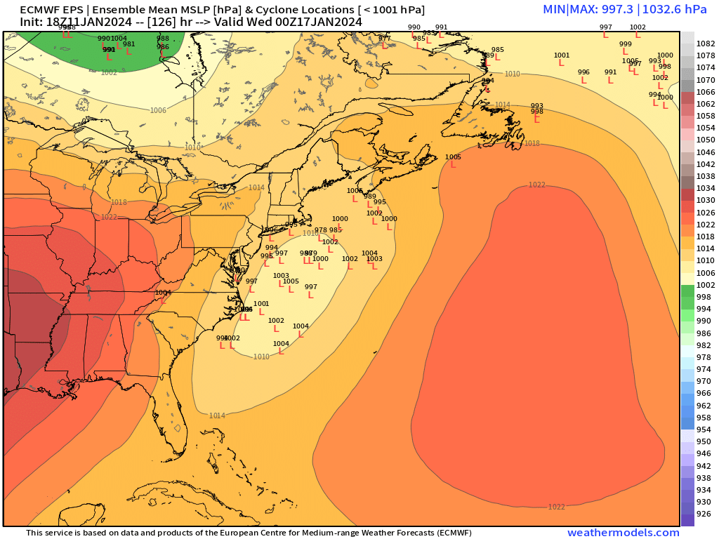
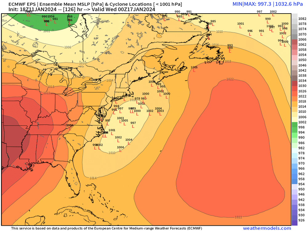
Right but which guidance is lacking the more correct data? Normally you’d toss the outlier but in the case of the Euro, its primary advantage is not processing data but rather initialization of it. So that begs the question…is the Euro data assimilation seeing something that is correct that the others aren’t seeing? Or maybe it’s just full of shit…at least we don’t have to wait that long to find out. This storm is going to be getting into D4 now.
-
It’s def weird for the euro to be OTS like that compared to all the other more amped guidance. Guess we’ll see how 12z responds. I’d expect the euro to at least partially bite at 12z if we’re gonna have a significant system.
-
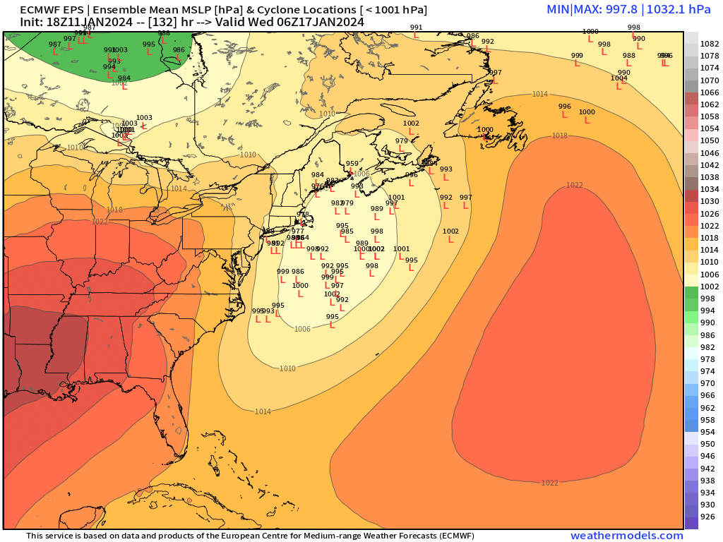
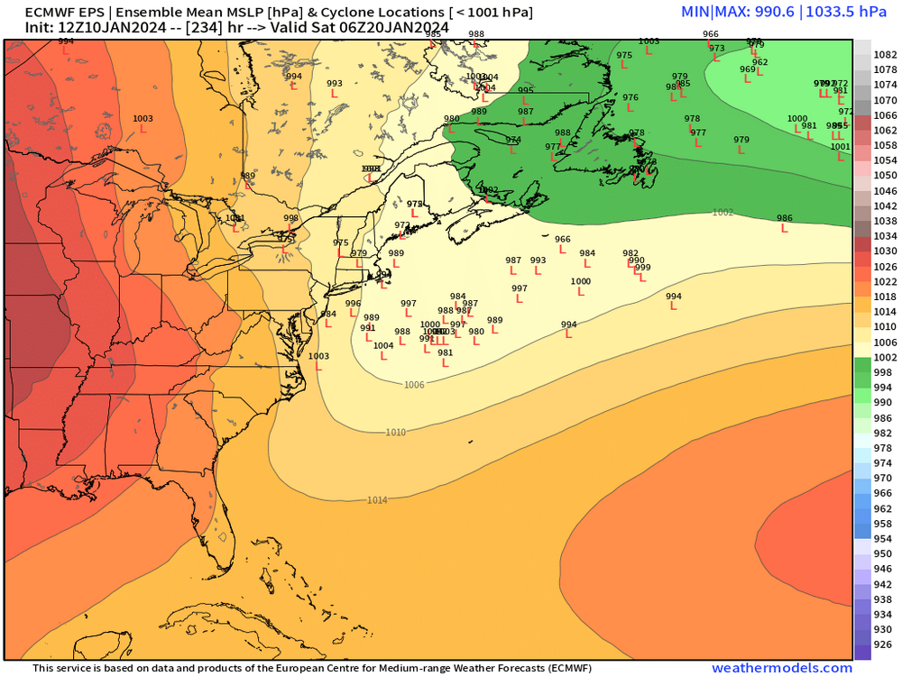
06z EPS was no help. Further SE than 00z run
-
Yeah this is the type of storm where if it comes close, you’re more worried about midlevels versus low levels. Let’s lay down some good pack in this one in preparation for the 1/20 HECS.
-
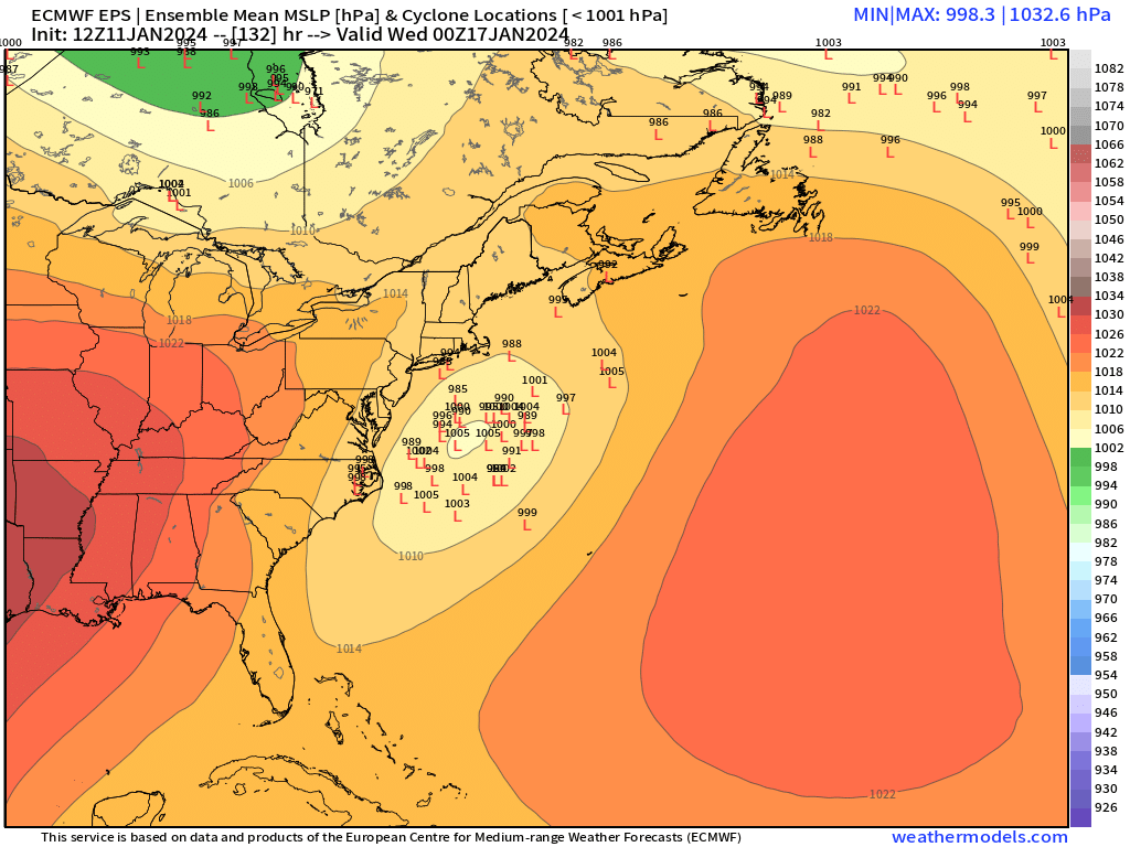
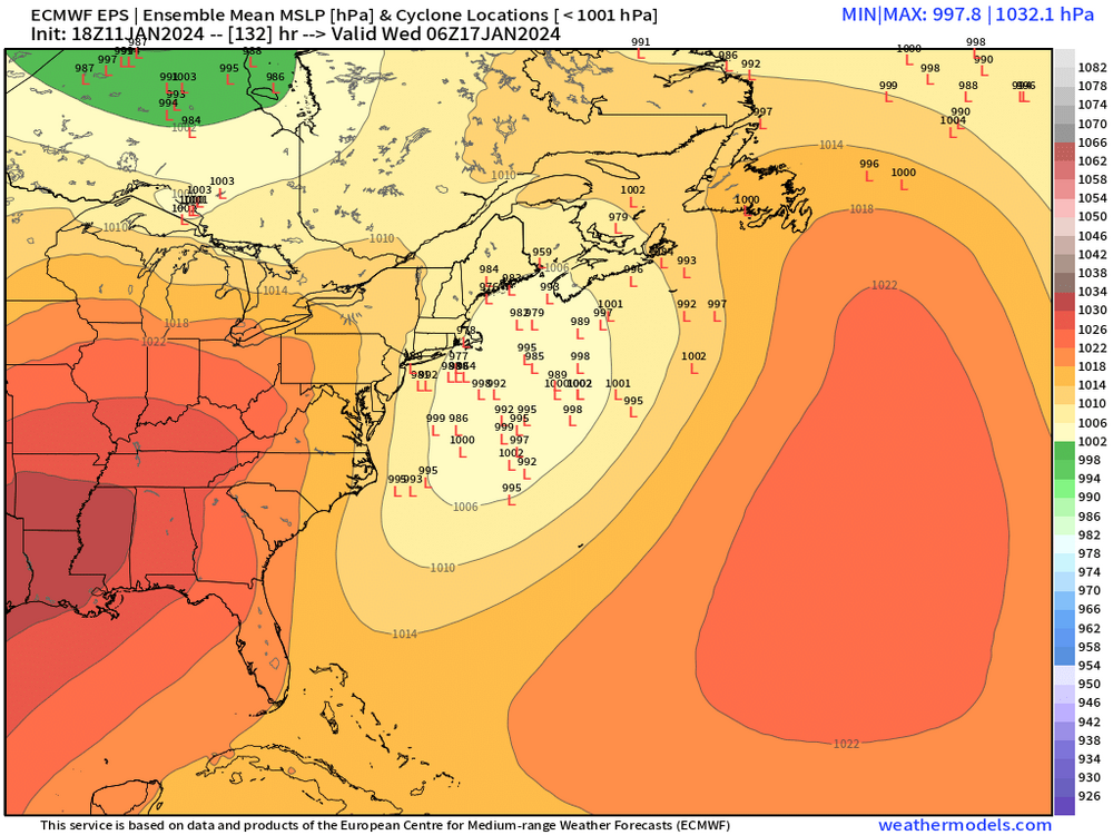
00z eps still had some nice hits though they were certainly more tame than the 18z eps. 06z eps come out in about 20-25 min
-
Having the EPS solidly NW of the OP is kind of a big tell imho. I think there’s a good chance we’ll least see something from this system even if it’s not a direct major hit…though that is certainly still on the table too.
-
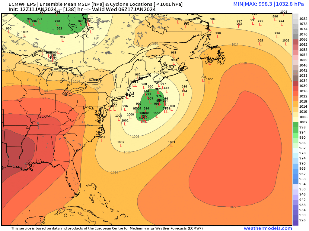
18z EPS a nice bump NW. Lot of good hits in there
-
We had 20” in ORH in ‘93 storm but it was a local max. Very few spots in New England even got 2 feet. The largest area of 2 feet in New England is almost certainly Feb ‘69 and Feb ‘13 was pretty impressive too. I’d say 2013 even outdid 1978 in New England as a whole for aerial coverage of 24”+. If we want to include March 1888 then that is right up there with Feb ‘69.
-
Jan 2015 blizzard didn’t do much over the rest of the northeast outside of central/eastern New England and Long Island.
-
Don’t fear the sleet…I’d take half a foot of thump and then an inch of sleet to solidify the pack for the cold week in the wake of that system. Not that it’s going to be the final solution so it’s all just fodder. EPS at 18z will be interesting to see if they come NW too. OP run was probably out to lunch given the ensembles were mostly NW of the OP run.
-
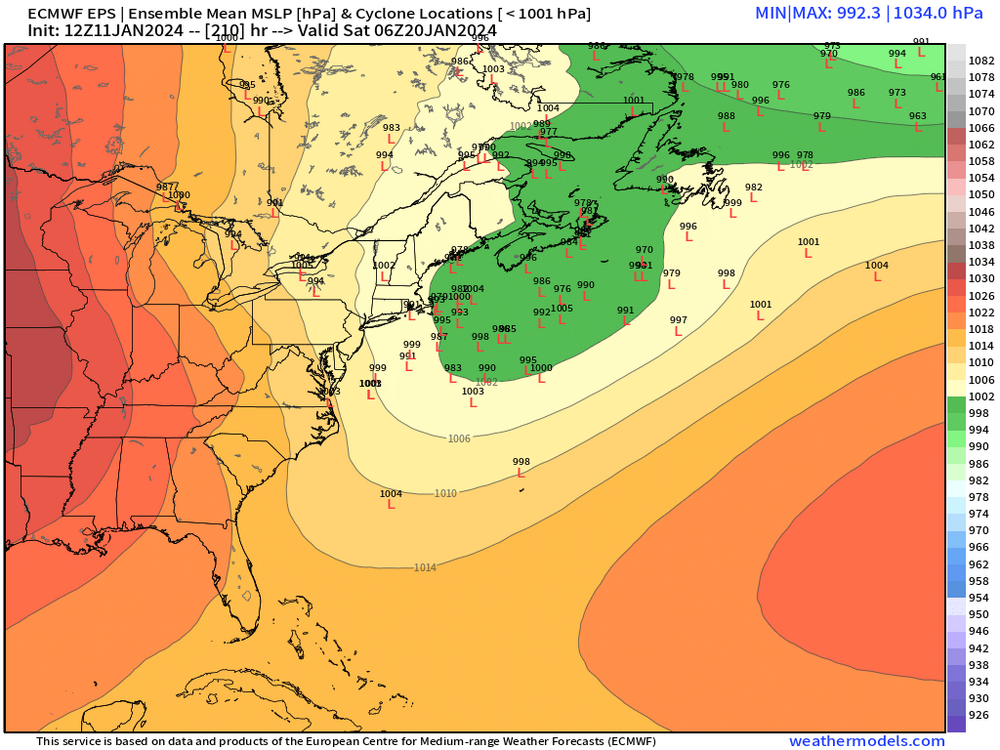
EPS still dabbling in 1/19-20 threat
-
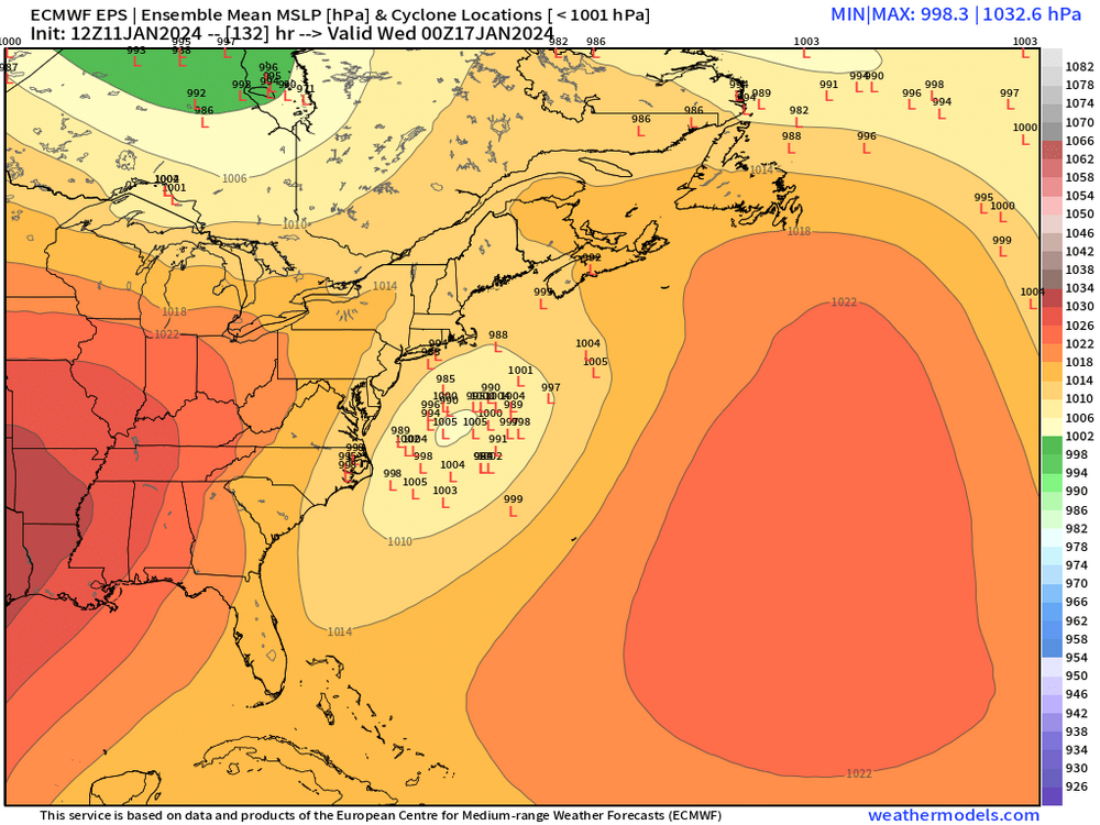
Yes it’s a bit wide right but not a total miss. Not necessarily the worst spot at D5.
-
Yeah this does not look like the OP run

-
Don’t think we ever had more than about 29-30” OTG even though the storm total was 33”.
-
1/9-1/10 Now Morphing to Less-Than-Exciting Power Cutter
ORH_wxman replied to Torch Tiger's topic in New England
You measure it but it’s understood that you aren’t measuring everything that falls. Like some of the more sheltered spots not far below the summit in Tuckermans or other basins prob get 400” while summit MWN is pulling 275” because you’re losing a bunch of snow to blow-off. -
That might have been before all the kegstands in college. Now i just merely have my memory

-
Yeah I didn't include 1993 since I was only really listing since 2000....we were close to 30" depth that month too in ORH, but never topped it. Hard to do late season (unless it's March 2001, lol....that year was on another level).
-
We never had a look like that though in 2016 (and not to my knowledge in 1983 either)....even leading into the blizzard, there was a huge GOA low which is quite common in super ninos. We did have the big NAO block, but the PAC on the models looks like a weak Nino or maybe moderate....huge GOA low still absent. Something we haven't been able to get all winter in any sort of sustained capacity. Maybe it shows up in February.
-
Yeah getting past 30" is always tough, though we managed to do it several times in the 2000-2015 period....March 2001 over the interior was the first one (1996 if we want to include a few years earlier), then we did it again in early Feb 2011, then we managed to do it again in March 2013 (but not on the coastal plain), then of course Feb 2015. Years like Jan/Feb 2005 got "stuck" around 27-30", ditto 2007-08, Jan 2009, Feb 2014, Mar 2018, and we fell a little short of that number in Feb 2021 (more like 23-24" depth)
-
Looks like some legit airmasses around for these threats at least. Those curtains of snow remind me of right before we went to town in Dec '92 and later on in Oct 2009....you saw the curtains of snow just off the deck and they'd mix in with gusts of wind and then retreat back up a few hundred feet. Usually you flip within an hour or two in that scenario but it's torture if that happens all day.
-
Not terrible for the D10 signal either at this range
-
Really nice run for the SE peeps who need to play a little catchup. But everyone gets something this run and plenty of arctic cold.
-
The 1/19 system has a rapidly building western ridge with it....so I would keep an eye out on that one potentially ramping up into something bigger....but I'd agree if we're going for the full I-95 KU kill-shot, then it's probably likely to happen when that PV moves closer to the 50/50 position and we get some sort of PAC firehose southern stream vort trying to slam up into it. I don't know if we'll get that shot, but conceptually that would be more classical than trying to use a PV lobe itself....those tend to be more New England-centric as redevelopers.