ORH_wxman
-
Posts
93,098 -
Joined
-
Last visited
Content Type
Profiles
Blogs
Forums
American Weather
Media Demo
Store
Gallery
Everything posted by ORH_wxman
-
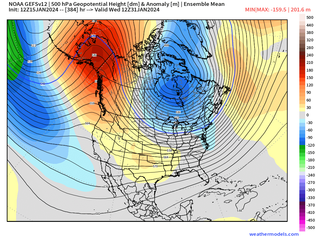
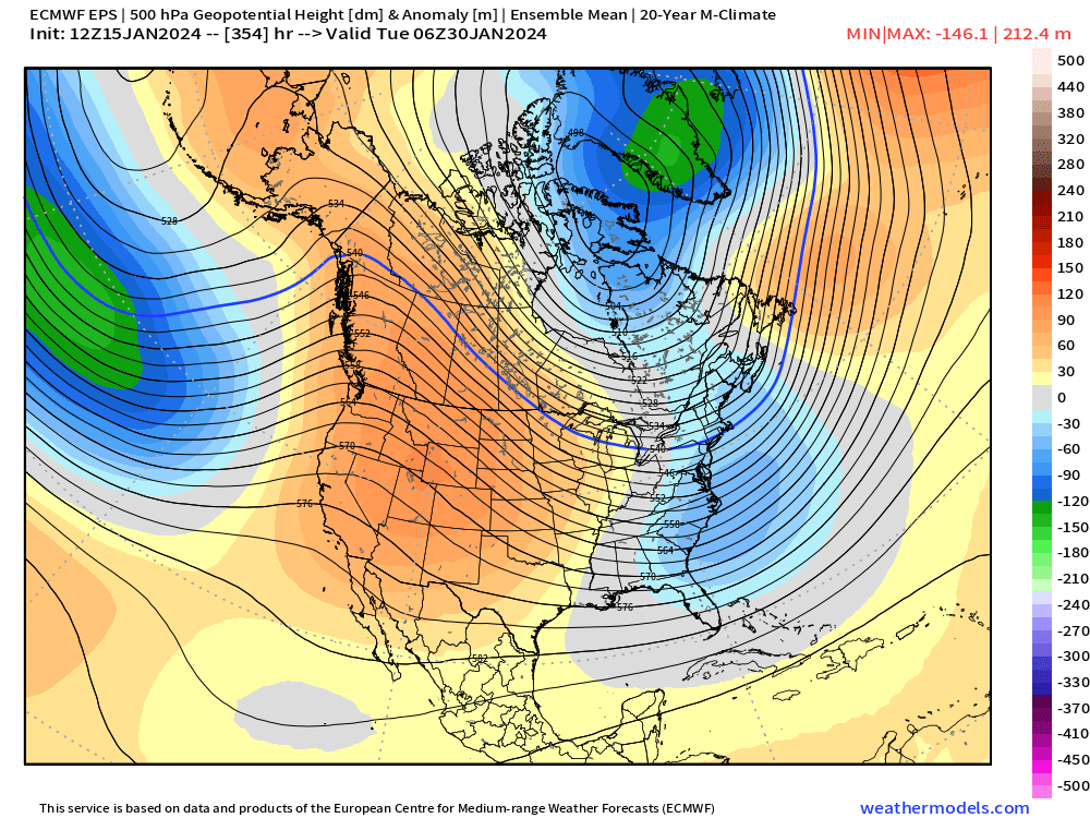
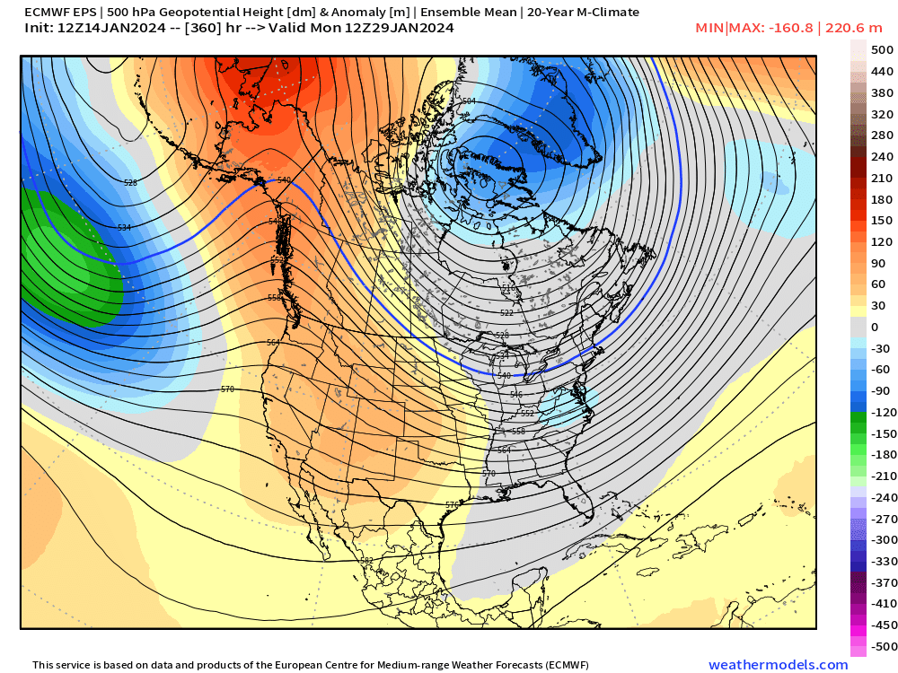
If you’re looking for a pattern shakeup compared to the last couple of years, then root for the ensembles at the end of the month. This is the closest to a great pacific pattern we’ve had in a while. But good to remain skeptical until we’re closer. But that’s a look you want to see for big cold/snow threats.

-
My educated guess is it will break. We’ve had western troughs produce some ugly multi-year periods in the east before (1972-1974 or early 1950s).
-
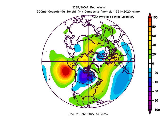
We’ve been in a predominately western trough pattern for years now. Tomorrow’s system even has major southwest flow aloft ahead of it…it’s not a coastal storm aloft…only at the sfc. The vortmax goes through Erie, PA…that’s basically a SWFE. Heres the past two winters combined. That’s a bad upper air pattern for good storm tracks here. You throw in a bit of bad luck too when we happened to be favorable, and that’s how you get some ugly numbers.
-
Euro looked a touch better to me for 1/19 looping H5…still a light event verbatim but you can see how it could be more significant with some minor improvements. I don’t think a big dog is going to happen but you could still get a moderate event or even a solid warning event if improvements continue over the next few runs. The danger of course is you trend back worse and then you essentially have no event at all.
-
Nice stripe over the interior on the euro. Looks a bit like the GFS except maybe a little bit NW. I’d def have an advisory for at least west of 128 in SNE. You’re going to either get 3-5” of snow or get like 2-3” plus some ZR/IP. Either one is going to trigger an advisory. It actually might be more like 3-5” with a touch of ZR at the end with the increasing QPF before the warming aloft makes it inland.
-
Slight improvement on 12 GEFS for 1/19-20 but it’s not enough to move the needle much. Only the 12z GGEM has anything really close to a big hit this cycle so far. Looking unlikely we’ll get a major system out of that setup. Close but no cigar. Had the ingredients but just not quite enough separation on the two PV lobes.
-
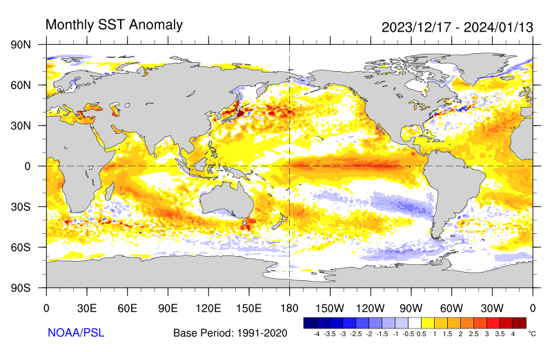
I don’t think this explains our recent struggles. It hasn’t really been that warm offshore this year…we’ve had warmer in the past
-
More of a south coast special but that was really close to a big one. GFS shot eastward so no help from that model.
-
Nice little 495 jackpot.
-
The old saying “misery loves company” might be in play as an explanation. But anyways…I sort of get it. People become irrational in a scientific sense when things break a certain direction for longer than is typical. You see it in both directions too…when we keep ringing up triple 7s in good winters or even a few years in a row, the model discourse becomes way overly optimistic and then it becomes obscenely pessimistic when things are running snowless. For someone like me who is obsessed with numbers and statistics, I see it through that prism of statistical anomalies and not necessarily some underlying predictable outcome long before model guidance has a lot of skill to make a confident call….but I know many others don’t think like that. I still don’t quite understand wanting to bludgeon others for not joining the pity party though. I’ve seen some of that and it’s pathetic.
-
What’s always been strange to me is those who log into a forum to be miserable. Didn’t see nearly as much of that even in our shit winters back 10-15 years ago. I literally had to move like 30 posts into here because an entire page and a half of the january pattern thread was just bitching and you would have no idea what is actually happening over the next 2-3 weeks based on those posts.
-
I’d like to see stronger lift modeled to entertain more seriously a low end warning event. Seems like we could get a nice steady light to moderate snow for a while and I guess if snow growth is good enough then maybe we can get a stripe of 6-8” out of 0.44” of QPF or something like that…but I also think there’s a lot more paths to 2-4” of powder where radar returns are a bit inconsistent.
-
Nah, people would rather just bitch and do “woe is me” to the largest audience possible…so they do it in here instead of banter.
-
RGEM still pretty juiced. Really nice event up in Maine.
-
Forecast doesn’t look overly complicated. Prob go 3-5” for 495 to ORH hills down into interior CT…1-3” for SE MA/RI/SE CT except maybe NW RI. Maybe someone gets a little higher lolli from a surprise band but so far the lift doesn’t look all that prolific.
-
06z euro came in more robust too. Thinking 3-5” where it stays all snow (so prob interior SNE up into central and eastern CNE/NNE)
-
Gonna get the 7-10 split here
-
We haven’t seen a low set up way down there SW of the Aleutians in eons. It was prob 2015 the last time we had one setup there for more than just a fleeting moment. Nice to see it on guidance….that’s about as good as a pacific pattern as we can get. Maybe shift the ridge axis a couple hundred miles east if we’re nitpicking, but otherwise it’s what we’ll want to see showing up as we move forward.
-
Might really pick up soon there.
-
@CoastalWx, check out late in the EPS (GEFS also have the same look)….that’s 2015-ish? We’ll see if that look continues as we get closer
-
@HIPPYVALLEYabout to get croaked
-
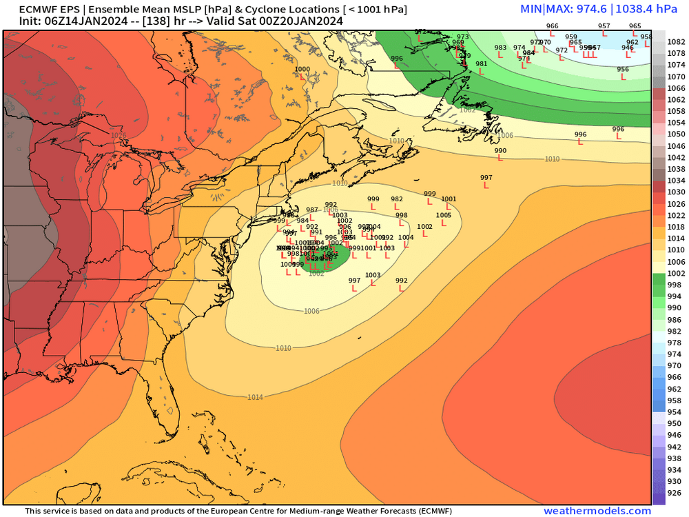
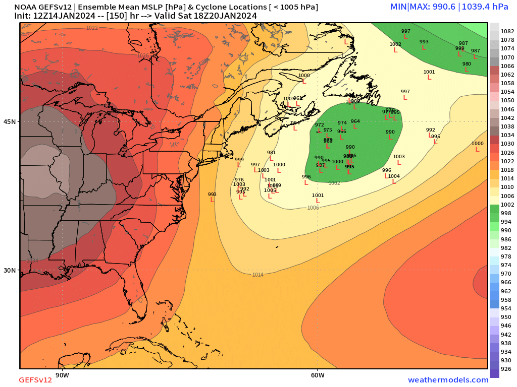
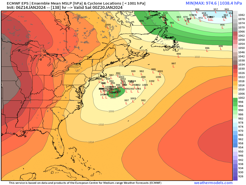
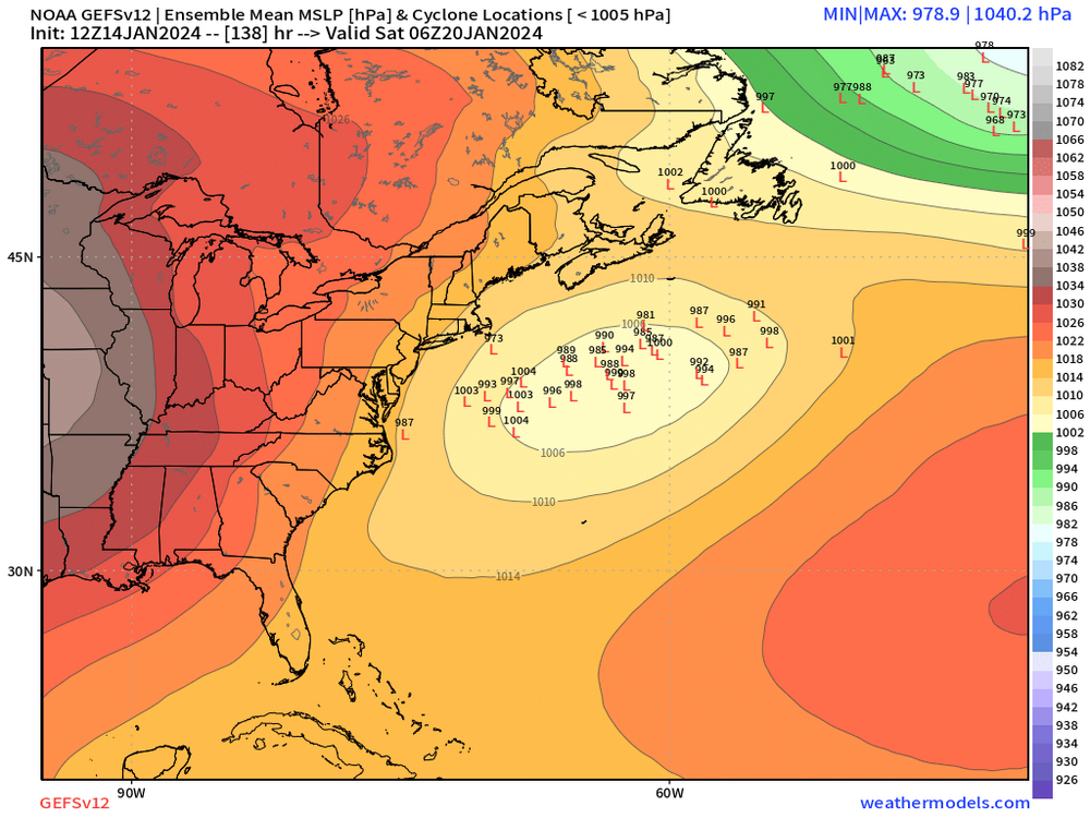
There seems to be more late bloomers on the 12z GEFS. The mean has the low well east of us but a bunch of westward individual members keep popping near the BM. You can see it below at 138 hours the distribution looks pretty typical, but then fast forward 12 hours and you see all those late bloomers back there

-
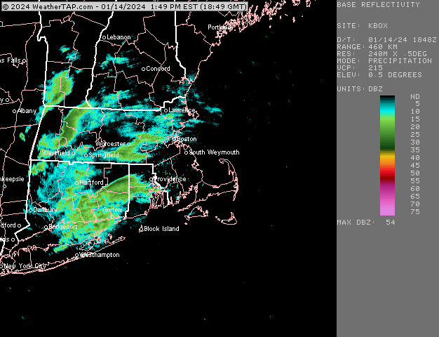
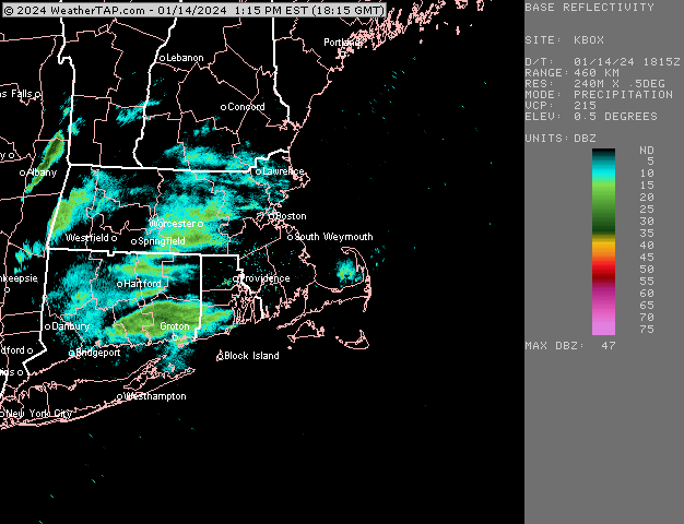
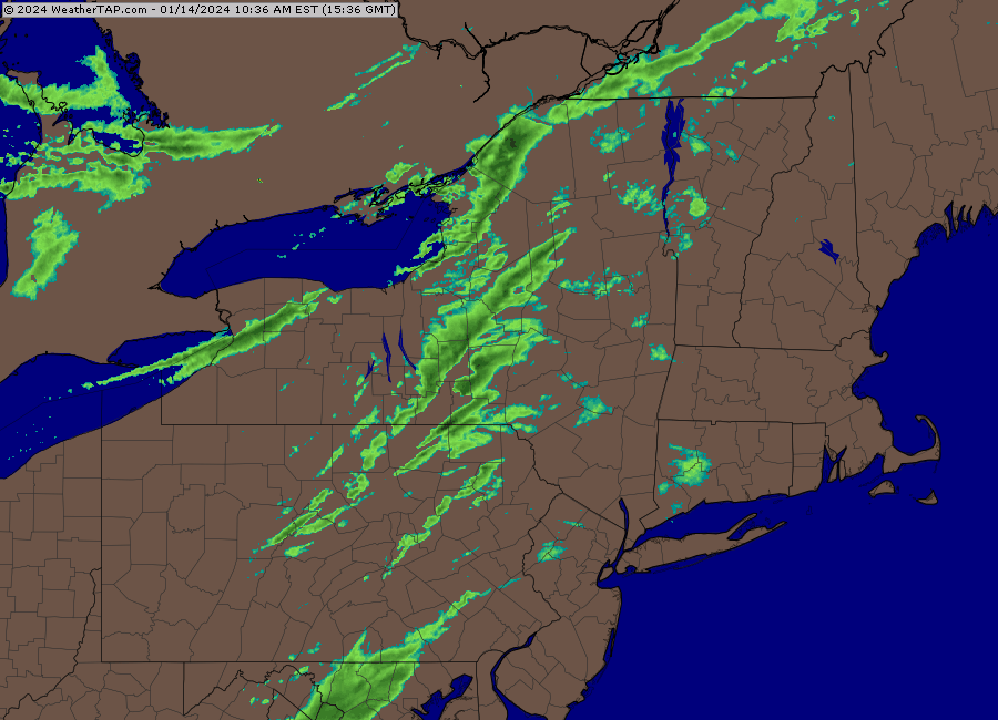
Regional loop
-
Yeah you aren’t raining for long with 516 thicknesses.
-
06z EPS was decent too