

ORH_wxman
-
Posts
90,902 -
Joined
-
Last visited
Content Type
Profiles
Blogs
Forums
American Weather
Media Demo
Store
Gallery
Everything posted by ORH_wxman
-
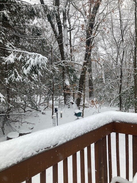
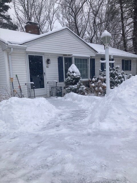
5.2” looks like it will do it with that final band of pure fake champagne. The first 4” or so was prob 10 to 1 at most while the final inch or so was like jspin fluff.
-
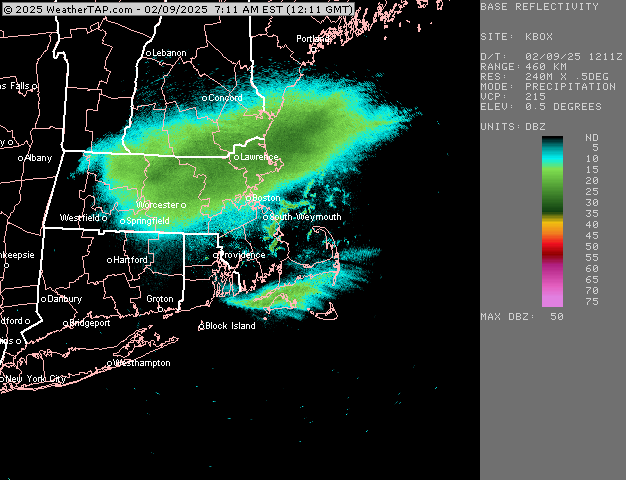
Unless this moves east in the final few days, take the under on 4-8….it’s like 0.3-0.5 QPF and then dryslot. Primary a couple days ago was going through PIT and dying around ROC/SYR, but now it’s going up through CLE and dying near Toronto. We don’t get that healthier and more dynamic WCB when it’s that far west.
-
This band is a nice bonus right now. Total fluff…prob 18 to 1 minimum maybe more. Can fake my way to another inch on top of the denser stuff. Measured just shy of 5” about 15 min ago…looks nice out there
-
06z euro has about 3” of snow and then a shot of IP/ZR before slotting. QPF looks pretty meh. We need to get more vorticity eastward on this one to make it a little higher impact.
-
Actually ripping very good now in this. Hopefully pick up a quick inch or so here. Excellent snow growth
-
Looks like 4-5” out there but coming down good again in this band.
-
Nuking dendrites right now. Wasn’t expecting the snow growth to be this good after the first hour or two. This band is regenerating a bit back to the west
-
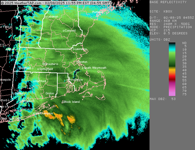
And now 00z back to being much warmer. This one has been tough on guidance.
-
These are the goods right now. 1-2” per hour stuff
-
New England Winter 2024-25 Bantering, Whining, and Sobbing Thread
ORH_wxman replied to klw's topic in New England
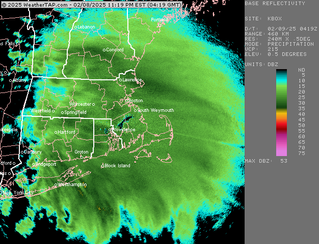
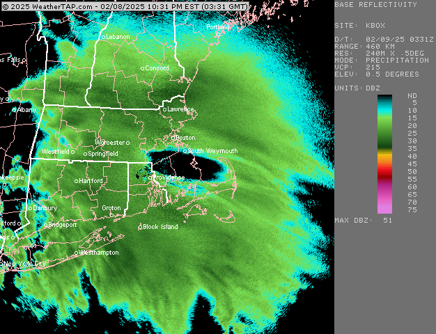
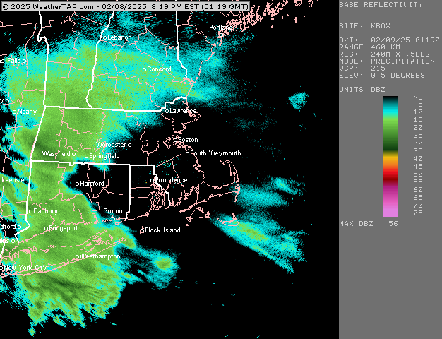
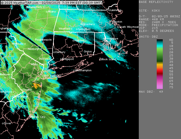
Top 5 SNE snowstorm all time. -
It’s going to try and fill in as it moves ESE but I’m not sure how efficient it will be. If it can generate some convective bands then it could help grab an extra inch or two. But if it’s more showery then it will be tougher.
-
Ripping right now. Looks like an inch down eyeballing. Like how the enhanced echoes are lining up for here back to NW CT.
-
Heavy snow here now. Even the street light up the hill 200 yards is getting pretty dim.
-
Excellent snow growth here now. Prob that initial fronto push.
-
Light snow has started in Holliston
-
If it was supposed to happen earlier and prevent accumulations, then it was wrong.
-
It’s a little sucker hole but gonna start soon in CEF
-
Nobody does
-
Looks like steady stuff just reaching DXR and far SW CT
-
With this pattern, it’s prob not far off from 50/50.
-
Hopefully you guys grab a couple down there. Maybe I can scrape a C-1”. Still not enthused but that was a decent jump by 18z euro.
-
Lol we’ve said this like half a dozen times since this morning and still falling for it.
-
Just as long as it’s not a larger partial phase you’d prob get a net gainer…but let’s keep that phasing idea off the table and get a true big dog. Still a long ways to go obviously on that threat.
-
18z euro looked a little thumpier down into CT this run…still not a big system but maybe advisory snows before a flip to IP/ZR and a quick dryslot. Keep an eye on that main vort…if that can trend just a shade east, prob would increase snowfall non-linearly.
-
Yeah this would obviously not be as extreme as that one…that was a much deeper phase. But same concept for sure. But given the southeast ridge, even a small partial phase too early could screw us. Hopefully the block does its job.


