

ORH_wxman
-
Posts
93,099 -
Joined
-
Last visited
Content Type
Profiles
Blogs
Forums
American Weather
Media Demo
Store
Gallery
Everything posted by ORH_wxman
-
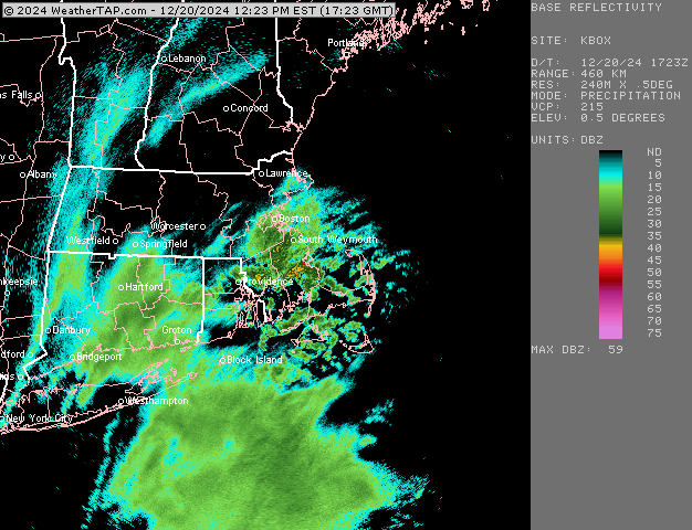
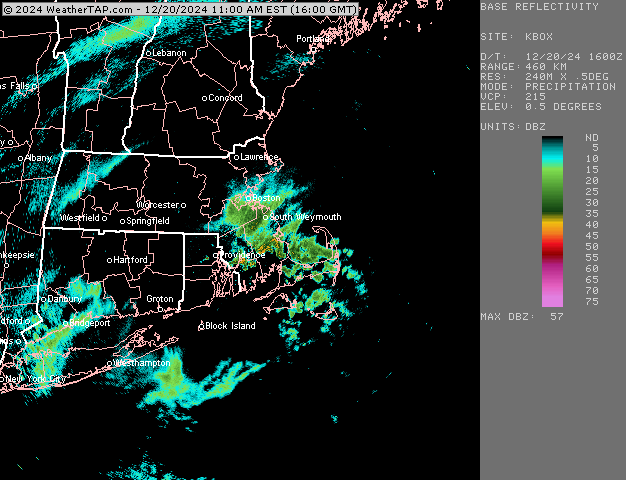
Coming down good now...snow growth picking up.
-
Yes...I think interior SE MA will be the jackpot in this unless the higher end part of the CCB with massive lift can clip the Cape....but it might just miss them.
-
You will want to get into the band that is currently south of LI fork region for advisory amounts I think....looks like it might get eastern CT near Ginxy and certainly RI and a chunk of E MA. We'll see if it can blossom west a bit more, but that's gonna be the main show this afternoon
-
Steady light snow now as this band backs in....quick coating now
-
RAP small tick west again....still not NAM-esque, but it's pretty solid advisory east of 495.
-
Was noticing that too when I went outside about an hjour ago with a few flakes spitting....slate overcast but it was cold. Upper 20s. Seems like every snow event the last couple winters was feeling more like late March with temps in the mid-30s trying to wetbulb down below freezing.
-
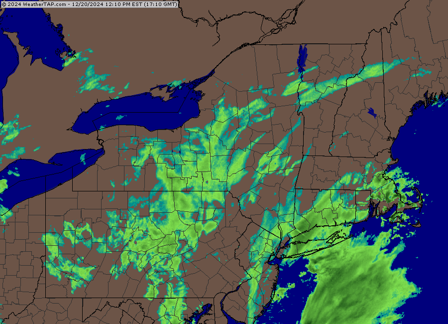
Nice bump west on 12z GFS
-
This is actually a decnet freebie one from RAP https://weather.rap.ucar.edu/satellite/displaySat.php?region=CONUS&itype=C10&size=large&endDate=20241220&endTime=-1&duration=3
-
Looks like MQE is getting hammered right now...but no obs there, lol.
-
We'll want to see the stuff nea rthe NJ shore start blossoming more to the north and northeast if something close to the NAM is correct....it actually had that stuff a little further inland than radar shows right now
-
He meant DIX...KDIX is the Mt. Holly radar down near philly
-
14z RAP came a tick west with the CCB....still not biting on NAM-esque type solution.
-
A few weenie flakes in Holliston....29F
-
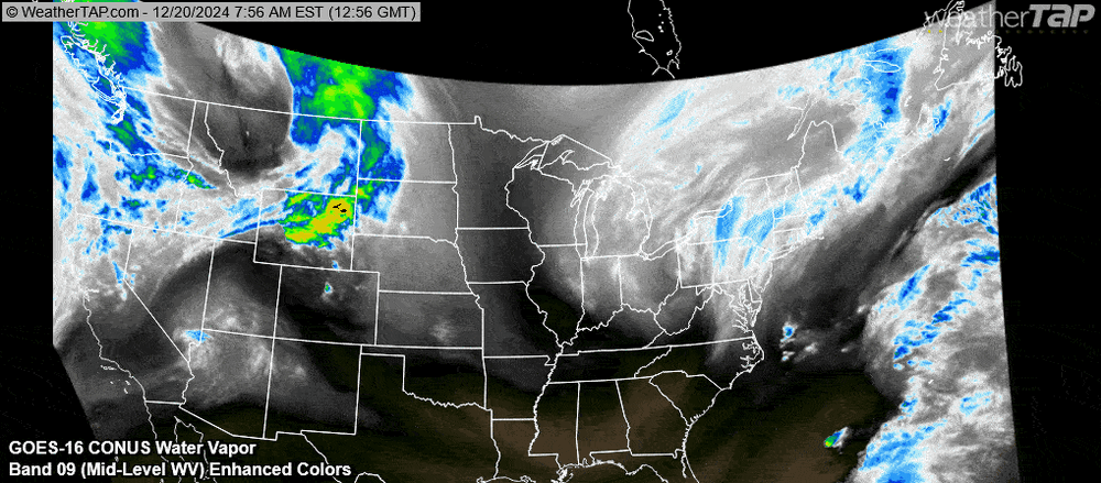
Here's WV loop....tried to optimize it so it will fit on here otherwise it was like 6mb of space.
-
3k is bullish too...NAM is legit warning snows for a lot of eastern zones. Maybe even into SW CT if that westward stuff is real.
-
Let’s nowcast this thing about another 40 miles. Even if it doesn’t, hoping for 2-3” here.
-
December 2024 - Best look to an early December pattern in many a year!
ORH_wxman replied to FXWX's topic in New England
My grandfather took me to my first Patriots game back in 1990 against Washington. It was the last year the field used astroturf before switching back to grass. It was a horrific night with temps in the 30s and steady rain. Very on-brand for that season, the Patriots threw a pick six and then got safetied when the long snapper snapped the ball into the stands out of the back of the end zone for a safety on a punt attempt. So the Patriots were down 9-0 and Washington’s offense hadn’t taken the field yet. Luckily for my grandfather, he was a huge Washington fan all his life. The other notable thing about that game was all the drunks. Even obvious to a 9 year old. Some of them fell down the bleachers a couple rows. Back then, they didn’t even kick you out for that type of crap, lol. They couldn’t fill those seats. -
Rgem bumped NW but only modestly. Nothing like the NAM trend. At least it was in the right direction but I was hoping for more than a nominal bump.
-
Yeah I think all of us have taken a dump on this threat at some point in this thread. TauntonBlizz does it a lot but he’s not alone this time.
-
We’re getting inside 24h to the onset. If we can’t believe any of the short term guidance at this point, then throw them in the trash. If the rgem jumps on board I’ll feel decent about the trend.
-
Airmass on Saturday night/Sunday is good delivery for us. Montreal express vector. If we can grab some snow cover, it’s a taking-the-under type of forecast…rarity the last few winters.
-
Yeah at least it gets nice and cold behind the storm. Airmass of yore. Hopefully this isn’t another fake trend and everyone can pick up at least enough to cover the grass.
-
That’s a pretty solid CF. Like upper 20s to mid 30s over 10-15 miles on the high res stuff.
-
00z RAP went west again. That would be very interesting for SE MA and the Cape if we could see another few frames
-
Story of this system. If we were getting these trends on top of the 00z runs last night, then we’d be in business. But we always sneak in a regression just in time to screw it up like at 12z today. The 12z runs were def the most frustrating because the trend last night is something you think might stick given that we were getting into that 48h range. Usually those are real.


